$1,800 / Month
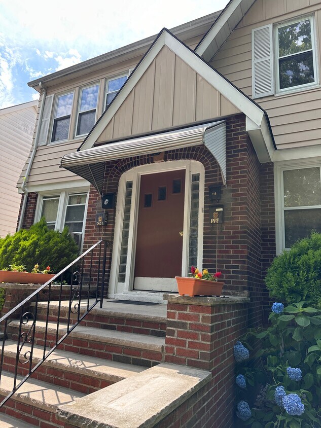
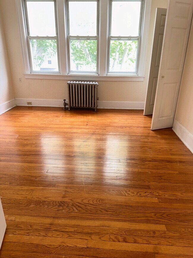
199 Shepard Ave Unit 2A
East Orange, NJ 07018
2 Weeks Ago
Favorites
199 Shepard Ave Unit 2A

Favorites
Check Back Soon for Upcoming Availability
| Beds | Baths | Average SF |
|---|---|---|
| 2 Bedrooms 2 Bedrooms 2 Br | 1 Bath 1 Bath 1 Ba | 1,300 SF |
Fees and Policies
The fees below are based on community-supplied data and may exclude additional fees and utilities.
- Parking
-
Street--
Details
Property Information
-
4 units
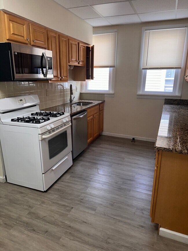
About This Property
199 Shepard Ave is an apartment community located in Essex County and the 07018 ZIP Code.
Apartment Features
- Smoke Free
Location
Get Directions
With large apartment complexes and mid-century, single-family Victorian and colonial-style homes for rent, Lower Vailsburg has a sense of retro charm that extends to the many small businesses lining the commercial streets. Residents here take so much pride in their community that many blocks have their own neighborhood associations.
You can run into many of your neighbors hanging out at Vailsburg Park, a 30-acre green space originally designed by noted landscape architect Frederick Olmsted. Soccer fields, baseball diamonds, and bocce ball courts attract locals, with a playground and a concert area for special events. Downtown Newark sits only three miles to the east, but you can meet up with your neighbors closer to home at casual spots like Bones Kitchen or Kayla & Dewitts.
Learn more about living in Lower VailsburgBelow are rent ranges for similar nearby apartments
| Beds | Average Size | Lowest | Typical | Premium |
|---|---|---|---|---|
| Studio Studio Studio | 2075 Sq Ft | $1,300 | $2,450 | $3,600 |
| 1 Bed 1 Bed 1 Bed | 663 Sq Ft | $1,200 | $1,518 | $1,780 |
| 2 Beds 2 Beds 2 Beds | 1100 Sq Ft | $1,650 | $2,024 | $3,000 |
| 3 Beds 3 Beds 3 Beds | 1747 Sq Ft | $1,850 | $2,366 | $3,450 |
| 4 Beds 4 Beds 4 Beds | 1333 Sq Ft | $2,495 | $2,619 | $2,800 |
Amenities
- Smoke Free
Education
| Colleges & Universities | Distance | ||
|---|---|---|---|
| Colleges & Universities | Distance | ||
| Drive: | 6 min | 1.9 mi | |
| Drive: | 5 min | 2.6 mi | |
| Drive: | 5 min | 2.8 mi | |
| Drive: | 5 min | 2.8 mi |
199 Shepard Ave Unit 2A is within 6 minutes or 1.9 miles from Seton Hall University. It is also near N.J. Inst. of Technology and Essex County College.
Transportation options available in East Orange include Norfolk Street Light Rail Station, located 2.2 miles from 199 Shepard Ave Unit 2A. 199 Shepard Ave Unit 2A is near Newark Liberty International, located 8.5 miles or 14 minutes away, and LaGuardia, located 29.5 miles or 45 minutes away.
| Transit / Subway | Distance | ||
|---|---|---|---|
| Transit / Subway | Distance | ||
| Drive: | 4 min | 2.2 mi | |
| Drive: | 5 min | 2.3 mi | |
| Drive: | 5 min | 2.4 mi | |
| Drive: | 5 min | 2.8 mi | |
| Drive: | 7 min | 3.6 mi |
| Commuter Rail | Distance | ||
|---|---|---|---|
| Commuter Rail | Distance | ||
| Walk: | 18 min | 0.9 mi | |
| Walk: | 20 min | 1.1 mi | |
| Drive: | 5 min | 2.1 mi | |
| Drive: | 4 min | 2.1 mi | |
| Drive: | 7 min | 2.5 mi |
| Airports | Distance | ||
|---|---|---|---|
| Airports | Distance | ||
|
Newark Liberty International
|
Drive: | 14 min | 8.5 mi |
|
LaGuardia
|
Drive: | 45 min | 29.5 mi |
Time and distance from 199 Shepard Ave Unit 2A.
| Shopping Centers | Distance | ||
|---|---|---|---|
| Shopping Centers | Distance | ||
| Walk: | 20 min | 1.1 mi | |
| Drive: | 3 min | 1.2 mi | |
| Drive: | 3 min | 1.4 mi |
199 Shepard Ave Unit 2A has 3 shopping centers within 1.4 miles, which is about a 3-minute walk. The miles and minutes will be for the farthest away property.
| Parks and Recreation | Distance | ||
|---|---|---|---|
| Parks and Recreation | Distance | ||
|
Newark Museum and Dreyfuss Planetarium
|
Drive: | 5 min | 2.9 mi |
|
Edison National Historic Site
|
Drive: | 8 min | 3.2 mi |
|
Branch Brook Park
|
Drive: | 8 min | 4.0 mi |
|
Turtle Back Zoo
|
Drive: | 11 min | 5.0 mi |
|
Greenwood Gardens
|
Drive: | 14 min | 6.1 mi |
199 Shepard Ave Unit 2A has 5 parks within 6.1 miles, including Newark Museum and Dreyfuss Planetarium, Edison National Historic Site, and Branch Brook Park.
| Hospitals | Distance | ||
|---|---|---|---|
| Hospitals | Distance | ||
| Walk: | 10 min | 0.5 mi | |
| Drive: | 4 min | 2.2 mi | |
| Drive: | 5 min | 2.7 mi |
199 Shepard Ave Unit 2A has 3 hospitals within 2.7 miles, the nearest is East Orange General Hospital which is 0.5 mile away and a 10 minute walk.
| Military Bases | Distance | ||
|---|---|---|---|
| Military Bases | Distance | ||
| Drive: | 20 min | 12.4 mi | |
| Drive: | 25 min | 13.5 mi | |
| Drive: | 31 min | 15.6 mi |
199 Shepard Ave Unit 2A has 3 military bases within 15.6 miles, the nearest is Military Ocean Terminal which is 12.4 miles away and a 20 minute drive.
You May Also Like
Similar Rentals Nearby


What Are Walk Score®, Transit Score®, and Bike Score® Ratings?
Walk Score® measures the walkability of any address. Transit Score® measures access to public transit. Bike Score® measures the bikeability of any address.
What is a Sound Score Rating?
A Sound Score Rating aggregates noise caused by vehicle traffic, airplane traffic and local sources

199 Shepard Ave
East Orange, NJ 07018