
$1,095 / Month
1985 Sedgwick Ave
Bronx, NY 10453
2 Weeks Ago
Favorites
1985 Sedgwick Ave

Favorites
Check Back Soon for Upcoming Availability
| Beds | Baths | Average SF |
|---|---|---|
| Studio Studio 0 Br | 1 Bath 1 Bath 1 Ba | — |
About This Property
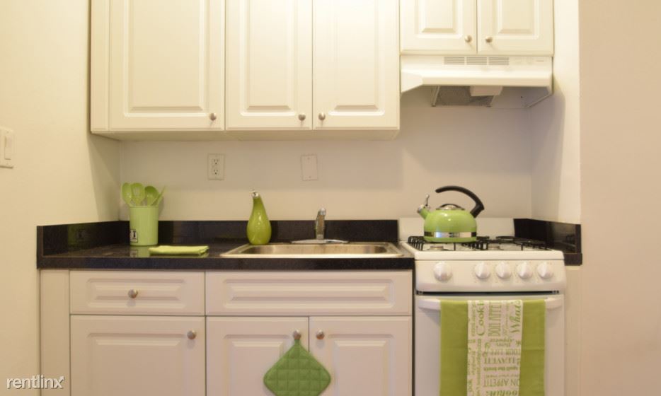
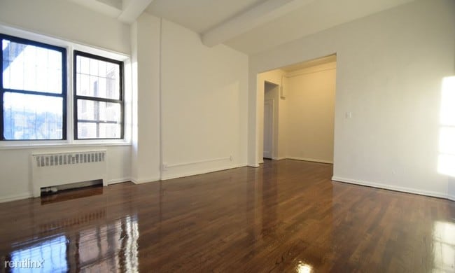
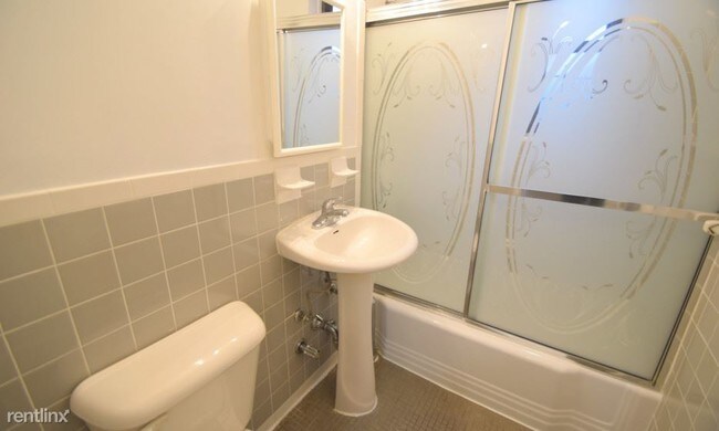
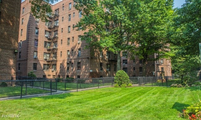
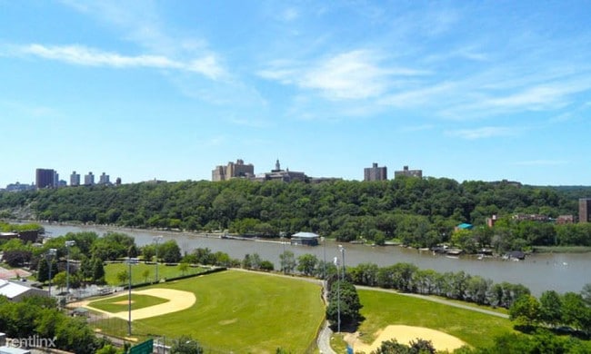
(516) 654-5673 - Open House Friday 7/21 | 3 PM - 5:45 PM Must have an income of 43x the rent. ****** 58,000 minimal annual income Amenities Hardwood Floors Steps from the Park Elevator Garage Heat and Hot Water Included Laundry Neighborhood University Heights, located in the West Bronx, adorns beautiful parks and playgrounds perfect for enjoying natural scenic tranquility. This area of the Bronx is located near universities and several parks including Devoe Park, Saint James Park, and Fordham Landing Playground. Along the Harlem River, find yourself at Roberto Clemente park, a waterfront recreational building featuring an Olympic-size pool, basketball courts, playgrounds and picnic areas. Residing in University Heights allows you to visit the capturing and stunning New York Botanical Gardens and view the captivating creatures at the Bronx Zoo. Transportation I 87 Highway Fordham Road Schools Fordham University Bronx Community College Entertainment Roberto Clemente State Park Care Centers St. Barnabas Hospital (RLNE3407512) Other Amenities - Elevator in Building. Lease lengths - 12 Months- choice, 24 Months- choice. Details regarding this property's Utilities - Heat Included, Water Included.
1985 Sedgwick Ave is a condo located in Bronx County and the 10453 ZIP Code. This area is served by the New York City Geographic District #10 attendance zone.
Location
Get Directions
University Heights is a historic neighborhood in the Bronx. As its name implies, University Heights was once home to New York University. Today, Bronx Community College is located in NYU’s old buildings, and many of them have earned a National Historic Landmark designation. The Hall of Fame for Great Americans is also located in University Heights. Like many New York neighborhoods, University Heights has multiple bus stops, several subway stations, and apartments and condos available for rent. Parks and greenways are located throughout University Heights, adding a pop of greenery in this urban neighborhood. University Woods overlooks the Harlem River while Roberto Clemente State Park is a popular spot for swimming.
Learn more about living in University HeightsBelow are rent ranges for similar nearby apartments
Education
| Colleges & Universities | Distance | ||
|---|---|---|---|
| Colleges & Universities | Distance | ||
| Walk: | 9 min | 0.5 mi | |
| Drive: | 4 min | 1.2 mi | |
| Drive: | 4 min | 1.7 mi | |
| Drive: | 5 min | 2.0 mi |
1985 Sedgwick Ave is within 9 minutes or 0.5 mile from Bronx Community College. It is also near Monroe College, Bronx Campus and Yeshiva University, Wilf.
Schools


Public Elementary School
Grades PK-5
336 Students
Attendance Zone
Public Middle School
Grades 6-8
394 Students
Attendance Zone
Public High School
Grades 9-12
341 Students
Nearby
Private Elementary & Middle School
Grades PK-8
Nearby
Private High School
Grades 9-12
323 Students
Nearby
School data provided by
 The GreatSchools Rating helps parents compare schools within a state based on a variety of school quality indicators and provides a helpful picture of how effectively each school serves all of its students. Ratings are on a scale of 1 (below average) to 10 (above average) and can include test scores, college readiness, academic progress, advanced courses, equity, discipline and attendance data. We also advise parents to visit schools, consider other information on school performance and programs, and consider family needs as part of the school selection process.
View GreatSchools Rating Methodology
Data provided by GreatSchools.org © 2025. All rights reserved.
View GreatSchools Rating Methodology
Data provided by GreatSchools.org © 2025. All rights reserved.
Transportation options available in Bronx include Burnside Avenue, located 0.7 mile from 1985 Sedgwick Ave. 1985 Sedgwick Ave is near LaGuardia, located 9.7 miles or 18 minutes away, and John F Kennedy International, located 20.6 miles or 30 minutes away.
| Transit / Subway | Distance | ||
|---|---|---|---|
| Transit / Subway | Distance | ||
|
|
Walk: | 14 min | 0.7 mi |
|
|
Walk: | 16 min | 0.8 mi |
|
|
Walk: | 16 min | 0.9 mi |
|
|
Drive: | 3 min | 1.1 mi |
|
|
Drive: | 5 min | 2.0 mi |
| Commuter Rail | Distance | ||
|---|---|---|---|
| Commuter Rail | Distance | ||
|
|
Walk: | 8 min | 0.4 mi |
|
|
Walk: | 15 min | 0.8 mi |
|
|
Drive: | 4 min | 1.4 mi |
|
|
Drive: | 5 min | 1.6 mi |
|
|
Drive: | 6 min | 2.6 mi |
| Airports | Distance | ||
|---|---|---|---|
| Airports | Distance | ||
|
LaGuardia
|
Drive: | 18 min | 9.7 mi |
|
John F Kennedy International
|
Drive: | 30 min | 20.6 mi |
Time and distance from 1985 Sedgwick Ave.
| Shopping Centers | Distance | ||
|---|---|---|---|
| Shopping Centers | Distance | ||
| Walk: | 14 min | 0.8 mi | |
| Drive: | 4 min | 1.4 mi | |
| Drive: | 5 min | 1.5 mi |
1985 Sedgwick Ave has 3 shopping centers within 1.5 miles, which is about a 5-minute walk. The miles and minutes will be for the farthest away property.
| Parks and Recreation | Distance | ||
|---|---|---|---|
| Parks and Recreation | Distance | ||
|
Dyckman House Park
|
Drive: | 4 min | 1.5 mi |
|
Inwood Hill Park
|
Drive: | 5 min | 2.4 mi |
|
Roberto Clemente State Park
|
Walk: | 51 min | 2.7 mi |
|
Fort Tryon Park
|
Drive: | 8 min | 3.0 mi |
|
Sherman Creek and Swindler Cove
|
Drive: | 10 min | 4.5 mi |
1985 Sedgwick Ave has 5 parks within 4.5 miles, including Roberto Clemente State Park, Dyckman House Park, and Sherman Creek and Swindler Cove.
| Hospitals | Distance | ||
|---|---|---|---|
| Hospitals | Distance | ||
| Drive: | 6 min | 2.1 mi | |
| Drive: | 7 min | 2.5 mi | |
| Drive: | 7 min | 2.9 mi |
1985 Sedgwick Ave has 3 hospitals within 2.9 miles, the nearest is St. Barnabas Hospital which is 2.1 miles away and a 6 minute drive.
| Military Bases | Distance | ||
|---|---|---|---|
| Military Bases | Distance | ||
| Drive: | 20 min | 11.0 mi |
1985 Sedgwick Ave is 11.0 miles and a 20 minute drive from Fort Totten US Govt Reservation.
You May Also Like
Similar Rentals Nearby
-
-
1 / 24

-
-
-
-
-

-
-

-


What Are Walk Score®, Transit Score®, and Bike Score® Ratings?
Walk Score® measures the walkability of any address. Transit Score® measures access to public transit. Bike Score® measures the bikeability of any address.
What is a Sound Score Rating?
A Sound Score Rating aggregates noise caused by vehicle traffic, airplane traffic and local sources

1985 Sedgwick Ave
Bronx, NY 10453