
The Vitagraph
1277 E 14th St,
Brooklyn, NY 11230
$2,770 - $3,668
1-3 Beds


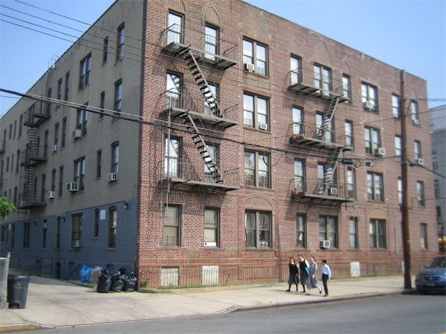
Find true Brooklyn living at 1974 51st St. This community can be found in Brooklyn at 1974 51st St. in the 11204 area. The professional leasing staff is waiting to show you all that this community has in store. Be sure to see the current floorplan options. Welcome home to 1974 51st St. Stop by the leasing office to talk about leasing your next apartment.
1974 51st St is an apartment community located in Kings County and the 11204 ZIP Code. This area is served by the New York City Geographic District #20 attendance zone.
The tiny town of Mapleton is almost completely residential, offering a few local stores here and there. Mapleton boasts a diverse, yet tight-knit community with a family-friendly atmosphere. Most rentals in the area are attached or semi-attached buildings offering various apartments and condos for those looking to rent in a safe Brooklyn neighborhood.
Mapleton is known for its library, good public and private schools, and upgraded community park. Gravesend Park offers playgrounds, baseball fields, tennis courts, and basketball courts. This is perfect for families in the area looking for outdoor recreational fun!
Mapleton houses Washington Cemetery, one of the largest Jewish cemeteries in Brooklyn. It offers numerous subway and bus stations, making commuting as simple as possible.
Learn more about living in MapletonCompare neighborhood and city base rent averages by bedroom.
| Mapleton | Brooklyn, NY | |
|---|---|---|
| Studio | - | $2,674 |
| 1 Bedroom | $1,444 | $2,996 |
| 2 Bedrooms | - | $3,925 |
| 3 Bedrooms | - | $4,864 |
| Colleges & Universities | Distance | ||
|---|---|---|---|
| Colleges & Universities | Distance | ||
| Drive: | 8 min | 2.1 mi | |
| Drive: | 10 min | 4.1 mi | |
| Drive: | 13 min | 5.6 mi | |
| Drive: | 13 min | 5.9 mi |


Transportation options available in Brooklyn include Avenue I, located 0.2 mile from 1974 51st St. 1974 51st St is near John F Kennedy International, located 14.3 miles or 26 minutes away, and Newark Liberty International, located 19.9 miles or 34 minutes away.
| Transit / Subway | Distance | ||
|---|---|---|---|
| Transit / Subway | Distance | ||
|
|
Walk: | 3 min | 0.2 mi |
|
|
Walk: | 6 min | 0.4 mi |
|
|
Walk: | 7 min | 0.4 mi |
|
|
Walk: | 12 min | 0.6 mi |
|
|
Walk: | 14 min | 0.8 mi |
| Commuter Rail | Distance | ||
|---|---|---|---|
| Commuter Rail | Distance | ||
|
|
Drive: | 13 min | 5.4 mi |
|
|
Drive: | 13 min | 5.4 mi |
|
|
Drive: | 17 min | 7.9 mi |
|
|
Drive: | 19 min | 8.6 mi |
|
|
Drive: | 21 min | 9.2 mi |
| Airports | Distance | ||
|---|---|---|---|
| Airports | Distance | ||
|
John F Kennedy International
|
Drive: | 26 min | 14.3 mi |
|
Newark Liberty International
|
Drive: | 34 min | 19.9 mi |
Scores provided by
Traffic
BusyAirport
CalmBusinesses
BusyScores provided by
HowLoud What is a Sound Score Rating? A Sound Score Rating aggregates noise caused by vehicle traffic, airplane traffic and local sources. How It WorksTime and distance from 1974 51st St.
| Shopping Centers | Distance | ||
|---|---|---|---|
| Shopping Centers | Distance | ||
| Drive: | 4 min | 1.4 mi | |
| Drive: | 5 min | 1.5 mi | |
| Drive: | 9 min | 2.4 mi |
| Parks and Recreation | Distance | ||
|---|---|---|---|
| Parks and Recreation | Distance | ||
|
Sunset Park
|
Drive: | 7 min | 2.8 mi |
|
Prospect Park Audubon Center at the Boathouse
|
Drive: | 8 min | 3.4 mi |
|
Prospect Park Zoo
|
Drive: | 8 min | 3.5 mi |
|
Dyker Beach Park
|
Drive: | 9 min | 3.6 mi |
|
Prospect Park
|
Drive: | 11 min | 4.5 mi |
| Hospitals | Distance | ||
|---|---|---|---|
| Hospitals | Distance | ||
| Drive: | 5 min | 1.8 mi | |
| Drive: | 7 min | 3.0 mi | |
| Drive: | 9 min | 3.9 mi |
| Military Bases | Distance | ||
|---|---|---|---|
| Military Bases | Distance | ||
| Drive: | 12 min | 4.2 mi | |
| Drive: | 16 min | 8.4 mi |
What Are Walk Score®, Transit Score®, and Bike Score® Ratings?
Walk Score® measures the walkability of any address. Transit Score® measures access to public transit. Bike Score® measures the bikeability of any address.
What is a Sound Score Rating?
A Sound Score Rating aggregates noise caused by vehicle traffic, airplane traffic and local sources.
1974 51st St
Brooklyn, NY 11204


