

$1,350 / Month
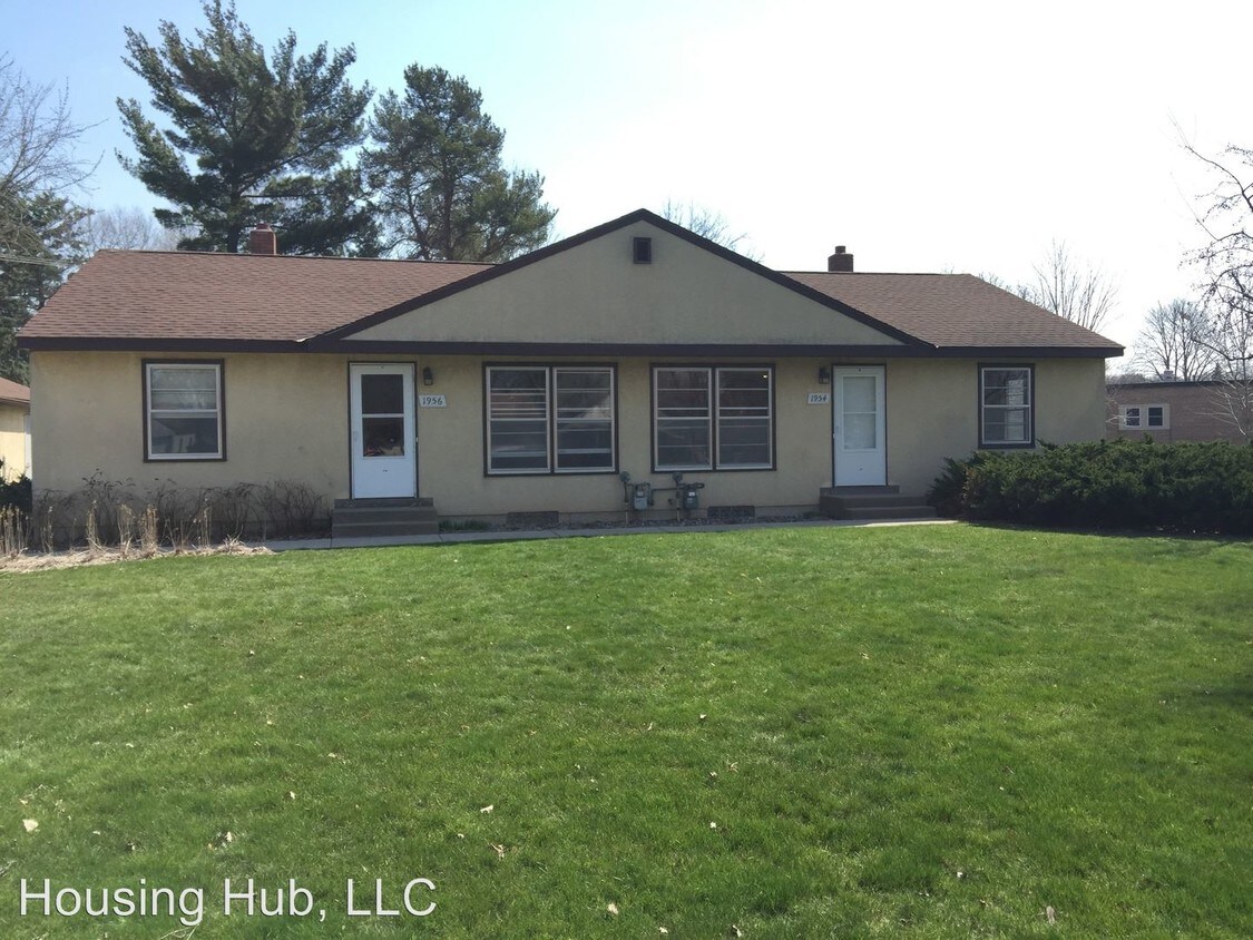
1956 Hazelwood St
Maplewood, MN 55109
2 Weeks Ago
Favorites
1956 Hazelwood St

Favorites
Check Back Soon for Upcoming Availability
| Beds | Baths | Average SF |
|---|---|---|
| 3 Bedrooms 3 Bedrooms 3 Br | 1 Bath 1 Bath 1 Ba | 1,740 SF |
About This Property
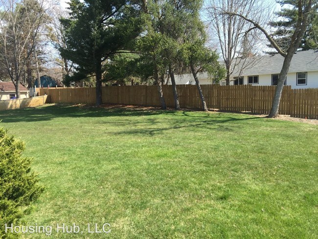
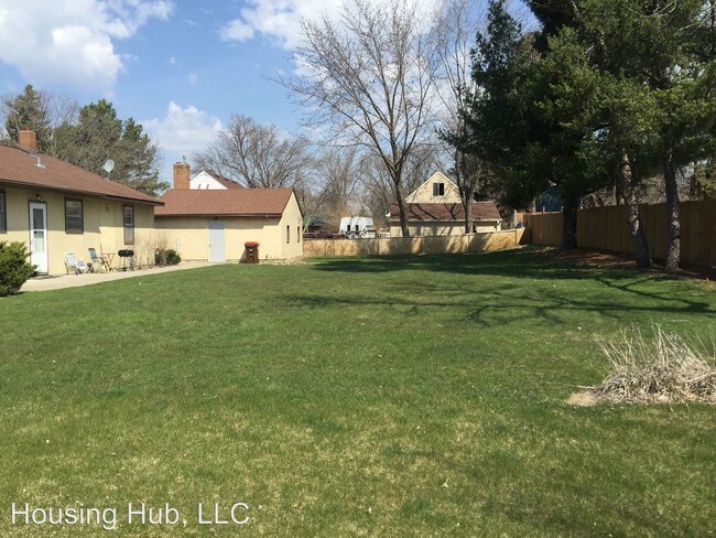
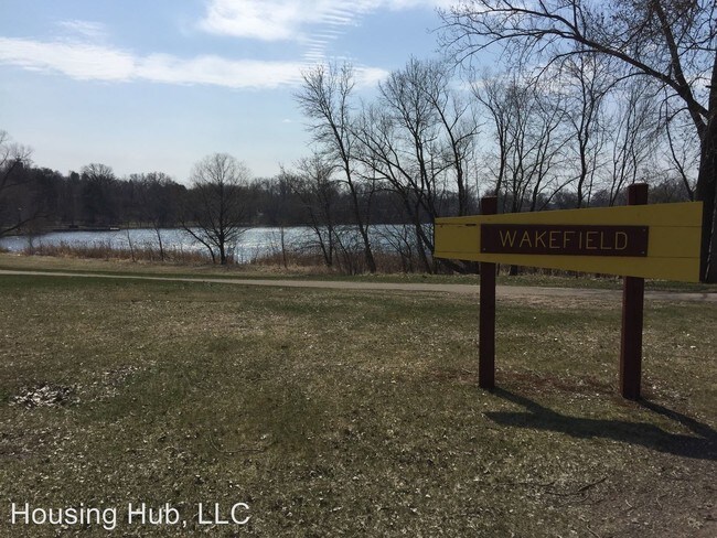
(952) 454-1767 - Another great listing from Housing Hub! - Another great listing from Housing Hub! This is a side by side duplex available now in Maplewood! Near the Goodrich Golf Course and Wakefield Lake & Park - just minutes from all the amazing shopping and eating spots on White Bear Ave between Hwy 36 and 694! Hardwood floors on the main level in the living room, dining room, and two bedrooms. There is a full bathroom and large kitchen on the main floor as well. Lower level features a large family room, the third bedroom and a huge storage room with washer/dryer hookups.This property includes a stall in the garage for an additional $75/mo and has a huge yard. Sorry no dogs allowed. Cats may be considered with an additional pet deposit and pet fee. Tenant pays all utilities, but lawn care and snow removal are included. Call or text 952-454-1767 for more information and/or to schedule a showing! No Dogs Allowed (RLNE2394034) Pet policies - Cats Allowed, No Dogs Allowed.
1956 Hazelwood St is a house located in Ramsey County and the 55109 ZIP Code. This area is served by the North St Paul-Maplewood School Dist attendance zone.
Location
Get Directions
Thanks to some odd geography, Maplewood has something of a split personality. This first-ring St. Paul suburb can be described as being shaped like a frying pan. The main business and residential area lies primarily to the north and east of St. Paul, while the chief amenities, such as the community center and an indoor mall, lie in the "pan." South Maplewood, or the "pan handle," runs south along Interstate 494 and has fewer business amenities. Residents of this area tend to shop in bordering Woodbury, since it takes a good half hour to get from the southern tip of Maplewood to the main northern business district.
Meanwhile, Oakdale lies between the two sections, just east of Maplewood's pan handle and north of Woodbury. This young suburb is a quiet bedroom community with a scattering of business districts. Cornfields make up its eastern portion, giving the area a distinctly rural vibe, even though it's just 10 minutes outside of downtown St. Paul.
Learn more about living in Maplewood-OakdaleBelow are rent ranges for similar nearby apartments
| Beds | Average Size | Lowest | Typical | Premium |
|---|---|---|---|---|
| Studio Studio Studio | 594-595 Sq Ft | $949 | $1,379 | $1,975 |
| 1 Bed 1 Bed 1 Bed | 726-727 Sq Ft | $846 | $1,552 | $3,036 |
| 2 Beds 2 Beds 2 Beds | 1014-1017 Sq Ft | $822 | $1,842 | $3,358 |
| 3 Beds 3 Beds 3 Beds | 1376-1382 Sq Ft | $1,204 | $2,375 | $3,534 |
| 4 Beds 4 Beds 4 Beds | 1778-1789 Sq Ft | $830 | $2,121 | $3,600 |
Education
| Colleges & Universities | Distance | ||
|---|---|---|---|
| Colleges & Universities | Distance | ||
| Drive: | 9 min | 4.2 mi | |
| Drive: | 9 min | 4.9 mi | |
| Drive: | 13 min | 7.0 mi | |
| Drive: | 19 min | 10.1 mi |
1956 Hazelwood St is within 9 minutes or 4.2 miles from Metropolitan State University. It is also near Century College and Saint Paul College.
Schools


Public Elementary School
Grades PK-5
285 Students
Nearby
Public Elementary School
Grades PK-5
480 Students
Attendance Zone
Public Middle School
Grades 6-8
985 Students
Attendance Zone
Private Elementary, Middle & High School
Grades PK-12
466 Students
Nearby
Private Elementary & Middle School
Grades K-8
124 Students
Nearby
School data provided by
 The GreatSchools Rating helps parents compare schools within a state based on a variety of school quality indicators and provides a helpful picture of how effectively each school serves all of its students. Ratings are on a scale of 1 (below average) to 10 (above average) and can include test scores, college readiness, academic progress, advanced courses, equity, discipline and attendance data. We also advise parents to visit schools, consider other information on school performance and programs, and consider family needs as part of the school selection process.
View GreatSchools Rating Methodology
Data provided by GreatSchools.org © 2025. All rights reserved.
View GreatSchools Rating Methodology
Data provided by GreatSchools.org © 2025. All rights reserved.
Transportation options available in Maplewood include Union Depot Station, located 5.3 miles from 1956 Hazelwood St. 1956 Hazelwood St is near Minneapolis-St Paul International/Wold-Chamberlain, located 14.8 miles or 27 minutes away.
| Transit / Subway | Distance | ||
|---|---|---|---|
| Transit / Subway | Distance | ||
| Drive: | 12 min | 5.3 mi | |
| Drive: | 12 min | 5.4 mi | |
| Drive: | 11 min | 5.9 mi | |
| Drive: | 12 min | 6.0 mi | |
| Drive: | 11 min | 6.0 mi |
| Commuter Rail | Distance | ||
|---|---|---|---|
| Commuter Rail | Distance | ||
|
|
Drive: | 12 min | 5.3 mi |
|
|
Drive: | 25 min | 14.8 mi |
|
|
Drive: | 22 min | 15.7 mi |
|
|
Drive: | 33 min | 23.8 mi |
|
|
Drive: | 34 min | 25.5 mi |
| Airports | Distance | ||
|---|---|---|---|
| Airports | Distance | ||
|
Minneapolis-St Paul International/Wold-Chamberlain
|
Drive: | 27 min | 14.8 mi |
Time and distance from 1956 Hazelwood St.
| Shopping Centers | Distance | ||
|---|---|---|---|
| Shopping Centers | Distance | ||
| Drive: | 3 min | 1.1 mi | |
| Drive: | 3 min | 1.2 mi | |
| Drive: | 4 min | 1.5 mi |
1956 Hazelwood St has 3 shopping centers within 1.5 miles, which is about a 4-minute drive. The miles and minutes will be for the farthest away property.
| Parks and Recreation | Distance | ||
|---|---|---|---|
| Parks and Recreation | Distance | ||
|
Keller Regional Park
|
Drive: | 4 min | 1.5 mi |
|
Phelan Regional Park
|
Drive: | 7 min | 2.6 mi |
|
Phalen Park
|
Drive: | 7 min | 2.9 mi |
|
Arlington/Arkwright Park
|
Drive: | 8 min | 3.2 mi |
|
Maplewood Nature Center
|
Drive: | 11 min | 5.4 mi |
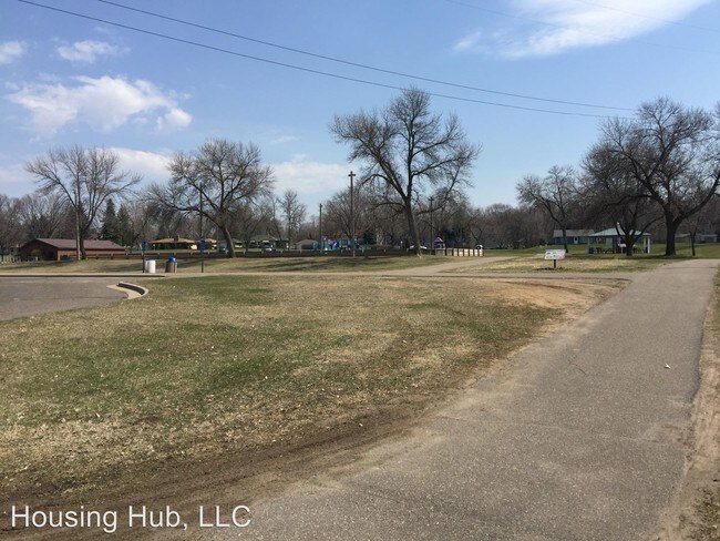
1956 Hazelwood St has 5 parks within 5.4 miles, including Keller Regional Park, Phelan Regional Park, and Phalen Park.
| Hospitals | Distance | ||
|---|---|---|---|
| Hospitals | Distance | ||
| Drive: | 7 min | 3.2 mi | |
| Drive: | 11 min | 5.6 mi | |
| Drive: | 11 min | 5.7 mi |
1956 Hazelwood St has 3 hospitals within 5.7 miles, the nearest is Healtheast St. John's Hospital which is 3.2 miles away and a 7 minute drive.
| Military Bases | Distance | ||
|---|---|---|---|
| Military Bases | Distance | ||
| Drive: | 25 min | 13.5 mi |
1956 Hazelwood St is 13.5 miles and a 25 minute drive from Fort Snelling Military Reservation.
You May Also Like
Similar Rentals Nearby


What Are Walk Score®, Transit Score®, and Bike Score® Ratings?
Walk Score® measures the walkability of any address. Transit Score® measures access to public transit. Bike Score® measures the bikeability of any address.
What is a Sound Score Rating?
A Sound Score Rating aggregates noise caused by vehicle traffic, airplane traffic and local sources
1956 Hazelwood St
Maplewood, MN 55109