
$2,500
/ Month
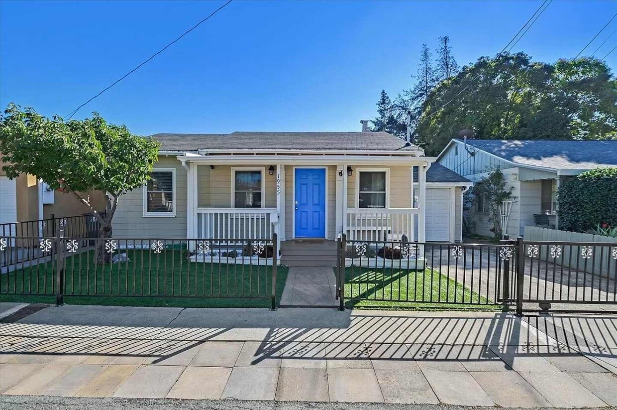
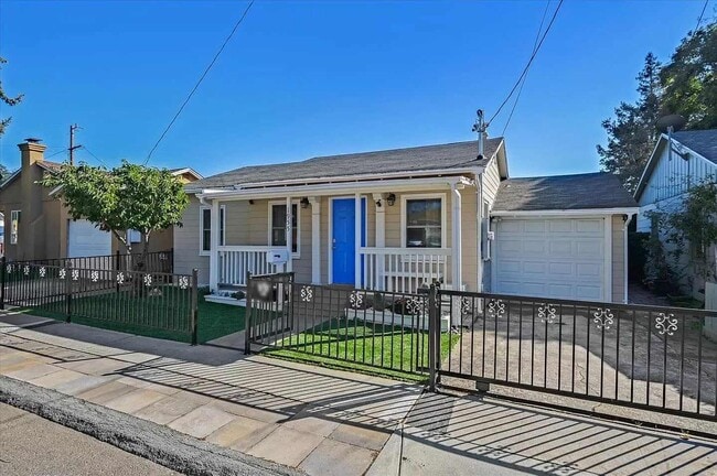
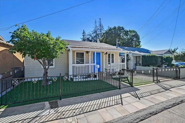
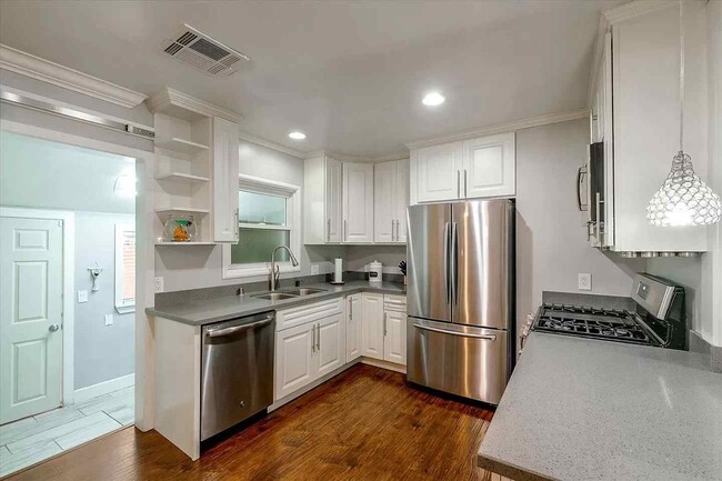
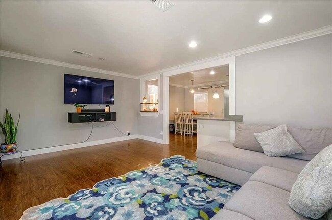
1955 Wingate Way
Hayward, CA 94541
Today
|
Edit
Favorites
209-628-4082
-
Bedrooms
2
-
Bathrooms
1
-
Square Feet
818 sq ft
-
Available
Available Dec 15
1955 Wingate Way

Favorites
Fees and Policies
The fees below are based on community-supplied data and may exclude additional fees and utilities.
- One-Time Basics
- Due at Move-In
- Security Deposit - RefundableCharged per unit.$0
- Due at Move-In
Property Fee Disclaimer: Based on community-supplied data and independent market research. Subject to change without notice. May exclude fees for mandatory or optional services and usage-based utilities.
Contact
- Listed by Mark
- Phone Number
- Contact
Location
Get Directions
Situated in the northeastern-most part of Hayward, Upper B Street offers plenty of affordable rental options and convenient amenities along with easy access to several nearby highways and BART stations. Aside from its remarkable accessibility, Upper B Street’s quiet boulevards lined with charming bungalows and mature trees make the neighborhood stand out.
Located about one mile northeast of Downtown Hayward, Upper B Street is surrounded by a host of lush green spaces for residents to enjoy as well as numerous urban amenities. Hayward Japanese Gardens, Sulphur Creek Nature Center, Don Castro Regional Recreation Area, and Lake Chabot Regional Park are all situated within close proximity to the neighborhood.
The many metropolitan delights of San Francisco are about 27 miles northwest of Upper B Street. Southland Mall offers a bevy of shopping and dining opportunities a little closer to home, sitting just three miles southwest of the neighborhood.
Learn more about living in Upper B Street
Education
| Colleges & Universities | Distance | ||
|---|---|---|---|
| Colleges & Universities | Distance | ||
| Drive: | 9 min | 3.5 mi | |
| Drive: | 12 min | 5.1 mi | |
| Drive: | 20 min | 12.5 mi | |
| Drive: | 22 min | 13.7 mi |
1955 Wingate Way is within 9 minutes or 3.5 miles from Cal State East Bay. It is also near Chabot College and Mills College.
Schools


Public Elementary School
Grades K-6
562 Students
Attendance Zone
Charter Elementary School
Grades K-5
483 Students
Nearby
Public Middle School
Grades 7-8
545 Students
Attendance Zone
Public High School
Grades 9-12
1,712 Students
Attendance Zone
Private Elementary School
Grades 1-6
Nearby
Private Elementary School
Grades PK-5
158 Students
Nearby
Private Elementary & Middle School
Grades K-8
203 Students
Nearby
Private Elementary, Middle & High School
Grades 4-12
Nearby
Private Middle & High School
Grades 9
Nearby
Private Middle & High School
Grades 7 & 9-11
Nearby
School data provided by
 The GreatSchools Rating helps parents compare schools within a state based on a variety of school quality indicators and provides a helpful picture of how effectively each school serves all of its students. Ratings are on a scale of 1 (below average) to 10 (above average) and can include test scores, college readiness, academic progress, advanced courses, equity, discipline and attendance data. We also advise parents to visit schools, consider other information on school performance and programs, and consider family needs as part of the school selection process.
View GreatSchools Rating Methodology
Data provided by GreatSchools.org © 2025. All rights reserved.
View GreatSchools Rating Methodology
Data provided by GreatSchools.org © 2025. All rights reserved.
Transportation options available in Hayward include Hayward Station, located 1.8 miles from 1955 Wingate Way. 1955 Wingate Way is near Metro Oakland International, located 11.5 miles or 18 minutes away, and San Francisco International, located 24.4 miles or 34 minutes away.
| Transit / Subway | Distance | ||
|---|---|---|---|
| Transit / Subway | Distance | ||
|
|
Drive: | 4 min | 1.8 mi |
|
|
Drive: | 7 min | 3.5 mi |
|
|
Drive: | 12 min | 4.7 mi |
|
|
Drive: | 10 min | 5.3 mi |
|
|
Drive: | 14 min | 8.7 mi |
| Commuter Rail | Distance | ||
|---|---|---|---|
| Commuter Rail | Distance | ||
|
|
Drive: | 6 min | 2.5 mi |
| Drive: | 6 min | 2.5 mi | |
| Drive: | 20 min | 11.5 mi | |
| Drive: | 20 min | 11.7 mi | |
| Drive: | 19 min | 13.2 mi |
| Airports | Distance | ||
|---|---|---|---|
| Airports | Distance | ||
|
Metro Oakland International
|
Drive: | 18 min | 11.5 mi |
|
San Francisco International
|
Drive: | 34 min | 24.4 mi |
Time and distance from 1955 Wingate Way.
| Shopping Centers | Distance | ||
|---|---|---|---|
| Shopping Centers | Distance | ||
| Walk: | 3 min | 0.2 mi | |
| Walk: | 3 min | 0.2 mi | |
| Walk: | 20 min | 1.1 mi |
1955 Wingate Way has 3 shopping centers within 1.1 miles, which is about a 20-minute walk. The miles and minutes will be for the farthest away property.
| Parks and Recreation | Distance | ||
|---|---|---|---|
| Parks and Recreation | Distance | ||
|
Don Castro Regional Recreation Area
|
Walk: | 16 min | 0.9 mi |
|
Sulphur Creek Nature Center
|
Drive: | 5 min | 1.6 mi |
|
Cull Canyon Regional Recreation Area
|
Drive: | 7 min | 2.4 mi |
|
Lake Chabot Regional Park
|
Drive: | 9 min | 4.1 mi |
|
Hayward Regional Shoreline
|
Drive: | 17 min | 8.1 mi |
1955 Wingate Way has 5 parks within 8.1 miles, including Don Castro Regional Recreation Area, Sulphur Creek Nature Center, and Cull Canyon Regional Recreation Area.
| Hospitals | Distance | ||
|---|---|---|---|
| Hospitals | Distance | ||
| Drive: | 10 min | 4.9 mi | |
| Drive: | 8 min | 5.0 mi | |
| Drive: | 12 min | 7.8 mi |
1955 Wingate Way has 3 hospitals within 7.8 miles, the nearest is St. Rose Hospital which is 4.9 miles away and a 10 minute drive.
| Military Bases | Distance | ||
|---|---|---|---|
| Military Bases | Distance | ||
| Drive: | 29 min | 18.9 mi |
1955 Wingate Way is 18.9 miles and a 29 minute drive from Alameda/US Naval Air Station Alameda.
You May Also Like
Similar Rentals Nearby


What Are Walk Score®, Transit Score®, and Bike Score® Ratings?
Walk Score® measures the walkability of any address. Transit Score® measures access to public transit. Bike Score® measures the bikeability of any address.
What is a Sound Score Rating?
A Sound Score Rating aggregates noise caused by vehicle traffic, airplane traffic and local sources

1955 Wingate Way
Hayward, CA 94541