$2,200 / Month
1950 Osbourne Pl
Bronx, NY 10453
2 Weeks Ago
Favorites
1950 Osbourne Pl

Favorites
Check Back Soon for Upcoming Availability
| Beds | Baths | Average SF |
|---|---|---|
| 3 Bedrooms 3 Bedrooms 3 Br | 2 Baths 2 Baths 2 Ba | — |
About This Property
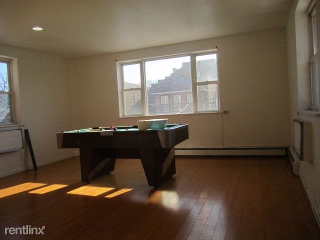
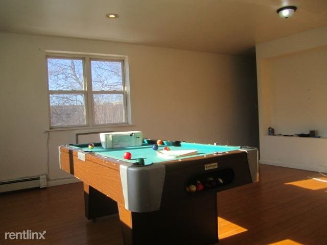
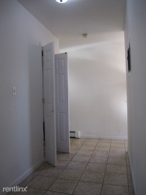
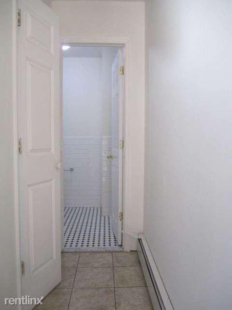
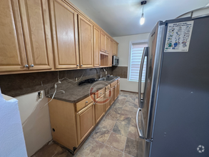
(917) 444-9769 x84 - Newly renovated 3 bedrooms apartment unit multi-fam in the Morris Heights section of BX. The apartment features three large bedrooms and spacious living room and a beautiful kitchen with white appliances and oak cabinets. includes 2 1/2 bathroom. The master bedroom with 1 large closet and full bathroom, also features access to a private balcony overlooking the street. the others 2 bedrooms with closets. Located on a quiet street directly across from Bronx Community College. Easy street parking. Convenient commute by multiple MTA bus lines Bus x3, xto Manhattan. Serviced by the #4 Subway line. (((((CALL ME FOR A VIEWING AT 917.544.5685)))) To Qualify: Proof of income Copy of SS Card and ID 100.00 dollar application fee *non refundable* Credit score 670 and above If you work : Income 88 k or combined Last 3 paystubs Recently income tax / W2 Last 2 months bank statements NOTE: Combined applicant must make together 88k or above to qualify. Accepts Section 8. (RLNE3809531) Other Amenities - Balcony. Appliances - Refrigerator, Oven. Lease lengths - 12 Months- after 2 year renewal. Details regarding this property's Utilities - Resident Pays Electricity, Resident Pays Gas, Water Included, Trash Pick-up Included. Pet policies - Small Dogs Allowed, Cats Allowed.
1950 Osbourne Pl is a townhome located in Bronx County and the 10453 ZIP Code. This area is served by the New York City Geographic District #10 attendance zone.
Location
Get Directions
University Heights is a historic neighborhood in the Bronx. As its name implies, University Heights was once home to New York University. Today, Bronx Community College is located in NYU’s old buildings, and many of them have earned a National Historic Landmark designation. The Hall of Fame for Great Americans is also located in University Heights. Like many New York neighborhoods, University Heights has multiple bus stops, several subway stations, and apartments and condos available for rent. Parks and greenways are located throughout University Heights, adding a pop of greenery in this urban neighborhood. University Woods overlooks the Harlem River while Roberto Clemente State Park is a popular spot for swimming.
Learn more about living in University HeightsBelow are rent ranges for similar nearby apartments
Education
| Colleges & Universities | Distance | ||
|---|---|---|---|
| Colleges & Universities | Distance | ||
| Walk: | 5 min | 0.3 mi | |
| Drive: | 4 min | 1.3 mi | |
| Drive: | 5 min | 1.9 mi | |
| Drive: | 5 min | 2.0 mi |
1950 Osbourne Pl is within 5 minutes or 0.3 mile from Bronx Community College. It is also near Monroe College, Bronx Campus and Yeshiva University, Wilf.
Schools


Public Elementary School
Grades PK-5
336 Students
Attendance Zone
Public Middle School
Grades 6-8
394 Students
Attendance Zone
Public High School
Grades 9-12
341 Students
Nearby
Private Elementary & Middle School
Grades PK-8
Nearby
Private High School
Grades 9-12
323 Students
Nearby
School data provided by
 The GreatSchools Rating helps parents compare schools within a state based on a variety of school quality indicators and provides a helpful picture of how effectively each school serves all of its students. Ratings are on a scale of 1 (below average) to 10 (above average) and can include test scores, college readiness, academic progress, advanced courses, equity, discipline and attendance data. We also advise parents to visit schools, consider other information on school performance and programs, and consider family needs as part of the school selection process.
View GreatSchools Rating Methodology
View GreatSchools Rating Methodology
Transportation options available in Bronx include Burnside Avenue, located 0.5 mile from 1950 Osbourne Pl. 1950 Osbourne Pl is near Laguardia, located 10.2 miles or 20 minutes away, and John F Kennedy International, located 20.7 miles or 31 minutes away.
| Transit / Subway | Distance | ||
|---|---|---|---|
| Transit / Subway | Distance | ||
|
|
Walk: | 10 min | 0.5 mi |
|
|
Walk: | 16 min | 0.8 mi |
|
|
Walk: | 16 min | 0.8 mi |
|
|
Drive: | 5 min | 1.6 mi |
|
|
Drive: | 7 min | 2.4 mi |
| Commuter Rail | Distance | ||
|---|---|---|---|
| Commuter Rail | Distance | ||
|
|
Drive: | 4 min | 1.1 mi |
|
|
Drive: | 4 min | 1.3 mi |
|
|
Drive: | 4 min | 1.4 mi |
|
|
Drive: | 5 min | 1.6 mi |
|
|
Drive: | 7 min | 2.6 mi |
| Airports | Distance | ||
|---|---|---|---|
| Airports | Distance | ||
|
Laguardia
|
Drive: | 20 min | 10.2 mi |
|
John F Kennedy International
|
Drive: | 31 min | 20.7 mi |
Time and distance from 1950 Osbourne Pl.
| Shopping Centers | Distance | ||
|---|---|---|---|
| Shopping Centers | Distance | ||
| Walk: | 10 min | 0.6 mi | |
| Drive: | 4 min | 1.4 mi | |
| Drive: | 5 min | 1.5 mi |
1950 Osbourne Pl has 3 shopping centers within 1.5 miles, which is about a 5-minute walk. The miles and minutes will be for the farthest away property.
| Parks and Recreation | Distance | ||
|---|---|---|---|
| Parks and Recreation | Distance | ||
|
Roberto Clemente State Park
|
Drive: | 4 min | 1.2 mi |
|
St. James Park
|
Drive: | 4 min | 1.5 mi |
|
Dyckman House Park
|
Drive: | 6 min | 1.9 mi |
|
Fort Tryon Park
|
Drive: | 9 min | 3.1 mi |
|
Sherman Creek and Swindler Cove
|
Drive: | 11 min | 4.8 mi |
1950 Osbourne Pl has 5 parks within 4.8 miles, including Roberto Clemente State Park, St. James Park, and Dyckman House Park.
| Hospitals | Distance | ||
|---|---|---|---|
| Hospitals | Distance | ||
| Drive: | 6 min | 2.0 mi | |
| Drive: | 8 min | 2.8 mi | |
| Drive: | 7 min | 2.8 mi |
1950 Osbourne Pl has 3 hospitals within 2.8 miles, the nearest is St. Barnabas Hospital which is 2.0 miles away and a 6 minute drive.
| Military Bases | Distance | ||
|---|---|---|---|
| Military Bases | Distance | ||
| Drive: | 21 min | 11.1 mi |
1950 Osbourne Pl is 11.1 miles and a 21 minute drive from Fort Totten US Govt Reservation.
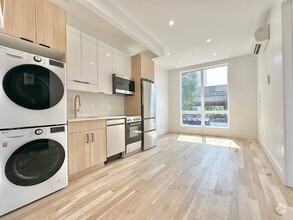
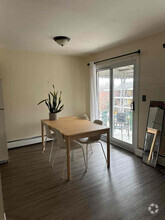
You May Also Like
Similar Rentals Nearby
-
-
1 / 9
-
-
-
-
-
-
-

-


What Are Walk Score®, Transit Score®, and Bike Score® Ratings?
Walk Score® measures the walkability of any address. Transit Score® measures access to public transit. Bike Score® measures the bikeability of any address.
What is a Sound Score Rating?
A Sound Score Rating aggregates noise caused by vehicle traffic, airplane traffic and local sources

1950 Osbourne Pl
Bronx, NY 10453