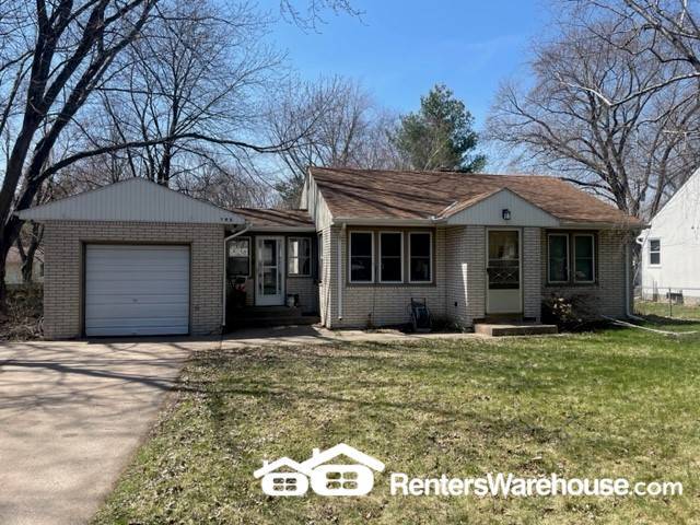
195 McClelland St N
Saint Paul, MN 55119
-
Bedrooms
2
-
Bathrooms
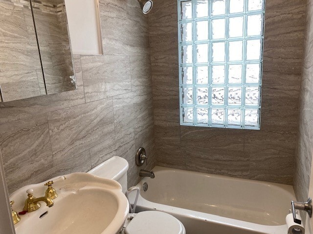
1
-
Square Feet
696 sq ft
-
Available
Available Now
Highlight
- Pets Allowed

About This Home
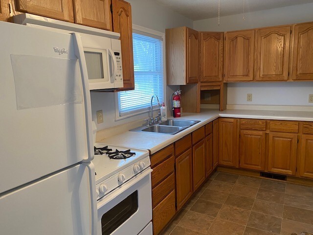
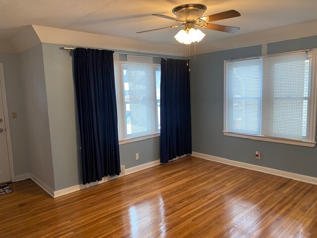
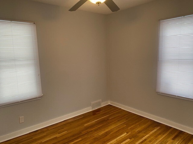
Another excellent Renters Warehouse listing in Maplewood! This 700 sq. ft. 2 bedroom 1 bath home comes complete with hardwood floors, central air, washer/dryer, deck and plenty of extra space. Call this place home today for only $1950 per month. Pets OK with $400 deposit. $60 application fee per adult. This property is not set up for Section 8. Tenant pays gas, electric, water/sewer and trash. Tenants responsible for lawn care and snow removal. $199 lease admin fee due at lease signing and 1% monthly processing fee applies.
195 McClelland St N is a house located in Ramsey County and the 55119 ZIP Code. This area is served by the North St Paul-Maplewood School Dist attendance zone.
House Features
- Refrigerator
Fees and Policies
The fees below are based on community-supplied data and may exclude additional fees and utilities.
- Dogs Allowed
-
Fees not specified
- Cats Allowed
-
Fees not specified
Contact
- Phone Number
- Website View Property Website
- Contact
-
Source

- Refrigerator
Thanks to some odd geography, Maplewood has something of a split personality. This first-ring St. Paul suburb can be described as being shaped like a frying pan. The main business and residential area lies primarily to the north and east of St. Paul, while the chief amenities, such as the community center and an indoor mall, lie in the "pan." South Maplewood, or the "pan handle," runs south along Interstate 494 and has fewer business amenities. Residents of this area tend to shop in bordering Woodbury, since it takes a good half hour to get from the southern tip of Maplewood to the main northern business district.
Meanwhile, Oakdale lies between the two sections, just east of Maplewood's pan handle and north of Woodbury. This young suburb is a quiet bedroom community with a scattering of business districts. Cornfields make up its eastern portion, giving the area a distinctly rural vibe, even though it's just 10 minutes outside of downtown St. Paul.
Learn more about living in Maplewood-Oakdale| Colleges & Universities | Distance | ||
|---|---|---|---|
| Colleges & Universities | Distance | ||
| Drive: | 9 min | 4.8 mi | |
| Drive: | 13 min | 6.9 mi | |
| Drive: | 14 min | 7.2 mi | |
| Drive: | 15 min | 8.9 mi |


View GreatSchools Rating Methodology
Data provided by GreatSchools.org © 2025. All rights reserved.
Transportation options available in Saint Paul include Union Depot Station, located 5.4 miles from 195 McClelland St N. 195 McClelland St N is near Minneapolis-St Paul International/Wold-Chamberlain, located 15.0 miles or 25 minutes away.
| Transit / Subway | Distance | ||
|---|---|---|---|
| Transit / Subway | Distance | ||
| Drive: | 11 min | 5.4 mi | |
| Drive: | 11 min | 5.8 mi | |
| Drive: | 11 min | 5.9 mi | |
| Drive: | 11 min | 6.0 mi | |
| Drive: | 12 min | 6.2 mi |
| Commuter Rail | Distance | ||
|---|---|---|---|
| Commuter Rail | Distance | ||
|
|
Drive: | 11 min | 5.1 mi |
|
|
Drive: | 28 min | 15.7 mi |
|
|
Drive: | 30 min | 21.6 mi |
|
|
Drive: | 41 min | 29.7 mi |
|
|
Drive: | 42 min | 31.4 mi |
| Airports | Distance | ||
|---|---|---|---|
| Airports | Distance | ||
|
Minneapolis-St Paul International/Wold-Chamberlain
|
Drive: | 25 min | 15.0 mi |
Time and distance from 195 McClelland St N.
| Shopping Centers | Distance | ||
|---|---|---|---|
| Shopping Centers | Distance | ||
| Drive: | 6 min | 1.4 mi | |
| Drive: | 5 min | 1.5 mi | |
| Drive: | 4 min | 1.8 mi |
| Parks and Recreation | Distance | ||
|---|---|---|---|
| Parks and Recreation | Distance | ||
|
Maplewood Nature Center
|
Drive: | 5 min | 2.0 mi |
|
Indian Mounds Park
|
Drive: | 9 min | 4.1 mi |
|
Phalen Park
|
Drive: | 13 min | 5.7 mi |
|
Phelan Regional Park
|
Drive: | 14 min | 5.9 mi |
|
Keller Regional Park
|
Drive: | 15 min | 6.6 mi |
| Hospitals | Distance | ||
|---|---|---|---|
| Hospitals | Distance | ||
| Drive: | 5 min | 2.4 mi | |
| Drive: | 10 min | 5.7 mi | |
| Drive: | 11 min | 5.9 mi |
| Military Bases | Distance | ||
|---|---|---|---|
| Military Bases | Distance | ||
| Drive: | 24 min | 13.7 mi |
You May Also Like
What Are Walk Score®, Transit Score®, and Bike Score® Ratings?
Walk Score® measures the walkability of any address. Transit Score® measures access to public transit. Bike Score® measures the bikeability of any address.
What is a Sound Score Rating?
A Sound Score Rating aggregates noise caused by vehicle traffic, airplane traffic and local sources

195 McClelland St N
Saint Paul, MN 55119