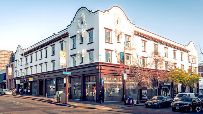
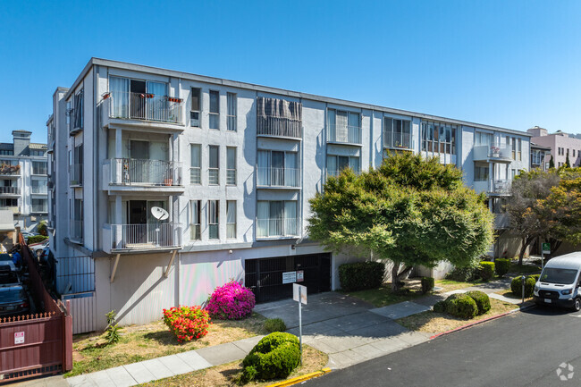
1948 Desert Cir
1948 Desert Cir,
Walnut Creek,
CA
94598
2 Weeks Ago
Favorites
1948 Desert Cir
Favorites
Check Back Soon for Upcoming Availability
Fees and Policies
Details
Property Information
-
Built in 1967
-
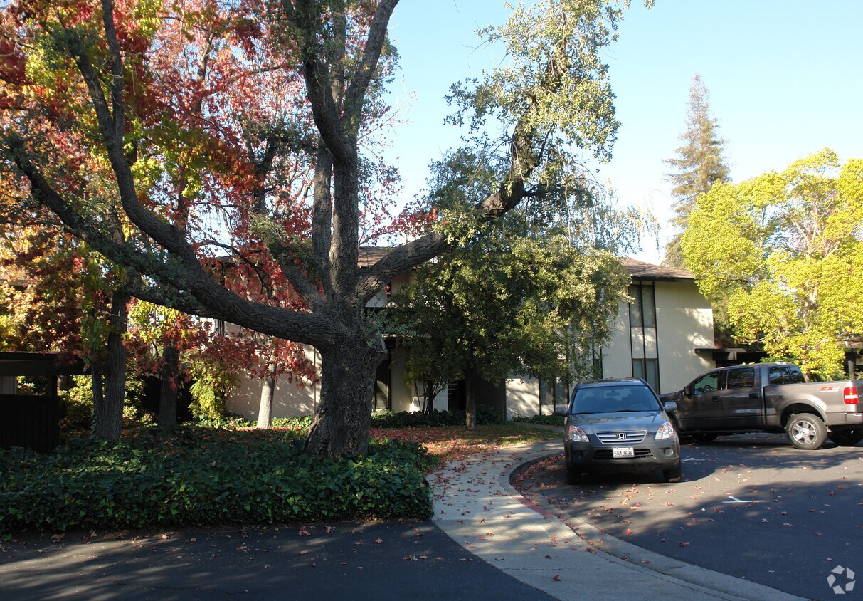
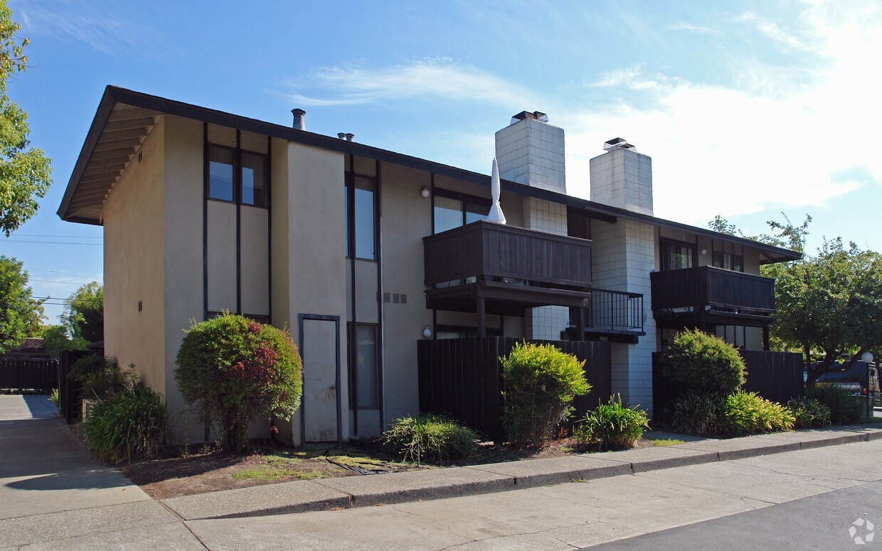
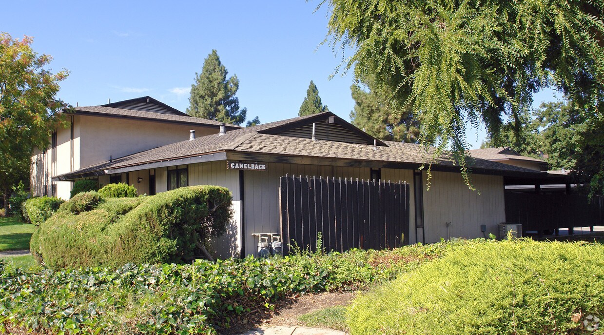
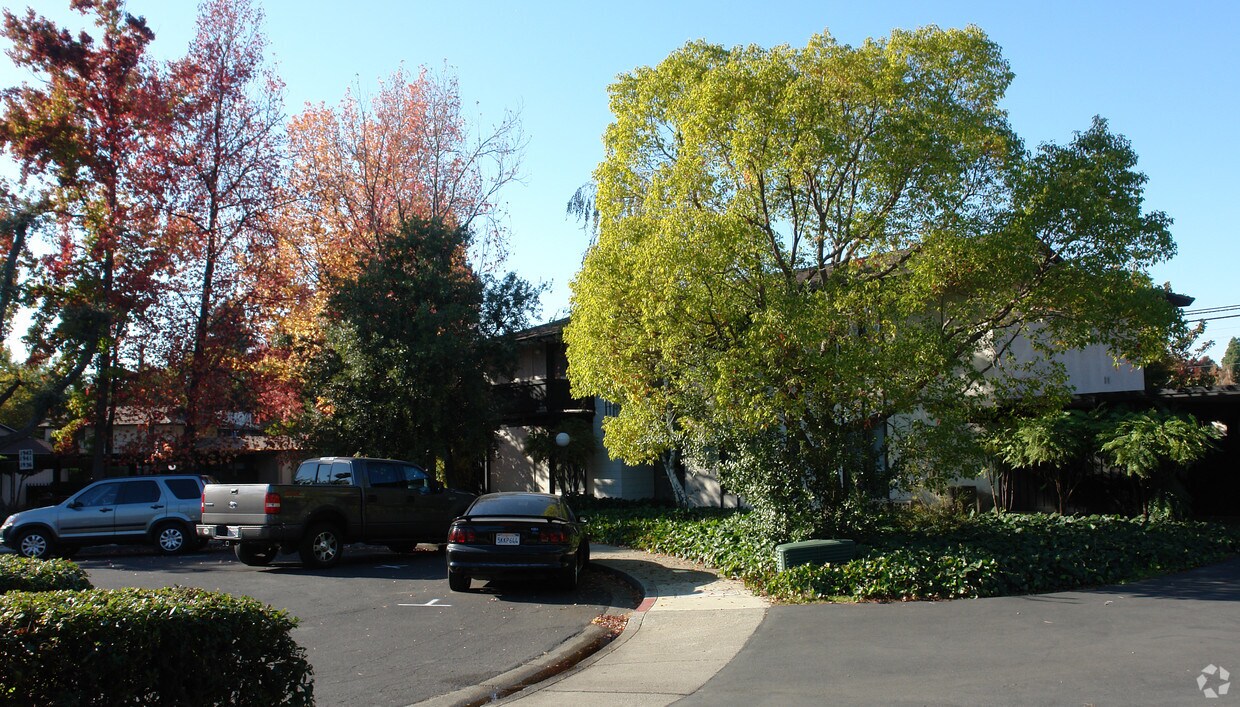
5 units/2 stories
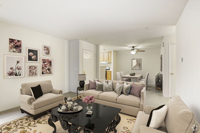
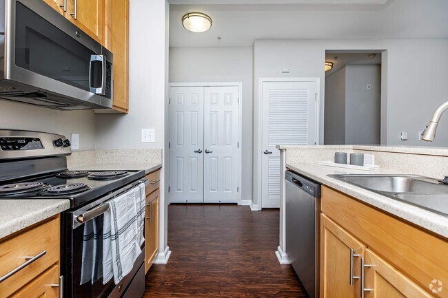
About 1948 Desert Cir Walnut Creek, CA 94598
1948 Desert Cir in Walnut Creek, CA is ready for you to visit. Situated in the 94598 Zip code of Walnut Creek on Desert Cir., residents have access to enjoyable attractions in the surrounding area. The professional leasing team is ready to help you find your perfect new place. Come for a visit to check out the current floorplan options. Come see 1948 Desert Cir today.
1948 Desert Cir is an apartment community located in Contra Costa County and the 94598 ZIP Code. This area is served by the Mt. Diablo Unified attendance zone.
Location
Get Directions
Conveniently located near Oakland and San Francisco, Walnut Creek is an East Bay community filled with rugged, wide-open spaces and an abundance of shopping opportunities, making it the ideal city for easy access to big-city amenities and the great outdoors. Walnut Creek is roughly 30 minutes from Oakland by vehicle, but if public transportation is your preference, this suburb also has direct BART service to both Oakland and San Fran!
Walnut Creek is home to numerous bike paths for both recreation and practical transportation—if you enjoy running your errands or getting to work by bike. Upscale apartments near downtown are very walkable, while rentals towards the east end offer residents easy access to nearby nature preserves and the city’s open spaces. Walnut Creek owns more open space per capita than any city in California, giving residents an enormous amount of room to enjoy outdoor activities.
Learn more about living in Walnut Creek
Education
| Colleges & Universities | Distance | ||
|---|---|---|---|
| Colleges & Universities | Distance | ||
| Drive: | 13 min | 4.9 mi | |
| Drive: | 20 min | 9.0 mi | |
| Drive: | 25 min | 14.3 mi | |
| Drive: | 28 min | 16.5 mi |
1948 Desert Cir is within 13 minutes or 4.9 miles from Diablo Valley, Pleasant Hill. It is also near Saint Marys Coll. of Calif. and Los Medanos College, Pittsburg.
Schools


Public Elementary School
Grades K-5
638 Students
Attendance Zone
Public Elementary School
Grades K-5
317 Students
Nearby
Public Elementary School
Grades K-5
364 Students
Nearby
Public Elementary School
Grades K-5
497 Students
Nearby
Charter Middle & High School
Grades 6-12
341 Students
Nearby
Public Middle School
Grades 6-8
876 Students
Attendance Zone
Public High School
Grades 9-12
1,507 Students
Attendance Zone
Private Elementary & Middle School
Grades PK-8
534 Students
Nearby
Private High School
Grades 9-12
418 Students
Nearby
School data provided by
 The GreatSchools Rating helps parents compare schools within a state based on a variety of school quality indicators and provides a helpful picture of how effectively each school serves all of its students. Ratings are on a scale of 1 (below average) to 10 (above average) and can include test scores, college readiness, academic progress, advanced courses, equity, discipline and attendance data. We also advise parents to visit schools, consider other information on school performance and programs, and consider family needs as part of the school selection process.
View GreatSchools Rating Methodology
View GreatSchools Rating Methodology
Transportation options available in Walnut Creek include Pleasant Hill Station, located 1.9 miles from 1948 Desert Cir. 1948 Desert Cir is near Metro Oakland International, located 26.3 miles or 37 minutes away, and San Francisco International, located 38.3 miles or 56 minutes away.
| Transit / Subway | Distance | ||
|---|---|---|---|
| Transit / Subway | Distance | ||
|
Pleasant Hill Station
|
Drive: | 4 min | 1.9 mi |
|
|
Drive: | 6 min | 2.6 mi |
|
|
Drive: | 12 min | 5.1 mi |
|
|
Drive: | 10 min | 6.3 mi |
|
|
Drive: | 13 min | 7.3 mi |
| Commuter Rail | Distance | ||
|---|---|---|---|
| Commuter Rail | Distance | ||
|
|
Drive: | 18 min | 11.2 mi |
|
|
Drive: | 27 min | 16.8 mi |
|
|
Drive: | 28 min | 17.7 mi |
|
|
Drive: | 27 min | 19.5 mi |
|
|
Drive: | 31 min | 21.4 mi |
| Airports | Distance | ||
|---|---|---|---|
| Airports | Distance | ||
|
Metro Oakland International
|
Drive: | 37 min | 26.3 mi |
|
San Francisco International
|
Drive: | 56 min | 38.3 mi |
Time and distance from 1948 Desert Cir.
| Shopping Centers | Distance | ||
|---|---|---|---|
| Shopping Centers | Distance | ||
| Walk: | 14 min | 0.7 mi | |
| Drive: | 3 min | 1.2 mi | |
| Drive: | 3 min | 1.3 mi |
1948 Desert Cir has 3 shopping centers within 1.3 miles, which is about a 3-minute walk. The miles and minutes will be for the farthest away property.
| Parks and Recreation | Distance | ||
|---|---|---|---|
| Parks and Recreation | Distance | ||
|
The Ruth Bancroft Garden
|
Walk: | 7 min | 0.4 mi |
|
Heather Farm Park
|
Walk: | 14 min | 0.7 mi |
|
Gardens at Heather Farm
|
Walk: | 17 min | 0.9 mi |
|
Contra Costa Canal Regional Trail
|
Drive: | 5 min | 2.2 mi |
|
Howe Homestead Park
|
Drive: | 7 min | 2.7 mi |
1948 Desert Cir has 5 parks within 2.7 miles, including The Ruth Bancroft Garden, Heather Farm Park, and Gardens at Heather Farm.
| Hospitals | Distance | ||
|---|---|---|---|
| Hospitals | Distance | ||
| Walk: | 35 min | 1.8 mi | |
| Drive: | 6 min | 3.1 mi | |
| Drive: | 11 min | 6.2 mi |
1948 Desert Cir has 3 hospitals within 6.2 miles, the nearest is John Muir Medical Center - Walnut Creek Campus which is 1.8 miles away and a 35 minute walk.
You May Also Like
Similar Rentals Nearby


What Are Walk Score®, Transit Score®, and Bike Score® Ratings?
Walk Score® measures the walkability of any address. Transit Score® measures access to public transit. Bike Score® measures the bikeability of any address.
What is a Sound Score Rating?
A Sound Score Rating aggregates noise caused by vehicle traffic, airplane traffic and local sources
Responded To This Review