$3,150
/ Month
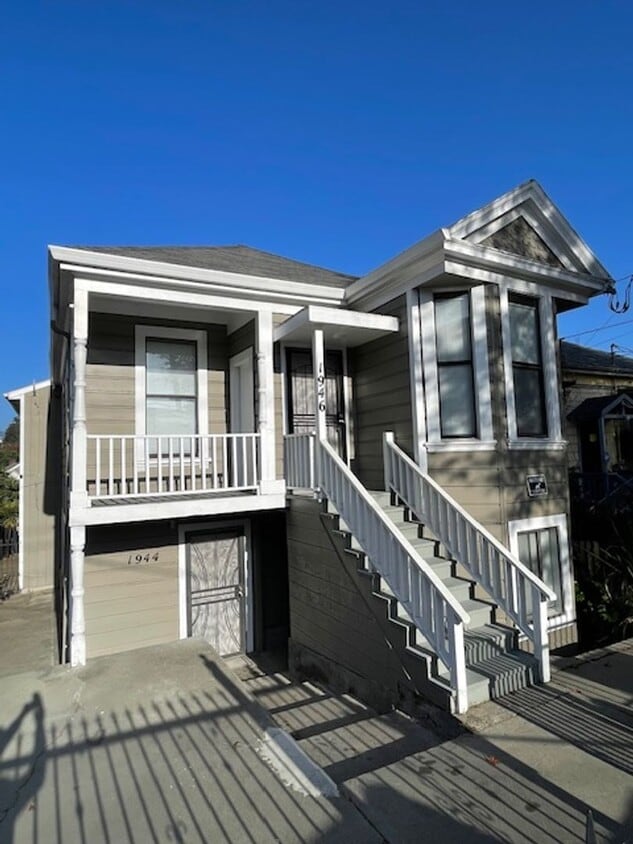
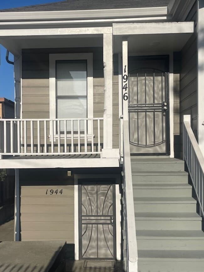
1946 E 20th St Unit 1944 E 20th St
Oakland, CA 94606
Today
|
Edit
Favorites
510-422-0985
-
Bedrooms
4
-
Bathrooms
2
-
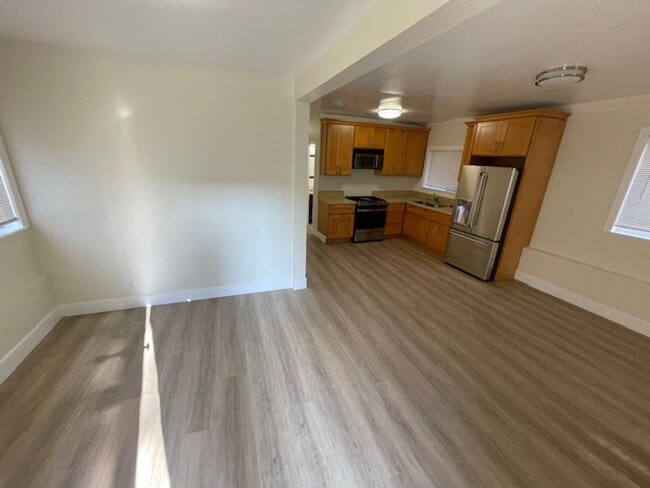
Square Feet
1,452 sq ft
-
Available
Available Now
1946 E 20th St Unit 1944 E 20th St

Favorites
Fees and Policies
The fees below are based on community-supplied data and may exclude additional fees and utilities.
-
One-Time Basics
-
Due at Move-In
-
Security Deposit - RefundableCharged per unit.$2,500
-
-
Due at Move-In
Property Fee Disclaimer: Based on community-supplied data and independent market research. Subject to change without notice. May exclude fees for mandatory or optional services and usage-based utilities.
Contact
- Listed by Selborne Properties Inc | Selborne Properties Inc
- Phone Number
- Contact
Location
Get Directions
Stretching east from 14th Avenue to 29th Avenue in east Oakland, San Antonio may share a name with a Texan city, but this neighborhood is 100% Californian. Bordering the neighborhoods of Fruitvale and East Lake, San Antonio provides a walkable Oakland setting with plenty to see, eat, and experience in the Bay Area. The neighborhood is just three miles from Downtown Oakland and about 14 miles from San Francisco's civic center. Explore International Boulevard, a fitting name for a place that houses taco shops, Cajun food, Thai food, and artisan coffee. San Antonio has the added benefit of being close to Interstate 880 and a few Bay Area Rapid Transit lines. You’ll find impressive Victorian homes here, but most residents enjoy a plethora of low- and mid-rise apartments with access to all that San Antonio has to offer.
Learn more about living in San Antonio
Education
| Colleges & Universities | Distance | ||
|---|---|---|---|
| Colleges & Universities | Distance | ||
| Drive: | 3 min | 1.7 mi | |
| Drive: | 5 min | 2.5 mi | |
| Drive: | 9 min | 4.0 mi | |
| Drive: | 9 min | 4.1 mi |
1946 E 20th St Unit 1944 E 20th St is within 3 minutes or 1.7 miles from Laney College. It is also near Lincoln University, Oakland and Samuel Merritt University.
Transportation options available in Oakland include Fruitvale Station, located 1.7 miles from 1946 E 20th St Unit 1944 E 20th St. 1946 E 20th St Unit 1944 E 20th St is near Metro Oakland International, located 7.6 miles or 12 minutes away, and San Francisco International, located 25.7 miles or 39 minutes away.
| Transit / Subway | Distance | ||
|---|---|---|---|
| Transit / Subway | Distance | ||
|
|
Drive: | 4 min | 1.7 mi |
|
|
Drive: | 5 min | 2.1 mi |
|
|
Drive: | 5 min | 2.5 mi |
|
|
Drive: | 5 min | 2.5 mi |
|
|
Drive: | 6 min | 2.8 mi |
| Commuter Rail | Distance | ||
|---|---|---|---|
| Commuter Rail | Distance | ||
|
|
Drive: | 6 min | 2.4 mi |
|
|
Drive: | 11 min | 6.8 mi |
|
|
Drive: | 14 min | 8.8 mi |
| Drive: | 20 min | 13.3 mi | |
| Drive: | 21 min | 13.4 mi |
| Airports | Distance | ||
|---|---|---|---|
| Airports | Distance | ||
|
Metro Oakland International
|
Drive: | 12 min | 7.6 mi |
|
San Francisco International
|
Drive: | 39 min | 25.7 mi |
Time and distance from 1946 E 20th St Unit 1944 E 20th St.
| Shopping Centers | Distance | ||
|---|---|---|---|
| Shopping Centers | Distance | ||
| Drive: | 3 min | 1.5 mi | |
| Drive: | 3 min | 1.6 mi | |
| Drive: | 4 min | 1.8 mi |
1946 E 20th St Unit 1944 E 20th St has 3 shopping centers within 1.8 miles, which is about a 4-minute drive. The miles and minutes will be for the farthest away property.
| Parks and Recreation | Distance | ||
|---|---|---|---|
| Parks and Recreation | Distance | ||
|
Juan Bautista de Anza National Historic Trail
|
Drive: | 4 min | 2.2 mi |
|
Oakland Museum of California
|
Drive: | 4 min | 2.2 mi |
|
Lakeside Park
|
Drive: | 6 min | 2.4 mi |
|
Rotary Nature Center
|
Drive: | 7 min | 2.7 mi |
|
Lakeside Park Garden Center
|
Drive: | 7 min | 2.7 mi |
1946 E 20th St Unit 1944 E 20th St has 5 parks within 2.7 miles, including Lakeside Park, Oakland Museum of California, and Rotary Nature Center.
| Hospitals | Distance | ||
|---|---|---|---|
| Hospitals | Distance | ||
| Drive: | 3 min | 1.1 mi | |
| Drive: | 3 min | 1.2 mi | |
| Drive: | 7 min | 2.9 mi |
1946 E 20th St Unit 1944 E 20th St has 3 hospitals within 2.9 miles, the nearest is Telecare Heritage Psychiatric Health Facility which is 1.1 miles away and a 3 minute drive.
| Military Bases | Distance | ||
|---|---|---|---|
| Military Bases | Distance | ||
| Drive: | 13 min | 5.6 mi | |
| Drive: | 15 min | 6.0 mi |
1946 E 20th St Unit 1944 E 20th St is 5.6 miles from Alameda/US Naval Air Station Alameda, and is convenient to other military bases, including Oakland Army Base.
You May Also Like
Similar Rentals Nearby


What Are Walk Score®, Transit Score®, and Bike Score® Ratings?
Walk Score® measures the walkability of any address. Transit Score® measures access to public transit. Bike Score® measures the bikeability of any address.
What is a Sound Score Rating?
A Sound Score Rating aggregates noise caused by vehicle traffic, airplane traffic and local sources

1946 E 20th St
Oakland, CA 94606