$3,125
Total Monthly Price
12 Month Lease
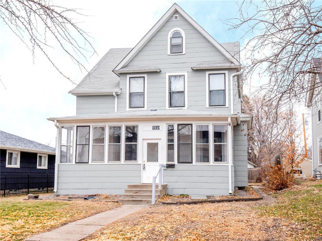
1939 Iglehart Ave
Saint Paul, MN 55104
Today
Favorites
612-294-9396
-
Bedrooms
5
-
Bathrooms
2
-
Square Feet
2,618 sq ft
-
Available
Available Jun 1, 2026
Highlights
- Pets Allowed
- Basement
1939 Iglehart Ave

Favorites
About This Home
12 Month Lease,
$1,575 deposit,
Available Jun 1, 2026
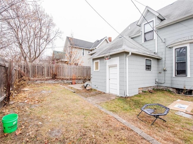
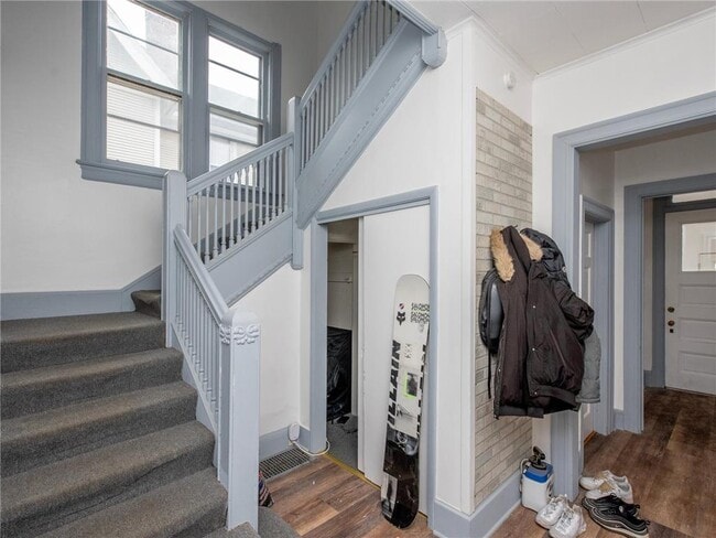
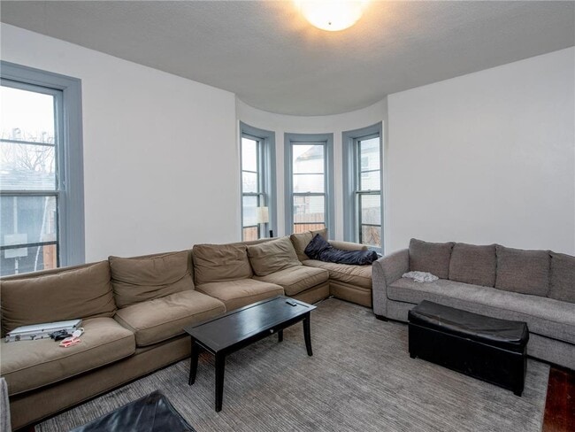
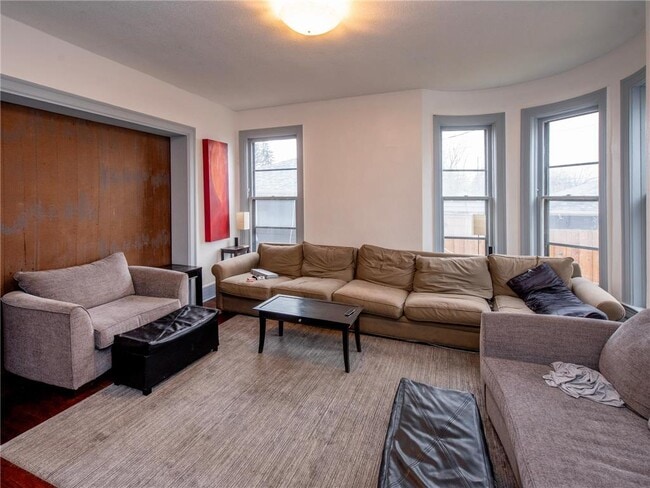
1939 Iglehart Ave. – 5 Bed / 2 Bath – Steps from St. Thomas University Available June 1 This spacious five-bedroom, two-bathroom single-family home is perfectly located near St. Thomas University, making it an ideal choice for students, families or groups looking for a convenient and comfortable place to call home. Enjoy a large living and dining area, bright bedrooms, and tons of space throughout. The home also features a huge basement—perfect for storage or setting up a great hangout and party area. There’s also ample off-street and street parking, plus a nice backyard for summer gatherings. Rental Specials: ? No application fee ? Half-off security deposit ? No pet rent or pet deposit Don’t miss this fantastic home in an unbeatable location—schedule a showing today!
1939 Iglehart Ave is a house located in Ramsey County and the 55104 ZIP Code.
* Price shown is total price based on community-supplied monthly required fees. Excludes user-selected optional fees and variable or usage-based fees and required charges due at or prior to move-in or at move-out. Price, availability, fees, and any applicable rent special are subject to change without notice.
* Square footage definitions vary. Displayed square footage is approximate.
House Features
- Dining Room
- Basement
Fees and Policies
The fees below are based on community-supplied data and may exclude additional fees and utilities.
- Dogs Allowed
-
Fees not specified
- Cats Allowed
-
Fees not specified
- Parking
-
Street--
Contact
- Phone Number
- Contact
Location
Get Directions
Along the shore of the Mississippi River, Merriam Park West offers riverfront parks, a large golf course, and quaint local restaurants just minutes from downtown Saint Paul, Minnesota. Stop on in at Izzy’s Ice Cream Café, or grab a treat at Black Coffee and Waffle Bar. Local businesses thrive alongside riverfront community spaces like Shadow Falls Park, a picturesque nature preserve.
The University of Saint Thomas resides on the south end of town, and the neighborhood offers a blend of private and public schools, churches, and every day conveniences. Situated just five miles southeast of Minneapolis and seven miles northeast of the Minneapolis-Saint Paul International Airport, this neighborhood is in a premier location for commuting, shopping, dining, and entertainment.
Learn more about living in Merriam Park West
Education
| Colleges & Universities | Distance | ||
|---|---|---|---|
| Colleges & Universities | Distance | ||
| Walk: | 18 min | 1.0 mi | |
| Drive: | 3 min | 1.4 mi | |
| Drive: | 3 min | 1.6 mi | |
| Drive: | 6 min | 2.2 mi |
1939 Iglehart Ave is within 18 minutes or 1.0 mile from Univ. of St Thomas, St. Paul. It is also near Concordia Univ.-Saint Paul and Macalester College.
Transportation options available in Saint Paul include Fairview Ave Station, located 0.7 mile from 1939 Iglehart Ave. 1939 Iglehart Ave is near Minneapolis-St Paul International/Wold-Chamberlain, located 7.4 miles or 15 minutes away.
| Transit / Subway | Distance | ||
|---|---|---|---|
| Transit / Subway | Distance | ||
| Walk: | 13 min | 0.7 mi | |
| Drive: | 3 min | 1.3 mi | |
| Drive: | 4 min | 1.6 mi | |
| Drive: | 3 min | 1.7 mi | |
| Drive: | 5 min | 2.0 mi |
| Commuter Rail | Distance | ||
|---|---|---|---|
| Commuter Rail | Distance | ||
|
|
Drive: | 9 min | 5.5 mi |
|
|
Drive: | 14 min | 6.4 mi |
|
|
Drive: | 22 min | 14.9 mi |
|
|
Drive: | 32 min | 23.7 mi |
|
|
Drive: | 33 min | 25.4 mi |
| Airports | Distance | ||
|---|---|---|---|
| Airports | Distance | ||
|
Minneapolis-St Paul International/Wold-Chamberlain
|
Drive: | 15 min | 7.4 mi |
Time and distance from 1939 Iglehart Ave.
| Shopping Centers | Distance | ||
|---|---|---|---|
| Shopping Centers | Distance | ||
| Drive: | 4 min | 1.5 mi | |
| Drive: | 3 min | 1.5 mi | |
| Drive: | 3 min | 1.6 mi |
1939 Iglehart Ave has 3 shopping centers within 1.6 miles, which is about a 3-minute drive. The miles and minutes will be for the farthest away property.
| Parks and Recreation | Distance | ||
|---|---|---|---|
| Parks and Recreation | Distance | ||
|
Macalester College Observatory
|
Drive: | 3 min | 1.6 mi |
|
Newell Park
|
Drive: | 4 min | 1.9 mi |
|
Brackett Park
|
Drive: | 5 min | 2.1 mi |
|
Tower Hill Park
|
Drive: | 6 min | 2.4 mi |
|
Longfellow Park
|
Drive: | 6 min | 2.5 mi |
1939 Iglehart Ave has 5 parks within 2.5 miles, including Newell Park, Macalester College Observatory, and Brackett Park.
| Hospitals | Distance | ||
|---|---|---|---|
| Hospitals | Distance | ||
| Drive: | 7 min | 3.7 mi | |
| Drive: | 11 min | 4.3 mi | |
| Drive: | 8 min | 4.4 mi |
1939 Iglehart Ave has 3 hospitals within 4.4 miles, the nearest is University of Minnesota Medical Center, Fairview which is 3.7 miles away and a 7 minute drive.
| Military Bases | Distance | ||
|---|---|---|---|
| Military Bases | Distance | ||
| Drive: | 14 min | 6.1 mi |
1939 Iglehart Ave is 6.1 miles and a 14 minute drive from Fort Snelling Military Reservation.
Amenities
- Dining Room
- Basement
1939 Iglehart Ave Photos
What Are Walk Score®, Transit Score®, and Bike Score® Ratings?
Walk Score® measures the walkability of any address. Transit Score® measures access to public transit. Bike Score® measures the bikeability of any address.
What is a Sound Score Rating?
A Sound Score Rating aggregates noise caused by vehicle traffic, airplane traffic and local sources

1939 Iglehart Ave
Saint Paul, MN 55104