1926-1934 S West Temple
1926-1934 S West Temple,
Salt Lake City,
UT
84115
2 Weeks Ago
Favorites
1926-1934 S West Temple
Favorites
Check Back Soon for Upcoming Availability
Fees and Policies
The fees below are based on community-supplied data and may exclude additional fees and utilities.
- Parking
-
Surface Lot--1 Max
Details
Property Information
-
Built in 1967
-
12 units/2 stories
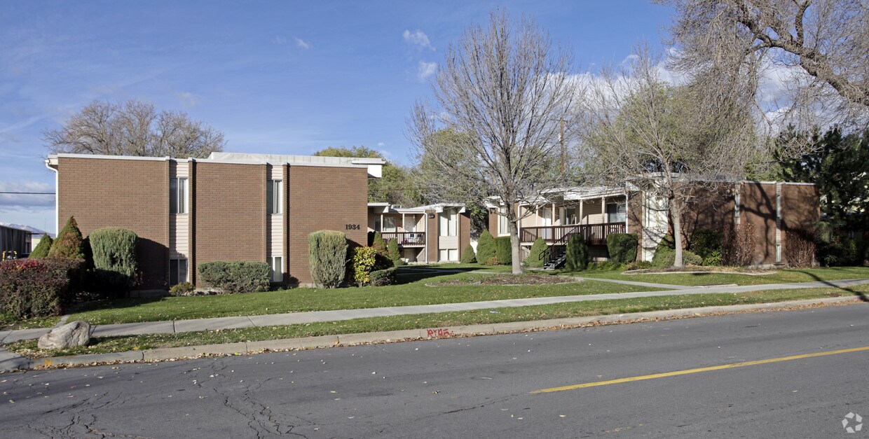
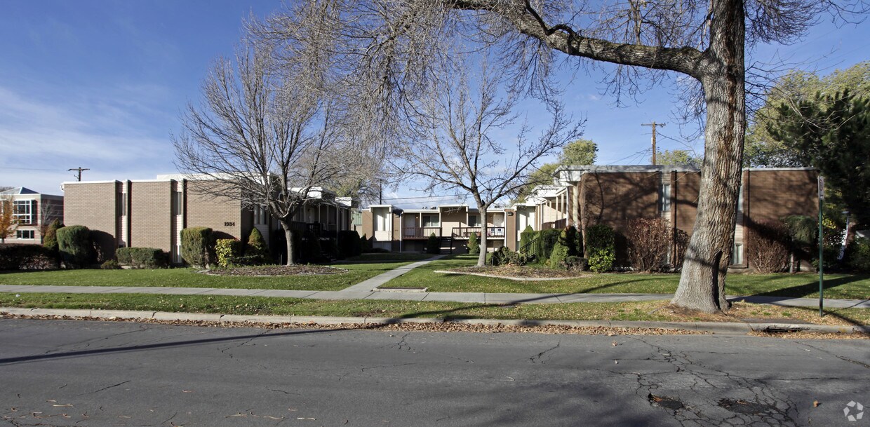
About 1926-1934 S West Temple Salt Lake City, UT 84115
At 1926-1934 S West Temple in Salt Lake City, UT, find a great place to live. These apartments are located in Salt Lake City on S. West Temple in the 84115 area. Come by to check out the current floorplan options. The professional leasing staff is waiting to show you all that this community has in store. Come see 1926-1934 S West Temple today.
1926-1934 S West Temple is an apartment community located in Salt Lake County and the 84115 ZIP Code. This area is served by the Salt Lake District attendance zone.
Location
Get Directions
Situated between Interstate 15 and Highway 89, People’s Freeway is a park-like area home to quirky attractions. Catch a Salt Lake Bees game at Smith’s Ballpark, located off Main Street, or head a bit north of the neighborhood to Brewvies Cinema Pub, a movie theater serving local beers. Other excitement within the area includes a rock-climbing gym, a haunted house, and community parks. People’s Freeway is also known for its great food and shopping options. Restaurants serving everything from biscuits and limeade to dim sum are located throughout town. Retail centers equipped with a variety of businesses and stores round out the commercial developments. The rest of People’s Freeway is made up residential areas with a variety of apartments for rent.
Learn more about living in People's FreewayBelow are rent ranges for similar nearby apartments
Education
| Colleges & Universities | Distance | ||
|---|---|---|---|
| Colleges & Universities | Distance | ||
| Drive: | 7 min | 2.5 mi | |
| Drive: | 12 min | 5.2 mi | |
| Drive: | 14 min | 5.8 mi | |
| Drive: | 14 min | 6.4 mi |
1926-1934 S West Temple is within 7 minutes or 2.5 miles from Westminster College. It is also near The University of Utah and The Univ. of Utah, Ft Douglas.
Schools


Public Elementary & Middle School
Grades K-8
Attendance Zone
Public Elementary School
Grades PK-6
499 Students
Attendance Zone
Public Middle & High School
Grades 7-12
40 Students
Nearby
Public Middle School
Grades 7-8
555 Students
Attendance Zone
Public High School
Grades 9-12
1,980 Students
Attendance Zone
Public High School
Grades 9-12
293 Students
Attendance Zone
Private Elementary & Middle School
Grades PK-8
205 Students
Nearby
Private High School
Grades 9-12
35 Students
Nearby
School data provided by
 The GreatSchools Rating helps parents compare schools within a state based on a variety of school quality indicators and provides a helpful picture of how effectively each school serves all of its students. Ratings are on a scale of 1 (below average) to 10 (above average) and can include test scores, college readiness, academic progress, advanced courses, equity, discipline and attendance data. We also advise parents to visit schools, consider other information on school performance and programs, and consider family needs as part of the school selection process.
View GreatSchools Rating Methodology
Data provided by GreatSchools.org © 2025. All rights reserved.
View GreatSchools Rating Methodology
Data provided by GreatSchools.org © 2025. All rights reserved.
Transportation options available in Salt Lake City include Central Pointe Station, located 0.4 mile from 1926-1934 S West Temple. 1926-1934 S West Temple is near Salt Lake City International, located 8.5 miles or 13 minutes away.
| Transit / Subway | Distance | ||
|---|---|---|---|
| Transit / Subway | Distance | ||
|
|
Walk: | 8 min | 0.4 mi |
|
|
Walk: | 12 min | 0.6 mi |
|
|
Walk: | 19 min | 1.0 mi |
|
|
Drive: | 3 min | 1.2 mi |
|
|
Drive: | 4 min | 1.4 mi |
| Commuter Rail | Distance | ||
|---|---|---|---|
| Commuter Rail | Distance | ||
|
|
Drive: | 9 min | 4.5 mi |
|
|
Drive: | 10 min | 5.9 mi |
|
|
Drive: | 16 min | 12.9 mi |
|
|
Drive: | 17 min | 13.3 mi |
|
|
Drive: | 23 min | 16.6 mi |
| Airports | Distance | ||
|---|---|---|---|
| Airports | Distance | ||
|
Salt Lake City International
|
Drive: | 13 min | 8.5 mi |
Time and distance from 1926-1934 S West Temple.
| Shopping Centers | Distance | ||
|---|---|---|---|
| Shopping Centers | Distance | ||
| Walk: | 8 min | 0.5 mi | |
| Walk: | 10 min | 0.6 mi | |
| Walk: | 15 min | 0.8 mi |
1926-1934 S West Temple has 3 shopping centers within 0.8 mile, which is about a 15-minute walk. The miles and minutes will be for the farthest away property.
| Parks and Recreation | Distance | ||
|---|---|---|---|
| Parks and Recreation | Distance | ||
|
Liberty Park
|
Drive: | 6 min | 2.5 mi |
|
International Peace Gardens
|
Drive: | 6 min | 2.6 mi |
|
Mormon Pioneer National Historic Trail
|
Drive: | 7 min | 2.8 mi |
|
Tracy Aviary
|
Drive: | 9 min | 3.2 mi |
|
Jordan River Parkway
|
Drive: | 8 min | 3.2 mi |
1926-1934 S West Temple has 5 parks within 3.2 miles, including Tracy Aviary, Liberty Park, and Mormon Pioneer National Historic Trail.
| Hospitals | Distance | ||
|---|---|---|---|
| Hospitals | Distance | ||
| Drive: | 3 min | 1.3 mi | |
| Drive: | 7 min | 4.0 mi | |
| Drive: | 10 min | 4.2 mi |
1926-1934 S West Temple has 3 hospitals within 4.2 miles, the nearest is Marian Center which is 1.3 miles away and a 3 minute drive.
| Military Bases | Distance | ||
|---|---|---|---|
| Military Bases | Distance | ||
| Drive: | 10 min | 6.8 mi |
1926-1934 S West Temple is 6.8 miles and a 10 minute drive from Salt Lake City Airport Air Guard Station.
You May Also Like
What neighborhood is the property located in?
1926-1934 S West Temple Salt Lake City, UT 84115 is in People's Freeway in the city of Salt Lake City. Here you’ll find three shopping centers within 0.8 mile of the property. Five parks are within 3.2 miles, including Tracy Aviary, Liberty Park, and Mormon Pioneer National Historic Trail.
Similar Rentals Nearby


What Are Walk Score®, Transit Score®, and Bike Score® Ratings?
Walk Score® measures the walkability of any address. Transit Score® measures access to public transit. Bike Score® measures the bikeability of any address.
What is a Sound Score Rating?
A Sound Score Rating aggregates noise caused by vehicle traffic, airplane traffic and local sources
Responded To This Review