$595
/ Month
1918-1920 Bellerive Dr
Nixa, MO 65714
2 Weeks Ago
|
Edit
Favorites
1918-1920 Bellerive Dr

Favorites
Check Back Soon for Upcoming Availability
| Beds | Baths | Average SF |
|---|---|---|
| 2 Bedrooms 2 Bedrooms 2 Br | 1 Bath 1 Bath 1 Ba | 1,064 SF |
About This Property
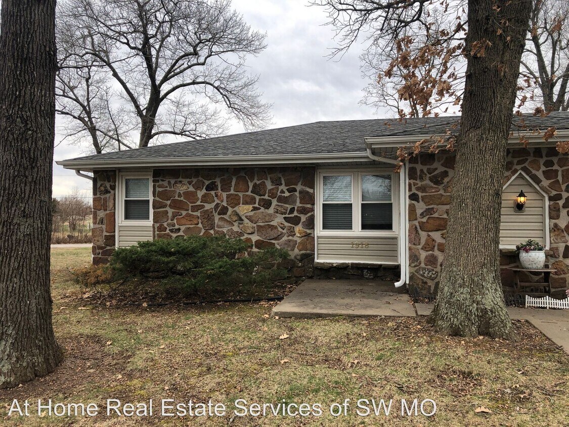
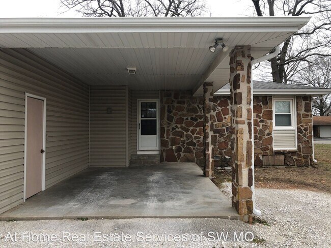
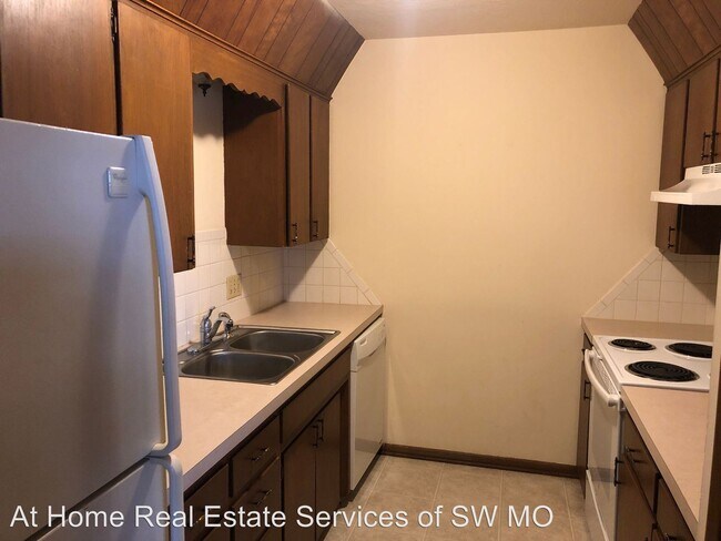
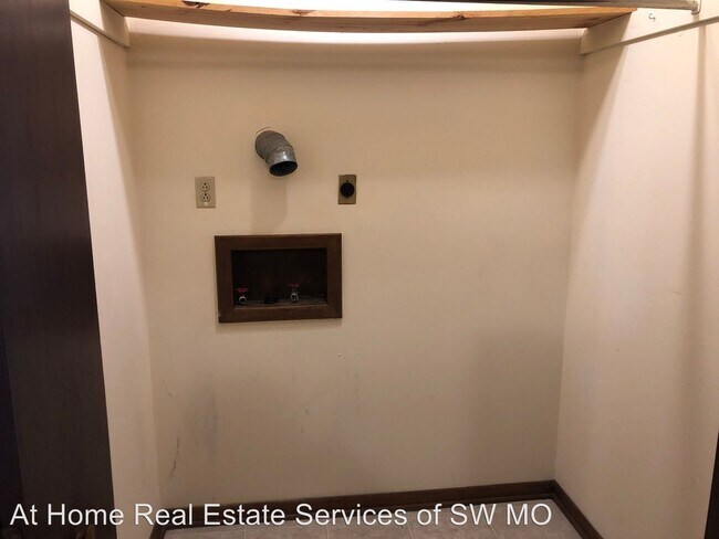
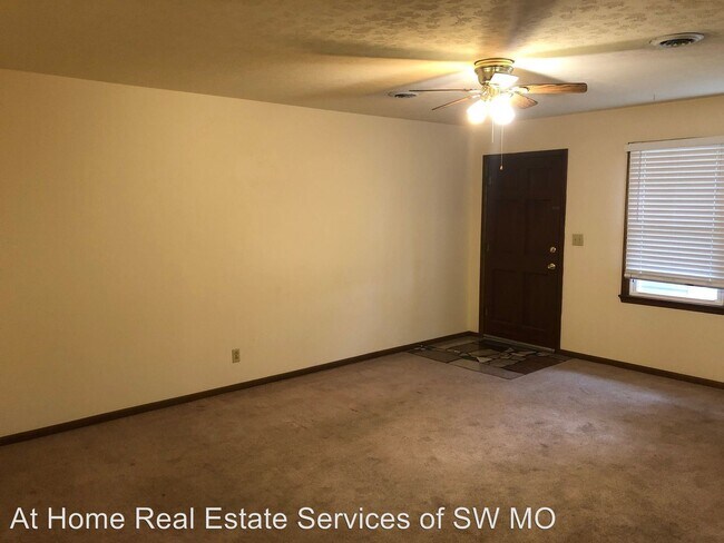
(417) 832-0885 x205 - - 1918 Bellerive 2 bedrooms, 1 bath, carport Washer/dryer hook-ups Central heating and air Refrigerator, stove, dishwasher provided No pets allowed Trash and lawn care provided Lots of closet space Ceiling fans AT HOME REAL ESTATE SERVICES 832-0885 EXT 205 ATHOMEHERE.COM Jamie@athomehere.com CELL 417-763-2093 (RLNE5649120)
1918-1920 Bellerive Dr is an apartment community located in Christian County and the 65714 ZIP Code.
1918-1920 Bellerive Dr,
Nixa,
MO
65714
Education
| Colleges & Universities | Distance | ||
|---|---|---|---|
| Colleges & Universities | Distance | ||
| Drive: | 23 min | 13.0 mi | |
| Drive: | 22 min | 14.1 mi | |
| Drive: | 23 min | 14.8 mi | |
| Drive: | 23 min | 15.1 mi |
1918-1920 Bellerive Dr is within 23 minutes or 13.0 miles from Missouri State University. It is also near Ozarks Tech. C.C., Springfield and Drury University.
Walkability Near 1918-1920 Bellerive Dr Nixa, MO 65714
Getting Around
 What do Walkability, Transit, Drivability, and Bikeability mean?
Walkability measures the walking distance to day-to-day needs.
Transit measures access to public transportation.
Drivability measures congestion, parking availability, and access to major roads.
Bikeability measures the suitability for cycling.
How It Works
What do Walkability, Transit, Drivability, and Bikeability mean?
Walkability measures the walking distance to day-to-day needs.
Transit measures access to public transportation.
Drivability measures congestion, parking availability, and access to major roads.
Bikeability measures the suitability for cycling.
How It Works
Somewhat Walkable
Walkability
20
/ 100
Exceptionally Drivable
Drivability
100
/ 100
Somewhat Bikeable
Bikeability
20
/ 100
Scores provided by
-
Soundscore™
-
/ 100
Traffic
-Airport
-Businesses
-Scores provided by
HowLoud What is a Sound Score Rating? A Sound Score Rating aggregates noise caused by vehicle traffic, airplane traffic and local sources. How It WorksYou May Also Like
Similar Rentals Nearby
-
-
-
-
-
2 Beds$791+3 Beds$726+4 Beds$656+Total Monthly PriceTotal Monthly Price NewPrices include base rent and required monthly fees of $51 - $52. Variable costs based on usage may apply.Base Rent:2 Beds$740+3 Beds$675+4 Beds$605+
Pets Allowed Fitness Center Pool Dishwasher Refrigerator Kitchen
-
-
-
-
-


")


What Are Walk Score®, Transit Score®, and Bike Score® Ratings?
Walk Score® measures the walkability of any address. Transit Score® measures access to public transit. Bike Score® measures the bikeability of any address.
What is a Sound Score Rating?
A Sound Score Rating aggregates noise caused by vehicle traffic, airplane traffic and local sources.

1918-1920 Bellerive Dr
Nixa, MO 65714