$1,750 / Month
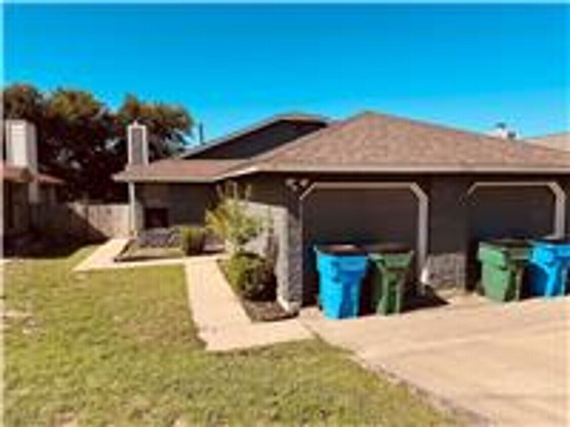
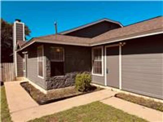
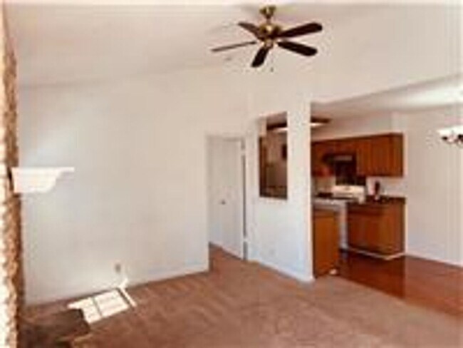
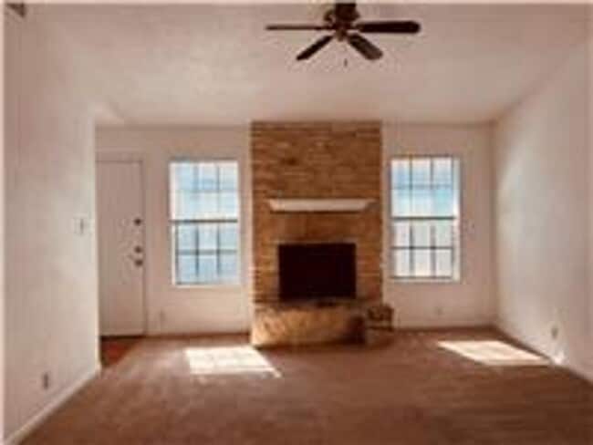
1917 Margalene Way Unit 1917 Margalene Way - A
Austin, TX 78728
Today
Favorites
512-337-9396
-
Bedrooms
3
-
Bathrooms
2
-
Square Feet
1,949 sq ft
-
Available
Available Now
1917 Margalene Way Unit 1917 Margalene Way - A

Favorites
Contact
- Listed by The Texas Property Manager | The Texas Property Manager
- Phone Number
- Contact
Location
Get Directions
Located about 15 miles north of Downtown Austin and five miles south of Round Rock, Wells Branch is a family-friendly suburb with plenty to see and do. Residents have their choice of a wide variety of apartments and single-family houses available for rent in Wells Branch.
The area offers a delightful suburban experience, with peaceful neighborhoods, scenic parks, and plenty of convenient shopping opportunities. Recreational options abound at Katherine Fleischer Park, Mills Pond Recreation Area, and Wells Branch Disc Golf Course, where residents often gather to enjoy the outdoors. Getting around from Wells Branch is a breeze with quick access to I-35 and the MoPac Expressway.
Learn more about living in Wells Branch
Education
| Colleges & Universities | Distance | ||
|---|---|---|---|
| Colleges & Universities | Distance | ||
| Drive: | 8 min | 3.7 mi | |
| Drive: | 8 min | 4.1 mi | |
| Drive: | 18 min | 12.1 mi | |
| Drive: | 22 min | 14.8 mi |
1917 Margalene Way Unit 1917 Margalene Way - A is within 8 minutes or 3.7 miles from Austin C.C., Northridge Campus. It is also near The Art Institute of Austin and Austin C.C., Round Rock Campus.
Transportation options available in Austin include Howard Station, located 1.6 miles from 1917 Margalene Way Unit 1917 Margalene Way - A. 1917 Margalene Way Unit 1917 Margalene Way - A is near Austin-Bergstrom International, located 24.5 miles or 37 minutes away.
| Transit / Subway | Distance | ||
|---|---|---|---|
| Transit / Subway | Distance | ||
| Drive: | 4 min | 1.6 mi | |
| Drive: | 11 min | 5.2 mi | |
| Drive: | 10 min | 5.2 mi | |
| Drive: | 15 min | 8.2 mi | |
| Drive: | 16 min | 9.5 mi |
| Commuter Rail | Distance | ||
|---|---|---|---|
| Commuter Rail | Distance | ||
|
|
Drive: | 21 min | 15.2 mi |
|
|
Drive: | 33 min | 25.6 mi |
| Airports | Distance | ||
|---|---|---|---|
| Airports | Distance | ||
|
Austin-Bergstrom International
|
Drive: | 37 min | 24.5 mi |
Time and distance from 1917 Margalene Way Unit 1917 Margalene Way - A.
| Shopping Centers | Distance | ||
|---|---|---|---|
| Shopping Centers | Distance | ||
| Walk: | 6 min | 0.3 mi | |
| Walk: | 10 min | 0.5 mi | |
| Walk: | 18 min | 0.9 mi |
1917 Margalene Way Unit 1917 Margalene Way - A has 3 shopping centers within 0.9 mile, which is about a 18-minute walk. The miles and minutes will be for the farthest away property.
| Parks and Recreation | Distance | ||
|---|---|---|---|
| Parks and Recreation | Distance | ||
|
Walnut Creek Park
|
Drive: | 6 min | 3.3 mi |
|
Balcones District Park
|
Drive: | 8 min | 4.5 mi |
|
Copperfield Nature Trail and Park
|
Drive: | 9 min | 4.9 mi |
|
The Stephen F. Austin Planetarium
|
Drive: | 9 min | 5.6 mi |
|
Jourdan-Bachman Pioneer Farms
|
Drive: | 13 min | 6.5 mi |
1917 Margalene Way Unit 1917 Margalene Way - A has 5 parks within 6.5 miles, including Walnut Creek Park, Balcones District Park, and Copperfield Nature Trail and Park.
| Hospitals | Distance | ||
|---|---|---|---|
| Hospitals | Distance | ||
| Drive: | 7 min | 3.7 mi | |
| Drive: | 10 min | 6.4 mi | |
| Drive: | 11 min | 7.3 mi |
1917 Margalene Way Unit 1917 Margalene Way - A has 3 hospitals within 7.3 miles, the nearest is North Austin Medical Center which is 3.7 miles away and a 7 minute drive.
| Military Bases | Distance | ||
|---|---|---|---|
| Military Bases | Distance | ||
| Drive: | 77 min | 61.8 mi | |
| Drive: | 96 min | 79.7 mi |
1917 Margalene Way Unit 1917 Margalene Way - A is 61.8 miles from Fort Cavazos, and is convenient to other military bases, including Randolph Air Force Base.
You May Also Like
Similar Rentals Nearby


What Are Walk Score®, Transit Score®, and Bike Score® Ratings?
Walk Score® measures the walkability of any address. Transit Score® measures access to public transit. Bike Score® measures the bikeability of any address.
What is a Sound Score Rating?
A Sound Score Rating aggregates noise caused by vehicle traffic, airplane traffic and local sources

1917 Margalene Way
Austin, TX 78728