$3,000
/ Month
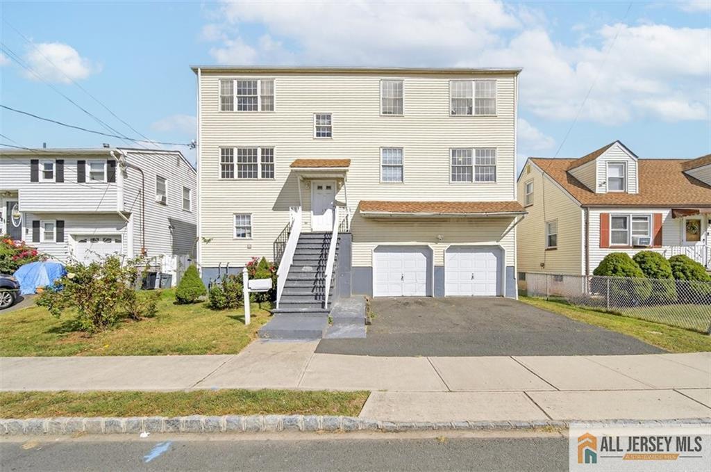
19 Harris St
Carteret, NJ 07008
Today
|
Edit
Favorites
-
Bedrooms
3
-
Bathrooms
2
-
Square Feet
1,200 sq ft
-
Available
Available Now
19 Harris St

Favorites
About This Home
12 Month Lease,
$4,500 deposit,
Available Now
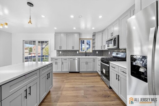
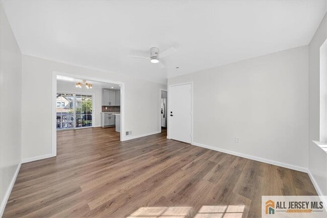
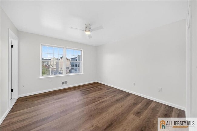
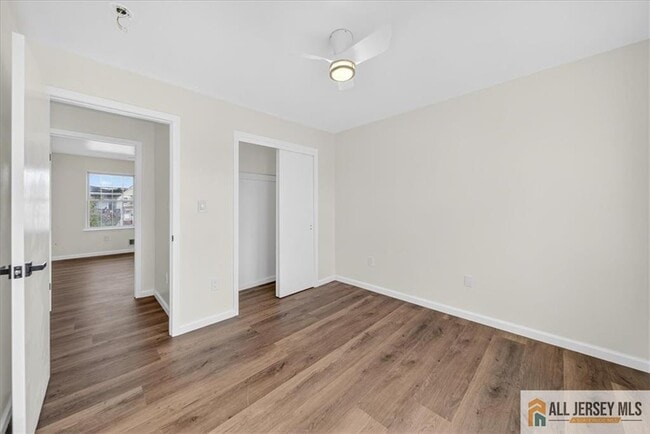
This spacious and fully renovated first-floor unit offers three bedrooms and two full baths, combining modern comfort with everyday convenience. The updated kitchen features contemporary finishes and plenty of storage, while the open living area provides a warm and inviting space to relax or entertain. Brand new flooring all throughout. Bus stop that takes you to New York City is walking distance from the home at the corner of Harris St. This home is conveniently located near public transportation and major highways, offering easy access for commuters
19 Harris St is an apartment community located in Middlesex County and the 07008 ZIP Code. This area is served by the Carteret Public attendance zone.
* Price shown is base rent. Excludes user-selected optional fees and variable or usage-based fees and required charges due at or prior to move-in or at move-out. Price, availability, fees, and any applicable rent special are subject to change without notice.
* Square footage definitions vary. Displayed square footage is approximate.
Apartment Features
- Air Conditioning
- Dishwasher
- Kitchen
Fees and Policies
The fees below are based on community-supplied data and may exclude additional fees and utilities.
Details
Utilities Included
-
Water
Property Information
-
2 units
Contact
- Contact
Location
Get Directions
Located directly across the Arthur Kill from Staten Island, Carteret was once part of the Woodbridge Township. It became the borough of Roosevelt in 1906 and was renamed Carteret in 1922. This popular community is bordered by the Rahway River to the north, Arthur Kill to the east, and the Ernest L. Oros Wildlife Preserve to the west. Due to its central location, the borough bills itself as the "Center of it All."
Residents enjoy a fantastic location and beautiful parks. Carteret Waterfront Park has a fishing pier and access to two hiking trails: Danielle's Garden Trail and the Waterfront Fitness Trail. Shopping in Carteret is plentiful -- the brick-paved sidewalks and outdoor cafes along Washington Avenue provide historic charm and locally-owned businesses, while the shops and restaurants along Roosevelt Avenue have a more modern feel. With just 22 miles to Manhattan, 10 miles to Newark, and 70 miles to Philadelphia, residents can easily commute to nearby cities.
Learn more about living in Carteret
Education
| Colleges & Universities | Distance | ||
|---|---|---|---|
| Colleges & Universities | Distance | ||
| Drive: | 14 min | 7.6 mi | |
| Drive: | 18 min | 9.2 mi | |
| Drive: | 19 min | 10.4 mi | |
| Drive: | 23 min | 13.4 mi |
19 Harris St is within 14 minutes or 7.6 miles from Union County Coll., Elizabeth. It is also near Kean University and Coll. of Staten Island, CUNY.
Schools


Public Elementary School
Grades PK-4
438 Students
Attendance Zone
Public Elementary School
Grades 5-6
553 Students
Attendance Zone
Public High School
Grades 9-12
1,089 Students
Attendance Zone
Private Elementary School
Grades PK-5
Nearby
Private Elementary, Middle & High School
40 Students
Nearby
School data provided by
 The GreatSchools Rating helps parents compare schools within a state based on a variety of school quality indicators and provides a helpful picture of how effectively each school serves all of its students. Ratings are on a scale of 1 (below average) to 10 (above average) and can include test scores, college readiness, academic progress, advanced courses, equity, discipline and attendance data. We also advise parents to visit schools, consider other information on school performance and programs, and consider family needs as part of the school selection process.
View GreatSchools Rating Methodology
Data provided by GreatSchools.org © 2025. All rights reserved.
View GreatSchools Rating Methodology
Data provided by GreatSchools.org © 2025. All rights reserved.
Transportation options available in Carteret include 8Th Street Light Rail Station, located 12.0 miles from 19 Harris St. 19 Harris St is near Newark Liberty International, located 13.6 miles or 22 minutes away, and LaGuardia, located 31.0 miles or 51 minutes away.
| Transit / Subway | Distance | ||
|---|---|---|---|
| Transit / Subway | Distance | ||
| Drive: | 20 min | 12.0 mi | |
|
|
Drive: | 22 min | 13.3 mi |
|
|
Drive: | 21 min | 14.9 mi |
|
|
Drive: | 20 min | 14.9 mi |
| Commuter Rail | Distance | ||
|---|---|---|---|
| Commuter Rail | Distance | ||
|
|
Drive: | 10 min | 4.3 mi |
|
|
Drive: | 9 min | 4.8 mi |
|
|
Drive: | 11 min | 5.2 mi |
|
|
Drive: | 22 min | 11.3 mi |
|
|
Drive: | 23 min | 12.7 mi |
| Airports | Distance | ||
|---|---|---|---|
| Airports | Distance | ||
|
Newark Liberty International
|
Drive: | 22 min | 13.6 mi |
|
LaGuardia
|
Drive: | 51 min | 31.0 mi |
Time and distance from 19 Harris St.
| Shopping Centers | Distance | ||
|---|---|---|---|
| Shopping Centers | Distance | ||
| Walk: | 16 min | 0.8 mi | |
| Drive: | 3 min | 1.1 mi | |
| Drive: | 16 min | 9.9 mi |
19 Harris St has 3 shopping centers within 9.9 miles, which is about a 16-minute walk. The miles and minutes will be for the farthest away property.
| Parks and Recreation | Distance | ||
|---|---|---|---|
| Parks and Recreation | Distance | ||
|
Liberty State Park
|
Drive: | 5 min | 1.9 mi |
|
Hawk Rise Sanctuary
|
Drive: | 12 min | 5.2 mi |
|
William T. Davis Wildlife Refuge
|
Drive: | 18 min | 10.6 mi |
|
Clay Pit Ponds State Park Preserve
|
Drive: | 22 min | 10.8 mi |
|
Freshkills Park
|
Drive: | 24 min | 13.5 mi |
19 Harris St has 5 parks within 13.5 miles, including Liberty State Park, Hawk Rise Sanctuary, and William T. Davis Wildlife Refuge.
| Hospitals | Distance | ||
|---|---|---|---|
| Hospitals | Distance | ||
| Drive: | 12 min | 5.3 mi | |
| Drive: | 15 min | 7.8 mi | |
| Drive: | 18 min | 9.5 mi |
19 Harris St has 3 hospitals within 9.5 miles, the nearest is Robert Wood Johnson University Hospital at Rahway which is 5.3 miles away and a 12 minute drive.
| Military Bases | Distance | ||
|---|---|---|---|
| Military Bases | Distance | ||
| Drive: | 20 min | 8.2 mi | |
| Drive: | 23 min | 9.0 mi | |
| Drive: | 27 min | 15.0 mi |
19 Harris St has 3 military bases within 15.0 miles, the nearest is Ash Brook Reservation which is 8.2 miles away and a 20 minute drive.
Amenities
- Air Conditioning
- Dishwasher
- Kitchen
19 Harris St Photos
How do I access Social Services in New Jersey?
Statewide service is free, confidential, multilingual and always open. Three easy ways to reach Social Services in NJ: Dial 2-1-1; text your zip code to 898-211; or chat at https://www.nj211.org
What Are Walk Score®, Transit Score®, and Bike Score® Ratings?
Walk Score® measures the walkability of any address. Transit Score® measures access to public transit. Bike Score® measures the bikeability of any address.
What is a Sound Score Rating?
A Sound Score Rating aggregates noise caused by vehicle traffic, airplane traffic and local sources

19 Harris St
Carteret, NJ 07008