$1,500
/ Month
1851 73rd St
Brooklyn, NY 11204
2 Weeks Ago
|
Edit
Favorites
1851 73rd St

Favorites
Check Back Soon for Upcoming Availability
| Beds | Baths | Average SF |
|---|---|---|
| 2 Bedrooms 2 Bedrooms 2 Br | 1 Bath 1 Bath 1 Ba | — |
About This Property
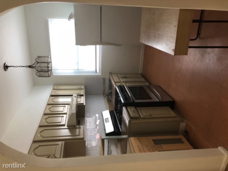
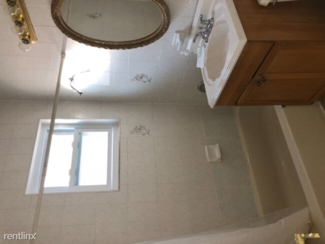
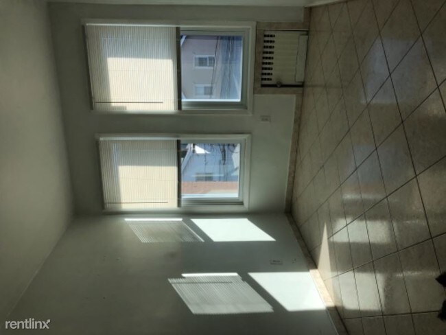
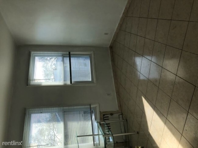
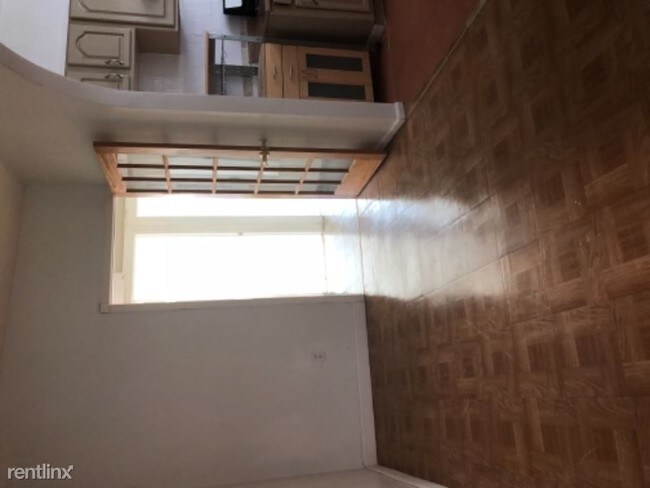
(347) 581-7252 - 2 bedroom for rent - Property Id: 63393 Nice bright rooms, located near D and N train by 18th Ave, Brooklyn. Recently upgraded new windows and new stove top. It suits best for 2 person. Apply at TurboTenant: http://rental.turbotenant.com/properties/63393 Property Id 63393 No Pets Allowed (RLNE4133520) Other Amenities - Other- Floor Covering: Hardwood. Appliances - Refrigerator, Other- Freezer. Lease lengths - 12 Months. Details regarding this property's Utilities - Water Included, Trash Pick-up Included. Pet policies - No Dogs Allowed, No Pets Allowed.
1851 73rd St is a condo located in Kings County and the 11204 ZIP Code. This area is served by the New York City Geographic District #20 attendance zone.
1851 73rd St,
Brooklyn,
NY
11204
Bensonhurst may only stretch 25 blocks, but it’s filled with activity, diversity, and a lively community. This neighborhood is known for being home at one point or another to an array of celebrities, including Larry King, the Three Stooges, and Joey Fatone, and it’s been used as the setting for several movies and television shows. Bensonhurst is as unique as it is dynamic. Located in Southwest Brooklyn, Bensonhurst sits at the southern tip of the borough, just four blocks from the bay. Apartments in Bensonhurst are highly sought-after due to reasonable rents and larger floor plans. The neighborhood also offers good schools, easy access to Manhattan via the D-train or N-train, and a variety of historic sites.
Learn more about living in BensonhurstBelow are rent ranges for similar nearby apartments
Expenses
Utilities Included
Water
Included
Education
| Colleges & Universities | Distance | ||
|---|---|---|---|
| Colleges & Universities | Distance | ||
| Drive: | 9 min | 4.1 mi | |
| Drive: | 13 min | 5.2 mi | |
| Drive: | 12 min | 6.0 mi | |
| Drive: | 16 min | 7.2 mi |
1851 73rd St is within 9 minutes or 4.1 miles from Brooklyn College. It is also near Medgar Evers College, CUNY and Kingsborough Community College.
Schools


Public Elementary School
Grades K-5
976 Students
Attendance Zone
Public Middle School
Grades 6-8
858 Students
Attendance Zone
Public High School
Grades 9-12
3,227 Students
Attendance Zone
Private Elementary, Middle & High School
Grades PK-12
Nearby
Private Middle & High School
Grades 6-12
45 Students
Nearby
School data provided by
 The GreatSchools Rating helps parents compare schools within a state based on a variety of school quality indicators and provides a helpful picture of how effectively each school serves all of its students. Ratings are on a scale of 1 (below average) to 10 (above average) and can include test scores, college readiness, academic progress, advanced courses, equity, discipline and attendance data. We also advise parents to visit schools, consider other information on school performance and programs, and consider family needs as part of the school selection process.
View GreatSchools Rating Methodology
Data provided by GreatSchools.org © 2026. All rights reserved.
View GreatSchools Rating Methodology
Data provided by GreatSchools.org © 2026. All rights reserved.
Transportation options available in Brooklyn include 79 Street (D,M Line), located 0.5 mile from 1851 73rd St. 1851 73rd St is near John F Kennedy International, located 15.2 miles or 27 minutes away, and Newark Liberty International, located 21.5 miles or 35 minutes away.
| Transit / Subway | Distance | ||
|---|---|---|---|
| Transit / Subway | Distance | ||
|
|
Walk: | 10 min | 0.5 mi |
|
|
Walk: | 10 min | 0.6 mi |
|
|
Walk: | 13 min | 0.7 mi |
|
|
Walk: | 13 min | 0.7 mi |
|
|
Walk: | 13 min | 0.7 mi |
| Commuter Rail | Distance | ||
|---|---|---|---|
| Commuter Rail | Distance | ||
|
|
Drive: | 13 min | 6.5 mi |
|
|
Drive: | 14 min | 6.8 mi |
|
|
Drive: | 16 min | 7.5 mi |
|
|
Drive: | 18 min | 8.1 mi |
|
|
Drive: | 21 min | 8.7 mi |
| Airports | Distance | ||
|---|---|---|---|
| Airports | Distance | ||
|
John F Kennedy International
|
Drive: | 27 min | 15.2 mi |
|
Newark Liberty International
|
Drive: | 35 min | 21.5 mi |
Walkability Near 1851 73rd St Brooklyn, NY 11204
Getting Around
 What do Walkability, Transit, Drivability, and Bikeability mean?
Walkability measures the walking distance to day-to-day needs.
Transit measures access to public transportation.
Drivability measures congestion, parking availability, and access to major roads.
Bikeability measures the suitability for cycling.
How It Works
What do Walkability, Transit, Drivability, and Bikeability mean?
Walkability measures the walking distance to day-to-day needs.
Transit measures access to public transportation.
Drivability measures congestion, parking availability, and access to major roads.
Bikeability measures the suitability for cycling.
How It Works
Exceptionally Walkable
Walkability
100
/ 100
Exceptional Public Transit
Transit
90
/ 100
Fairly Drivable
Drivability
40
/ 100
Moderately Bikeable
Bikeability
60
/ 100
Scores provided by
-
Soundscore™
-
/ 100
Traffic
-Airport
-Businesses
-Scores provided by
HowLoud What is a Sound Score Rating? A Sound Score Rating aggregates noise caused by vehicle traffic, airplane traffic and local sources. How It WorksTime and distance from 1851 73rd St.
| Shopping Centers | Distance | ||
|---|---|---|---|
| Shopping Centers | Distance | ||
| Drive: | 4 min | 1.8 mi | |
| Drive: | 5 min | 2.3 mi | |
| Drive: | 6 min | 2.4 mi |
1851 73rd St has 3 shopping centers within 2.4 miles, which is about a 6-minute drive. The miles and minutes will be for the farthest away property.
| Parks and Recreation | Distance | ||
|---|---|---|---|
| Parks and Recreation | Distance | ||
|
Dyker Beach Park
|
Drive: | 5 min | 2.4 mi |
|
Calvert Vaux Park
|
Drive: | 6 min | 2.8 mi |
|
Leon S. Kaiser Park
|
Drive: | 7 min | 3.3 mi |
|
Owl's Head Park
|
Drive: | 9 min | 3.5 mi |
|
Sunset Park
|
Drive: | 9 min | 4.0 mi |
1851 73rd St has 5 parks within 4.0 miles, including Dyker Beach Park, Calvert Vaux Park, and Sunset Park.
| Hospitals | Distance | ||
|---|---|---|---|
| Hospitals | Distance | ||
| Drive: | 7 min | 2.8 mi | |
| Drive: | 6 min | 2.9 mi | |
| Drive: | 7 min | 3.2 mi |
1851 73rd St has 3 hospitals within 3.2 miles, the nearest is Maimonides Medical Center which is 2.8 miles away and a 7 minute drive.
| Military Bases | Distance | ||
|---|---|---|---|
| Military Bases | Distance | ||
| Drive: | 8 min | 3.0 mi | |
| Drive: | 17 min | 7.7 mi |
1851 73rd St is 3.0 miles from Fort Hamilton, and is convenient to other military bases, including Naval Station NY Stapleton Site.
You May Also Like
Similar Rentals Nearby


What Are Walk Score®, Transit Score®, and Bike Score® Ratings?
Walk Score® measures the walkability of any address. Transit Score® measures access to public transit. Bike Score® measures the bikeability of any address.
What is a Sound Score Rating?
A Sound Score Rating aggregates noise caused by vehicle traffic, airplane traffic and local sources.

1851 73rd St
Brooklyn, NY 11204