

$7,800
/ Month
181 N Bourndale Rd
Manhasset, NY 11030
2 Weeks Ago
Favorites
181 N Bourndale Rd

Favorites
Check Back Soon for Upcoming Availability
| Beds | Baths | Average SF |
|---|---|---|
| 4 Bedrooms 4 Bedrooms 4 Br | 3 Baths 3 Baths 3 Ba | — |
Fees and Policies
The fees below are based on community-supplied data and may exclude additional fees and utilities.
About This Property
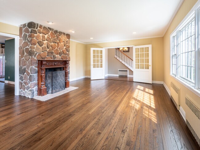
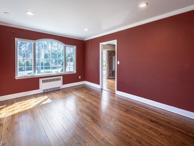
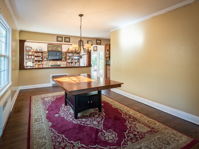
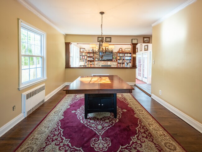
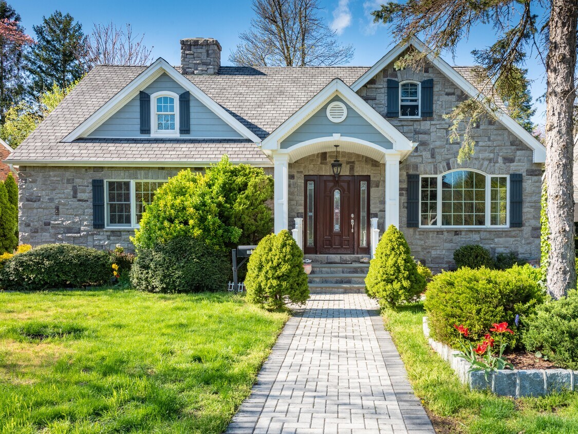
Beautiful, sundrenched Plandome Heights Cape style home. Its comfortable layout includes 4 bd (2 up, 2 on main level - including en-suite Primary) & 3 full Bathrooms. First floor features nicely proportioned Living Room with stone fireplace & Dining Room. The cozy Den with a second fireplace & custom built-in offers access to the paver patio yard through glass sliding doors, which hosts an outdoor table, grilling and grassy areas. The EIK Kitchen offers wood cabinetry and is adjacent to a full Bathroom. To complete, there is a comfortable En-Suite Primary Bedroom and add'l Bedroom which could also be considered the perfect Home Office space. The second level it hosts 2 generously sized Bedrooms and full Bathroom. Location is key, with close proximity to LIRR, shopping, restaurants, schools, hospitals, Plandome Pond Park & so much more!
181 N Bourndale Rd is a house located in Nassau County and the 11030 ZIP Code.
House Features
- Air Conditioning
- Hardwood Floors
- Tile Floors
- Package Service
- Laundry Facilities
- Controlled Access
Location
Get Directions
With Manhasset Bay on its north end and three golf courses on its south end, Manhasset is the ideal community for those who enjoy outdoor activities. Manhasset, a hamlet on Long Island's North Shore, is a popular destination for many escaping the busy-ness of Manhattan -- the train provides easy access to the city, and the cozy, family-friendly community of Manhasset is an ideal retreat.
If you're looking for a rental within walking or biking distance of the train station, look along Plandome Road, which is also the business district for the hamlet, featuring a variety of shops and restaurants. The charming train station is located near the intersection of Hillside Avenue and Plandome Road. The Mary Jane Davies Green is the heart of the downtown area, featuring a band shell, a playground, benches, and green space.
Learn more about living in ManhassetBelow are rent ranges for similar nearby apartments
Amenities
- Air Conditioning
- Hardwood Floors
- Tile Floors
- Package Service
- Laundry Facilities
- Controlled Access
Education
| Colleges & Universities | Distance | ||
|---|---|---|---|
| Colleges & Universities | Distance | ||
| Drive: | 13 min | 5.7 mi | |
| Drive: | 12 min | 6.5 mi | |
| Drive: | 14 min | 7.6 mi | |
| Drive: | 17 min | 7.8 mi |
181 N Bourndale Rd is within 13 minutes or 5.7 miles from Queensborough Comm. Coll.. It is also near N.Y. Inst. of Technology and Long Island Univ., CW Post.
Transportation options available in Manhasset include Flushing-Main Street, located 9.1 miles from 181 N Bourndale Rd. 181 N Bourndale Rd is near LaGuardia, located 14.2 miles or 25 minutes away, and John F Kennedy International, located 17.4 miles or 29 minutes away.
| Transit / Subway | Distance | ||
|---|---|---|---|
| Transit / Subway | Distance | ||
|
|
Drive: | 19 min | 9.1 mi |
|
|
Drive: | 17 min | 9.5 mi |
|
|
Drive: | 24 min | 13.5 mi |
|
|
Drive: | 25 min | 13.8 mi |
|
|
Drive: | 26 min | 14.1 mi |
| Commuter Rail | Distance | ||
|---|---|---|---|
| Commuter Rail | Distance | ||
|
|
Walk: | 13 min | 0.7 mi |
|
|
Walk: | 19 min | 1.0 mi |
|
|
Drive: | 6 min | 3.0 mi |
|
|
Drive: | 8 min | 3.4 mi |
|
|
Drive: | 10 min | 4.6 mi |
| Airports | Distance | ||
|---|---|---|---|
| Airports | Distance | ||
|
LaGuardia
|
Drive: | 25 min | 14.2 mi |
|
John F Kennedy International
|
Drive: | 29 min | 17.4 mi |
Time and distance from 181 N Bourndale Rd.
| Shopping Centers | Distance | ||
|---|---|---|---|
| Shopping Centers | Distance | ||
| Drive: | 3 min | 1.2 mi | |
| Drive: | 5 min | 2.2 mi | |
| Drive: | 6 min | 2.3 mi |
181 N Bourndale Rd has 3 shopping centers within 2.3 miles, which is about a 6-minute drive. The miles and minutes will be for the farthest away property.
| Parks and Recreation | Distance | ||
|---|---|---|---|
| Parks and Recreation | Distance | ||
|
Science Museum of Long Island
|
Drive: | 4 min | 1.6 mi |
|
Alley Pond Environmental Center
|
Drive: | 11 min | 5.3 mi |
|
Clark Botanic Garden
|
Drive: | 11 min | 5.3 mi |
|
Sands Point Preserve
|
Drive: | 12 min | 5.3 mi |
|
Queens County Farm Museum
|
Drive: | 12 min | 5.8 mi |
181 N Bourndale Rd has 5 parks within 5.8 miles, including Science Museum of Long Island, Alley Pond Environmental Center, and Clark Botanic Garden.
| Hospitals | Distance | ||
|---|---|---|---|
| Hospitals | Distance | ||
| Drive: | 5 min | 1.5 mi | |
| Drive: | 5 min | 2.2 mi | |
| Drive: | 12 min | 6.5 mi |
181 N Bourndale Rd has 3 hospitals within 6.5 miles, the nearest is St. Francis Hospital - The Heart Center which is 1.5 miles away and a 5 minute drive.
| Military Bases | Distance | ||
|---|---|---|---|
| Military Bases | Distance | ||
| Drive: | 15 min | 7.8 mi | |
| Drive: | 50 min | 25.9 mi |
181 N Bourndale Rd is 7.8 miles from Fort Totten US Govt Reservation, and is convenient to other military bases, including US Coast Guard Heliport.
You May Also Like
Similar Rentals Nearby


What Are Walk Score®, Transit Score®, and Bike Score® Ratings?
Walk Score® measures the walkability of any address. Transit Score® measures access to public transit. Bike Score® measures the bikeability of any address.
What is a Sound Score Rating?
A Sound Score Rating aggregates noise caused by vehicle traffic, airplane traffic and local sources
181 N Bourndale Rd
Manhasset, NY 11030