
Venue Residences
3688 Overland Ave,
Los Angeles, CA 90034
$2,695 - $5,650
Studio - 2 Beds

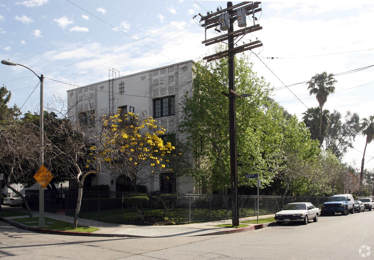
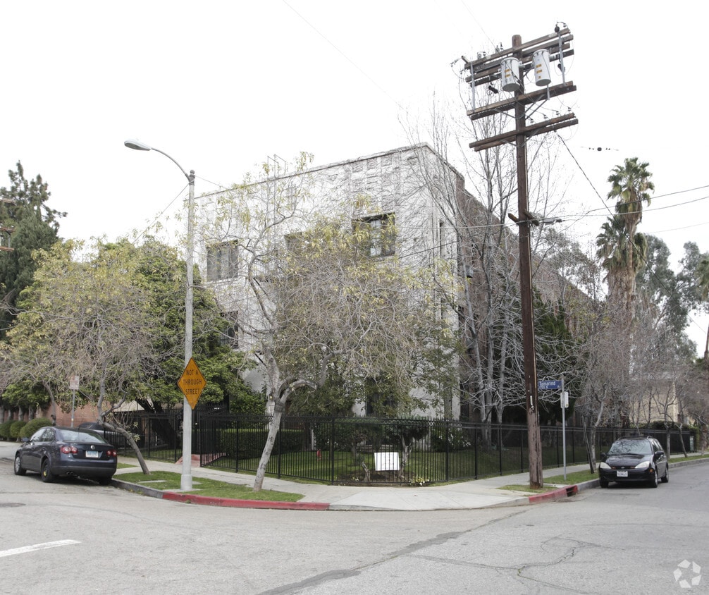

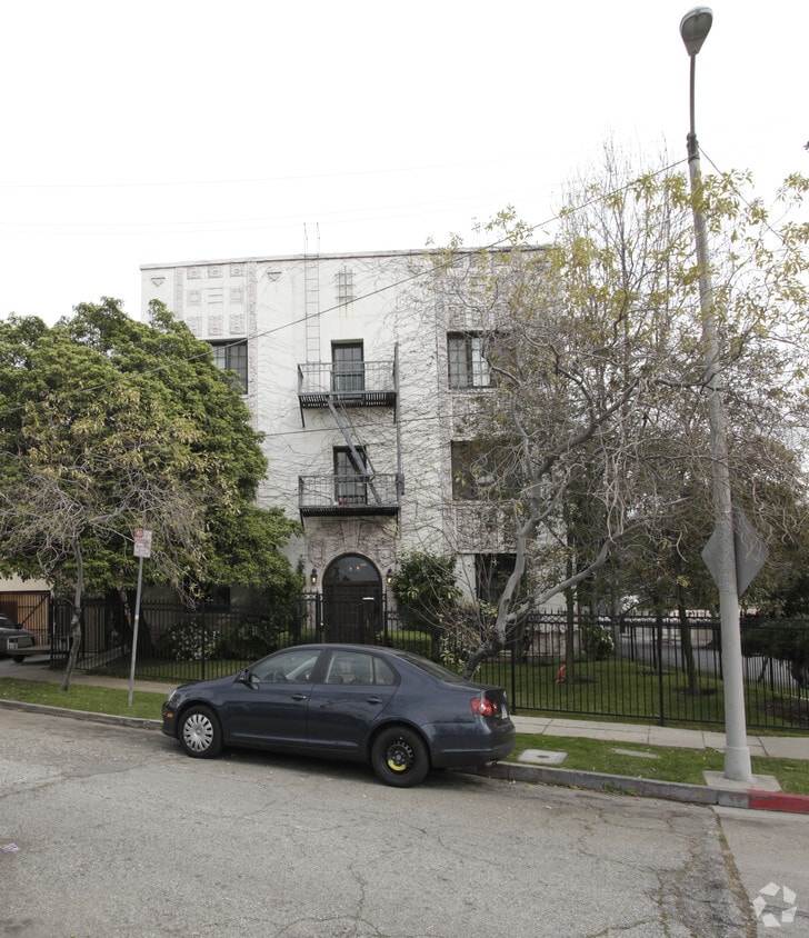
PRIME LOCATION Franklin Ave. Not Specified units Street Parking. Beautiful, architectural property, wrought iron security gated, with 9 ft ceilings, hardwood floors, French windows, architectural details, appliances, large walk-in closet which many residents use as a separate office area and laundry facilities on premises. Such a great location! Walk to Birds Cafe, Mayfair Market and Franklin Avenue shops and restaurants. Cats only.
1756 Tamarind Ave is an apartment community located in Los Angeles County and the 90028 ZIP Code. This area is served by the Los Angeles Unified Rocp School District attendance zone.
Hardwood Floors
Walk-In Closets
Refrigerator
Office
Los Angeles sprawls across nearly 500 square miles between the Pacific Ocean and the San Gabriel Mountains, making it one of the few places where you can surf in the morning and hike through chaparral-covered hills by afternoon. Sunshine, open-air farmers markets, and a food scene that pulls from dozens of culinary traditions are a staple of living in the city.
Neighborhoods each have a distinct personality surrounding a particular focus, whether it be culture or nature. Westwood keeps residents close to entertainment at UCLA and the Hammer Museum's rotating art exhibitions. Koreatown is a cultural and food destination, known for authentic restaurants and shops paired with a bustling street energy and nightlife.
The city overflows with iconic landmarks, from natural to man-made. Griffith Park, one of the largest urban parks in the country, offers hiking trails, sweeping skyline views, and the iconic Griffith Observatory.
Learn more about living in Los Angeles| Colleges & Universities | Distance | ||
|---|---|---|---|
| Colleges & Universities | Distance | ||
| Walk: | 15 min | 0.8 mi | |
| Drive: | 3 min | 1.3 mi | |
| Drive: | 5 min | 2.7 mi | |
| Drive: | 7 min | 3.8 mi |


Transportation options available in Los Angeles include Hollywood/Vine Station, located 0.5 mile from 1756 Tamarind Ave. 1756 Tamarind Ave is near Bob Hope, located 8.9 miles or 16 minutes away, and Los Angeles International, located 14.8 miles or 28 minutes away.
| Transit / Subway | Distance | ||
|---|---|---|---|
| Transit / Subway | Distance | ||
|
|
Walk: | 9 min | 0.5 mi |
|
|
Walk: | 12 min | 0.6 mi |
|
|
Drive: | 3 min | 1.3 mi |
|
|
Drive: | 3 min | 1.9 mi |
|
|
Drive: | 4 min | 2.5 mi |
| Commuter Rail | Distance | ||
|---|---|---|---|
| Commuter Rail | Distance | ||
|
|
Drive: | 8 min | 4.8 mi |
|
|
Drive: | 10 min | 6.1 mi |
|
|
Drive: | 12 min | 6.3 mi |
|
|
Drive: | 13 min | 6.8 mi |
|
|
Drive: | 15 min | 7.8 mi |
| Airports | Distance | ||
|---|---|---|---|
| Airports | Distance | ||
|
Bob Hope
|
Drive: | 16 min | 8.9 mi |
|
Los Angeles International
|
Drive: | 28 min | 14.8 mi |
Scores provided by
Traffic
-Airport
-Businesses
-Scores provided by
HowLoud What is a Sound Score Rating? A Sound Score Rating aggregates noise caused by vehicle traffic, airplane traffic and local sources. How It WorksTime and distance from 1756 Tamarind Ave.
| Shopping Centers | Distance | ||
|---|---|---|---|
| Shopping Centers | Distance | ||
| Walk: | 5 min | 0.3 mi | |
| Walk: | 11 min | 0.6 mi |
| Parks and Recreation | Distance | ||
|---|---|---|---|
| Parks and Recreation | Distance | ||
|
Runyon Canyon
|
Drive: | 5 min | 2.1 mi |
|
Bird Sanctuary
|
Drive: | 7 min | 2.6 mi |
|
Griffith Observatory
|
Drive: | 10 min | 3.8 mi |
|
La Brea Tar Pits
|
Drive: | 10 min | 5.0 mi |
|
Griffith Park
|
Drive: | 21 min | 6.6 mi |
| Hospitals | Distance | ||
|---|---|---|---|
| Hospitals | Distance | ||
| Walk: | 16 min | 0.8 mi | |
| Drive: | 3 min | 1.7 mi | |
| Drive: | 3 min | 1.9 mi |
| Military Bases | Distance | ||
|---|---|---|---|
| Military Bases | Distance | ||
| Drive: | 28 min | 16.4 mi | |
| Drive: | 43 min | 30.9 mi | |
| Drive: | 44 min | 32.8 mi |
Pets Allowed Fitness Center Pool Maintenance on site High-Speed Internet Controlled Access EV Charging
What Are Walk Score®, Transit Score®, and Bike Score® Ratings?
Walk Score® measures the walkability of any address. Transit Score® measures access to public transit. Bike Score® measures the bikeability of any address.
What is a Sound Score Rating?
A Sound Score Rating aggregates noise caused by vehicle traffic, airplane traffic and local sources.
1756 Tamarind Ave
Los Angeles, CA 90028


