
NOVEL Uptown by Crescent Communities
1557 N Logan St,
Denver, CO 80203
Studio - 2 Beds $1,715 - $4,285
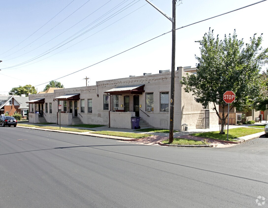
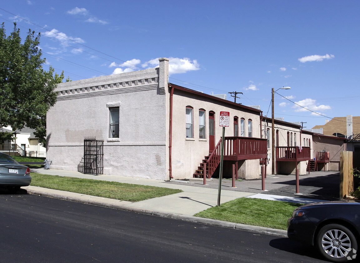

1738-1748 W 33rd Ave is ready for your visit. This apartment community is located in Denver at 1738-1748 W. 33rd Ave in the 80211 area. Here at this community, the professional leasing staff is available to assist you in finding the perfect new home. Come by to check out the current floorplan options. Stop by the leasing office to find out the current floorplan availability.
1738-1748 W 33rd Ave is an apartment community located in Denver County and the 80211 ZIP Code. This area is served by the Denver County 1 attendance zone.
Lower Highlands, known as LoHi, is a family-friendly neighborhood just three miles outside of Denver, where you’ll find the Colorado State Capitol, Civic Center Park, the Denver Art Museum, and so much more. LoHi boasts a variety of local burger joints, taverns, beer gardens, and coffee shops such as Recess Beer Garden and Root Down, an old filling station turned New American eatery. LoHi is located near major parks such as the City of Cuernavaca Park along the South Platte River, boasting biking and hiking trails with scenic city views.
Hirshorn Park is a smaller neighborhood park that’s worth a visit, housing baseball fields, basketball courts, and a playground. Nestled along Interstate 25, commuting is no issue in LoHi, especially with Denver so close, but if you don’t plan to drive, there are plenty of public bus stops on the area’s major roads.
Learn more about living in LoHi| Colleges & Universities | Distance | ||
|---|---|---|---|
| Colleges & Universities | Distance | ||
| Drive: | 6 min | 2.1 mi | |
| Drive: | 6 min | 2.9 mi | |
| Drive: | 6 min | 2.9 mi | |
| Drive: | 9 min | 3.2 mi |


Transportation options available in Denver include Union Station Track 11, located 0.9 mile from 1738-1748 W 33rd Ave. 1738-1748 W 33rd Ave is near Denver International, located 24.1 miles or 32 minutes away.
| Transit / Subway | Distance | ||
|---|---|---|---|
| Transit / Subway | Distance | ||
| Walk: | 16 min | 0.9 mi | |
| Walk: | 17 min | 0.9 mi | |
|
|
Drive: | 5 min | 1.6 mi |
|
|
Drive: | 5 min | 2.0 mi |
|
|
Drive: | 7 min | 2.2 mi |
| Commuter Rail | Distance | ||
|---|---|---|---|
| Commuter Rail | Distance | ||
|
|
Drive: | 4 min | 1.3 mi |
|
|
Drive: | 4 min | 1.3 mi |
| Drive: | 4 min | 1.6 mi | |
| Drive: | 5 min | 1.7 mi | |
| Drive: | 14 min | 2.9 mi |
| Airports | Distance | ||
|---|---|---|---|
| Airports | Distance | ||
|
Denver International
|
Drive: | 32 min | 24.1 mi |
Time and distance from 1738-1748 W 33rd Ave.
| Shopping Centers | Distance | ||
|---|---|---|---|
| Shopping Centers | Distance | ||
| Walk: | 9 min | 0.5 mi | |
| Walk: | 13 min | 0.7 mi | |
| Walk: | 13 min | 0.7 mi |
| Parks and Recreation | Distance | ||
|---|---|---|---|
| Parks and Recreation | Distance | ||
|
Centennial Gardens
|
Walk: | 19 min | 1.0 mi |
|
Landry's Downtown Aquarium
|
Walk: | 20 min | 1.1 mi |
|
Children's Museum of Denver
|
Drive: | 5 min | 1.4 mi |
|
Lower Downtown Historic District (LoDo)
|
Drive: | 4 min | 1.6 mi |
|
Civic Center Park
|
Drive: | 7 min | 2.6 mi |
| Hospitals | Distance | ||
|---|---|---|---|
| Hospitals | Distance | ||
| Drive: | 8 min | 2.7 mi | |
| Drive: | 8 min | 3.0 mi | |
| Drive: | 9 min | 3.0 mi |
| Military Bases | Distance | ||
|---|---|---|---|
| Military Bases | Distance | ||
| Drive: | 47 min | 21.6 mi | |
| Drive: | 82 min | 66.9 mi | |
| Drive: | 91 min | 76.6 mi |

What Are Walk Score®, Transit Score®, and Bike Score® Ratings?
Walk Score® measures the walkability of any address. Transit Score® measures access to public transit. Bike Score® measures the bikeability of any address.
What is a Sound Score Rating?
A Sound Score Rating aggregates noise caused by vehicle traffic, airplane traffic and local sources


