$2,450 / Month
17309 Burbank Blvd
Encino, CA 91316
1 Day Ago
Favorites
820-200-4147
-
Bedrooms
1
-
Bathrooms
1
-
Square Feet
500 sq ft
-
Available
Available Now
Highlight
- Patio
17309 Burbank Blvd

Favorites
About This Home
12 Month Lease,
$2,450 deposit,
Available Now
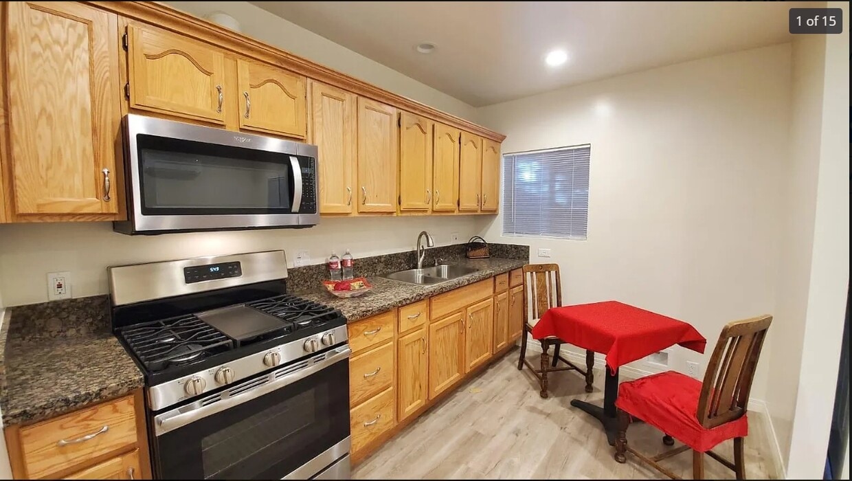
Very cute detached guest house with private front fenced in patio. All newer appliances. Washer/dryer included. Walking distance to Balboa Park, The Commons shopping centre of Encino and much more! Eacy access to the 101 freeway. Available for immediate move in. Nearby schools include Westmark School, The Academy For Enriched Sciences and Holy Martyrs Armenian High School-Ferrahian. The closest grocery stores are Trader Joe's, Sabzee Market and Sabzee Mediterranean Market. Nearby coffee shops include Coral Tree Cafe, The Coffee Bean and Tea Leaf and Starbucks. Nearby restaurants include West Valley Cafe, Passion Cafe & Lounge and Encino Glen. 17309 Burbank Blvd is near Los Encinos State Historic Park, Reseda Park and Recreation Center and Reseda Park and Recreation Center. Great location for work or play! Water Included. Only pay for electric.
17309 Burbank Blvd is a house located in Los Angeles County and the 91316 ZIP Code. This area is served by the Los Angeles Unified attendance zone.
* Price shown is base rent and may not include non-optional fees and utilities.
Price, availability, fees, and any applicable rent special are subject to change without notice.
* Square footage definitions vary. Displayed square footage is approximate.
House Features
- Washer/Dryer
- Lounge
- Patio
Fees and Policies
The fees below are based on community-supplied data and may exclude additional fees and utilities.
- Parking
-
Garage--
Details
Utilities Included
-
Air Conditioning
Contact
- Listed by Colin Lightfoot
- Phone Number
- Contact
Location
Get Directions
Located just west of Sherman Oaks in Los Angeles’ San Fernando Valley, Encino is a picturesque neighborhood brimming with stately homes and luxury apartments. Residents cite the community’s accessibility among its many perks, with numerous amenities situated within walking distance or a short drive. Encino’s vibrant commercial corridor along Ventura Boulevard complements its quiet residential areas, touting an array of shops, eateries, markets, cafes, salons, and much more.
What’s it like living in Encino? Encino residents enjoy endless opportunities for outdoor recreation, including the local Los Encinos State Historic Park and the sprawling Lake Balboa/Anthony C. Beilenson Park to the north, and the Santa Monica Mountains to the south. Getting around from Encino is a breeze with convenience to the 405 and Ventura Freeway.
Encino residents enjoy endless opportunities for outdoor recreation, from the local Los Encinos State Historic Park to the sprawling Lake Balboa/Anthony C.
Learn more about living in Encino
Education
| Colleges & Universities | Distance | ||
|---|---|---|---|
| Colleges & Universities | Distance | ||
| Drive: | 8 min | 4.7 mi | |
| Drive: | 13 min | 6.3 mi | |
| Drive: | 12 min | 6.3 mi | |
| Drive: | 23 min | 12.0 mi |
17309 Burbank Blvd is within 8 minutes or 4.7 miles from Pierce College. It is also near Valley College and Cal State Northridge.
Schools


Public Elementary School
Grades K-5
283 Students
Attendance Zone
Charter Elementary, Middle & High School
Grades K-12
2,877 Students
Nearby
Public Middle School
Grades 6-8
1,002 Students
Attendance Zone
Charter High School
Grades 9-12
3,058 Students
Attendance Zone
Charter High School
Grades 9-12
1,403 Students
Attendance Zone
Private Elementary, Middle & High School
Grades 2-12
225 Students
Nearby
Private Elementary School
Grades K-6
178 Students
Nearby
Private Elementary School
Grades PK-1
98 Students
Nearby
School data provided by
 The GreatSchools Rating helps parents compare schools within a state based on a variety of school quality indicators and provides a helpful picture of how effectively each school serves all of its students. Ratings are on a scale of 1 (below average) to 10 (above average) and can include test scores, college readiness, academic progress, advanced courses, equity, discipline and attendance data. We also advise parents to visit schools, consider other information on school performance and programs, and consider family needs as part of the school selection process.
View GreatSchools Rating Methodology
Data provided by GreatSchools.org © 2025. All rights reserved.
View GreatSchools Rating Methodology
Data provided by GreatSchools.org © 2025. All rights reserved.
Transportation options available in Encino include North Hollywood Station, located 8.0 miles from 17309 Burbank Blvd. 17309 Burbank Blvd is near Bob Hope, located 10.9 miles or 18 minutes away, and Los Angeles International, located 20.3 miles or 28 minutes away.
| Transit / Subway | Distance | ||
|---|---|---|---|
| Transit / Subway | Distance | ||
|
|
Drive: | 13 min | 8.0 mi |
|
|
Drive: | 13 min | 9.8 mi |
| Commuter Rail | Distance | ||
|---|---|---|---|
| Commuter Rail | Distance | ||
|
|
Drive: | 12 min | 6.0 mi |
|
|
Drive: | 13 min | 6.0 mi |
|
|
Drive: | 12 min | 6.6 mi |
|
|
Drive: | 19 min | 10.6 mi |
|
|
Drive: | 19 min | 11.8 mi |
| Airports | Distance | ||
|---|---|---|---|
| Airports | Distance | ||
|
Bob Hope
|
Drive: | 18 min | 10.9 mi |
|
Los Angeles International
|
Drive: | 28 min | 20.3 mi |
Time and distance from 17309 Burbank Blvd.
| Shopping Centers | Distance | ||
|---|---|---|---|
| Shopping Centers | Distance | ||
| Walk: | 17 min | 0.9 mi | |
| Walk: | 17 min | 0.9 mi | |
| Drive: | 3 min | 1.2 mi |
17309 Burbank Blvd has 3 shopping centers within 1.2 miles, which is about a 3-minute walk. The miles and minutes will be for the farthest away property.
| Parks and Recreation | Distance | ||
|---|---|---|---|
| Parks and Recreation | Distance | ||
|
Lake Balboa
|
Drive: | 3 min | 1.4 mi |
|
Los Encinos State Historic Park
|
Drive: | 3 min | 1.5 mi |
|
Reseda Park Lake
|
Drive: | 4 min | 2.4 mi |
|
The Japanese Garden
|
Drive: | 5 min | 2.9 mi |
|
Sepulveda Basin Wildlife Reserve
|
Drive: | 8 min | 3.3 mi |
17309 Burbank Blvd has 5 parks within 3.3 miles, including Lake Balboa, Los Encinos State Historic Park, and Reseda Park Lake.
| Hospitals | Distance | ||
|---|---|---|---|
| Hospitals | Distance | ||
| Drive: | 3 min | 1.4 mi | |
| Drive: | 4 min | 2.2 mi | |
| Drive: | 4 min | 2.2 mi |
17309 Burbank Blvd has 3 hospitals within 2.2 miles, the nearest is Providence Tarzana Medical Center which is 1.4 miles away and a 3 minute drive.
| Military Bases | Distance | ||
|---|---|---|---|
| Military Bases | Distance | ||
| Drive: | 29 min | 22.9 mi |
17309 Burbank Blvd is 22.9 miles and a 29 minute drive from Los Angeles Air Force Base.
Amenities
- Washer/Dryer
- Lounge
- Patio
17309 Burbank Blvd Photos
What Are Walk Score®, Transit Score®, and Bike Score® Ratings?
Walk Score® measures the walkability of any address. Transit Score® measures access to public transit. Bike Score® measures the bikeability of any address.
What is a Sound Score Rating?
A Sound Score Rating aggregates noise caused by vehicle traffic, airplane traffic and local sources

17309 Burbank Blvd
Encino, CA 91316