
17 Thomas St
Bloomfield, NJ 07003
-
Bedrooms
2
-
Bathrooms
1
-
Square Feet
1,558 sq ft
-
Available
Available Jan 1, 2026
Highlights
- Furnished
- Smoke Free

2 Available Units
17 Thomas St is an apartment community located in Essex County and the 07003 ZIP Code. This area is served by the Bloomfield Board Of Education attendance zone.
Apartment Features
Air Conditioning
Dishwasher
Microwave
Refrigerator
- Wi-Fi
- Air Conditioning
- Heating
- Smoke Free
- Dishwasher
- Kitchen
- Microwave
- Refrigerator
- Dining Room
- Office
- Furnished
- Laundry Facilities
Fees and Policies
The fees below are based on community-supplied data and may exclude additional fees and utilities.
- Parking
-
Street--
Details
Utilities Included
-
Water
-
Sewer
Property Information
-
2 units
-
Furnished Units Available
Contact
- Phone Number
- Contact
Located 12 miles from Manhattan, Bloomfield combines small-town atmosphere with metropolitan accessibility. This Essex County township features established neighborhoods with housing options from classic single-family homes to contemporary apartment communities. The historic Bloomfield Green, anchored by the Presbyterian Church dating to 1794, serves as the town center. With two NJ Transit stations connecting to New York City and Newark, Bloomfield offers convenient transportation options for commuters. Current rental data shows one-bedroom apartments averaging $2,012, while three-bedroom units average $2,828.
Brookdale Park, spanning 77 acres, provides recreational opportunities with walking paths and athletic facilities. The downtown area near Bloomfield College features local shops and dining establishments. The Garden State Parkway and other major routes make commuting convenient from Bloomfield.
Learn more about living in Bloomfield| Colleges & Universities | Distance | ||
|---|---|---|---|
| Colleges & Universities | Distance | ||
| Walk: | 14 min | 0.7 mi | |
| Drive: | 8 min | 4.3 mi | |
| Drive: | 9 min | 4.5 mi | |
| Drive: | 9 min | 4.8 mi |

View GreatSchools Rating Methodology
Data provided by GreatSchools.org © 2025. All rights reserved.
Transportation options available in Bloomfield include Grove Street, located 1.6 miles from 17 Thomas St. 17 Thomas St is near Newark Liberty International, located 10.2 miles or 18 minutes away, and LaGuardia, located 26.0 miles or 45 minutes away.
| Transit / Subway | Distance | ||
|---|---|---|---|
| Transit / Subway | Distance | ||
|
|
Drive: | 4 min | 1.6 mi |
|
|
Drive: | 5 min | 2.0 mi |
|
|
Drive: | 5 min | 2.2 mi |
|
|
Drive: | 5 min | 2.3 mi |
|
|
Drive: | 5 min | 2.5 mi |
| Commuter Rail | Distance | ||
|---|---|---|---|
| Commuter Rail | Distance | ||
|
|
Walk: | 8 min | 0.4 mi |
|
|
Drive: | 3 min | 1.1 mi |
|
|
Drive: | 3 min | 1.3 mi |
|
|
Drive: | 4 min | 1.9 mi |
|
|
Drive: | 6 min | 2.4 mi |
| Airports | Distance | ||
|---|---|---|---|
| Airports | Distance | ||
|
Newark Liberty International
|
Drive: | 18 min | 10.2 mi |
|
LaGuardia
|
Drive: | 45 min | 26.0 mi |
Time and distance from 17 Thomas St.
| Shopping Centers | Distance | ||
|---|---|---|---|
| Shopping Centers | Distance | ||
| Drive: | 4 min | 1.6 mi | |
| Drive: | 4 min | 1.6 mi | |
| Drive: | 5 min | 2.0 mi |
| Parks and Recreation | Distance | ||
|---|---|---|---|
| Parks and Recreation | Distance | ||
|
Edison National Historic Site
|
Drive: | 8 min | 3.2 mi |
|
Branch Brook Park
|
Drive: | 7 min | 3.2 mi |
|
Van Vleck House & Gardens
|
Drive: | 6 min | 3.3 mi |
|
Newark Museum and Dreyfuss Planetarium
|
Drive: | 8 min | 4.4 mi |
|
Kearny Marsh
|
Drive: | 13 min | 6.2 mi |
| Hospitals | Distance | ||
|---|---|---|---|
| Hospitals | Distance | ||
| Drive: | 7 min | 3.5 mi | |
| Drive: | 9 min | 4.3 mi | |
| Drive: | 8 min | 4.3 mi |
| Military Bases | Distance | ||
|---|---|---|---|
| Military Bases | Distance | ||
| Drive: | 23 min | 14.0 mi | |
| Drive: | 33 min | 16.0 mi | |
| Drive: | 39 min | 22.1 mi |
- Wi-Fi
- Air Conditioning
- Heating
- Smoke Free
- Dishwasher
- Kitchen
- Microwave
- Refrigerator
- Dining Room
- Office
- Furnished
- Laundry Facilities
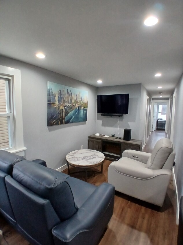
17 Thomas St Photos
-
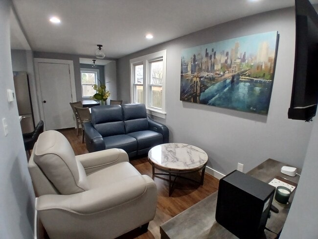
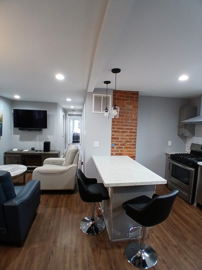
Living Room
-
-
Living Room
-
Living Room
-
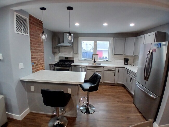
Kitchen
-
Kitchen
-
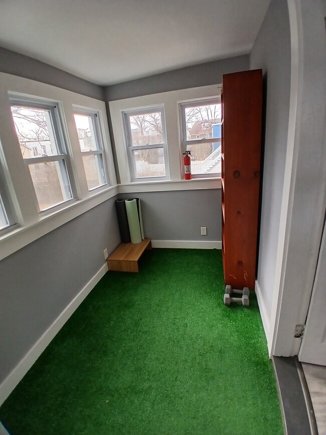
Office Space
-
Bedroom 1
-
Bedroom 1
Statewide service is free, confidential, multilingual and always open. Three easy ways to reach Social Services in NJ: Dial 2-1-1; text your zip code to 898-211; or chat at https://www.nj211.org
What Are Walk Score®, Transit Score®, and Bike Score® Ratings?
Walk Score® measures the walkability of any address. Transit Score® measures access to public transit. Bike Score® measures the bikeability of any address.
What is a Sound Score Rating?
A Sound Score Rating aggregates noise caused by vehicle traffic, airplane traffic and local sources
17 Thomas St
Bloomfield, NJ 07003