
The Journal
36 Journal Sq,
Jersey City, NJ 07306
$3,095 - $7,500
Studio - 3 Beds
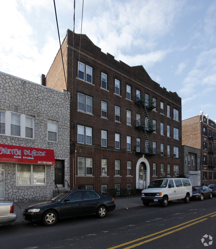
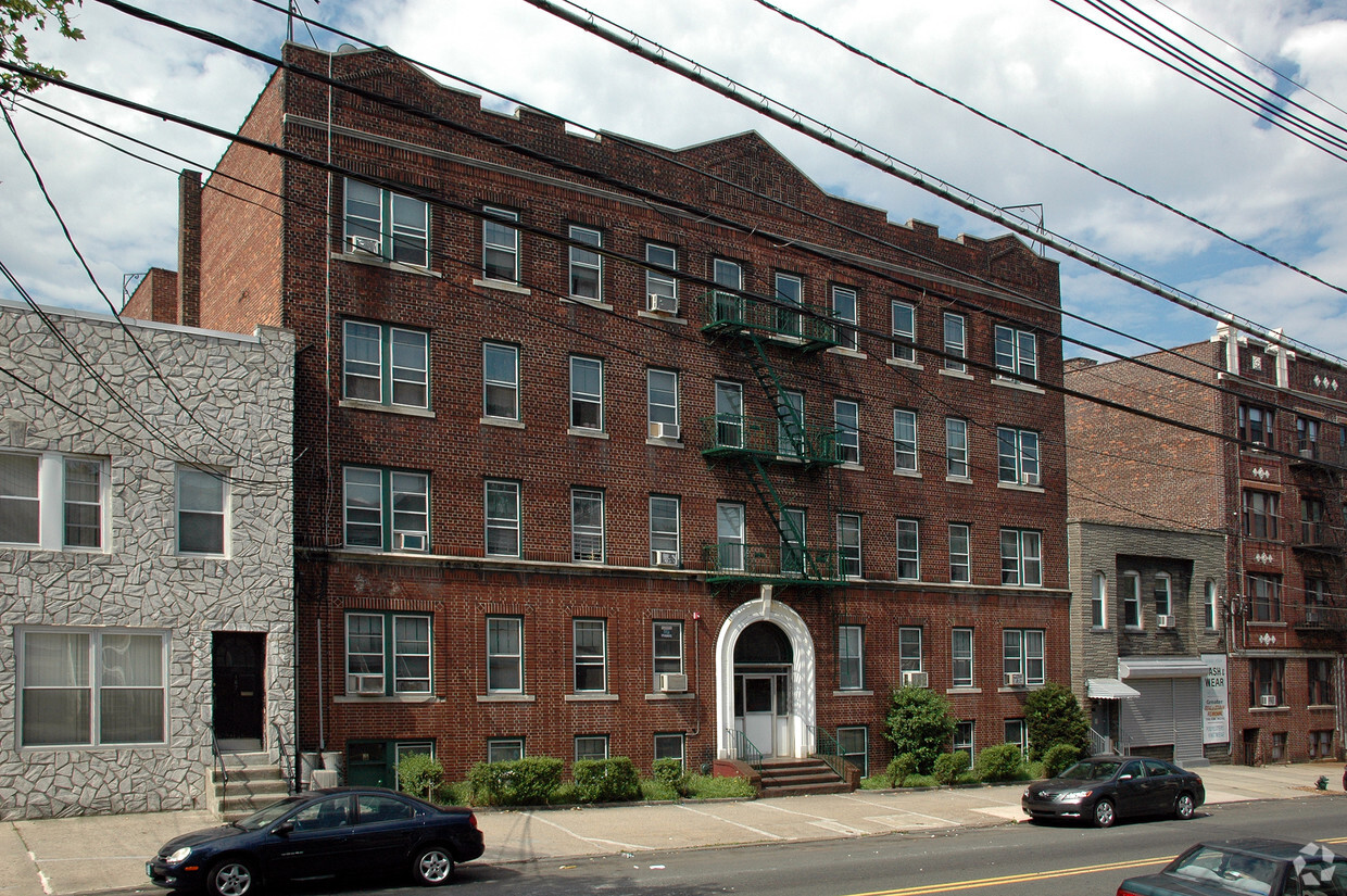
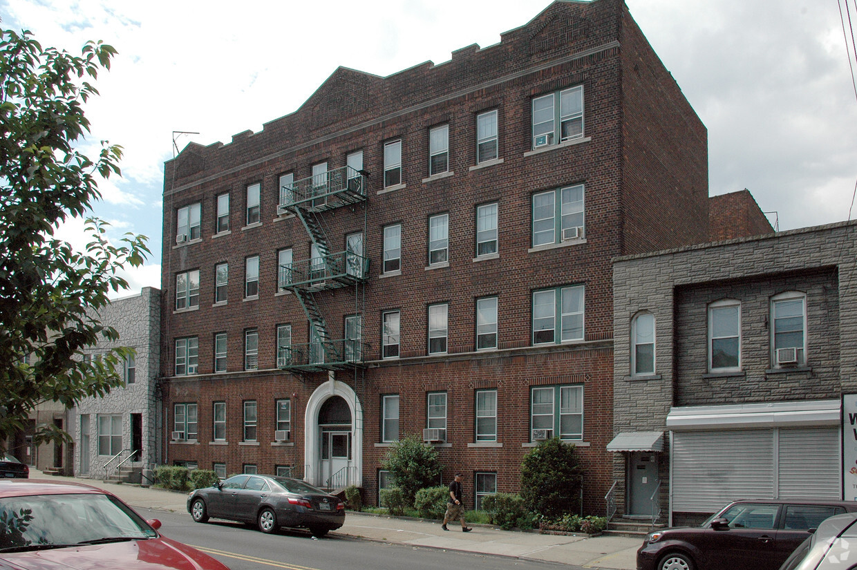
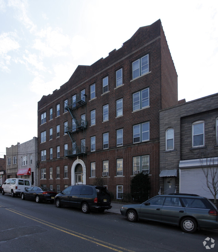
At 169-171 Manhattan Ave in Jersey City, NJ, you've discovered your new place. The location of this community is at 169-171 Manhattan Ave in Jersey City. The community staff is ready and waiting for you to visit. Be sure to come for a visit to check out the current floorplan options. Come see 169-171 Manhattan Ave today.
169-171 Manhattan Ave is an apartment community located in Hudson County and the 07307 ZIP Code. This area is served by the Jersey City Public School District attendance zone.
Hardwood Floors
Microwave
Refrigerator
Range
Overlooking the New Jersey Palisades on the north end of Jersey City, the neighborhood known as the Heights offers breathtaking views of the New York City skyline. Mainly known as a residential area, this thriving historic community is home to a diverse population. Like much of Jersey City, there’s an eclectic mix of rentals available. Towering condos with incredible amenities meet traditional brownstones and understated apartment communities.
Residents enjoy a multitude of convenient shopping, dining, and entertainment options within a few blocks of anywhere in the neighborhood. Savor the unique fare of Central Avenue's 250 storefronts and restaurants. Explore the art of the Heights, from the public art found throughout the city to the galleries to the cultural fairs.
Just south of the Heights, Jersey City’s popular Journal Square district offers an even wider array of specialty eats, from regional Indian bistros to Filipino bakeries.
Learn more about living in The HeightsCompare neighborhood and city base rent averages by bedroom.
| The Heights | Jersey City, NJ | |
|---|---|---|
| Studio | $2,494 | $2,767 |
| 1 Bedroom | $2,657 | $3,281 |
| 2 Bedrooms | $2,904 | $4,392 |
| 3 Bedrooms | $3,159 | $5,379 |
| Colleges & Universities | Distance | ||
|---|---|---|---|
| Colleges & Universities | Distance | ||
| Drive: | 3 min | 1.3 mi | |
| Drive: | 3 min | 1.7 mi | |
| Drive: | 10 min | 3.0 mi | |
| Drive: | 6 min | 3.3 mi |


Transportation options available in Jersey City include 2Nd Street, located 1.6 miles from 169-171 Manhattan Ave. 169-171 Manhattan Ave is near Newark Liberty International, located 10.0 miles or 13 minutes away, and LaGuardia, located 14.3 miles or 31 minutes away.
| Transit / Subway | Distance | ||
|---|---|---|---|
| Transit / Subway | Distance | ||
|
|
Drive: | 4 min | 1.6 mi |
|
|
Drive: | 6 min | 2.2 mi |
|
|
Drive: | 6 min | 2.2 mi |
|
|
Drive: | 5 min | 2.4 mi |
|
|
Drive: | 7 min | 2.7 mi |
| Commuter Rail | Distance | ||
|---|---|---|---|
| Commuter Rail | Distance | ||
|
|
Drive: | 3 min | 1.3 mi |
|
|
Drive: | 6 min | 2.0 mi |
|
|
Drive: | 5 min | 2.4 mi |
|
|
Drive: | 6 min | 2.7 mi |
|
|
Drive: | 10 min | 4.0 mi |
| Airports | Distance | ||
|---|---|---|---|
| Airports | Distance | ||
|
Newark Liberty International
|
Drive: | 13 min | 10.0 mi |
|
LaGuardia
|
Drive: | 31 min | 14.3 mi |
Scores provided by
Traffic
-Airport
-Businesses
-Scores provided by
HowLoud What is a Sound Score Rating? A Sound Score Rating aggregates noise caused by vehicle traffic, airplane traffic and local sources. How It WorksTime and distance from 169-171 Manhattan Ave.
| Shopping Centers | Distance | ||
|---|---|---|---|
| Shopping Centers | Distance | ||
| Drive: | 4 min | 1.6 mi | |
| Drive: | 5 min | 1.8 mi | |
| Drive: | 6 min | 2.2 mi |
| Parks and Recreation | Distance | ||
|---|---|---|---|
| Parks and Recreation | Distance | ||
|
Laurel Hill Park
|
Drive: | 7 min | 2.6 mi |
|
Liberty Science Center
|
Drive: | 8 min | 3.5 mi |
|
Liberty Landing Marina
|
Drive: | 9 min | 3.6 mi |
|
Hudson River Park
|
Drive: | 14 min | 5.1 mi |
|
The High Line
|
Drive: | 15 min | 6.0 mi |
| Hospitals | Distance | ||
|---|---|---|---|
| Hospitals | Distance | ||
| Walk: | 18 min | 0.9 mi | |
| Drive: | 6 min | 2.2 mi | |
| Drive: | 5 min | 2.5 mi |
| Military Bases | Distance | ||
|---|---|---|---|
| Military Bases | Distance | ||
| Drive: | 15 min | 6.4 mi | |
| Drive: | 14 min | 8.0 mi | |
| Drive: | 32 min | 16.9 mi |
What Are Walk Score®, Transit Score®, and Bike Score® Ratings?
Walk Score® measures the walkability of any address. Transit Score® measures access to public transit. Bike Score® measures the bikeability of any address.
What is a Sound Score Rating?
A Sound Score Rating aggregates noise caused by vehicle traffic, airplane traffic and local sources.

169-171 Manhattan Ave
Jersey City, NJ 07307


