
$3,300 / Month
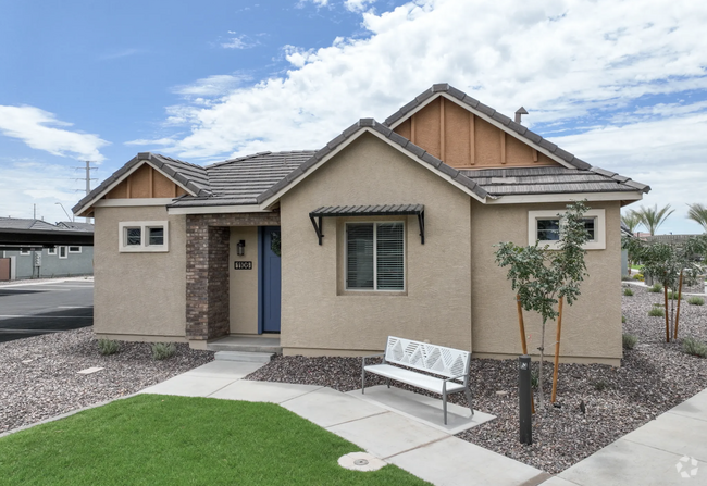
1685 E Maryland Ave
Phoenix, AZ 85016
2 Weeks Ago
Favorites
1685 E Maryland Ave

Favorites
Check Back Soon for Upcoming Availability
| Beds | Baths | Average SF |
|---|---|---|
| 3 Bedrooms 3 Bedrooms 3 Br | 3 Baths 3 Baths 3 Ba | 1,793 SF |
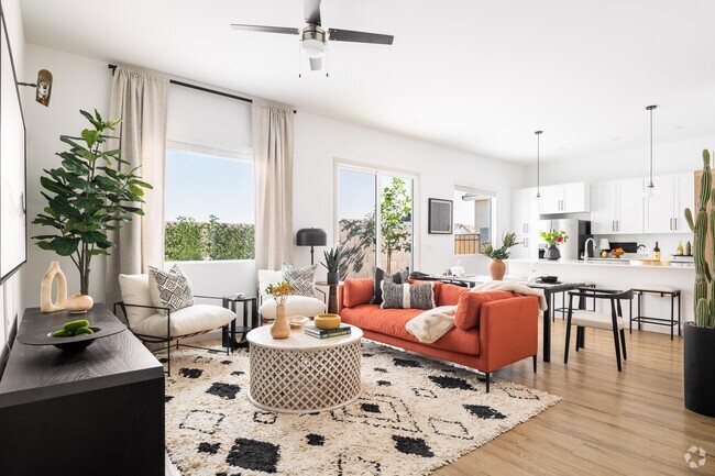
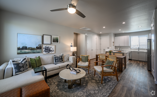
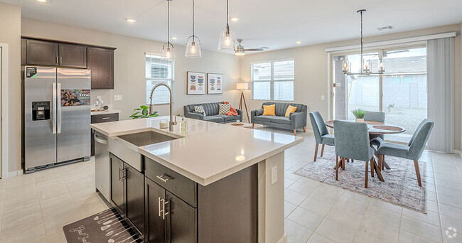
About This Property
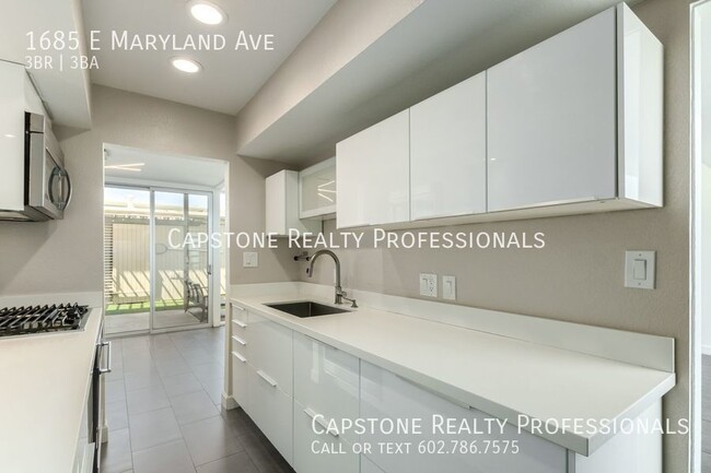
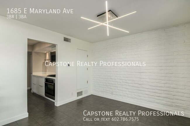
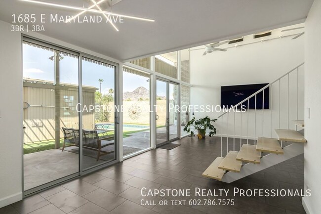
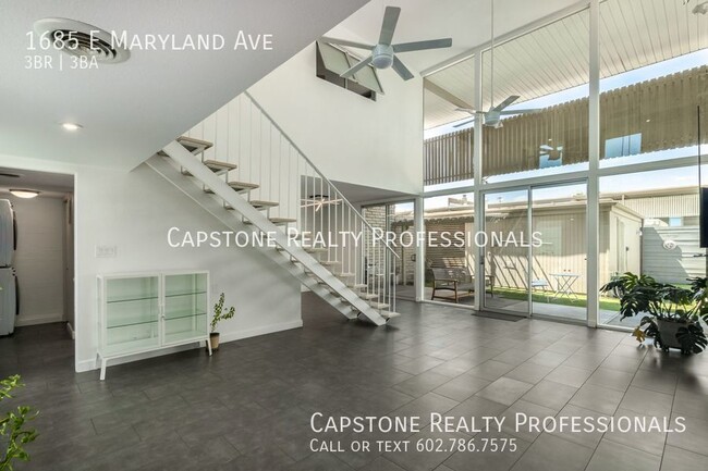
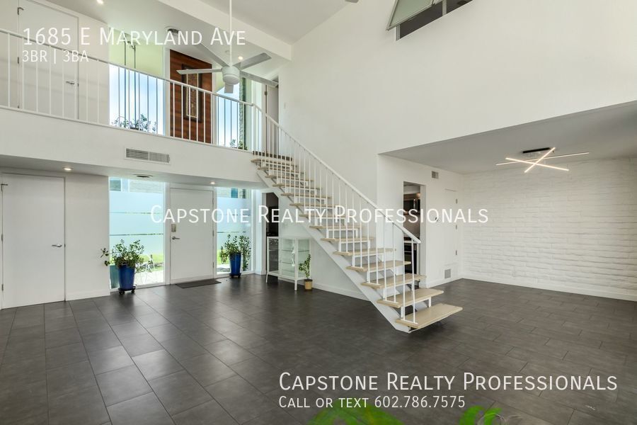
---- SCHEDULE A SHOWING ONLINE AT: http://showmojo.com/lac/5b0a3370bd ---- This rare and unique property sits in the heart of Central Corridor. This 3 bed 3 bath, 1964 mid century townhome is a historic Al Beadle treasure! Cool off in the private pool, and relax under the covered patio. This townhome comes with a 2 car garage and the unique interior offers north-facing windows, 18’ ceilings and an open staircase. On the first floor, you will find the third bedroom and bath and the second level offers two master bedrooms and en-suite bathrooms which are separated by an open bridge-way. The Roman Roads community is located in the uptown area of Central Phoenix, west of the Arizona Biltmore. Conveniently located near many restaurants, hiking tails and the 51 freeway. This rental will not last long as you won’t find many other townhomes with a private pool! Apply today! **TV and plants to remain & Pool service is included** Built In Microwave Carbon Monoxide Detectors Dryer Garage Pool Range/Oven Smoke Detectors Washer
1685 E Maryland Ave is a house located in Maricopa County and the 85016 ZIP Code. This area is served by the Madison Elementary District attendance zone.
House Features
- Dishwasher
- Refrigerator
Fees and Policies
The fees below are based on community-supplied data and may exclude additional fees and utilities.
- Dogs Allowed
-
Fees not specified
-
Weight limit--
-
Pet Limit--
Location
Get Directions
North Phoenix refers to the vast swath of land that stretches from Bethany Home Road up towards the Phoenix mountains. Bounded to the east by State Route 51 and to the west by 51st Avenue, North Phoenix is home a slew of diverse communities and neighborhoods all offering a variety of rentals ranging from the upscale to the more affordable. There are numerous golf courses and of course the mountains that offer residents a number of outdoor activities to engage in. For shopping and dining, residents head to Desert Ridge Marketplace on High Street, which is filled with upscale boutiques, nightlife hotspots, restaurants, and more. Interstate 17 and Route 101 make commuting around this desirable area simple.
Learn more about living in North PhoenixBelow are rent ranges for similar nearby apartments
| Beds | Average Size | Lowest | Typical | Premium |
|---|---|---|---|---|
| Studio Studio Studio | 571 Sq Ft | $914 | $1,475 | $2,034 |
| 1 Bed 1 Bed 1 Bed | 740-741 Sq Ft | $645 | $1,343 | $3,721 |
| 2 Beds 2 Beds 2 Beds | 1110-1111 Sq Ft | $950 | $1,839 | $10,202 |
| 3 Beds 3 Beds 3 Beds | 1548 Sq Ft | $649 | $2,588 | $8,300 |
| 4 Beds 4 Beds 4 Beds | 2218 Sq Ft | $1,189 | $3,219 | $8,000 |
Amenities
- Dishwasher
- Refrigerator
Education
| Colleges & Universities | Distance | ||
|---|---|---|---|
| Colleges & Universities | Distance | ||
| Drive: | 13 min | 5.7 mi | |
| Drive: | 12 min | 5.9 mi | |
| Drive: | 13 min | 6.0 mi | |
| Drive: | 15 min | 6.1 mi |
1685 E Maryland Ave is within 12 minutes or 5.9 miles from DeVry University, Arizona. It is also near Argosy University and Phoenix College.
Schools


Public Elementary & Middle School
Grades 5-8
913 Students
Attendance Zone
Public Elementary School
Grades PK-4
687 Students
Attendance Zone
Public High School
Grades 9-12
276 Students
Attendance Zone
Public High School
Grades 9-12
2,135 Students
Attendance Zone
Private Elementary School
Grades PK-3
36 Students
Nearby
Private Elementary & Middle School
Grades PK-7
Nearby
Private Elementary & Middle School
Grades K-8
159 Students
Nearby
Private High School
Grades 9-12
39 Students
Nearby
School data provided by
 The GreatSchools Rating helps parents compare schools within a state based on a variety of school quality indicators and provides a helpful picture of how effectively each school serves all of its students. Ratings are on a scale of 1 (below average) to 10 (above average) and can include test scores, college readiness, academic progress, advanced courses, equity, discipline and attendance data. We also advise parents to visit schools, consider other information on school performance and programs, and consider family needs as part of the school selection process.
View GreatSchools Rating Methodology
View GreatSchools Rating Methodology
Transportation options available in Phoenix include Central Ave/Camelback, located 3.6 miles from 1685 E Maryland Ave. 1685 E Maryland Ave is near Phoenix Sky Harbor International, located 9.3 miles or 16 minutes away, and Phoenix-Mesa Gateway, located 36.1 miles or 49 minutes away.
| Transit / Subway | Distance | ||
|---|---|---|---|
| Transit / Subway | Distance | ||
|
|
Drive: | 8 min | 3.6 mi |
|
|
Drive: | 8 min | 3.7 mi |
|
|
Drive: | 8 min | 3.7 mi |
|
|
Drive: | 8 min | 3.8 mi |
|
|
Drive: | 9 min | 4.1 mi |
| Commuter Rail | Distance | ||
|---|---|---|---|
| Commuter Rail | Distance | ||
|
|
Drive: | 49 min | 37.2 mi |
| Airports | Distance | ||
|---|---|---|---|
| Airports | Distance | ||
|
Phoenix Sky Harbor International
|
Drive: | 16 min | 9.3 mi |
|
Phoenix-Mesa Gateway
|
Drive: | 49 min | 36.1 mi |
Time and distance from 1685 E Maryland Ave.
| Shopping Centers | Distance | ||
|---|---|---|---|
| Shopping Centers | Distance | ||
| Walk: | 10 min | 0.5 mi | |
| Walk: | 13 min | 0.7 mi | |
| Walk: | 15 min | 0.8 mi |
1685 E Maryland Ave has 3 shopping centers within 0.8 mile, which is about a 15-minute walk. The miles and minutes will be for the farthest away property.
| Parks and Recreation | Distance | ||
|---|---|---|---|
| Parks and Recreation | Distance | ||
|
Desert Storm Park
|
Drive: | 3 min | 1.6 mi |
|
Granada Park
|
Drive: | 5 min | 1.8 mi |
|
Tonto National Forest
|
Drive: | 9 min | 4.1 mi |
|
Steele Indian School Park
|
Drive: | 9 min | 4.3 mi |
|
Dreamy Draw Recreation Area
|
Drive: | 9 min | 6.1 mi |
1685 E Maryland Ave has 5 parks within 6.1 miles, including Granada Park, Desert Storm Park, and Dreamy Draw Recreation Area.
| Hospitals | Distance | ||
|---|---|---|---|
| Hospitals | Distance | ||
| Drive: | 6 min | 2.5 mi | |
| Drive: | 8 min | 3.2 mi | |
| Drive: | 8 min | 4.0 mi |
1685 E Maryland Ave has 3 hospitals within 4.0 miles, the nearest is Phoenix Indian Medical Center which is 2.5 miles away and a 6 minute drive.
| Military Bases | Distance | ||
|---|---|---|---|
| Military Bases | Distance | ||
| Drive: | 17 min | 9.1 mi | |
| Drive: | 37 min | 18.1 mi | |
| Drive: | 106 min | 80.7 mi |
1685 E Maryland Ave has 3 military bases within 80.7 miles, the nearest is Phoenix Sky Harbor Airport Air Guard Station which is 9.1 miles away and a 17 minute drive.
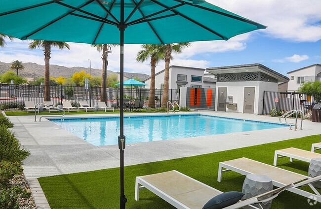
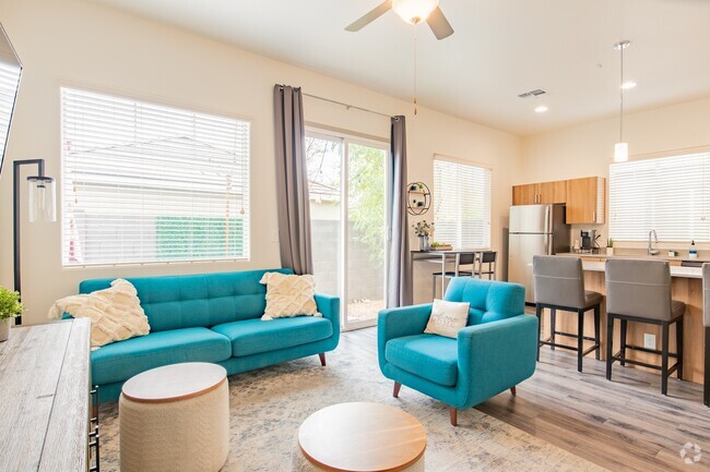
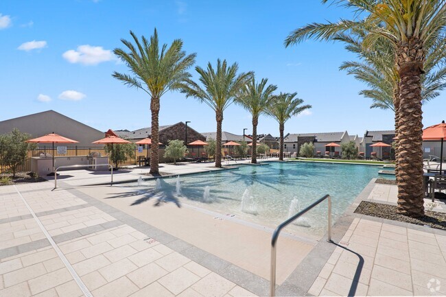
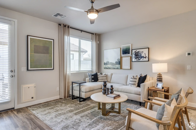
You May Also Like
Similar Rentals Nearby


What Are Walk Score®, Transit Score®, and Bike Score® Ratings?
Walk Score® measures the walkability of any address. Transit Score® measures access to public transit. Bike Score® measures the bikeability of any address.
What is a Sound Score Rating?
A Sound Score Rating aggregates noise caused by vehicle traffic, airplane traffic and local sources
1685 E Maryland Ave
Phoenix, AZ 85016