$1,550
Total Monthly Price
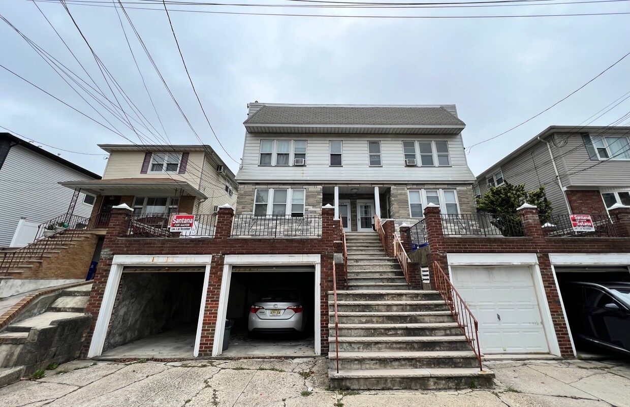
167 Davis Ave Unit 2
Kearny, NJ 07032
Favorites
-
Bedrooms
1
-
Bathrooms
1
-
Square Feet
4,480 sq ft
-
Available
Available Now
167 Davis Ave Unit 2

Favorites
About This Home
12 Month Lease,
$2,325 deposit,
Available Now
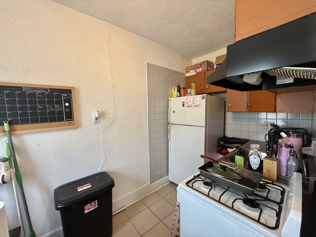
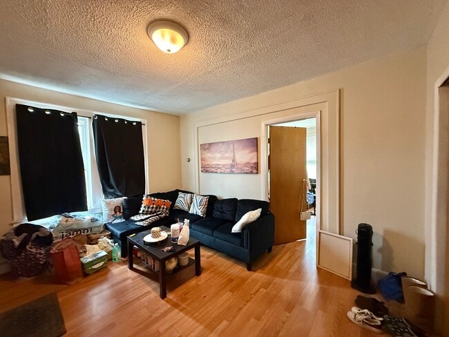
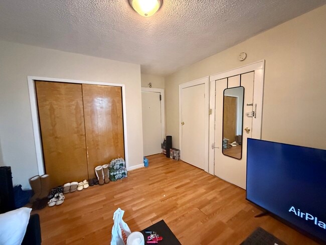
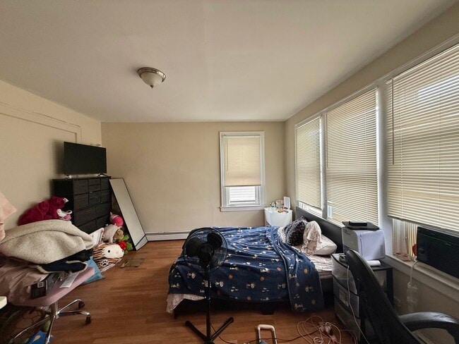
NICE HUGE SPACIOUS 1 BEDROOM APARTMENT FOR RENT! 1 BEDROOM, HUGE LIVING ROOM, KITCHEN AND FULL BATH. LOCATES IN THE CENTER OF KEARNY TOWN. LOVELY AND QUIET NEIGHBORHOOD. EASY STREET PARKING. MINUTES DISTANCE TO MAIN STREET, BANKS, RESTAURANTS, SHOPPING, VARIOUS GROCERY STORES, SCHOOL AND TRANSPORTATION. THERE IS A SUPER TO HELP WITH GARBAGE COLLECTING, SNOW REMOVAL, PUBLIC AREA CLEANING.. A MUST SEE!!!
167 Davis Ave is an apartment community located in Hudson County and the 07032 ZIP Code.
* Price shown is total price based on community-supplied monthly required fees. Excludes user-selected optional fees and variable or usage-based fees and required charges due at or prior to move-in or at move-out. Price, availability, fees, and any applicable rent special are subject to change without notice.
* Square footage definitions vary. Displayed square footage is approximate.
Apartment Features
- Kitchen
Fees and Policies
The fees listed below are community-provided and may exclude utilities or add-ons. All payments are made directly to the property and are non-refundable unless otherwise specified.
Details
Property Information
-
4 units
Contact
- Contact
Location
Get Directions
Arlington is a close-knit community in the city of Kearny just a few miles north of Newark. A few blocks to the west will take you to the Passaic River as it meanders towards Newark Bay. As you approach Kearny Avenue on the west side of town, be sure to check out some of the charming local restaurants that call Kearny home. Arlington offers affordable housing, homes with character, and an overall family-friendly atmosphere. Arlington is only 10 miles west of New York City, so residents can easily commute to the Big Apple for work, shopping, entertainment, and more.
Learn more about living in Arlington
Education
| Colleges & Universities | Distance | ||
|---|---|---|---|
| Colleges & Universities | Distance | ||
| Drive: | 6 min | 2.3 mi | |
| Drive: | 7 min | 2.8 mi | |
| Drive: | 7 min | 3.3 mi | |
| Drive: | 11 min | 5.6 mi |
167 Davis Ave Unit 2 is within 6 minutes or 2.3 miles from Rutgers, Newark Campus. It is also near N.J. Inst. of Technology and Essex County College.
Transportation options available in Kearny include Atlantic Street, located 1.8 miles from 167 Davis Ave Unit 2. 167 Davis Ave Unit 2 is near Newark Liberty International, located 7.4 miles or 10 minutes away, and LaGuardia, located 25.4 miles or 39 minutes away.
| Transit / Subway | Distance | ||
|---|---|---|---|
| Transit / Subway | Distance | ||
|
|
Drive: | 5 min | 1.8 mi |
|
|
Drive: | 5 min | 1.9 mi |
|
|
Drive: | 5 min | 1.9 mi |
|
|
Drive: | 5 min | 2.1 mi |
|
|
Drive: | 6 min | 3.0 mi |
| Commuter Rail | Distance | ||
|---|---|---|---|
| Commuter Rail | Distance | ||
|
|
Drive: | 3 min | 1.6 mi |
|
|
Drive: | 6 min | 2.6 mi |
|
|
Drive: | 6 min | 3.0 mi |
|
|
Drive: | 8 min | 4.3 mi |
|
|
Drive: | 10 min | 5.4 mi |
| Airports | Distance | ||
|---|---|---|---|
| Airports | Distance | ||
|
Newark Liberty International
|
Drive: | 10 min | 7.4 mi |
|
LaGuardia
|
Drive: | 39 min | 25.4 mi |
Getting Around
 What do Walkability, Transit, Drivability, and Bikeability mean?
Walkability measures the walking distance to day-to-day needs.
Transit measures access to public transportation.
Drivability measures congestion, parking availability, and access to major roads.
Bikeability measures the suitability for cycling.
How It Works
What do Walkability, Transit, Drivability, and Bikeability mean?
Walkability measures the walking distance to day-to-day needs.
Transit measures access to public transportation.
Drivability measures congestion, parking availability, and access to major roads.
Bikeability measures the suitability for cycling.
How It Works
Very Walkable
Walkability
80
/ 100
Good Public Transit
Transit
70
/ 100
Moderately Drivable
Drivability
60
/ 100
Fairly Bikeable
Bikeability
50
/ 100
Scores provided by
Active
Soundscore™
73
/ 100
Traffic
BusyAirport
ActiveBusinesses
ActiveScores provided by
HowLoud What is a Sound Score Rating? A Sound Score Rating aggregates noise caused by vehicle traffic, airplane traffic and local sources. How It WorksTime and distance from 167 Davis Ave Unit 2.
| Shopping Centers | Distance | ||
|---|---|---|---|
| Shopping Centers | Distance | ||
| Walk: | 14 min | 0.7 mi | |
| Walk: | 18 min | 1.0 mi | |
| Drive: | 3 min | 1.1 mi |
167 Davis Ave Unit 2 has 3 shopping centers within 1.1 miles, which is about a 3-minute drive. The miles and minutes will be for the farthest away property.
| Parks and Recreation | Distance | ||
|---|---|---|---|
| Parks and Recreation | Distance | ||
|
Kearny Marsh
|
Walk: | 19 min | 1.0 mi |
|
Newark Museum and Dreyfuss Planetarium
|
Drive: | 6 min | 2.2 mi |
|
Richard W. DeKorte Park
|
Drive: | 8 min | 2.9 mi |
|
Branch Brook Park
|
Drive: | 9 min | 4.0 mi |
|
McDowell Observatory
|
Drive: | 18 min | 6.5 mi |
167 Davis Ave Unit 2 has 5 parks within 6.5 miles, including Kearny Marsh, Newark Museum and Dreyfuss Planetarium, and Richard W. DeKorte Park.
| Hospitals | Distance | ||
|---|---|---|---|
| Hospitals | Distance | ||
| Drive: | 6 min | 2.3 mi | |
| Drive: | 7 min | 3.6 mi | |
| Drive: | 9 min | 4.5 mi |
167 Davis Ave Unit 2 has 3 hospitals within 4.5 miles, the nearest is Saint Michael's Medical Center which is 2.3 miles away and a 6 minute drive.
| Military Bases | Distance | ||
|---|---|---|---|
| Military Bases | Distance | ||
| Drive: | 24 min | 10.9 mi | |
| Drive: | 18 min | 11.3 mi | |
| Drive: | 34 min | 21.4 mi |
167 Davis Ave Unit 2 has 3 military bases within 21.4 miles, the nearest is Governors Island Support Center which is 10.9 miles away and a 24 minute drive.
Amenities
- Kitchen
167 Davis Ave Unit 2 Photos
How do I access Social Services in New Jersey?
Statewide service is free, confidential, multilingual and always open. Three easy ways to reach Social Services in NJ: Dial 2-1-1; text your zip code to 898-211; or chat at https://www.nj211.org

167 Davis Ave
Kearny, NJ 07032