$4,900
Total Monthly Price
165 High St Unit 165 High
Brookline, MA 02445
Favorites
165 High St Unit 165 High

Favorites
Check Back Soon for Upcoming Availability
| Beds | Baths | Average SF |
|---|---|---|
| 4 Bedrooms 4 Bedrooms 4 Br | 3 Baths 3 Baths 3 Ba | 1,794 SF |
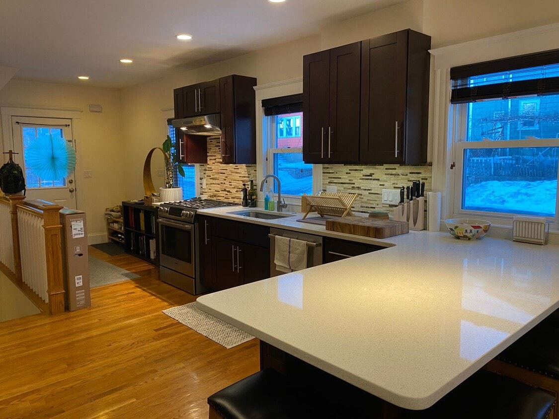
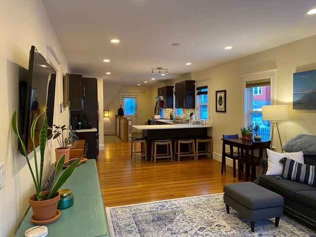
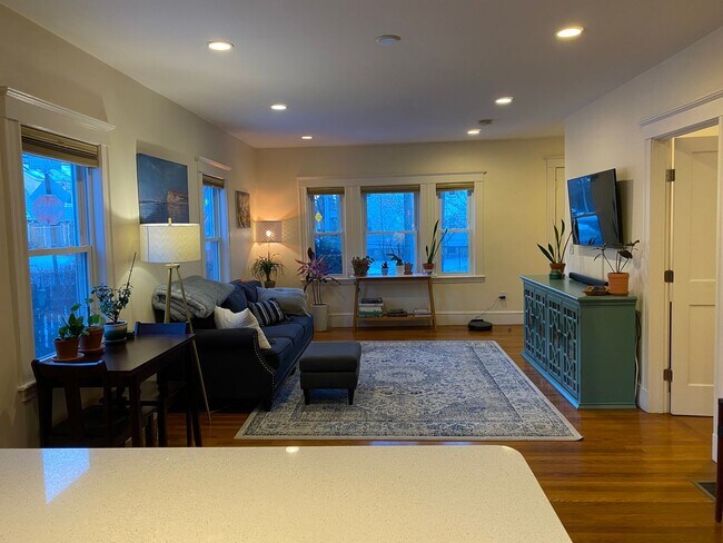
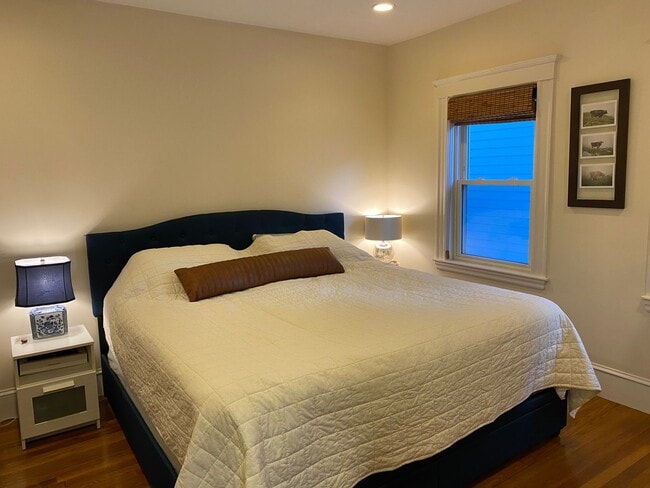
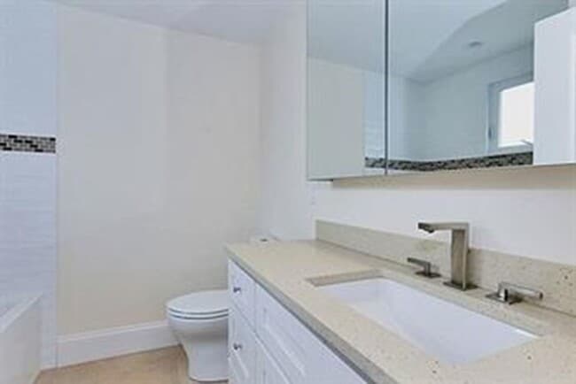
About This Property
If you're moving to Brookline, MA, this great property could be your new place. Located at 165 High St in Brookline, this apartment unit for rent is convenient to nearby destinations. Stop your search and start living in your new home. Let us assist you! Contact us now to schedule a tour!
165 High St is an apartment community located in Norfolk County and the 02445 ZIP Code.
Features
- Dishwasher
165 High St,
Brookline,
MA
02445
Brookline Village is an opulent neighborhood about five miles outside of Boston by car or train. This historic district is known for its beautiful homes and eclectic shopping destinations along Harvard Street and Washington Street. The other parts of Brookline Village feature lush community parks and residential homes. Renters have an abundance of moderately priced to luxury apartments and condos as well as spacious single-family homes for rent. Just outside of the neighborhood, residents enjoy parks like Olmsted Park, resort-like golf courses, and all the attractions offered by the big city.
Learn more about living in Brookline VillageBelow are rent ranges for similar nearby apartments
| Beds | Average Size | Lowest | Typical | Premium |
|---|---|---|---|---|
| Studio Studio Studio | 1127 Sq Ft | $1,500 | $2,345 | $3,725 |
| 1 Bed 1 Bed 1 Bed | 2037-2038 Sq Ft | $1,600 | $3,067 | $6,780 |
| 2 Beds 2 Beds 2 Beds | 1711 Sq Ft | $2,400 | $3,748 | $10,651 |
| 3 Beds 3 Beds 3 Beds | 3814 Sq Ft | $1,295 | $4,749 | $30,000 |
| 4 Beds 4 Beds 4 Beds | 4264 Sq Ft | $1,460 | $5,898 | $12,500 |
Amenities
- Dishwasher
Education
| Colleges & Universities | Distance | ||
|---|---|---|---|
| Colleges & Universities | Distance | ||
| Drive: | 3 min | 1.5 mi | |
| Drive: | 3 min | 1.9 mi | |
| Drive: | 4 min | 1.9 mi | |
| Drive: | 4 min | 1.9 mi |
165 High St Unit 165 High is within 3 minutes or 1.5 miles from MCPHS University, Boston. It is also near Simmons College and Emmanuel College.
Transportation options available in Brookline include Brookline Village Station, located 0.5 mile from 165 High St Unit 165 High. 165 High St Unit 165 High is near General Edward Lawrence Logan International, located 8.1 miles or 16 minutes away.
| Transit / Subway | Distance | ||
|---|---|---|---|
| Transit / Subway | Distance | ||
|
|
Walk: | 10 min | 0.5 mi |
|
|
Walk: | 13 min | 0.7 mi |
|
|
Walk: | 14 min | 0.8 mi |
|
|
Walk: | 15 min | 0.8 mi |
|
|
Walk: | 16 min | 0.8 mi |
| Commuter Rail | Distance | ||
|---|---|---|---|
| Commuter Rail | Distance | ||
|
|
Drive: | 4 min | 2.1 mi |
|
|
Drive: | 5 min | 2.3 mi |
| Drive: | 9 min | 3.6 mi | |
|
|
Drive: | 10 min | 4.4 mi |
| Drive: | 15 min | 6.5 mi |
| Airports | Distance | ||
|---|---|---|---|
| Airports | Distance | ||
|
General Edward Lawrence Logan International
|
Drive: | 16 min | 8.1 mi |
Walkability Near 165 High St Brookline, MA 02445
Getting Around
 What do Walkability, Transit, Drivability, and Bikeability mean?
Walkability measures the walking distance to day-to-day needs.
Transit measures access to public transportation.
Drivability measures congestion, parking availability, and access to major roads.
Bikeability measures the suitability for cycling.
How It Works
What do Walkability, Transit, Drivability, and Bikeability mean?
Walkability measures the walking distance to day-to-day needs.
Transit measures access to public transportation.
Drivability measures congestion, parking availability, and access to major roads.
Bikeability measures the suitability for cycling.
How It Works
Exceptionally Walkable
Walkability
90
/ 100
Good Public Transit
Transit
70
/ 100
Moderately Drivable
Drivability
60
/ 100
Exceptionally Bikeable
Bikeability
90
/ 100
Scores provided by
-
Soundscore™
-
/ 100
Traffic
-Airport
-Businesses
-Scores provided by
HowLoud What is a Sound Score Rating? A Sound Score Rating aggregates noise caused by vehicle traffic, airplane traffic and local sources. How It WorksTime and distance from 165 High St Unit 165 High.
| Shopping Centers | Distance | ||
|---|---|---|---|
| Shopping Centers | Distance | ||
| Drive: | 2 min | 1.2 mi | |
| Drive: | 4 min | 1.5 mi | |
| Drive: | 5 min | 1.9 mi |
165 High St Unit 165 High has 3 shopping centers within 1.9 miles, which is about a 5-minute drive. The miles and minutes will be for the farthest away property.
| Parks and Recreation | Distance | ||
|---|---|---|---|
| Parks and Recreation | Distance | ||
|
Frederick Law Olmsted National Historic Site
|
Walk: | 18 min | 1.0 mi |
|
John Fitzgerald Kennedy National Historic Site
|
Drive: | 4 min | 1.6 mi |
|
Roxbury Heritage State Park
|
Drive: | 4 min | 2.1 mi |
|
Chestnut Hill Reservation
|
Drive: | 5 min | 2.3 mi |
|
Coit Observatory
|
Drive: | 6 min | 2.7 mi |
165 High St Unit 165 High has 5 parks within 2.7 miles, including Frederick Law Olmsted National Historic Site, John Fitzgerald Kennedy National Historic Site, and Coit Observatory.
| Hospitals | Distance | ||
|---|---|---|---|
| Hospitals | Distance | ||
| Drive: | 3 min | 1.1 mi | |
| Drive: | 2 min | 1.2 mi | |
| Drive: | 2 min | 1.3 mi |
165 High St Unit 165 High has 3 hospitals within 1.3 miles, the nearest is Arbour Hospital which is 1.1 miles away and a 3 minute drive.
| Military Bases | Distance | ||
|---|---|---|---|
| Military Bases | Distance | ||
| Drive: | 26 min | 14.1 mi | |
| Drive: | 31 min | 16.0 mi | |
| Drive: | 40 min | 23.0 mi |
165 High St Unit 165 High has 3 military bases within 23.0 miles, the nearest is US Military Reservation which is 14.1 miles away and a 26 minute drive.
You May Also Like
-
Peterborough Apartments
109 Peterborough St
Boston, MA 02215
$5,500 Plus Fees
4 Br 12 Month Lease 1.6 mi
-
330 Saint Paul St
Brookline, MA 02446
$5,200 - $9,000 Total Monthly Price
4-6 Br 12 Month Lease 1.6 mi
-
65 Saint Marys St
Brookline, MA 02446
$4,400 - $8,000 Total Monthly Price
4-6 Br 12 Month Lease 1.6 mi
Similar Rentals Nearby
-
-
1 / 17

-
-
-
-
4 Beds$6,100Total Monthly PriceTotal Monthly Price NewPrices include all required monthly fees.Specials
-
4 Beds$15,000Total Monthly Price12 Month LeaseTotal Monthly Price NewPrices include base rent and required monthly fees. Variable costs based on usage may apply.1 Month Free
-
1 / 50

-
-


What Are Walk Score®, Transit Score®, and Bike Score® Ratings?
Walk Score® measures the walkability of any address. Transit Score® measures access to public transit. Bike Score® measures the bikeability of any address.
What is a Sound Score Rating?
A Sound Score Rating aggregates noise caused by vehicle traffic, airplane traffic and local sources.

165 High St
Brookline, MA 02445