
$1,750
/ Month
164 Church St
New Rochelle, NY 10805
2 Weeks Ago
|
Edit
Favorites
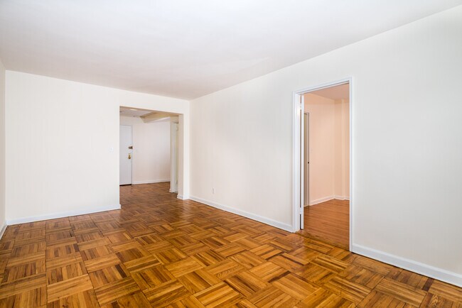
164 Church St

Favorites
Check Back Soon for Upcoming Availability
| Beds | Baths | Average SF |
|---|---|---|
| 1 Bedroom 1 Bedroom 1 Br | 1 Bath 1 Bath 1 Ba | 850 SF |
Fees and Policies
The fees below are based on community-supplied data and may exclude additional fees and utilities.
164 Church St is a condo located in Westchester County and the 10805 ZIP Code. This area is served by the New Rochelle City attendance zone.
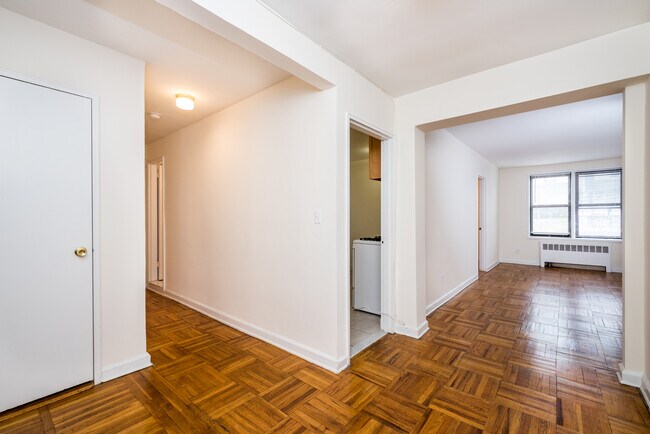
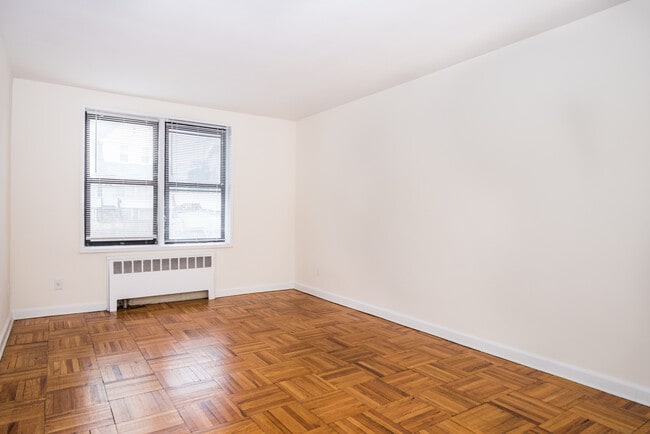
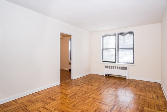
Condo Features
- Nevera

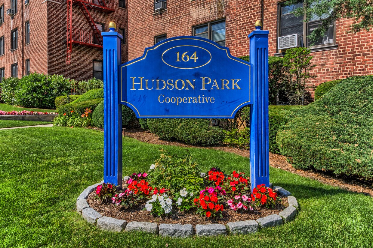
Hudson Park Cooperative Apartments
66 Units
6 Stories
Built in 1957
72,000 Sq Ft
Discover Hudson Park Cooperative Apartments - a condo community offering many amenities, a great location, and a variety of available units tailored to your lifestyle. Explore your next home today!
Learn more about Hudson Park Cooperative Apartments
Location
Get Directions
Isle of San Souci rests on the coast of the Long Island Sound, about a mile southeast of Downtown New Rochelle. Residents enjoy the beautiful scenery of the Sound along with New Rochelle Harbor to the southwest and several islands, including Pine Island and Echo Island, nearby. Locals spend their free time at waterfront parks and beaches like Hudson Park and Beach, a popular spot for concerts and fishing. Isle of San Souci is also home to several country clubs, yacht clubs, and event venues including Davenport Mansion. Isle of San Souci houses several older estates that tout an impressive history and architecture, but there are also apartments, houses, and condos available for rent as well. Although Isle of San Souci is a great option for renters seeking a quiet, coastal community, it’s also a great option for commuters since Route 1 and Interstate 95 allow residents to travel into New York City with ease.
Learn more about living in Isle Of San SouciBelow are rent ranges for similar nearby apartments
Amenities
- Nevera
Education
| Colleges & Universities | Distance | ||
|---|---|---|---|
| Colleges & Universities | Distance | ||
| Walk: | 9 min | 0.5 mi | |
| Walk: | 13 min | 0.7 mi | |
| Drive: | 4 min | 1.8 mi | |
| Drive: | 11 min | 5.5 mi |
164 Church St is within 9 minutes or 0.5 mile from The College of New Rochelle. It is also near Monroe College, New Rochelle and Iona College.
Schools


Public Elementary School
Grades PK-2
450 Students
Nearby
Public Elementary School
Grades K-5
863 Students
Attendance Zone
Public Middle School
Grades 6-8
1,138 Students
Attendance Zone
Public High School
Grades 9-12
3,076 Students
Attendance Zone
Private Elementary School
Grades PK-K
102 Students
Nearby
Private Elementary, Middle & High School
Grades 2-12
265 Students
Nearby
Private High School
Grades 9-12
235 Students
Nearby
School data provided by
 The GreatSchools Rating helps parents compare schools within a state based on a variety of school quality indicators and provides a helpful picture of how effectively each school serves all of its students. Ratings are on a scale of 1 (below average) to 10 (above average) and can include test scores, college readiness, academic progress, advanced courses, equity, discipline and attendance data. We also advise parents to visit schools, consider other information on school performance and programs, and consider family needs as part of the school selection process.
View GreatSchools Rating Methodology
Data provided by GreatSchools.org © 2025. All rights reserved.
View GreatSchools Rating Methodology
Data provided by GreatSchools.org © 2025. All rights reserved.
Transportation options available in New Rochelle include Eastchester-Dyre Ave, located 3.7 miles from 164 Church St. 164 Church St is near LaGuardia, located 14.7 miles or 27 minutes away, and Westchester County, located 16.5 miles or 26 minutes away.
| Transit / Subway | Distance | ||
|---|---|---|---|
| Transit / Subway | Distance | ||
|
|
Drive: | 7 min | 3.7 mi |
|
|
Drive: | 8 min | 4.2 mi |
|
|
Drive: | 9 min | 5.1 mi |
|
|
Drive: | 10 min | 5.5 mi |
|
|
Drive: | 10 min | 5.5 mi |
| Commuter Rail | Distance | ||
|---|---|---|---|
| Commuter Rail | Distance | ||
|
|
Walk: | 12 min | 0.6 mi |
|
|
Drive: | 6 min | 2.7 mi |
|
|
Drive: | 6 min | 2.9 mi |
|
|
Drive: | 8 min | 3.7 mi |
|
|
Drive: | 9 min | 4.5 mi |
| Airports | Distance | ||
|---|---|---|---|
| Airports | Distance | ||
|
LaGuardia
|
Drive: | 27 min | 14.7 mi |
|
Westchester County
|
Drive: | 26 min | 16.5 mi |
Time and distance from 164 Church St.
| Shopping Centers | Distance | ||
|---|---|---|---|
| Shopping Centers | Distance | ||
| Walk: | 6 min | 0.3 mi | |
| Walk: | 10 min | 0.5 mi | |
| Walk: | 12 min | 0.7 mi |
164 Church St has 3 shopping centers within 0.7 mile, which is about a 12-minute walk. The miles and minutes will be for the farthest away property.
| Parks and Recreation | Distance | ||
|---|---|---|---|
| Parks and Recreation | Distance | ||
|
Davenport Neck Bird Sanctuary
|
Walk: | 14 min | 0.7 mi |
|
Bartow-Pell Woods
|
Drive: | 6 min | 3.0 mi |
|
Pelham Bay Park
|
Drive: | 6 min | 3.5 mi |
|
Seton Falls Park
|
Drive: | 9 min | 4.2 mi |
|
Sheldrake Environmental Center
|
Drive: | 9 min | 4.6 mi |
164 Church St has 5 parks within 4.6 miles, including Davenport Neck Bird Sanctuary, Bartow-Pell Woods, and Pelham Bay Park.
| Hospitals | Distance | ||
|---|---|---|---|
| Hospitals | Distance | ||
| Walk: | 16 min | 0.8 mi | |
| Drive: | 8 min | 4.3 mi | |
| Drive: | 14 min | 6.9 mi |
164 Church St has 3 hospitals within 6.9 miles, the nearest is Montefiore New Rochelle Hospital which is 0.8 mile away and a 16 minute walk.
| Military Bases | Distance | ||
|---|---|---|---|
| Military Bases | Distance | ||
| Drive: | 23 min | 12.7 mi |
164 Church St is 12.7 miles and a 23 minute drive from Fort Totten US Govt Reservation.
You May Also Like
Similar Rentals Nearby


What Are Walk Score®, Transit Score®, and Bike Score® Ratings?
Walk Score® measures the walkability of any address. Transit Score® measures access to public transit. Bike Score® measures the bikeability of any address.
What is a Sound Score Rating?
A Sound Score Rating aggregates noise caused by vehicle traffic, airplane traffic and local sources

164 Church St
New Rochelle, NY 10805