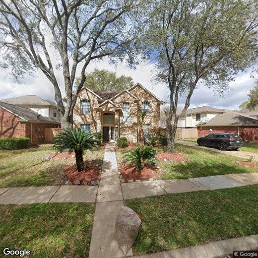
1638 Berkoff Dr
1638 Berkoff Dr
Sugar Land, TX 77479
Favorites
1638 Berkoff Dr

Favorites
Check Back Soon for Upcoming Availability
1638 Berkoff Dr,
Sugar Land,
TX
77479
Sugar Land grew from a 19th-century sugar plantation along the Brazos River into one of the largest and most well-regarded cities in Fort Bend County, sitting about 19 miles southwest of downtown Houston. The city carries a strong sense of intentional planning, with master-planned neighborhoods like First Colony, Telfair, and Riverstone each offering a distinct character while sharing the same tree-lined streets and community-focused design. Major employers and corporate campuses have taken root here, drawn by the skilled workforce and proximity to the Houston metro, giving the local economy a stable, diversified foundation. The Smart Financial Centre draws regional concert and event crowds, and Constellation Field hosts the Houston Astros' Triple-A affiliate, the Space Cowboys, adding a genuine sense of civic energy.
Learn more about living in Sugar Land
Education
| Colleges & Universities | Distance | ||
|---|---|---|---|
| Colleges & Universities | Distance | ||
| Drive: | 22 min | 13.7 mi | |
| Drive: | 21 min | 14.2 mi | |
| Drive: | 25 min | 19.0 mi | |
| Drive: | 27 min | 19.4 mi |
1638 Berkoff Dr is within 22 minutes or 13.7 miles from Houston Baptist University. It is also near Houston Christian University and The Art Institute of Houston.
Walkability Near 1638 Berkoff Dr Sugar Land, TX 77479
Getting Around
 What do Walkability, Transit, Drivability, and Bikeability mean?
Walkability measures the walking distance to day-to-day needs.
Transit measures access to public transportation.
Drivability measures congestion, parking availability, and access to major roads.
Bikeability measures the suitability for cycling.
How It Works
What do Walkability, Transit, Drivability, and Bikeability mean?
Walkability measures the walking distance to day-to-day needs.
Transit measures access to public transportation.
Drivability measures congestion, parking availability, and access to major roads.
Bikeability measures the suitability for cycling.
How It Works
Fairly Walkable
Walkability
40
/ 100
Exceptionally Drivable
Drivability
90
/ 100
Moderately Bikeable
Bikeability
60
/ 100
Scores provided by
-
Soundscore™
-
/ 100
Traffic
-Airport
-Businesses
-Scores provided by
HowLoud What is a Sound Score Rating? A Sound Score Rating aggregates noise caused by vehicle traffic, airplane traffic and local sources. How It WorksYou May Also Like
Similar Rentals Nearby
-
-
-
-
3 Beds$2,454+4 Beds$2,803+Total Monthly PriceTotal Monthly Price NewPrices include base rent and required monthly fees of $203. Variable costs based on usage may apply.Base Rent:3 Beds$2,250+4 Beds$2,599+2 Months Free
Pets Allowed Fitness Center Pool In Unit Washer & Dryer High-Speed Internet Stainless Steel Appliances Ceiling Fans
-
-
-
3 Beds$2,867+4 Beds$2,682+Total Monthly PriceTotal Monthly Price NewPrices include base rent and required monthly fees of $131. Variable costs based on usage may apply.Base Rent:3 Beds$2,735+4 Beds$2,550+
-
1 / 48
 3 Beds$2,195+4 Beds$2,819Total Monthly PriceTotal Monthly Price NewPrices include base rent and required monthly fees of $224. Variable costs based on usage may apply.Base Rent:3 Beds$1,971+4 Beds$2,5952 Months Free
 -
-
 Total Monthly Price New3 Beds$1,888+4 Beds$2,263Total Monthly Price18 Month LeasePrices include base rent and required monthly fees of $37. Variable costs based on usage may apply.Base Rent:3 Beds$1,850+4 Beds$2,225


What Are Walk Score®, Transit Score®, and Bike Score® Ratings?
Walk Score® measures the walkability of any address. Transit Score® measures access to public transit. Bike Score® measures the bikeability of any address.
What is a Sound Score Rating?
A Sound Score Rating aggregates noise caused by vehicle traffic, airplane traffic and local sources.