1633 Macombs Rd
1633 Macombs Rd,
Bronx,
NY
10453
2 Weeks Ago
Favorites
1633 Macombs Rd

Favorites
Check Back Soon for Upcoming Availability
About 1633 Macombs Rd Bronx, NY 10453
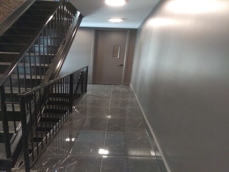
Beautiful Apartment in a Convenient Area in The Bronx Renovated state of the art building Close to the train station Safe area Don't miss out this apartment won't last!!
1633 Macombs Rd is an apartment community located in Bronx County and the 10453 ZIP Code.
Location
Get Directions
Morris Heights is a lively neighborhood that sits on the western edge along the Harlem River. Known for its hilly terrain, it offers charming views and a sense of community that draws residents in. The area is peppered with green spaces like Morris Heights Playground and Featherbed Lane Playground, perfect for a leisurely stroll or a fun day out. This neighborhood has a rich history tied to the influential Morris family and even serves as the birthplace of hip-hop, adding a unique cultural vibe. Although the cost of living here is about 27 percent higher than the New York average, the energetic community and amenities make it an attractive place to call home.
Residents often find employment in nearby health institutions such as the Bronx-Lebanon Hospital Center and the James J. Peters VA Medical Center, though many also commute to Manhattan. The neighborhood is well-connected to the rest of the city, with several subway and bus lines making travel convenient.
Learn more about living in Morris HeightsBelow are rent ranges for similar nearby apartments
Education
| Colleges & Universities | Distance | ||
|---|---|---|---|
| Colleges & Universities | Distance | ||
| Drive: | 3 min | 1.1 mi | |
| Drive: | 3 min | 1.1 mi | |
| Drive: | 4 min | 1.8 mi | |
| Drive: | 7 min | 2.8 mi |
1633 Macombs Rd is within 3 minutes or 1.1 miles from Bronx Community College. It is also near Yeshiva University, Wilf and Monroe College, Bronx Campus.
Transportation options available in Bronx include Mt Eden Av, located 0.3 mile from 1633 Macombs Rd. 1633 Macombs Rd is near LaGuardia, located 9.1 miles or 18 minutes away, and John F Kennedy International, located 19.8 miles or 28 minutes away.
| Transit / Subway | Distance | ||
|---|---|---|---|
| Transit / Subway | Distance | ||
| Walk: | 5 min | 0.3 mi | |
| Walk: | 6 min | 0.4 mi | |
| Walk: | 9 min | 0.5 mi | |
| Walk: | 9 min | 0.5 mi | |
|
|
Walk: | 13 min | 0.7 mi |
| Commuter Rail | Distance | ||
|---|---|---|---|
| Commuter Rail | Distance | ||
| Drive: | 3 min | 1.3 mi | |
| Drive: | 4 min | 1.4 mi | |
| Drive: | 3 min | 1.4 mi | |
| Drive: | 4 min | 1.4 mi | |
| Drive: | 5 min | 2.0 mi |
| Airports | Distance | ||
|---|---|---|---|
| Airports | Distance | ||
|
LaGuardia
|
Drive: | 18 min | 9.1 mi |
|
John F Kennedy International
|
Drive: | 28 min | 19.8 mi |
Time and distance from 1633 Macombs Rd.
| Shopping Centers | Distance | ||
|---|---|---|---|
| Shopping Centers | Distance | ||
| Walk: | 16 min | 0.8 mi | |
| Drive: | 5 min | 1.8 mi | |
| Drive: | 4 min | 1.9 mi |
1633 Macombs Rd has 3 shopping centers within 1.9 miles, which is about a 4-minute walk. The miles and minutes will be for the farthest away property.
| Parks and Recreation | Distance | ||
|---|---|---|---|
| Parks and Recreation | Distance | ||
|
Claremont Park
|
Walk: | 16 min | 0.8 mi |
|
Roberto Clemente State Park
|
Drive: | 4 min | 1.4 mi |
|
Crotona Park
|
Drive: | 5 min | 2.0 mi |
|
Highbridge Park
|
Drive: | 8 min | 3.5 mi |
|
Sherman Creek and Swindler Cove
|
Drive: | 9 min | 3.9 mi |
1633 Macombs Rd has 5 parks within 3.9 miles, including Claremont Park, Highbridge Park, and Crotona Park.
| Hospitals | Distance | ||
|---|---|---|---|
| Hospitals | Distance | ||
| Drive: | 5 min | 1.9 mi | |
| Drive: | 6 min | 2.3 mi | |
| Drive: | 5 min | 2.3 mi |
1633 Macombs Rd has 3 hospitals within 2.3 miles, the nearest is New York State Psychiatric Institute which is 1.9 miles away and a 5 minute drive.
| Military Bases | Distance | ||
|---|---|---|---|
| Military Bases | Distance | ||
| Drive: | 18 min | 10.3 mi | |
| Drive: | 30 min | 15.2 mi |
1633 Macombs Rd is 10.3 miles from Fort Totten US Govt Reservation, and is convenient to other military bases, including Governors Island Support Center.
You May Also Like
Similar Rentals Nearby


What Are Walk Score®, Transit Score®, and Bike Score® Ratings?
Walk Score® measures the walkability of any address. Transit Score® measures access to public transit. Bike Score® measures the bikeability of any address.
What is a Sound Score Rating?
A Sound Score Rating aggregates noise caused by vehicle traffic, airplane traffic and local sources