
1213 Walnut
1213 Walnut St,
Philadelphia, PA 19107
$2,540 - $5,400
Studio - 2 Beds

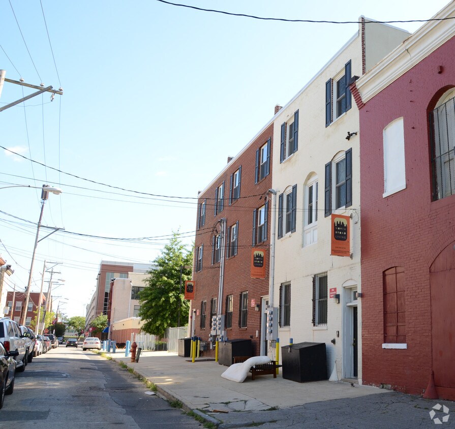
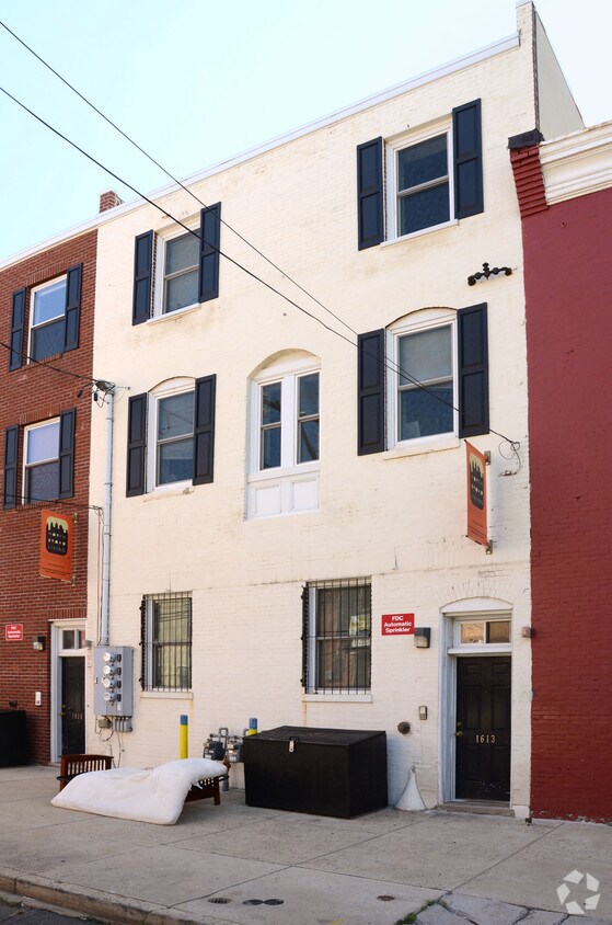
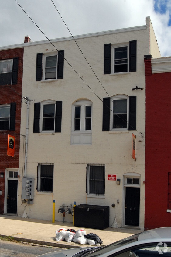
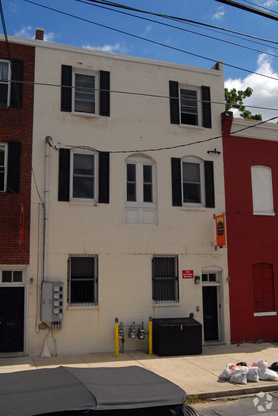
1613-1617 N Sydenham St offers a mixture of comfort, design and quality. In the 19121 area of Philadelphia on N. Sydenham St., you have an easy connection to a number of entertainment options found in the surrounding area. Make sure you to see the current floorplan options. The knowledgeable leasing staff is waiting to show you all that this community has to offer. Come see 1613-1617 N Sydenham St today.
1613-1617 N Sydenham St is an apartment community located in Philadelphia County and the 19121 ZIP Code. This area is served by the The School District of Philadelphia attendance zone.
Running alongside Fairmount Park, North Philadelphia West encompasses the area between Girard and Lehigh Avenues, west of Broad Street. There’s an incredible diversity of rentals here, including modern apartments that display incredible architecture and amenities to long-standing brick townhomes. Residents delight in the wealth of outdoor opportunities afforded by their proximity to the park, including the Sedgley Woods disc golf course, home of the city's innovative blend of ultimate Frisbee and classic golf. The neighborhood includes the smaller residential areas of Stanton, Brewerytown and Strawberry Mansion, and counts Girard College and Temple University among its academic landmarks.
Learn more about living in North Philadelphia WestCompare neighborhood and city base rent averages by bedroom.
| North Philadelphia West | Philadelphia, PA | |
|---|---|---|
| Studio | $1,042 | $1,410 |
| 1 Bedroom | $1,353 | $1,765 |
| 2 Bedrooms | $1,448 | $2,207 |
| 3 Bedrooms | $1,928 | $2,949 |
| Colleges & Universities | Distance | ||
|---|---|---|---|
| Colleges & Universities | Distance | ||
| Walk: | 9 min | 0.5 mi | |
| Drive: | 4 min | 1.7 mi | |
| Drive: | 5 min | 1.8 mi | |
| Drive: | 6 min | 2.4 mi |


Transportation options available in Philadelphia include Cecil B Moore, located 0.2 mile from 1613-1617 N Sydenham St. 1613-1617 N Sydenham St is near Philadelphia International, located 14.3 miles or 25 minutes away, and Trenton Mercer, located 33.5 miles or 52 minutes away.
| Transit / Subway | Distance | ||
|---|---|---|---|
| Transit / Subway | Distance | ||
|
|
Walk: | 3 min | 0.2 mi |
| Walk: | 9 min | 0.5 mi | |
| Walk: | 11 min | 0.6 mi | |
| Walk: | 11 min | 0.6 mi | |
|
|
Walk: | 11 min | 0.6 mi |
| Commuter Rail | Distance | ||
|---|---|---|---|
| Commuter Rail | Distance | ||
|
|
Drive: | 3 min | 1.1 mi |
|
|
Drive: | 4 min | 1.2 mi |
|
|
Drive: | 4 min | 1.4 mi |
|
|
Drive: | 6 min | 1.8 mi |
|
|
Drive: | 6 min | 2.2 mi |
| Airports | Distance | ||
|---|---|---|---|
| Airports | Distance | ||
|
Philadelphia International
|
Drive: | 25 min | 14.3 mi |
|
Trenton Mercer
|
Drive: | 52 min | 33.5 mi |
Scores provided by
Traffic
-Airport
-Businesses
-Scores provided by
HowLoud What is a Sound Score Rating? A Sound Score Rating aggregates noise caused by vehicle traffic, airplane traffic and local sources. How It WorksTime and distance from 1613-1617 N Sydenham St.
| Shopping Centers | Distance | ||
|---|---|---|---|
| Shopping Centers | Distance | ||
| Walk: | 3 min | 0.2 mi | |
| Walk: | 6 min | 0.3 mi | |
| Walk: | 17 min | 0.9 mi |
| Parks and Recreation | Distance | ||
|---|---|---|---|
| Parks and Recreation | Distance | ||
|
Wagner Free Institute of Science
|
Walk: | 5 min | 0.3 mi |
|
Edgar Allan Poe Nat'l Historic Site
|
Drive: | 5 min | 1.8 mi |
|
The Academy of Natural Sciences
|
Drive: | 5 min | 2.2 mi |
|
Fels Planetarium
|
Drive: | 6 min | 2.3 mi |
|
Franklin Institute
|
Drive: | 6 min | 2.3 mi |
| Hospitals | Distance | ||
|---|---|---|---|
| Hospitals | Distance | ||
| Drive: | 4 min | 1.7 mi | |
| Drive: | 6 min | 2.0 mi | |
| Drive: | 7 min | 2.7 mi |
| Military Bases | Distance | ||
|---|---|---|---|
| Military Bases | Distance | ||
| Drive: | 16 min | 8.7 mi |
What Are Walk Score®, Transit Score®, and Bike Score® Ratings?
Walk Score® measures the walkability of any address. Transit Score® measures access to public transit. Bike Score® measures the bikeability of any address.
What is a Sound Score Rating?
A Sound Score Rating aggregates noise caused by vehicle traffic, airplane traffic and local sources.
1613-1617 N Sydenham St
Philadelphia, PA 19121


