
$995 / Month
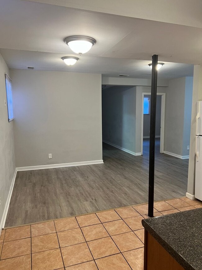
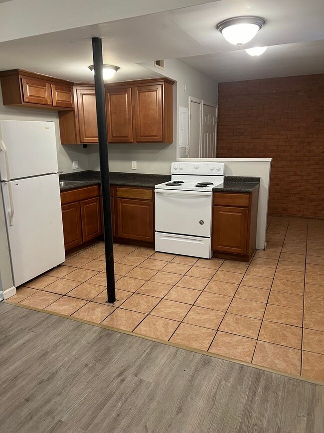
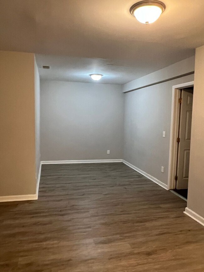
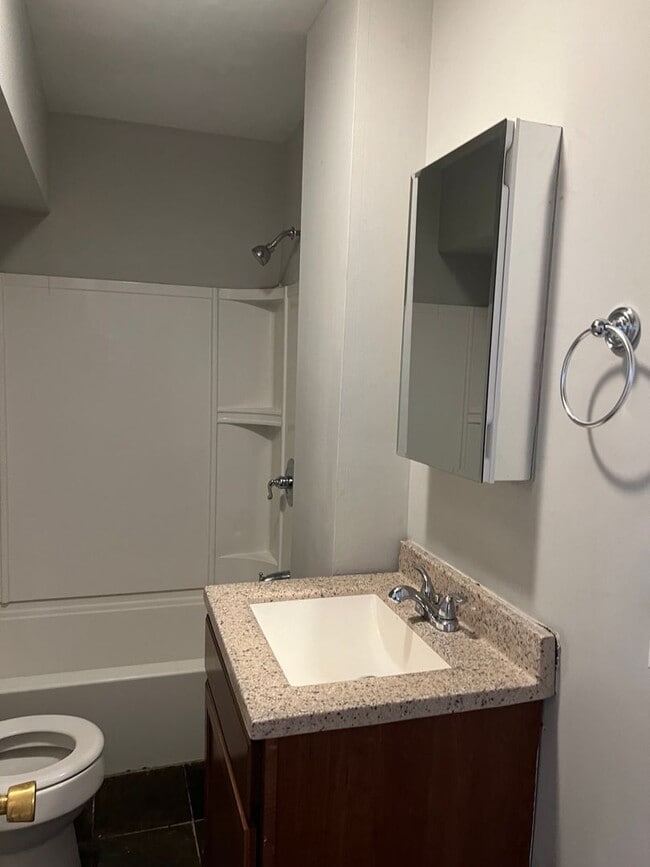
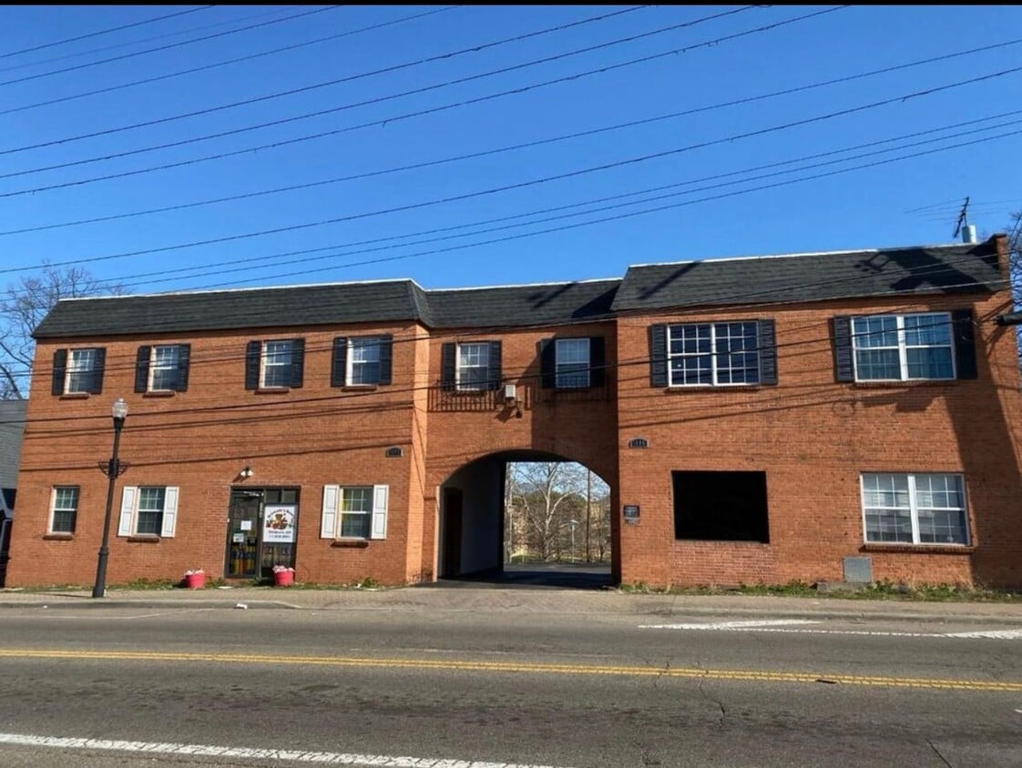
1604-1608 W Galbraith Rd Unit F
North College Hill, OH 45239
Today
Favorites
513-829-4446
-
Bedrooms
2
-
Bathrooms
1
-
Square Feet
--
-
Available
Available Now
1604-1608 W Galbraith Rd Unit F

Favorites
Contact
- Listed by RFMiller Homes Ltd | RFMiller Homes Ltd
- Phone Number
- Contact
Location
Get Directions
North College Hill is a wooded suburb that sits just 10 miles north of Cincinnati and six miles north of the University of Cincinnati. Because of its proximity to campus, North College Hill offers a blend of a college-town feel and a family-friendly atmosphere. Affordable apartments and single-family homes are available for rent in this laid-back suburb, and residents have access to an array of supermarkets, restaurants, and small shops. Locals enjoy playing a round of golf at the Clovernook Country Club or visiting the Cincinnati Zoo & Botanical Garden or Findlay Market nearby. Although North College Hill boasts a small-town charm that appeals to many renters, the neighborhood sits close enough to Cincinnati for daily commuters.
Learn more about living in North College Hill
Education
| Colleges & Universities | Distance | ||
|---|---|---|---|
| Colleges & Universities | Distance | ||
| Drive: | 16 min | 5.5 mi | |
| Drive: | 18 min | 8.1 mi | |
| Drive: | 19 min | 8.2 mi | |
| Drive: | 18 min | 10.3 mi |
1604-1608 W Galbraith Rd Unit F is within 16 minutes or 5.5 miles from Cincinnati State. It is also near University of Cincinnati and Univ. of Cincinnati, Medical.
Transportation options available in North College Hill include Brewery District Station, Elm & Henry, located 8.5 miles from 1604-1608 W Galbraith Rd Unit F. 1604-1608 W Galbraith Rd Unit F is near Cincinnati/Northern Kentucky International, located 22.5 miles or 43 minutes away.
| Transit / Subway | Distance | ||
|---|---|---|---|
| Transit / Subway | Distance | ||
| Drive: | 19 min | 8.5 mi | |
| Drive: | 19 min | 8.5 mi | |
| Drive: | 19 min | 8.6 mi | |
| Drive: | 20 min | 8.7 mi | |
| Drive: | 20 min | 8.8 mi |
| Commuter Rail | Distance | ||
|---|---|---|---|
| Commuter Rail | Distance | ||
|
|
Drive: | 18 min | 8.4 mi |
| Airports | Distance | ||
|---|---|---|---|
| Airports | Distance | ||
|
Cincinnati/Northern Kentucky International
|
Drive: | 43 min | 22.5 mi |
Time and distance from 1604-1608 W Galbraith Rd Unit F.
| Shopping Centers | Distance | ||
|---|---|---|---|
| Shopping Centers | Distance | ||
| Walk: | 2 min | 0.1 mi | |
| Walk: | 3 min | 0.2 mi | |
| Walk: | 7 min | 0.4 mi |
1604-1608 W Galbraith Rd Unit F has 3 shopping centers within 0.4 mile, which is about a 7-minute walk. The miles and minutes will be for the farthest away property.
| Parks and Recreation | Distance | ||
|---|---|---|---|
| Parks and Recreation | Distance | ||
|
LaBoiteaux Woods
|
Drive: | 6 min | 2.2 mi |
|
Buttercup Valley
|
Drive: | 9 min | 3.3 mi |
|
Farbach-Werner Nature Preserve
|
Drive: | 7 min | 3.7 mi |
|
Caldwell Preserve
|
Drive: | 10 min | 4.5 mi |
|
Winton Woods Park
|
Drive: | 11 min | 4.7 mi |
1604-1608 W Galbraith Rd Unit F has 5 parks within 4.7 miles, including LaBoiteaux Woods, Farbach-Werner Nature Preserve, and Buttercup Valley.
| Hospitals | Distance | ||
|---|---|---|---|
| Hospitals | Distance | ||
| Drive: | 14 min | 5.7 mi | |
| Drive: | 10 min | 6.3 mi | |
| Drive: | 16 min | 7.3 mi |
1604-1608 W Galbraith Rd Unit F has 3 hospitals within 7.3 miles, the nearest is Mercy Health - West Hospital which is 5.7 miles away and a 14 minute drive.
| Military Bases | Distance | ||
|---|---|---|---|
| Military Bases | Distance | ||
| Drive: | 65 min | 50.6 mi | |
| Drive: | 71 min | 55.6 mi | |
| Drive: | 73 min | 58.9 mi |
1604-1608 W Galbraith Rd Unit F has 3 military bases within 58.9 miles, the nearest is Gentile Air Force Station which is 50.6 miles away and a 65 minute drive.
You May Also Like
Similar Rentals Nearby


What Are Walk Score®, Transit Score®, and Bike Score® Ratings?
Walk Score® measures the walkability of any address. Transit Score® measures access to public transit. Bike Score® measures the bikeability of any address.
What is a Sound Score Rating?
A Sound Score Rating aggregates noise caused by vehicle traffic, airplane traffic and local sources
1604-1608 W Galbraith Rd
North College Hill, OH 45239