$1,900
/ Month
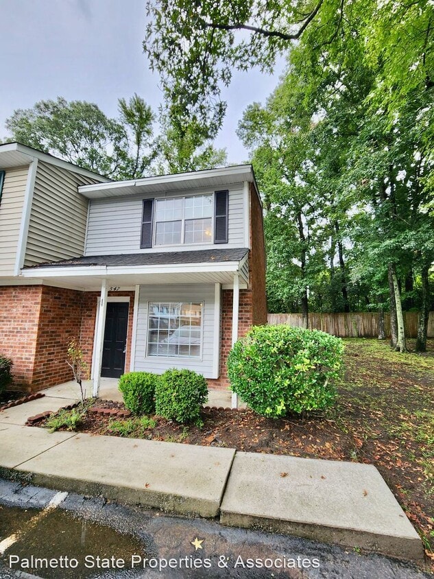
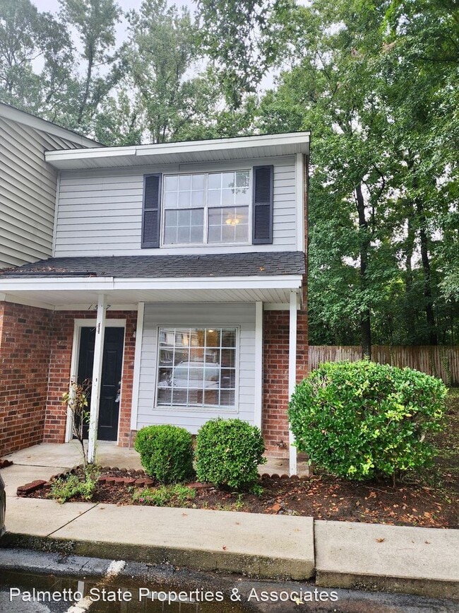
1547 Nantahala Blvd
Mount Pleasant, SC 29464
Favorites
1547 Nantahala Blvd

Favorites
Check Back Soon for Upcoming Availability
| Beds | Baths | Average SF |
|---|---|---|
| 2 Bedrooms 2 Bedrooms 2 Br | 1.5 Baths 1.5 Baths 1.5 Ba | 1,100 SF |
Fees and Policies
The fees listed below are community-provided and may exclude utilities or add-ons. All payments are made directly to the property and are non-refundable unless otherwise specified.
- Dogs Allowed
-
Fees not specified
-
Weight limit--
-
Pet Limit--
About This Property
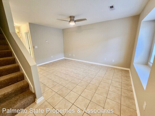
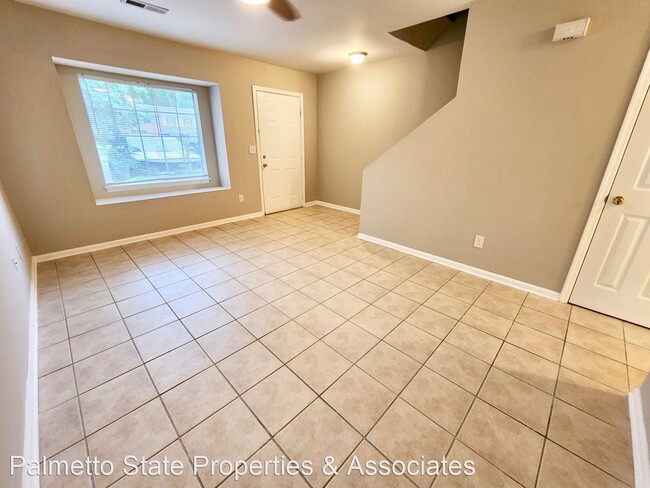
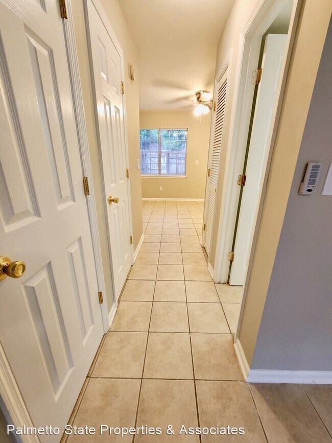
- Two bedroom townhome - Wando East - Mt. Pleasant - Live in the heart of Mt. Pleasant - just minutes away from the Town Center, Isle of Palms beach, and downtown Charleston! Well laid out 1,100 sq feet of living space Dine-in style kitchen with pantry Spacious living room One and a half bathrooms Two bedrooms upstairs Ample closet space His and Hers closets in the master Large utility / Laundry room A private backyard with six foot fencing Two pet maximum. Breed restrictions apply. HOA allows two parking spaces per unit. Stock photos are representative only. Individual units may vary slightly. For other availabilities, please contact us at . (RLNE7640255) Pet policies: Small Dogs Allowed, Cats Allowed, Large Dogs Allowed.
1547 Nantahala Blvd is a house located in Charleston County and the 29464 ZIP Code. This area is served by the Charleston 01 School District attendance zone.
1547 Nantahala Blvd,
Mount Pleasant,
SC
29464
Mount Pleasant, South Carolina sits across the Cooper River from Charleston, offering coastal living with easy city access. This waterfront community features diverse housing options, from properties along Shem Creek to homes in the Old Village district. Current rental trends show one-bedroom apartments averaging $2,084 monthly and two-bedroom units around $2,508.
The town's Shem Creek area draws residents to its waterfront restaurants and outdoor activities, where you can observe local shrimp boats or explore the waterways by paddle board. Patriots Point, featuring the USS Yorktown aircraft carrier museum, stands as a prominent landmark, while the Arthur Ravenel Jr. Bridge provides direct access to downtown Charleston.
Mount Pleasant seamlessly combines historic architecture with contemporary development. The Old Village preserves some of the area's earliest structures, including the Hibben House from 1755.
Learn more about living in Mount Pleasant
Education
| Colleges & Universities | Distance | ||
|---|---|---|---|
| Colleges & Universities | Distance | ||
| Drive: | 13 min | 7.6 mi | |
| Drive: | 14 min | 8.1 mi | |
| Drive: | 15 min | 8.6 mi | |
| Drive: | 15 min | 8.7 mi |
1547 Nantahala Blvd is within 15 minutes or 8.6 miles from College of Charleston. It is also near Charleston School Of Law and Trident Tech., Palmer.
Schools


Public Elementary School
Grades PK-5
763 Students
Attendance Zone
Public Middle & High School
Grades 6-12
547 Students
Nearby
Public Middle School
Grades 6-8
1,119 Students
Attendance Zone
Public High School
Grades 9-12
771 Students
Nearby
Private Elementary, Middle & High School
Grades PK-12
748 Students
Nearby
Private Elementary, Middle & High School
Grades K-12
50 Students
Nearby
School data provided by
 The GreatSchools Rating helps parents compare schools within a state based on a variety of school quality indicators and provides a helpful picture of how effectively each school serves all of its students. Ratings are on a scale of 1 (below average) to 10 (above average) and can include test scores, college readiness, academic progress, advanced courses, equity, discipline and attendance data. We also advise parents to visit schools, consider other information on school performance and programs, and consider family needs as part of the school selection process.
View GreatSchools Rating Methodology
Data provided by GreatSchools.org © 2026. All rights reserved.
View GreatSchools Rating Methodology
Data provided by GreatSchools.org © 2026. All rights reserved.
Walkability Near 1547 Nantahala Blvd Mount Pleasant, SC 29464
Getting Around
 What do Walkability, Transit, Drivability, and Bikeability mean?
Walkability measures the walking distance to day-to-day needs.
Transit measures access to public transportation.
Drivability measures congestion, parking availability, and access to major roads.
Bikeability measures the suitability for cycling.
How It Works
What do Walkability, Transit, Drivability, and Bikeability mean?
Walkability measures the walking distance to day-to-day needs.
Transit measures access to public transportation.
Drivability measures congestion, parking availability, and access to major roads.
Bikeability measures the suitability for cycling.
How It Works
Fairly Walkable
Walkability
50
/ 100
Limited Public Transit
Transit
20
/ 100
Very Drivable
Drivability
80
/ 100
Somewhat Bikeable
Bikeability
30
/ 100
Scores provided by
-
Soundscore™
-
/ 100
Traffic
-Airport
-Businesses
-Scores provided by
HowLoud What is a Sound Score Rating? A Sound Score Rating aggregates noise caused by vehicle traffic, airplane traffic and local sources. How It WorksYou May Also Like
Similar Rentals Nearby
-
-
-
-
-
 3 Beds$2,550Total Monthly PriceTotal Monthly Price NewPrices include all required monthly fees.House for Rent
 -
 3 Beds$2,095Total Monthly PriceTotal Monthly Price NewPrices include all required monthly fees.House for Rent
 -
 3 Beds$2,130Total Monthly PriceTotal Monthly Price NewPrices include all required monthly fees.House for Rent
 -
 4 Beds$2,260Total Monthly PriceTotal Monthly Price NewPrices include all required monthly fees.House for Rent
 -
 5 Beds$2,765Total Monthly PriceTotal Monthly Price NewPrices include all required monthly fees.House for Rent
 -
 5 Beds$2,690Total Monthly PriceTotal Monthly Price NewPrices include all required monthly fees.House for Rent


What Are Walk Score®, Transit Score®, and Bike Score® Ratings?
Walk Score® measures the walkability of any address. Transit Score® measures access to public transit. Bike Score® measures the bikeability of any address.
What is a Sound Score Rating?
A Sound Score Rating aggregates noise caused by vehicle traffic, airplane traffic and local sources.

1547 Nantahala Blvd
Mount Pleasant, SC 29464