

$2,200
/ Month
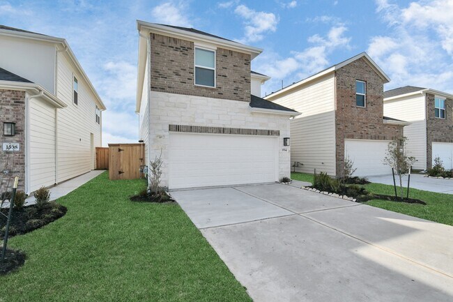
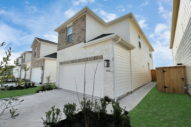
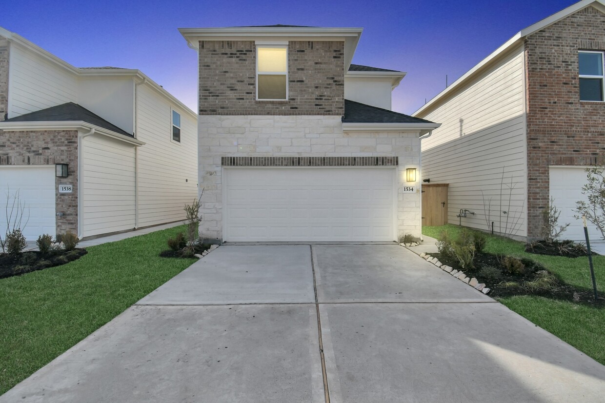
1534 Revolution Way
Missouri City, TX 77489
Favorites
713-885-7934
-
Bedrooms
3
-
Bathrooms
3
-
Square Feet
1,436 sq ft
-
Available
Available Now
Highlights
- Contemporary Architecture
- Quartz Countertops
- Family Room Off Kitchen
- 2 Car Attached Garage
- Tile Flooring
- Central Heating and Cooling System
1534 Revolution Way

Favorites
About This Home
Available Now
Brightland Homes is the builder,Two story Beautiful Town-Home,Built in 2023. Appliances included washer,dryer,refrigerator. Very close to major highways. Elementary school in walking distance. Direction - From downtown Southwest Freeway (59 / 69) south,Exit FM 1092 / Murphy Road left,Independence Left,Revolution Way Right,House is on right side MLS ID 25318261
1534 Revolution Way is a condo located in Fort Bend County and the 77489 ZIP Code.
* Price shown is base rent. Excludes user-selected optional fees and variable or usage-based fees and required charges due at or prior to move-in or at move-out. Price, availability, fees, and any applicable rent special are subject to change without notice.
* Square footage definitions vary. Displayed square footage is approximate.
Home Details
Home Type
Single Family Detached Home
Year Built
Built in 2023
Bedrooms and Bathrooms
2.5 Bathrooms
3 Bedrooms
Flooring
Tile
Carpet
Home Design
Contemporary Architecture
Home Security
Fire and Smoke Detector
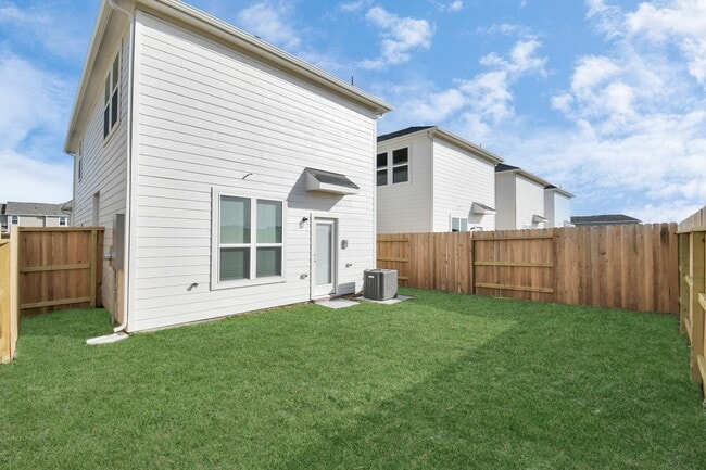
Interior Spaces
Family Room Off Kitchen
Combination Dining and Living Room
Utility Room
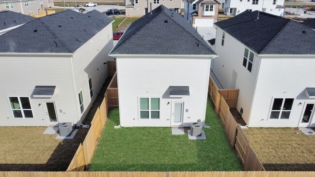
1,436 Sq Ft Home
2-Story Property
Kitchen
Quartz Countertops
Gas Oven
Gas Range
Microwave
Dishwasher
Laundry
Dryer
Washer
Listing and Financial Details
Property Available on 6/11/26
12 Month Lease Term
Lot Details
2,910 Sq Ft Lot
East Facing Home
Back Yard Fenced
Parking
2 Car Attached Garage
Garage Door Opener
Schools
Armstrong Elementary School
Missouri City Middle School
Marshall High School
Utilities
Central Heating and Cooling System
No Utilities
Community Details
Overview
Lexinton Village Subdivision
Pet Policy
No Pets Allowed
Contact
- Listed by Andrews Jacob | MIH REALTY,LLC
- Phone Number
- Contact
-
Source
 Houston Association of REALTORS®
Copyright © 2026 Houston Association of Realtors. All rights reserved. All information provided by the listing agent/broker is deemed reliable but is not guaranteed and should be independently verified.
Location
Get Directions
A tight-knit residential community in Missouri City, Quail Valley is known for its expansive golf courses, recreation centers, and welcoming neighbors. The well-maintained streets of Quail Valley are filled with a variety of upscale apartments, condos, houses, and townhomes that will fit any renter’s needs. Quail Valley’s community park offers a scenic outdoor reprieve with ponds, playgrounds, piers, sports fields, and an outdoor amphitheater.
This safe neighborhood sits near both Missouri City and Sugar Land, and is located about 22 miles southwest of Houston. Residents who play to commute can hop onto Highway 90, Interstate 610, and Highway 288 to get to downtown. This golf course community offers a laidback vibe with plenty of outdoor recreational opportunities.
Learn more about living in Quail Valley
Education
| Colleges & Universities | Distance | ||
|---|---|---|---|
| Colleges & Universities | Distance | ||
| Drive: | 15 min | 8.5 mi | |
| Drive: | 15 min | 8.9 mi | |
| Drive: | 20 min | 13.6 mi | |
| Drive: | 20 min | 14.2 mi |
1534 Revolution Way is within 15 minutes or 8.5 miles from Houston Baptist University. It is also near Houston Christian University and UT Health Houston.
Getting Around
 What do Walkability, Transit, Drivability, and Bikeability mean?
Walkability measures the walking distance to day-to-day needs.
Transit measures access to public transportation.
Drivability measures congestion, parking availability, and access to major roads.
Bikeability measures the suitability for cycling.
How It Works
What do Walkability, Transit, Drivability, and Bikeability mean?
Walkability measures the walking distance to day-to-day needs.
Transit measures access to public transportation.
Drivability measures congestion, parking availability, and access to major roads.
Bikeability measures the suitability for cycling.
How It Works
Fairly Walkable
Walkability
50
/ 100
Exceptionally Drivable
Drivability
100
/ 100
Moderately Bikeable
Bikeability
60
/ 100
Scores provided by
-
Soundscore™
-
/ 100
Traffic
-Airport
-Businesses
-Scores provided by
HowLoud What is a Sound Score Rating? A Sound Score Rating aggregates noise caused by vehicle traffic, airplane traffic and local sources. How It WorksYou May Also Like
Similar Rentals Nearby
-
-

-

-

-

-

-

-

-

-
 3 Beds, 3 Baths, 1,640 sq ft$2,250Total Monthly PriceTotal Monthly Price NewPrices include all required monthly fees.6404 Burgoyne Dr. Unit 159
1534 Revolution Way
Missouri City, TX 77489