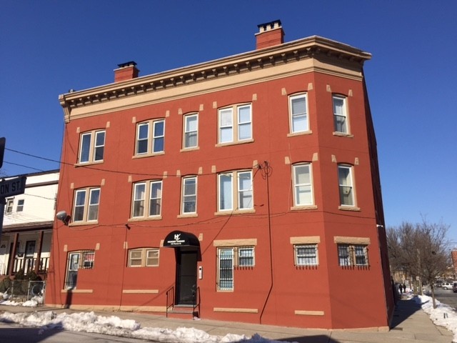
153 Pierson St
153 Pierson St,
City of Orange,
NJ
07050
2 Weeks Ago
Favorites
153 Pierson St

Favorites
Check Back Soon for Upcoming Availability
About 153 Pierson St City of Orange, NJ 07050
AVAILABLE IMMEDIATELY INCLUDES: 24/7 Camera Surveillance Super on-site Controlled access Public transportation 1 block away from public transportation (bus). COLLEGES NEAR BY: -Rutgers -Newark -UMDNJ -NJIT -Seton Hall Utilities not Included.
153 Pierson St is an apartment community located in Essex County and the 07050 ZIP Code.
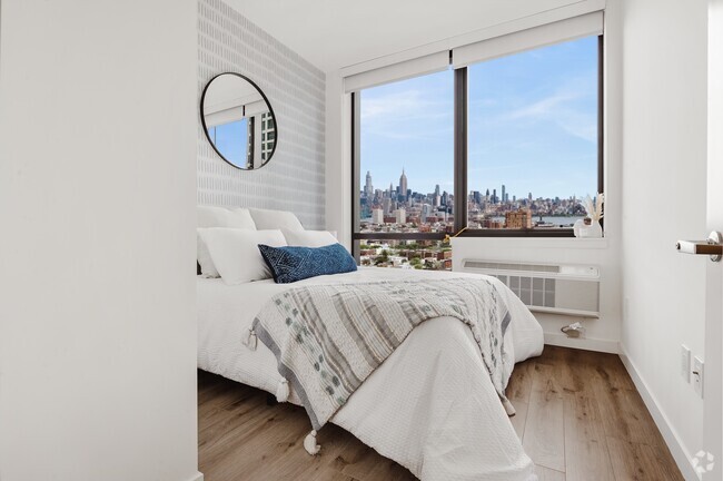
Apartment Features
- Controlled Access
- Gated
Fees and Policies
The fees below are based on community-supplied data and may exclude additional fees and utilities.
- Parking
-
Surface Lot$125/mo
Details
Lease Options
-
12 Months
Property Information
-
3 units
Location
Get Directions
The City of Orange is a historic and largely residential community in the suburbs outside of Newark, roughly fifteen miles from Manhattan. The thriving Main Street district is packed with shops and restaurants of every kind, making life easy whether you’re running errands or just looking for a quick bite to eat.
With multiple NJ Transit stops in town, it’s easy to get around the area without a car—this combined with the abundance of affordable apartments and condos makes Orange a highly popular home base for New York-area commuters. While close to the big city, living in Orange will also allow you to take advantage of the huge nearby nature preserves, such as the South Mountain and Eagle Rock Reservations.
Learn more about living in Orange
Amenities
- Controlled Access
- Gated
Expenses
Recurring
Unassigned Surface Lot Parking
$125
Education
| Colleges & Universities | Distance | ||
|---|---|---|---|
| Colleges & Universities | Distance | ||
| Drive: | 6 min | 2.3 mi | |
| Drive: | 7 min | 3.0 mi | |
| Drive: | 7 min | 3.4 mi | |
| Drive: | 7 min | 3.6 mi |
153 Pierson St is within 6 minutes or 2.3 miles from Seton Hall University. It is also near Bloomfield College and N.J. Inst. of Technology.
Transportation options available in City of Orange include Orange Street, located 2.7 miles from 153 Pierson St. 153 Pierson St is near Newark Liberty International, located 9.0 miles or 16 minutes away, and Laguardia, located 29.8 miles or 45 minutes away.
| Transit / Subway | Distance | ||
|---|---|---|---|
| Transit / Subway | Distance | ||
|
|
Drive: | 5 min | 2.7 mi |
|
|
Drive: | 5 min | 2.9 mi |
|
|
Drive: | 7 min | 3.3 mi |
|
|
Drive: | 7 min | 3.8 mi |
|
|
Drive: | 8 min | 4.4 mi |
| Commuter Rail | Distance | ||
|---|---|---|---|
| Commuter Rail | Distance | ||
|
|
Walk: | 10 min | 0.5 mi |
|
|
Walk: | 10 min | 0.6 mi |
|
|
Drive: | 2 min | 1.1 mi |
|
|
Drive: | 3 min | 1.2 mi |
|
|
Drive: | 7 min | 2.3 mi |
| Airports | Distance | ||
|---|---|---|---|
| Airports | Distance | ||
|
Newark Liberty International
|
Drive: | 16 min | 9.0 mi |
|
Laguardia
|
Drive: | 45 min | 29.8 mi |
Time and distance from 153 Pierson St.
| Shopping Centers | Distance | ||
|---|---|---|---|
| Shopping Centers | Distance | ||
| Walk: | 14 min | 0.7 mi | |
| Drive: | 5 min | 1.8 mi | |
| Drive: | 4 min | 1.9 mi |
153 Pierson St has 3 shopping centers within 1.9 miles, which is about a 4-minute walk. The miles and minutes will be for the farthest away property.
| Parks and Recreation | Distance | ||
|---|---|---|---|
| Parks and Recreation | Distance | ||
|
Edison National Historic Site
|
Drive: | 5 min | 1.9 mi |
|
Turtle Back Zoo
|
Drive: | 8 min | 3.6 mi |
|
Newark Museum and Dreyfuss Planetarium
|
Drive: | 7 min | 3.7 mi |
|
Branch Brook Park
|
Drive: | 8 min | 4.1 mi |
|
Van Vleck House & Gardens
|
Drive: | 11 min | 5.8 mi |
153 Pierson St has 5 parks within 5.8 miles, including Edison National Historic Site, Turtle Back Zoo, and Newark Museum and Dreyfuss Planetarium.
| Hospitals | Distance | ||
|---|---|---|---|
| Hospitals | Distance | ||
| Drive: | 3 min | 1.6 mi | |
| Drive: | 6 min | 3.1 mi | |
| Drive: | 6 min | 3.5 mi |
153 Pierson St has 3 hospitals within 3.5 miles, the nearest is East Orange General Hospital which is 1.6 miles away and a 3 minute drive.
| Military Bases | Distance | ||
|---|---|---|---|
| Military Bases | Distance | ||
| Drive: | 21 min | 12.8 mi | |
| Drive: | 27 min | 14.9 mi | |
| Drive: | 31 min | 15.4 mi |
153 Pierson St has 3 military bases within 15.4 miles, the nearest is Military Ocean Terminal which is 12.8 miles away and a 21 minute drive.
You May Also Like
Similar Rentals Nearby


What Are Walk Score®, Transit Score®, and Bike Score® Ratings?
Walk Score® measures the walkability of any address. Transit Score® measures access to public transit. Bike Score® measures the bikeability of any address.
What is a Sound Score Rating?
A Sound Score Rating aggregates noise caused by vehicle traffic, airplane traffic and local sources