

$2,300 / Month
1529-33 N Philip St Unit 12
Philadelphia, PA 19122
2 Weeks Ago
Favorites
1529-33 N Philip St Unit 12

Favorites
Check Back Soon for Upcoming Availability
| Beds | Baths | Average SF |
|---|---|---|
| 2 Bedrooms 2 Bedrooms 2 Br | 3 Baths 3 Baths 3 Ba | — |
About This Property
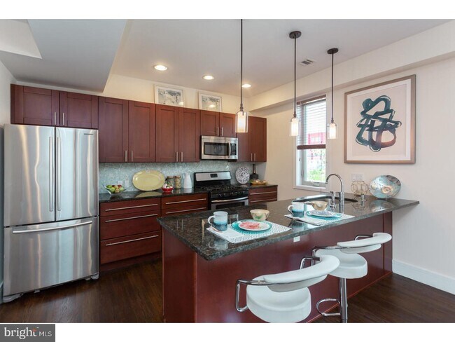
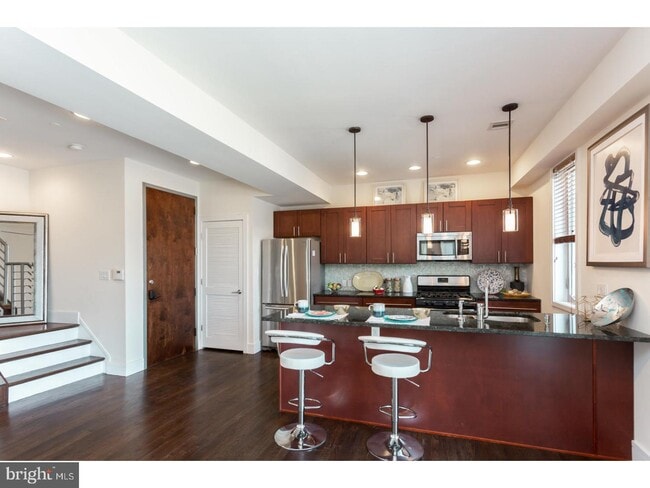
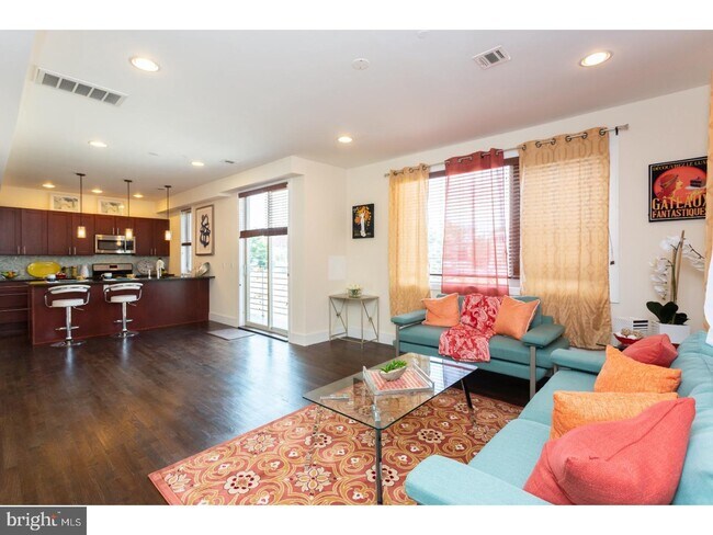
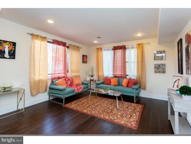
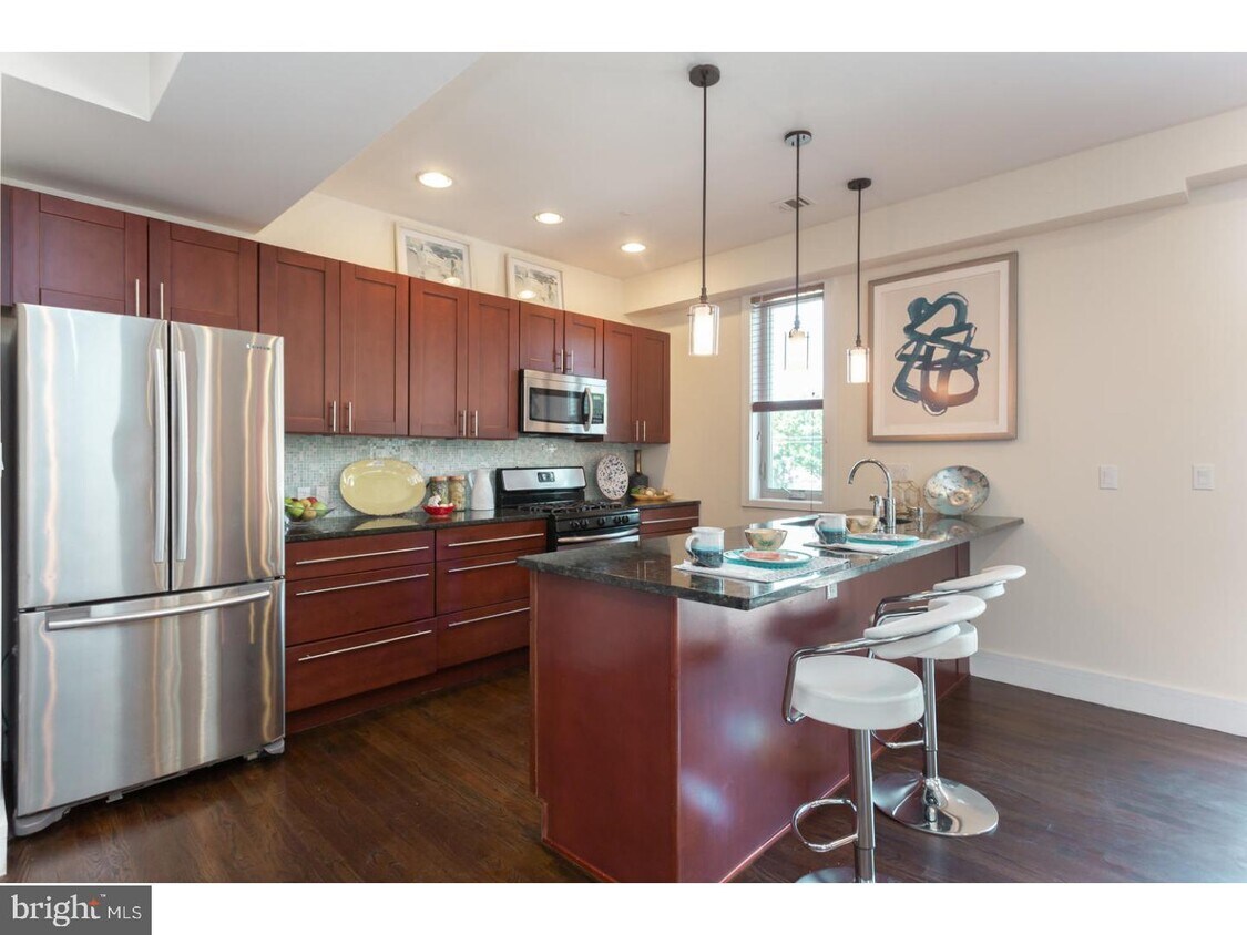
Must see, NEW KENSINGTON, 2 BEDROOM Bi level condo and a GATED PARKING space. This SUN SPLASHED and well designed residence boasts all open living and dining area, with granite countertops, stainless steel appliances,+ BREAKFAST BAR!!! On the 2nd level, you will find 2 VERY LARGE bedrooms, with awesome closet space and 2 stunning and stylish baths!!! Then ascend to your PRIVATE ROOF TOP DECK with 360 degree views, of the entire city!!! This residence is a must see, and offers great space and value. Also, just minutes from , William Mulhern's, Interstate Draft house+ Frankford Hall.
1529-33 N Philip St is a condo located in Philadelphia County and the 19122 ZIP Code. This area is served by the The School District of Philadelphia attendance zone.
Location
Get Directions
Located just west of Fishtown, Olde Kensington is an industrial neighborhood turned creative haven. Residents cherish Olde Kensington’s blend of modern and historic buildings, with many containing a variety of apartments and lofts available for rent.
The neighborhood exudes an artistic vibe, boasting a slew of art galleries, performing arts venues, design centers, and vibrant murals. Many of the rentals in Olde Kensington are within walking distance of eclectic eateries, dive bars, and independent businesses.
The community enjoys convenience to the exciting offerings of North Front Street as well as Northern Liberties’ North 2nd Street. Center City is also about two miles away. Getting around from Olde Kensington is easy with access to SEPTA trains and buses.
Learn more about living in Olde KensingtonBelow are rent ranges for similar nearby apartments
| Beds | Average Size | Lowest | Typical | Premium |
|---|---|---|---|---|
| Studio Studio Studio | 472-474 Sq Ft | $1,050 | $1,606 | $5,300 |
| 1 Bed 1 Bed 1 Bed | 735-740 Sq Ft | $549 | $2,083 | $4,645 |
| 2 Beds 2 Beds 2 Beds | 1117-1124 Sq Ft | $1,200 | $3,036 | $10,495 |
| 3 Beds 3 Beds 3 Beds | 1629-1634 Sq Ft | $1,600 | $3,449 | $6,354 |
| 4 Beds 4 Beds 4 Beds | 2244-2280 Sq Ft | $1,800 | $3,063 | $5,404 |
Education
| Colleges & Universities | Distance | ||
|---|---|---|---|
| Colleges & Universities | Distance | ||
| Drive: | 3 min | 1.2 mi | |
| Drive: | 6 min | 2.5 mi | |
| Drive: | 8 min | 2.6 mi | |
| Drive: | 9 min | 4.1 mi |
1529-33 N Philip St Unit 12 is within 3 minutes or 1.2 miles from Temple University, Main Campus. It is also near C.C. of Philadelphia and Drexel Univ., Hahnemann.
Schools


Public Elementary & Middle School
Grades PK-8
202 Students
Nearby
Public Elementary School
Grades K-5
250 Students
Attendance Zone
Public High School
Grades 9-12
469 Students
Nearby
Private Elementary, Middle & High School
Grades PK-12
272 Students
Nearby
Private Elementary & Middle School
Grades 3-8
94 Students
Nearby
School data provided by
 The GreatSchools Rating helps parents compare schools within a state based on a variety of school quality indicators and provides a helpful picture of how effectively each school serves all of its students. Ratings are on a scale of 1 (below average) to 10 (above average) and can include test scores, college readiness, academic progress, advanced courses, equity, discipline and attendance data. We also advise parents to visit schools, consider other information on school performance and programs, and consider family needs as part of the school selection process.
View GreatSchools Rating Methodology
Data provided by GreatSchools.org © 2025. All rights reserved.
View GreatSchools Rating Methodology
Data provided by GreatSchools.org © 2025. All rights reserved.
Transportation options available in Philadelphia include Girard Av & 2Nd St, located 0.4 mile from 1529-33 N Philip St Unit 12. 1529-33 N Philip St Unit 12 is near Philadelphia International, located 12.9 miles or 24 minutes away, and Trenton Mercer, located 32.2 miles or 48 minutes away.
| Transit / Subway | Distance | ||
|---|---|---|---|
| Transit / Subway | Distance | ||
| Walk: | 7 min | 0.4 mi | |
| Walk: | 8 min | 0.4 mi | |
| Walk: | 9 min | 0.5 mi | |
|
|
Walk: | 10 min | 0.5 mi |
|
|
Walk: | 10 min | 0.6 mi |
| Commuter Rail | Distance | ||
|---|---|---|---|
| Commuter Rail | Distance | ||
|
|
Drive: | 3 min | 1.1 mi |
|
|
Drive: | 5 min | 2.0 mi |
|
|
Drive: | 5 min | 2.3 mi |
|
|
Drive: | 7 min | 2.5 mi |
|
|
Drive: | 7 min | 2.7 mi |
| Airports | Distance | ||
|---|---|---|---|
| Airports | Distance | ||
|
Philadelphia International
|
Drive: | 24 min | 12.9 mi |
|
Trenton Mercer
|
Drive: | 48 min | 32.2 mi |
Time and distance from 1529-33 N Philip St Unit 12.
| Shopping Centers | Distance | ||
|---|---|---|---|
| Shopping Centers | Distance | ||
| Walk: | 10 min | 0.5 mi | |
| Drive: | 3 min | 1.2 mi | |
| Drive: | 4 min | 1.3 mi |
1529-33 N Philip St Unit 12 has 3 shopping centers within 1.3 miles, which is about a 4-minute walk. The miles and minutes will be for the farthest away property.
| Parks and Recreation | Distance | ||
|---|---|---|---|
| Parks and Recreation | Distance | ||
|
Edgar Allan Poe Nat'l Historic Site
|
Drive: | 4 min | 1.6 mi |
|
Wagner Free Institute of Science
|
Drive: | 4 min | 1.6 mi |
|
Lower Delaware National Wild and Scenic River
|
Drive: | 5 min | 1.9 mi |
|
Great Egg Harbor River
|
Drive: | 5 min | 1.9 mi |
|
Independence National Historical Park
|
Drive: | 5 min | 2.2 mi |
1529-33 N Philip St Unit 12 has 5 parks within 2.2 miles, including Edgar Allan Poe Nat'l Historic Site, Wagner Free Institute of Science, and Lower Delaware National Wild and Scenic River.
| Hospitals | Distance | ||
|---|---|---|---|
| Hospitals | Distance | ||
| Drive: | 6 min | 2.5 mi | |
| Drive: | 7 min | 2.6 mi | |
| Drive: | 6 min | 2.6 mi |
1529-33 N Philip St Unit 12 has 3 hospitals within 2.6 miles, the nearest is Hahnemann University Hospital which is 2.5 miles away and a 6 minute drive.
| Military Bases | Distance | ||
|---|---|---|---|
| Military Bases | Distance | ||
| Drive: | 14 min | 7.3 mi |
1529-33 N Philip St Unit 12 is 7.3 miles and a 14 minute drive from Philadelphia Naval Busi Center.
You May Also Like
Similar Rentals Nearby


What Are Walk Score®, Transit Score®, and Bike Score® Ratings?
Walk Score® measures the walkability of any address. Transit Score® measures access to public transit. Bike Score® measures the bikeability of any address.
What is a Sound Score Rating?
A Sound Score Rating aggregates noise caused by vehicle traffic, airplane traffic and local sources
1529-33 N Philip St
Philadelphia, PA 19122