
2510 Bancroft Way
2510 Bancroft Way,
Berkeley, CA 94704
$2,395
Studio - 3 Beds
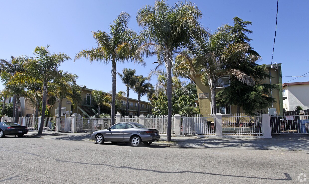
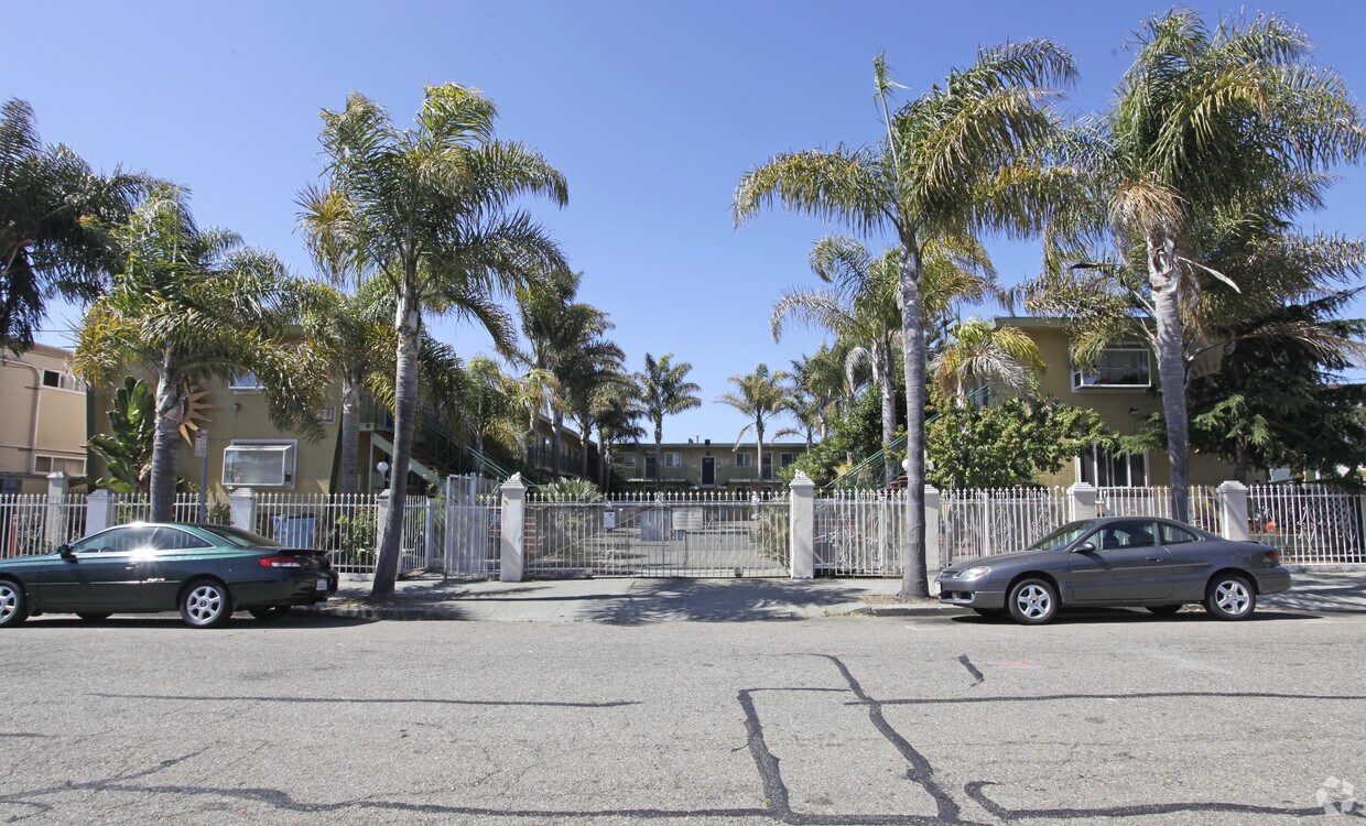

Discover true Berkeley living at 1529-1531 Russell St. These apartments are located on Russell St. in Berkeley. The leasing team is ready to help you find the perfect floorplan. Make a visit to check out the apartment floorplan options. Drop by the leasing office to schedule a tour.
1529-1531 Russell St is an apartment community located in Alameda County and the 94703 ZIP Code. This area is served by the Berkeley Unified attendance zone.
Dishwasher
High Speed Internet Access
Hardwood Floors
Refrigerator
Located just minutes from Downtown Berkeley, South Berkeley encompasses part of historic Rancho San Antonio. Today, it has become a mecca for sports as well as cool apartments. The Ashby Stage is a great place to see a show, and it’s down the road from the Berkeley Bowl supermarket. Adeline Street is where you’ll find most restaurants, nightlife, and Ashby BART Station.
Grove Park offers an array of outdoor amenities to locals including sports courts and a playground. When you live in South Berkeley, you’re close to the University of California, Berkeley and five miles from Oakland.
Learn more about living in South Berkeley| Colleges & Universities | Distance | ||
|---|---|---|---|
| Colleges & Universities | Distance | ||
| Drive: | 4 min | 1.5 mi | |
| Drive: | 9 min | 3.0 mi | |
| Drive: | 8 min | 3.1 mi | |
| Drive: | 9 min | 4.0 mi |


Transportation options available in Berkeley include Ashby Station, located 0.7 mile from 1529-1531 Russell St. 1529-1531 Russell St is near Metro Oakland International, located 13.6 miles or 22 minutes away, and San Francisco International, located 23.0 miles or 37 minutes away.
| Transit / Subway | Distance | ||
|---|---|---|---|
| Transit / Subway | Distance | ||
|
|
Walk: | 12 min | 0.7 mi |
|
|
Drive: | 4 min | 1.5 mi |
|
|
Drive: | 4 min | 1.6 mi |
|
|
Drive: | 5 min | 1.6 mi |
|
|
Drive: | 5 min | 1.6 mi |
| Commuter Rail | Distance | ||
|---|---|---|---|
| Commuter Rail | Distance | ||
|
|
Drive: | 5 min | 1.9 mi |
|
|
Drive: | 6 min | 2.1 mi |
|
|
Drive: | 11 min | 4.8 mi |
| Drive: | 15 min | 8.9 mi | |
| Drive: | 18 min | 10.6 mi |
| Airports | Distance | ||
|---|---|---|---|
| Airports | Distance | ||
|
Metro Oakland International
|
Drive: | 22 min | 13.6 mi |
|
San Francisco International
|
Drive: | 37 min | 23.0 mi |
Time and distance from 1529-1531 Russell St.
| Shopping Centers | Distance | ||
|---|---|---|---|
| Shopping Centers | Distance | ||
| Drive: | 4 min | 1.3 mi | |
| Drive: | 6 min | 2.0 mi | |
| Drive: | 6 min | 2.0 mi |
| Parks and Recreation | Distance | ||
|---|---|---|---|
| Parks and Recreation | Distance | ||
|
Strawberry Creek Park
|
Drive: | 3 min | 1.3 mi |
|
Willard Park
|
Drive: | 4 min | 1.4 mi |
|
Habitot Children's Museum
|
Drive: | 4 min | 1.4 mi |
|
San Francisco Bay Trail (at Emeryville)
|
Drive: | 4 min | 1.6 mi |
|
People's Park
|
Drive: | 5 min | 1.8 mi |
| Hospitals | Distance | ||
|---|---|---|---|
| Hospitals | Distance | ||
| Drive: | 4 min | 1.3 mi | |
| Drive: | 4 min | 1.7 mi | |
| Drive: | 7 min | 3.0 mi |
| Military Bases | Distance | ||
|---|---|---|---|
| Military Bases | Distance | ||
| Drive: | 15 min | 5.2 mi | |
| Drive: | 15 min | 6.1 mi |
What Are Walk Score®, Transit Score®, and Bike Score® Ratings?
Walk Score® measures the walkability of any address. Transit Score® measures access to public transit. Bike Score® measures the bikeability of any address.
What is a Sound Score Rating?
A Sound Score Rating aggregates noise caused by vehicle traffic, airplane traffic and local sources

1529-1531 Russell St
Berkeley, CA 94703


