
Presidential Towers
555 W Madison St,
Chicago, IL 60661
$1,738 - $5,590
Studio - 2 Beds
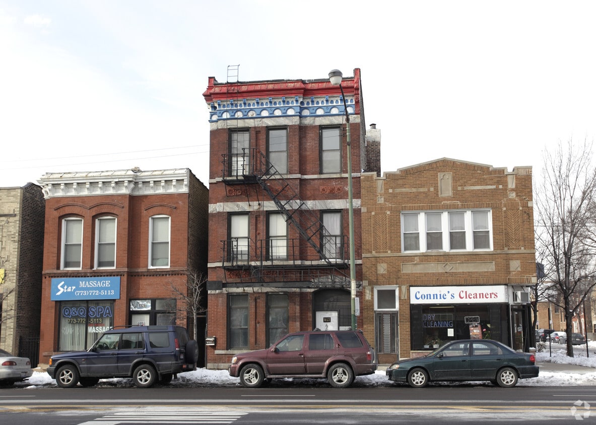
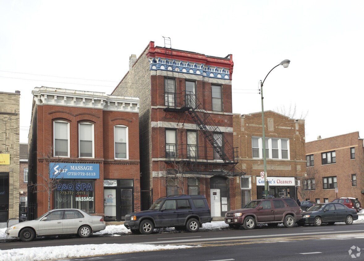
1528 N Ashland Ave is ready to be your home. This community is located at 1528 N. Ashland Ave in the 60622 area of Chicago. The leasing staff is ready and waiting for you to come by to check us out. Come by to see the available floorplan options. At 1528 N Ashland Ave you're home. Stop by the community today.
1528 N Ashland Ave is an apartment community located in Cook County and the 60622 ZIP Code. This area is served by the Chicago Public Schools attendance zone.
Not far outside of the corporate skyscrapers and tourist attractions of the The Loop, the Wicker Park neighborhood serves up an exciting and distinctly Chicago atmosphere. A thriving artistic community operates here, and both local and national touring acts regularly perform on the neighborhood’s many stages. Wicker Park is home to fun-loving, fast paced residents as well as historic home lovers who prefer tree-shaded strolls over stage lights.
Wicker Park is also home to many of Chicago’s most in-demand restaurants, drawing eager foodies from all across the city. Most of these attractions are clustered together around Milwaukee Avenue, with the rest of the neighborhood largely taken up by historic homes and apartment buildings along tree-lined streets. Several schools in Wicker Park make it easy for local students to walk to class quickly and safely.
Learn more about living in Wicker ParkCompare neighborhood and city base rent averages by bedroom.
| Wicker Park | Chicago, IL | |
|---|---|---|
| Studio | $1,706 | $1,640 |
| 1 Bedroom | $2,476 | $2,041 |
| 2 Bedrooms | $2,561 | $2,567 |
| 3 Bedrooms | $3,341 | $3,076 |
| Colleges & Universities | Distance | ||
|---|---|---|---|
| Colleges & Universities | Distance | ||
| Drive: | 4 min | 1.9 mi | |
| Drive: | 4 min | 1.9 mi | |
| Drive: | 5 min | 2.3 mi | |
| Drive: | 6 min | 2.7 mi |


Transportation options available in Chicago include Division Station, located 0.5 mile from 1528 N Ashland Ave. 1528 N Ashland Ave is near Chicago Midway International, located 11.1 miles or 20 minutes away, and Chicago O'Hare International, located 14.9 miles or 23 minutes away.
| Transit / Subway | Distance | ||
|---|---|---|---|
| Transit / Subway | Distance | ||
|
|
Walk: | 8 min | 0.5 mi |
|
|
Walk: | 11 min | 0.6 mi |
|
|
Walk: | 19 min | 1.0 mi |
|
|
Drive: | 3 min | 1.3 mi |
|
|
Drive: | 3 min | 1.4 mi |
| Commuter Rail | Distance | ||
|---|---|---|---|
| Commuter Rail | Distance | ||
|
|
Walk: | 10 min | 0.5 mi |
|
|
Drive: | 5 min | 2.5 mi |
|
|
Drive: | 5 min | 2.6 mi |
|
|
Drive: | 6 min | 2.9 mi |
|
|
Drive: | 6 min | 3.6 mi |
| Airports | Distance | ||
|---|---|---|---|
| Airports | Distance | ||
|
Chicago Midway International
|
Drive: | 20 min | 11.1 mi |
|
Chicago O'Hare International
|
Drive: | 23 min | 14.9 mi |
Scores provided by
Traffic
-Airport
-Businesses
-Scores provided by
HowLoud What is a Sound Score Rating? A Sound Score Rating aggregates noise caused by vehicle traffic, airplane traffic and local sources. How It WorksTime and distance from 1528 N Ashland Ave.
| Shopping Centers | Distance | ||
|---|---|---|---|
| Shopping Centers | Distance | ||
| Walk: | 5 min | 0.3 mi | |
| Walk: | 11 min | 0.6 mi | |
| Walk: | 14 min | 0.7 mi |
| Parks and Recreation | Distance | ||
|---|---|---|---|
| Parks and Recreation | Distance | ||
|
Wrightwood Park
|
Drive: | 4 min | 1.4 mi |
|
Oz Park
|
Drive: | 3 min | 1.7 mi |
|
Humboldt Park
|
Drive: | 4 min | 2.1 mi |
|
Lincoln Park Zoo
|
Drive: | 4 min | 2.4 mi |
|
Lincoln Park
|
Drive: | 5 min | 2.5 mi |
| Hospitals | Distance | ||
|---|---|---|---|
| Hospitals | Distance | ||
| Drive: | 2 min | 1.3 mi | |
| Drive: | 5 min | 2.3 mi | |
| Drive: | 6 min | 2.6 mi |
| Military Bases | Distance | ||
|---|---|---|---|
| Military Bases | Distance | ||
| Drive: | 31 min | 22.6 mi | |
| Drive: | 44 min | 29.8 mi | |
| Drive: | 44 min | 33.5 mi |
What Are Walk Score®, Transit Score®, and Bike Score® Ratings?
Walk Score® measures the walkability of any address. Transit Score® measures access to public transit. Bike Score® measures the bikeability of any address.
What is a Sound Score Rating?
A Sound Score Rating aggregates noise caused by vehicle traffic, airplane traffic and local sources.

1528 N Ashland Ave
Chicago, IL 60622


