$3,900
/ Month
1522 NW 41st St
Miami, FL 33142
Favorites
561-897-6475
-
Bedrooms
4
-
Bathrooms
2
-
Square Feet
1,200 sq ft
-
Available
Available Now
1522 NW 41st St

Favorites
About This Home
Available Now
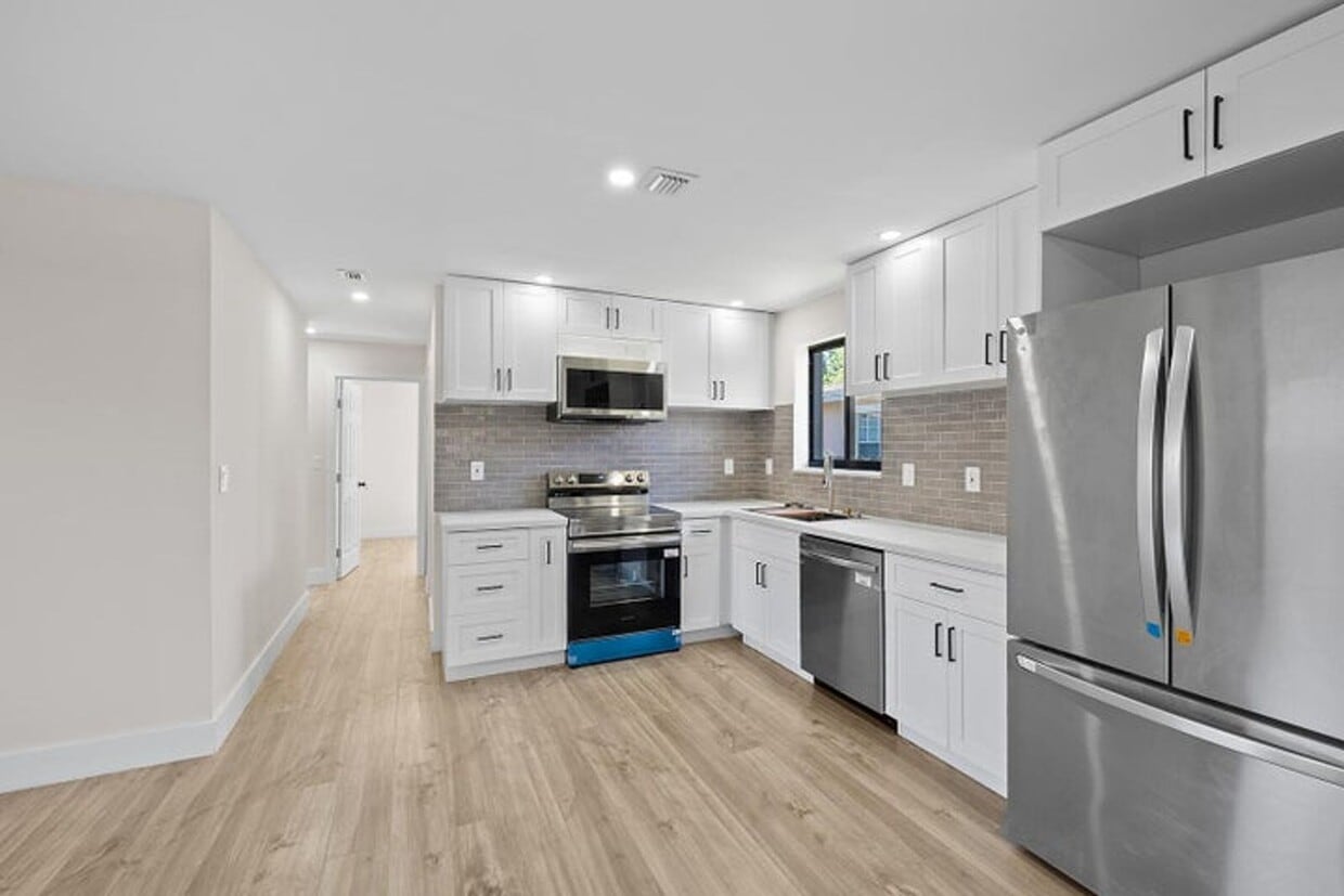
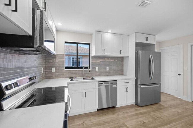
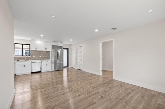
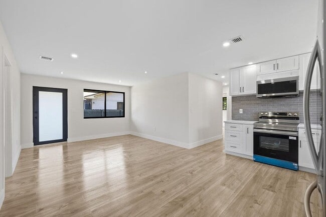
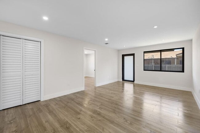
Courtesy of Interinvestments Realty, Inc. Posted by Andrew Coleman with EXP Realty . Beautiful four-bedroom and two-bath home. Spacious and modern kitchen, gorgeous master bedroom with oversized shower, stainless steel appliances, central a/c unit, fully painted. Sitting on a 5,000 sqft lot, this house offers an extensive backyard. Ample front space for parking multiple cars. The house is fully fenced for privacy. Dedicated full laundry room, rare in this area. Centrally located near Wynwood, Midtown, Design District, Downtown,. Easy access to SR 112 Airport Express way, I 95 and minutes away from Miami Health District, Jackson Memorial Hospital.
Unique Features
- All Kitchen Appliances
1522 Nw 41st St is a house located in Miami/Dade County and the 33142 ZIP Code. This area is served by the Miami-Dade County Public Schools attendance zone.
* Price shown is base rent. Excludes user-selected optional fees and variable or usage-based fees and required charges due at or prior to move-in or at move-out. Price, availability, fees, and any applicable rent special are subject to change without notice.
* Square footage definitions vary. Displayed square footage is approximate.
Contact
- Listed by Drew
- Phone Number
- Contact
Location
Get Directions
Liberty City is a Miami neighborhood on the rise that’s just six miles north of downtown. Here, you’ll find a hardworking, close-knit community that enjoys a slightly lower cost of living than the rest of the Miami area to the south. The neighborhood’s location directly west of Interstate 95 makes it convenient for the commuting crowd. A vibrant dining scene can be found in Liberty City. Creole food, Jamaican food, seafood, Thai, and so much more makes this area an unsung foodie’s hotspot. With Downtown Miami so close, living in Liberty City puts you close to all the action without the bigger price tags of living closer to the dazzling beaches.
Learn more about living in Liberty City
Amenities
- All Kitchen Appliances
Education
Schools


Public Elementary School
Grades PK-5
258 Students
Attendance Zone
Public Middle School
Grades 6-8
455 Students
Attendance Zone
Private Elementary, Middle & High School
Grades K-12
156 Students
Nearby
Private Elementary & Middle School
Grades PK-8
61 Students
Nearby
School data provided by
 The GreatSchools Rating helps parents compare schools within a state based on a variety of school quality indicators and provides a helpful picture of how effectively each school serves all of its students. Ratings are on a scale of 1 (below average) to 10 (above average) and can include test scores, college readiness, academic progress, advanced courses, equity, discipline and attendance data. We also advise parents to visit schools, consider other information on school performance and programs, and consider family needs as part of the school selection process.
View GreatSchools Rating Methodology
Data provided by GreatSchools.org © 2026. All rights reserved.
View GreatSchools Rating Methodology
Data provided by GreatSchools.org © 2026. All rights reserved.
Getting Around
 What do Walkability, Transit, Drivability, and Bikeability mean?
Walkability measures the walking distance to day-to-day needs.
Transit measures access to public transportation.
Drivability measures congestion, parking availability, and access to major roads.
Bikeability measures the suitability for cycling.
How It Works
What do Walkability, Transit, Drivability, and Bikeability mean?
Walkability measures the walking distance to day-to-day needs.
Transit measures access to public transportation.
Drivability measures congestion, parking availability, and access to major roads.
Bikeability measures the suitability for cycling.
How It Works
Very Walkable
Walkability
80
/ 100
Good Public Transit
Transit
70
/ 100
Moderately Drivable
Drivability
70
/ 100
Fairly Bikeable
Bikeability
40
/ 100
Scores provided by
-
Soundscore™
-
/ 100
Traffic
-Airport
-Businesses
-Scores provided by
HowLoud What is a Sound Score Rating? A Sound Score Rating aggregates noise caused by vehicle traffic, airplane traffic and local sources. How It WorksYou May Also Like
Similar Rentals Nearby


1522 NW 41st St
Miami, FL 33142