
The Vitagraph
1277 E 14th St,
Brooklyn, NY 11230
$3,295 - $4,304
2-3 Beds
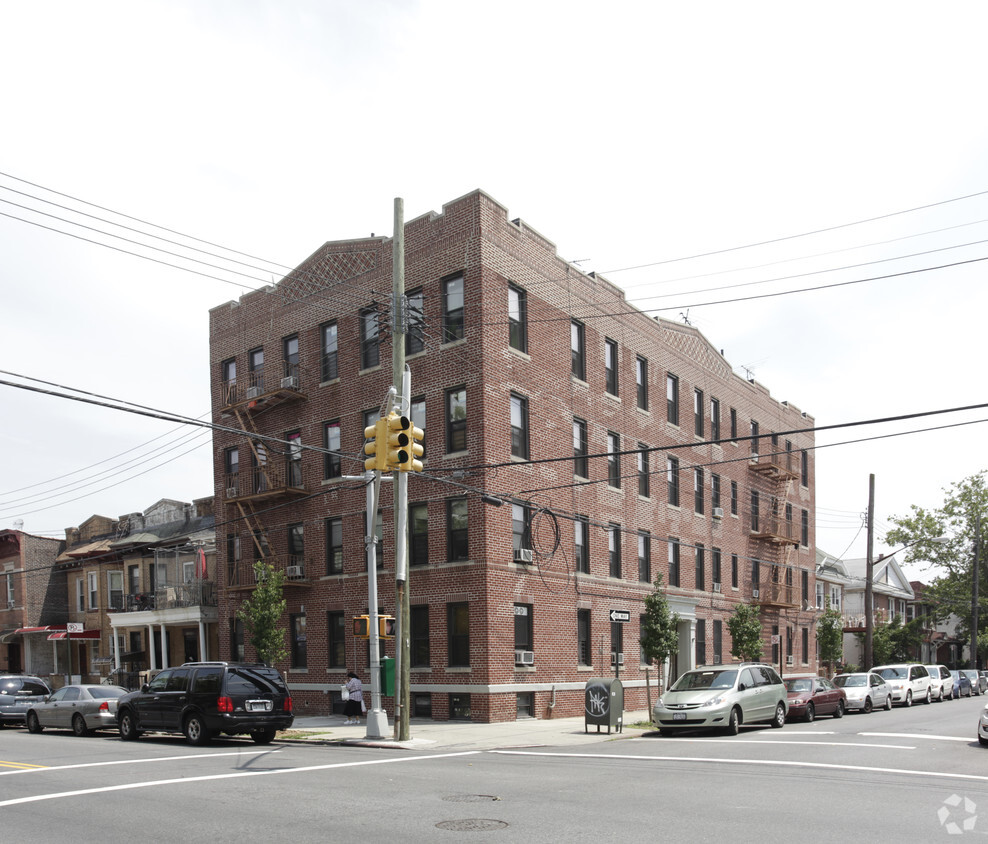
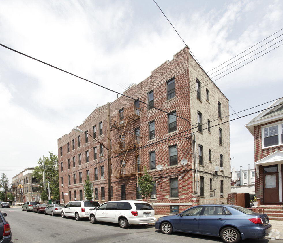

Thanks for your interest in 1501 E 10th St. Located at 1501 E. 10th St. in Brooklyn, this community is an ideal place to move. Schedule a time to see the current floorplan options. The professional leasing team is ready and waiting for you to come take a tour. At 1501 E 10th St you're home. Stop by the community today.
1501 E 10th St is an apartment community located in Kings County and the 11230 ZIP Code. This area is served by the New York City Geographic District #21 attendance zone.
Refrigerator
Heating
Oven
Range
Located just two miles north of Coney Island and stretches of sand along Brighton Beach and Manhattan Beach, Midwood is one of Brooklyn's much-loved -- and surprisingly lesser known -- neighborhoods. In some ways, it's traditional New York: extremely walkable, bicycle-friendly, and near mass transit. It features tall, brick buildings with wrought-iron fire escapes, and the wide sidewalks lead past friendly neighborhood bakeries, delis, and boutiques. But in other ways, it feels much more suburban, with its tree-filled neighborhoods, elegant single-family homes, and a historic shopping district filled with locally-owned businesses.
Subway stations are scattered throughout Midwood and provide a 45-minute ride to Manhattan. Residents can drive south on Ocean Parkway to enjoy a day at the beach, and students appreciate easy access to Brooklyn College, set just outside of Midwood. This diverse melting pot provides a little bit of everything when searching for a restaurant, shop, or grocer.
Learn more about living in MidwoodCompare neighborhood and city base rent averages by bedroom.
| Midwood | Brooklyn, NY | |
|---|---|---|
| Studio | $1,457 | $2,680 |
| 1 Bedroom | $2,312 | $3,031 |
| 2 Bedrooms | $2,577 | $3,947 |
| 3 Bedrooms | $3,848 | $4,907 |
| Colleges & Universities | Distance | ||
|---|---|---|---|
| Colleges & Universities | Distance | ||
| Drive: | 6 min | 2.4 mi | |
| Drive: | 8 min | 3.8 mi | |
| Drive: | 11 min | 4.5 mi | |
| Drive: | 14 min | 6.0 mi |


Transportation options available in Brooklyn include Kings Highway (B,Q Line), located 0.6 mile from 1501 E 10th St. 1501 E 10th St is near John F Kennedy International, located 13.5 miles or 23 minutes away, and Newark Liberty International, located 20.7 miles or 35 minutes away.
| Transit / Subway | Distance | ||
|---|---|---|---|
| Transit / Subway | Distance | ||
|
|
Walk: | 10 min | 0.6 mi |
|
|
Walk: | 11 min | 0.6 mi |
|
|
Walk: | 13 min | 0.7 mi |
|
|
Drive: | 2 min | 1.2 mi |
|
|
Drive: | 2 min | 1.3 mi |
| Commuter Rail | Distance | ||
|---|---|---|---|
| Commuter Rail | Distance | ||
|
|
Drive: | 14 min | 5.7 mi |
|
|
Drive: | 13 min | 5.8 mi |
|
|
Drive: | 12 min | 6.5 mi |
|
|
Drive: | 18 min | 8.7 mi |
|
|
Drive: | 20 min | 9.4 mi |
| Airports | Distance | ||
|---|---|---|---|
| Airports | Distance | ||
|
John F Kennedy International
|
Drive: | 23 min | 13.5 mi |
|
Newark Liberty International
|
Drive: | 35 min | 20.7 mi |
Scores provided by
Traffic
-Airport
-Businesses
-Scores provided by
HowLoud What is a Sound Score Rating? A Sound Score Rating aggregates noise caused by vehicle traffic, airplane traffic and local sources. How It WorksTime and distance from 1501 E 10th St.
| Shopping Centers | Distance | ||
|---|---|---|---|
| Shopping Centers | Distance | ||
| Drive: | 5 min | 2.5 mi |
| Parks and Recreation | Distance | ||
|---|---|---|---|
| Parks and Recreation | Distance | ||
|
New York Aquarium
|
Drive: | 7 min | 3.2 mi |
|
Marine Park
|
Drive: | 7 min | 3.3 mi |
|
Asser Levy Park
|
Drive: | 8 min | 3.4 mi |
|
Calvert Vaux Park
|
Drive: | 8 min | 3.7 mi |
|
Leon S. Kaiser Park
|
Drive: | 9 min | 3.9 mi |
| Hospitals | Distance | ||
|---|---|---|---|
| Hospitals | Distance | ||
| Drive: | 2 min | 1.2 mi | |
| Drive: | 5 min | 2.3 mi | |
| Drive: | 9 min | 4.1 mi |
| Military Bases | Distance | ||
|---|---|---|---|
| Military Bases | Distance | ||
| Drive: | 12 min | 4.8 mi | |
| Drive: | 13 min | 5.9 mi | |
| Drive: | 21 min | 7.4 mi |
What Are Walk Score®, Transit Score®, and Bike Score® Ratings?
Walk Score® measures the walkability of any address. Transit Score® measures access to public transit. Bike Score® measures the bikeability of any address.
What is a Sound Score Rating?
A Sound Score Rating aggregates noise caused by vehicle traffic, airplane traffic and local sources.


