
$2,200 / Month
14930 Ampstead Ct
Centreville, VA 20120
2 Weeks Ago
Favorites
14930 Ampstead Ct

Favorites
Check Back Soon for Upcoming Availability
| Beds | Baths | Average SF |
|---|---|---|
| 2 Bedrooms 2 Bedrooms 2 Br | 2.5 Baths 2.5 Baths 2.5 Ba | — |
About This Property
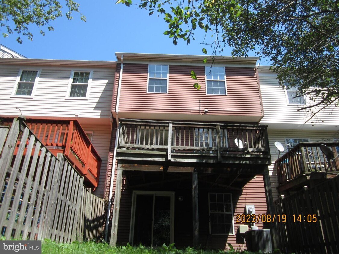
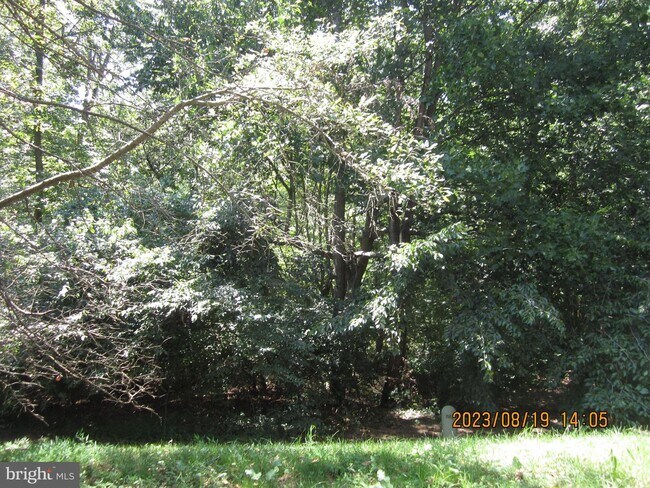
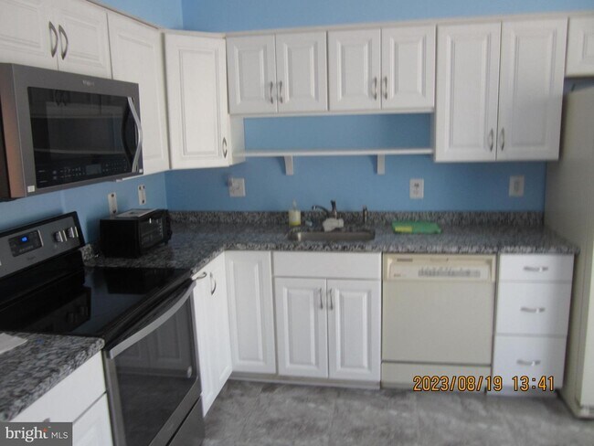
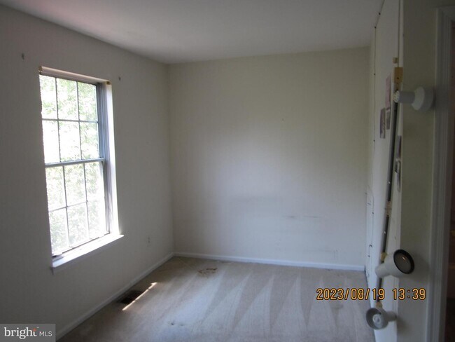
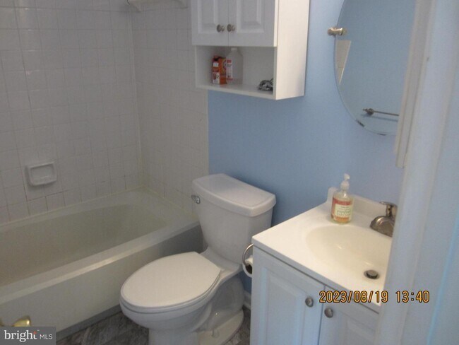
Welcome to this charming and beautifully upgraded two Master Bedroom, two-and-a-half-bathroom townhome. The front of the townhouse has received a fresh look with new front windows, architectural shingles, roof, siding, and storm door, along with the installation of new gutters featuring a leaf guard system providing peace of mind during the changing seasons. all installed in August/Sept, 2023. The Main level features new luxury vinyl plank flooring: updated kitchen with white cabinets, stainless steel stove and microwave, and granite countertops. The upper level features 2 large Master Bedrooms, 2 updated full baths, new carpeting and a bedroom level laundry. The Walkout Basement has a new SGD, Large Family Room, rough in for wet bar, new flooring and a remodeled Half Bath. The view to the rear is of parkland and woods. Take a leisurely stroll on the nearby Cub Run Trail. You'll also be close to Chalet Woods Park, Virginia Chase County Park, and Cub Run Stream Valley Park.
14930 Ampstead Ct is a townhome located in Fairfax County and the 20120 ZIP Code. This area is served by the Fairfax County Public Schools attendance zone.
Townhome Features
- Basement
Location
Get Directions
Situated 20 miles southwest of Washington, D.C. in the suburbs of Virginia, Centerville is a delightful little town with a very close-knit community. Residents rave about the great public schools in Fairfax County, along with the diverse population.
With such a convenient commute to the heart of DC, many residents of Centreville travel into the area for both work and play. But lucky for the residents of Centreville, the city has plenty to boast on its own, in addition to its proximity to DC! Enjoy this city’s unique suburban charm, variety of restaurants, grocers, and retailers, and well-kept community parks such as Ellanor C.
Learn more about living in Centreville
Amenities
- Basement
Education
| Colleges & Universities | Distance | ||
|---|---|---|---|
| Colleges & Universities | Distance | ||
| Drive: | 9 min | 5.2 mi | |
| Drive: | 19 min | 9.5 mi | |
| Drive: | 18 min | 9.6 mi | |
| Drive: | 24 min | 15.9 mi |
14930 Ampstead Ct is within 9 minutes or 5.2 miles from NOVA, Manassas Campus. It is also near George Mason Univ., Fairfax and George Mason Univ., PWC.
Schools


Public Elementary School
Grades PK-6
706 Students
Attendance Zone
Public Middle School
Grades 7-8
678 Students
Attendance Zone
Public High School
Grades 9-12
2,686 Students
Attendance Zone
Private Elementary School
Grades PK-1
111 Students
Nearby
Private Elementary, Middle & High School
Grades K-12
171 Students
Nearby
School data provided by
 The GreatSchools Rating helps parents compare schools within a state based on a variety of school quality indicators and provides a helpful picture of how effectively each school serves all of its students. Ratings are on a scale of 1 (below average) to 10 (above average) and can include test scores, college readiness, academic progress, advanced courses, equity, discipline and attendance data. We also advise parents to visit schools, consider other information on school performance and programs, and consider family needs as part of the school selection process.
View GreatSchools Rating Methodology
Data provided by GreatSchools.org © 2025. All rights reserved.
View GreatSchools Rating Methodology
Data provided by GreatSchools.org © 2025. All rights reserved.
Transportation options available in Centreville include Washington Dulles International Airport, Silver Line Center Platform, located 12.3 miles from 14930 Ampstead Ct. 14930 Ampstead Ct is near Washington Dulles International, located 13.2 miles or 24 minutes away, and Ronald Reagan Washington Ntl, located 27.8 miles or 39 minutes away.
| Transit / Subway | Distance | ||
|---|---|---|---|
| Transit / Subway | Distance | ||
| Drive: | 20 min | 12.3 mi | |
| Drive: | 24 min | 13.5 mi | |
| Drive: | 26 min | 15.9 mi | |
| Drive: | 34 min | 25.9 mi |
| Commuter Rail | Distance | ||
|---|---|---|---|
| Commuter Rail | Distance | ||
|
|
Drive: | 16 min | 7.6 mi |
|
|
Drive: | 17 min | 8.2 mi |
|
|
Drive: | 21 min | 11.4 mi |
|
|
Drive: | 21 min | 11.4 mi |
|
|
Drive: | 23 min | 12.8 mi |
| Airports | Distance | ||
|---|---|---|---|
| Airports | Distance | ||
|
Washington Dulles International
|
Drive: | 24 min | 13.2 mi |
|
Ronald Reagan Washington Ntl
|
Drive: | 39 min | 27.8 mi |
Time and distance from 14930 Ampstead Ct.
| Shopping Centers | Distance | ||
|---|---|---|---|
| Shopping Centers | Distance | ||
| Drive: | 4 min | 1.5 mi | |
| Drive: | 4 min | 1.6 mi | |
| Drive: | 5 min | 2.0 mi |
14930 Ampstead Ct has 3 shopping centers within 2.0 miles, which is about a 5-minute drive. The miles and minutes will be for the farthest away property.
| Parks and Recreation | Distance | ||
|---|---|---|---|
| Parks and Recreation | Distance | ||
|
Ellanor C. Lawrence Park
|
Drive: | 6 min | 3.0 mi |
|
Bull Run Regional Park
|
Drive: | 20 min | 5.2 mi |
|
Webb Sanctuary
|
Drive: | 16 min | 8.2 mi |
|
Steven F. Udvar-Hazy Center
|
Drive: | 16 min | 8.6 mi |
|
Hemlock Overlook Regional Park
|
Drive: | 22 min | 10.6 mi |
14930 Ampstead Ct has 5 parks within 10.6 miles, including Ellanor C. Lawrence Park, Bull Run Regional Park, and Webb Sanctuary.
| Hospitals | Distance | ||
|---|---|---|---|
| Hospitals | Distance | ||
| Drive: | 13 min | 7.2 mi | |
| Drive: | 14 min | 8.2 mi | |
| Drive: | 20 min | 11.0 mi |
14930 Ampstead Ct has 3 hospitals within 11.0 miles, the nearest is Inova Fair Oaks Hospital which is 7.2 miles away and a 13 minute drive.
| Military Bases | Distance | ||
|---|---|---|---|
| Military Bases | Distance | ||
| Drive: | 28 min | 15.6 mi | |
| Drive: | 40 min | 23.8 mi | |
| Drive: | 57 min | 26.4 mi |
14930 Ampstead Ct has 3 military bases within 26.4 miles, the nearest is Vint Hill Farms Station which is 15.6 miles away and a 28 minute drive.
You May Also Like
Similar Rentals Nearby


What Are Walk Score®, Transit Score®, and Bike Score® Ratings?
Walk Score® measures the walkability of any address. Transit Score® measures access to public transit. Bike Score® measures the bikeability of any address.
What is a Sound Score Rating?
A Sound Score Rating aggregates noise caused by vehicle traffic, airplane traffic and local sources

14930 Ampstead Ct
Centreville, VA 20120