
$1,700 / Month
144 E I St
Benicia, CA 94510
2 Weeks Ago
Favorites
144 E I St

Favorites
Check Back Soon for Upcoming Availability
| Beds | Baths | Average SF |
|---|---|---|
| 2 Bedrooms 2 Bedrooms 2 Br | 1 Bath 1 Bath 1 Ba | — |
About This Property
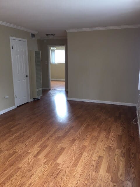
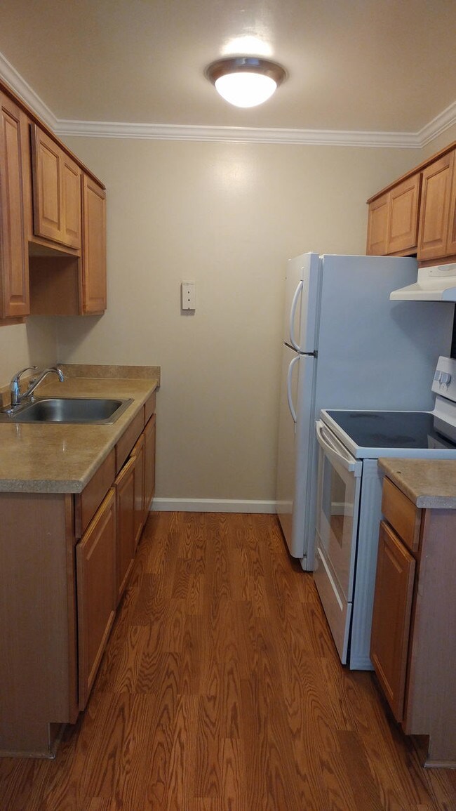
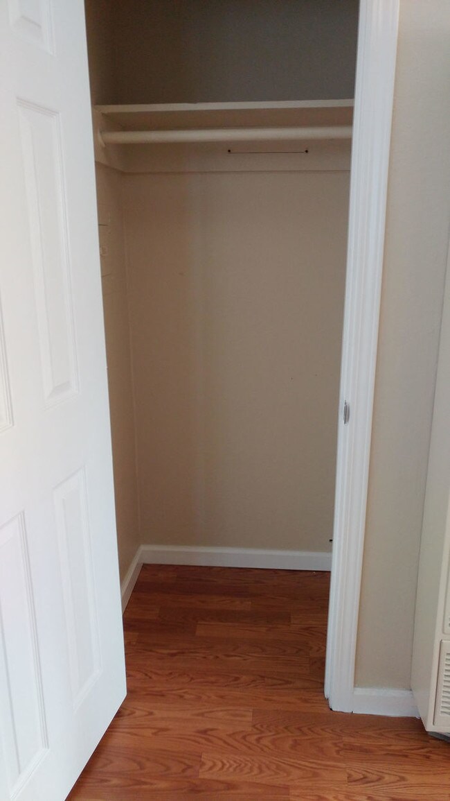
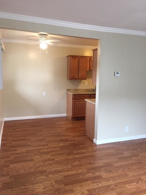
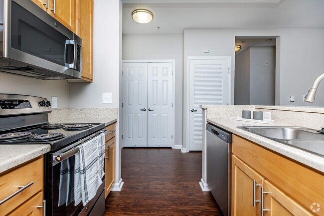
Estey Real Estate & Property management presents this fabulous Old Town Benicia apartment, it has great interior paint, crown molding, and a/c in living room. Dining room in kitchen. Kitchen with lots of cabinet space, refrigerator, and cook-top stove. One covered parking space and off street parking, small storage closet detached from apartment. Laundry room on-site. Renter's Insurance required. Due to third party listings please refer to our website at www.esteyrealestate.com for the accurate information. Contact us to schedule a showing.
144 E I St is an apartment community located in Solano County and the 94510 ZIP Code.
Location
Get Directions
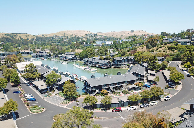
Situated along the Carquinez Strait in the San Francisco Bay Area, Benicia is a scenic waterfront city rich in history, cultural amenities, and sweeping vistas. Benicia boasts an irresistible historic charm, especially in its quaint downtown area, which is brimming with one-of-a-kind shops, delectable eateries, and vibrant artists’ studios.
Founded in 1847, Benicia once served as California’s state capital for 13 months, and now touts the only state capitol building outside of Sacramento. Residents and visitors alike can uncover much of Benicia’s past at the Benicia Historical Museum.
Nearly 500 acres of parkland provides ample green space and tranquil trails for all kinds of outdoor recreation. Benicia’s thriving arts community creates a broad range of art, from glass art and sculptures to theatrical plays and music. Benicia’s friendly community comes together for a variety of events, like the Downtown Farmers Market, Opening Day on the Strait, and artist studio open houses.
Learn more about living in Benicia
Education
| Colleges & Universities | Distance | ||
|---|---|---|---|
| Colleges & Universities | Distance | ||
| Drive: | 15 min | 9.8 mi | |
| Drive: | 20 min | 10.9 mi | |
| Drive: | 23 min | 16.6 mi | |
| Drive: | 24 min | 17.3 mi |
144 E I St is within 20 minutes or 10.9 miles from Touro University California. It is also near Diablo Valley, Pleasant Hill and Solano Community College.
Transportation options available in Benicia include North Concord Martinez Station, located 10.9 miles from 144 E I St. 144 E I St is near Metro Oakland International, located 37.3 miles or 49 minutes away, and San Francisco International, located 47.0 miles or 64 minutes away.
| Transit / Subway | Distance | ||
|---|---|---|---|
| Transit / Subway | Distance | ||
|
|
Drive: | 16 min | 10.9 mi |
|
|
Drive: | 17 min | 11.4 mi |
| Commuter Rail | Distance | ||
|---|---|---|---|
| Commuter Rail | Distance | ||
|
|
Drive: | 9 min | 5.9 mi |
|
|
Drive: | 27 min | 20.6 mi |
|
|
Drive: | 30 min | 22.5 mi |
|
|
Drive: | 33 min | 25.0 mi |
|
|
Drive: | 35 min | 26.8 mi |
| Airports | Distance | ||
|---|---|---|---|
| Airports | Distance | ||
|
Metro Oakland International
|
Drive: | 49 min | 37.3 mi |
|
San Francisco International
|
Drive: | 64 min | 47.0 mi |
Time and distance from 144 E I St.
| Shopping Centers | Distance | ||
|---|---|---|---|
| Shopping Centers | Distance | ||
| Walk: | 7 min | 0.4 mi | |
| Walk: | 8 min | 0.5 mi | |
| Walk: | 11 min | 0.6 mi |
144 E I St has 3 shopping centers within 0.6 mile, which is about a 11-minute walk. The miles and minutes will be for the farthest away property.
| Parks and Recreation | Distance | ||
|---|---|---|---|
| Parks and Recreation | Distance | ||
|
Benicia Capitol State Historic Park
|
Walk: | 2 min | 0.2 mi |
|
Benicia State Recreation Area
|
Drive: | 9 min | 4.2 mi |
|
Martinez Regional Shoreline
|
Drive: | 11 min | 5.3 mi |
|
Alhambra Creek Watershed
|
Drive: | 9 min | 5.9 mi |
|
Carquinez Strait Regional Shoreline
|
Drive: | 19 min | 11.3 mi |
144 E I St has 5 parks within 11.3 miles, including Benicia Capitol State Historic Park, Benicia State Recreation Area, and Martinez Regional Shoreline.
| Hospitals | Distance | ||
|---|---|---|---|
| Hospitals | Distance | ||
| Drive: | 11 min | 6.6 mi | |
| Drive: | 13 min | 7.9 mi | |
| Drive: | 14 min | 9.0 mi |
144 E I St has 3 hospitals within 9.0 miles, the nearest is Contra Costa Regional Medical Center which is 6.6 miles away and a 11 minute drive.
| Military Bases | Distance | ||
|---|---|---|---|
| Military Bases | Distance | ||
| Drive: | 4 min | 2.2 mi | |
| Drive: | 19 min | 10.4 mi |
144 E I St is 2.2 miles from Armory Vallejo, and is convenient to other military bases, including Mare Island Naval Reserve.
You May Also Like
Similar Rentals Nearby


What Are Walk Score®, Transit Score®, and Bike Score® Ratings?
Walk Score® measures the walkability of any address. Transit Score® measures access to public transit. Bike Score® measures the bikeability of any address.
What is a Sound Score Rating?
A Sound Score Rating aggregates noise caused by vehicle traffic, airplane traffic and local sources

144 E I St
Benicia, CA 94510