
1213 Walnut
1213 Walnut St,
Philadelphia, PA 19107
$1,850 - $7,035
Studio - 2 Beds
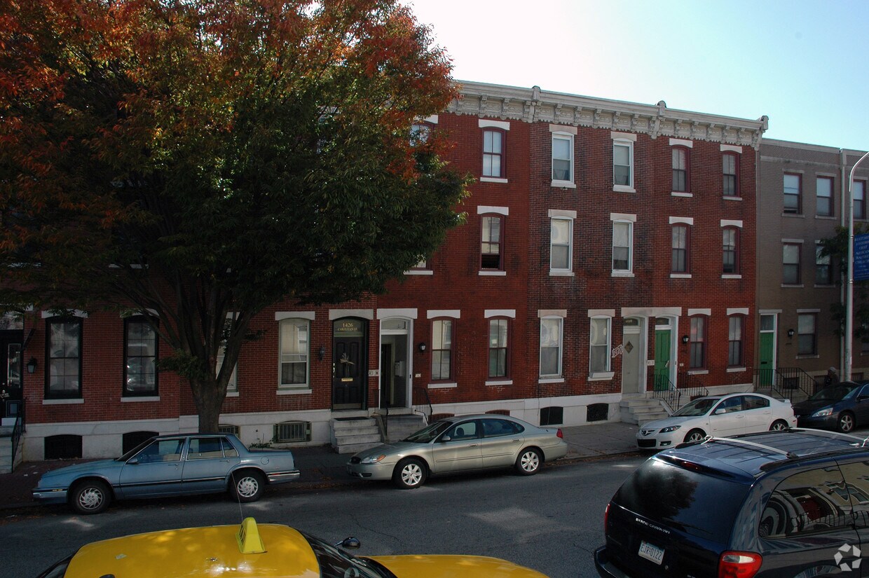
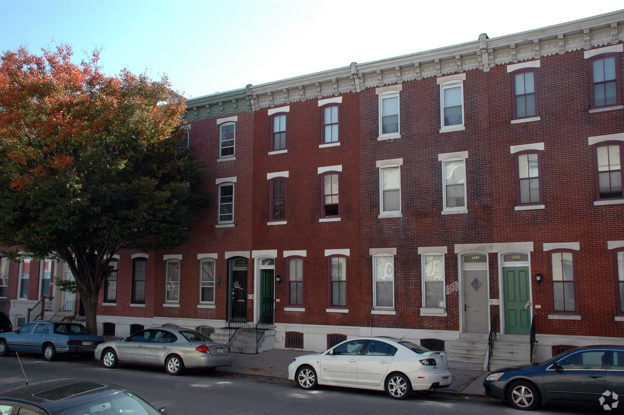

Explore Philadelphia living at 1428 Christian St. The 1428 Christian St. location in Philadelphia's 19146 Zip code is an ideal place to live. The community staff is ready to take you for a tour. Make sure you to check out the apartment floorplan options. It's all waiting for you at 1428 Christian St. Contact or drop by to talk about leasing your new apartment.
1428 Christian St is an apartment community located in Philadelphia County and the 19146 ZIP Code. This area is served by the The School District of Philadelphia attendance zone.
Refrigerator
Heating
Oven
Range
Nestled just southwest of the heart of Center City, Southwest Center City is a revitalized neighborhood strewn alongside the Schuylkill River. The neighborhood’s many alluring rentals include stylish lofts, modern apartments, and charming townhomes. Southwest Center City boasts excellent walkability, partly due to its layout and partly due to its ideal location.
The University of Pennsylvania, both a premier Ivy League institution and the area’s number one employer, lies just across the Schuylkill River from the neighborhood and is accessible within a 10-minute walk. Southwest Center City also sits within walking distance of SEPTA’s Ellsworth-Federal Station, which is served by the Broad Street Line. Major city attractions are just steps away as well, including Rittenhouse Square, the Kimmel Center, and Philadelphia’s Magic Gardens.
Learn more about living in Southwest Center CityCompare neighborhood and city base rent averages by bedroom.
| Southwest Center City | Philadelphia, PA | |
|---|---|---|
| Studio | $1,522 | $1,438 |
| 1 Bedroom | $1,951 | $1,783 |
| 2 Bedrooms | $2,303 | $2,224 |
| 3 Bedrooms | $3,569 | $2,929 |
| Colleges & Universities | Distance | ||
|---|---|---|---|
| Colleges & Universities | Distance | ||
| Drive: | 3 min | 1.2 mi | |
| Drive: | 4 min | 1.3 mi | |
| Drive: | 4 min | 1.6 mi | |
| Drive: | 4 min | 1.7 mi |


Transportation options available in Philadelphia include Ellsworth-Federal, located 0.3 mile from 1428 Christian St. 1428 Christian St is near Philadelphia International, located 8.4 miles or 19 minutes away, and Trenton Mercer, located 34.6 miles or 51 minutes away.
| Transit / Subway | Distance | ||
|---|---|---|---|
| Transit / Subway | Distance | ||
|
|
Walk: | 6 min | 0.3 mi |
|
|
Walk: | 6 min | 0.3 mi |
|
|
Walk: | 12 min | 0.6 mi |
|
|
Walk: | 15 min | 0.8 mi |
|
|
Walk: | 15 min | 0.8 mi |
| Commuter Rail | Distance | ||
|---|---|---|---|
| Commuter Rail | Distance | ||
|
|
Drive: | 3 min | 1.3 mi |
|
|
Drive: | 4 min | 1.3 mi |
| Drive: | 5 min | 1.8 mi | |
|
|
Drive: | 5 min | 1.9 mi |
|
|
Drive: | 7 min | 2.8 mi |
| Airports | Distance | ||
|---|---|---|---|
| Airports | Distance | ||
|
Philadelphia International
|
Drive: | 19 min | 8.4 mi |
|
Trenton Mercer
|
Drive: | 51 min | 34.6 mi |
Scores provided by
Traffic
-Airport
-Businesses
-Scores provided by
HowLoud What is a Sound Score Rating? A Sound Score Rating aggregates noise caused by vehicle traffic, airplane traffic and local sources. How It WorksTime and distance from 1428 Christian St.
| Shopping Centers | Distance | ||
|---|---|---|---|
| Shopping Centers | Distance | ||
| Walk: | 3 min | 0.2 mi | |
| Walk: | 9 min | 0.5 mi | |
| Walk: | 9 min | 0.5 mi |
| Parks and Recreation | Distance | ||
|---|---|---|---|
| Parks and Recreation | Distance | ||
|
Schuylkill River Park
|
Drive: | 3 min | 1.3 mi |
|
Thaddeus Kosciuszko National Memorial
|
Drive: | 4 min | 1.4 mi |
|
The Academy of Natural Sciences
|
Drive: | 4 min | 1.6 mi |
|
Franklin Institute
|
Drive: | 4 min | 1.6 mi |
|
Independence National Historical Park
|
Drive: | 5 min | 2.4 mi |
| Hospitals | Distance | ||
|---|---|---|---|
| Hospitals | Distance | ||
| Walk: | 20 min | 1.0 mi | |
| Drive: | 3 min | 1.1 mi | |
| Drive: | 4 min | 1.3 mi |
| Military Bases | Distance | ||
|---|---|---|---|
| Military Bases | Distance | ||
| Drive: | 10 min | 4.1 mi | |
| Drive: | 46 min | 23.7 mi | |
| Drive: | 45 min | 24.4 mi |
What Are Walk Score®, Transit Score®, and Bike Score® Ratings?
Walk Score® measures the walkability of any address. Transit Score® measures access to public transit. Bike Score® measures the bikeability of any address.
What is a Sound Score Rating?
A Sound Score Rating aggregates noise caused by vehicle traffic, airplane traffic and local sources.

1428 Christian St
Philadelphia, PA 19146


