

$1,849
/ Month
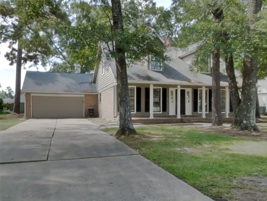
1411 Chart Dr
Crosby, TX 77532
1 Day Ago
Favorites
832-443-5987
-
Bedrooms
3
-
Bathrooms
3
-
Square Feet
2,380 sq ft
-
Available
Available Now
Highlights
- 1 Fireplace
- 2 Car Attached Garage
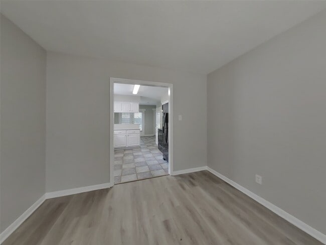
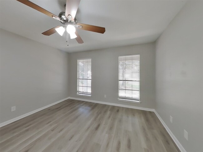
- Living Room
- Tile Flooring
- Central Heating and Cooling System
- Vinyl Flooring
1411 Chart Dr

Favorites
About This Home
Available Now
Take a look at this beautiful home featuring 3 bedrooms,2.5 bathrooms,and approximately 2,380 square feet. Enjoy the freedom of a virtually maintenance free lifestyle while residing in a great community. This home is professionally managed and maintained by Tricon Residential. MLS# 18669031
1411 Chart Dr is a house located in Harris County and the 77532 ZIP Code. This area is served by the Crosby Independent attendance zone.
* Price shown is base rent. Excludes user-selected optional fees and variable or usage-based fees and required charges due at or prior to move-in or at move-out. Price, availability, fees, and any applicable rent special are subject to change without notice.
* Square footage definitions vary. Displayed square footage is approximate.
Home Details
Home Type
Single Family Detached Home
Year Built
Built in 1984
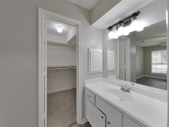
Bedrooms and Bathrooms
2.5 Bathrooms
3 Bedrooms
Flooring
Tile
Vinyl
Interior Spaces
1 Fireplace
Living Room
2,380 Sq Ft Home
2-Story Property
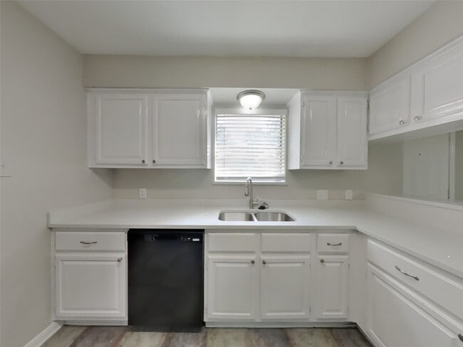
Kitchen
Microwave
Dishwasher
Disposal
Laundry
Dryer
Washer
Listing and Financial Details
Property Available on 9/24/25
Long Term Lease
Lot Details
10,400 Sq Ft Lot
Parking
2 Car Attached Garage
Schools
Crosby Elementary School
Crosby Middle School
Crosby High School
Utilities
Central Heating and Cooling System
Community Details
Overview
Tricon Residential Association
Newport Sec 04 Subdivision
Pet Policy
Call for details about the types of pets allowed
Pet Deposit Required
Contact
- Listed by Jailynn Shedd | TAH Texas Services,LLC
- Phone Number
- Contact
-
Source
 Houston Association of REALTORS®
Copyright © 2025 Houston Association of Realtors. All rights reserved. All information provided by the listing agent/broker is deemed reliable but is not guaranteed and should be independently verified.
Location
Get Directions
Characterized by thick woods and a variety of home prices and styles, North Shore sits on top of the Houston Ship Channel east of Loop 610. Located a 19-minute drive and about 11 miles northeast of Downtown, this primarily residential area straddles Interstate 10.
A number of smaller communities make up this neighborhood, including Songwood, Holiday Forest, Wood Bayou, Cimarron, Home Owned Estates, Woodland Acres, Hidden Forest, and Greens Bayou. Many of these areas contain mid-century ranch-style homes.
The Galena Park and Houston Independent School Districts serve the area, with neighborhoods east of Greens Bayou and south of Market Street falling under Galena Park, while the rest lie in Houston ISD. North Shore residents enjoy close proximity to the sprawling Herman Brown Park, a major nature area and recreational facility.
Learn more about living in North Shore
Education
| Colleges & Universities | Distance | ||
|---|---|---|---|
| Colleges & Universities | Distance | ||
| Drive: | 25 min | 14.2 mi | |
| Drive: | 37 min | 25.1 mi | |
| Drive: | 43 min | 27.0 mi | |
| Drive: | 43 min | 27.0 mi |
1411 Chart Dr is within 25 minutes or 14.2 miles from San Jacinto College, North. It is also near San Jacinto College, Central and Univ. of Houston, Downtown.
Schools


Public Elementary School
Grades 1-5
732 Students
Attendance Zone
Public Elementary School
Grades PK-5
655 Students
Nearby
Public Middle School
Grades 6-8
1,549 Students
Attendance Zone
Public High School
Grades 9-12
1,937 Students
Attendance Zone
Private Elementary, Middle & High School
Grades K-12
Nearby
Private Elementary & Middle School
Grades PK-8
144 Students
Nearby
School data provided by
 The GreatSchools Rating helps parents compare schools within a state based on a variety of school quality indicators and provides a helpful picture of how effectively each school serves all of its students. Ratings are on a scale of 1 (below average) to 10 (above average) and can include test scores, college readiness, academic progress, advanced courses, equity, discipline and attendance data. We also advise parents to visit schools, consider other information on school performance and programs, and consider family needs as part of the school selection process.
View GreatSchools Rating Methodology
Data provided by GreatSchools.org © 2025. All rights reserved.
View GreatSchools Rating Methodology
Data provided by GreatSchools.org © 2025. All rights reserved.
You May Also Like
Similar Rentals Nearby


What Are Walk Score®, Transit Score®, and Bike Score® Ratings?
Walk Score® measures the walkability of any address. Transit Score® measures access to public transit. Bike Score® measures the bikeability of any address.
What is a Sound Score Rating?
A Sound Score Rating aggregates noise caused by vehicle traffic, airplane traffic and local sources
1411 Chart Dr
Crosby, TX 77532