
Williamsburg
200 W Galbraith Rd,
Cincinnati, OH 45215
$658 - $2,852
Studio - 3 Beds
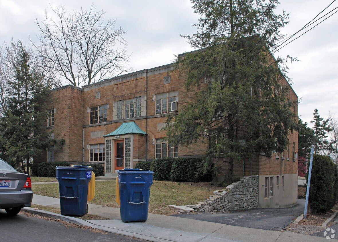
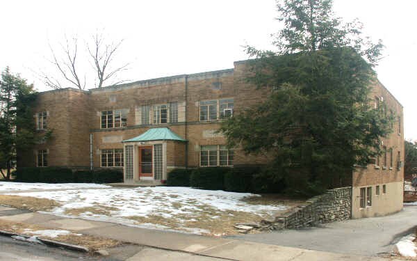
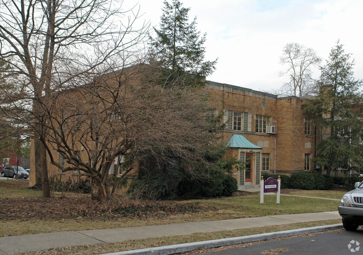
At 1363 Fleming, find your new home. These apartments are located at 1363 Fleming St. in the 45206 area of Cincinnati. This community offers a competitive amenity package like hardwood floors, convenient on-site parking options, and fireplaces. The professional leasing team is excited to help you find the perfect place to live. Contact us or stop by today.
1363 Fleming is an apartment community located in Hamilton County and the 45206 ZIP Code. This area is served by the Cincinnati Public Schools attendance zone.
Air Conditioning
Dishwasher
High Speed Internet Access
Hardwood Floors
East Walnut Hills is a charming historic neighborhood with modern influences. Once known for its impressive mansions and estates, East Walnut Hills beautifully blends the old and new featuring early 20th century dwellings and modern condos, apartments, and houses available for rent. The area is fairly affordable considering its proximity to the heart of the city, but there are rentals available for every budget. Maintaining its quaint charm, East Walnut Hills’ thriving business district is known for its locally owned art galleries, cocktail bars, cafes, and boutiques. This close-knit community hosts several events including movie nights, cookie exchanges, and Walk on Woodburn, a celebration highlighting galleries, local bands, and eateries.
Along with its strong sense of community and abundant amenities, renters are also attracted to East Walnut Hills for its excellent schools and neighborhood parks.
Learn more about living in East Walnut HIllsCompare neighborhood and city base rent averages by bedroom.
| East Walnut HIlls | Cincinnati, OH | |
|---|---|---|
| Studio | $1,085 | $1,069 |
| 1 Bedroom | $1,428 | $1,141 |
| 2 Bedrooms | $1,729 | $1,434 |
| 3 Bedrooms | $1,257 | $1,752 |
| Colleges & Universities | Distance | ||
|---|---|---|---|
| Colleges & Universities | Distance | ||
| Drive: | 6 min | 2.4 mi | |
| Drive: | 7 min | 2.5 mi | |
| Drive: | 7 min | 2.6 mi | |
| Drive: | 14 min | 5.3 mi |


Transportation options available in Cincinnati include Hanke Exchange Station - 12Th & Main, located 2.5 miles from 1363 Fleming. 1363 Fleming is near Cincinnati/Northern Kentucky International, located 16.7 miles or 32 minutes away.
| Transit / Subway | Distance | ||
|---|---|---|---|
| Transit / Subway | Distance | ||
| Drive: | 6 min | 2.5 mi | |
| Drive: | 6 min | 2.6 mi | |
| Drive: | 7 min | 2.7 mi | |
| Drive: | 7 min | 2.7 mi | |
| Drive: | 8 min | 2.9 mi |
| Commuter Rail | Distance | ||
|---|---|---|---|
| Commuter Rail | Distance | ||
|
|
Drive: | 11 min | 4.7 mi |
| Airports | Distance | ||
|---|---|---|---|
| Airports | Distance | ||
|
Cincinnati/Northern Kentucky International
|
Drive: | 32 min | 16.7 mi |
Scores provided by
Traffic
-Airport
-Businesses
-Scores provided by
HowLoud What is a Sound Score Rating? A Sound Score Rating aggregates noise caused by vehicle traffic, airplane traffic and local sources. How It WorksTime and distance from 1363 Fleming.
| Shopping Centers | Distance | ||
|---|---|---|---|
| Shopping Centers | Distance | ||
| Drive: | 7 min | 2.2 mi | |
| Drive: | 6 min | 2.7 mi | |
| Drive: | 8 min | 3.3 mi |
| Parks and Recreation | Distance | ||
|---|---|---|---|
| Parks and Recreation | Distance | ||
|
Eden Park
|
Walk: | 14 min | 0.8 mi |
|
Krohn Conservatory
|
Walk: | 18 min | 1.0 mi |
|
Theodore M. Berry Friendship Park
|
Drive: | 5 min | 1.9 mi |
|
William H. Taft National Historic Site
|
Drive: | 6 min | 2.1 mi |
|
Cincinnati Zoo and Botanical Garden
|
Drive: | 7 min | 2.9 mi |
| Hospitals | Distance | ||
|---|---|---|---|
| Hospitals | Distance | ||
| Drive: | 5 min | 2.2 mi | |
| Drive: | 6 min | 2.2 mi | |
| Drive: | 6 min | 2.4 mi |
| Military Bases | Distance | ||
|---|---|---|---|
| Military Bases | Distance | ||
| Drive: | 71 min | 52.2 mi | |
| Drive: | 77 min | 57.3 mi | |
| Drive: | 80 min | 60.6 mi |
What Are Walk Score®, Transit Score®, and Bike Score® Ratings?
Walk Score® measures the walkability of any address. Transit Score® measures access to public transit. Bike Score® measures the bikeability of any address.
What is a Sound Score Rating?
A Sound Score Rating aggregates noise caused by vehicle traffic, airplane traffic and local sources.

1363 Fleming St
Cincinnati, OH 45206


