
$2,700
/ Month
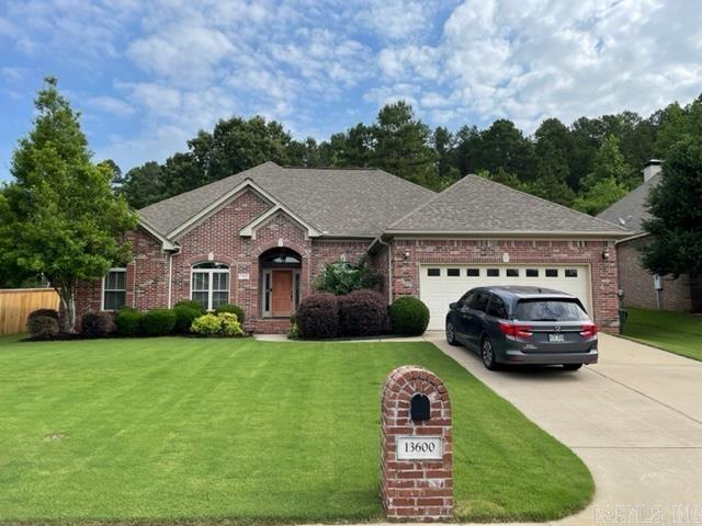
13600 Foxfield Ln
Little Rock, AR 72211
Today
Favorites
501-690-2482
-
Bedrooms
4
-
Bathrooms
3
-
Square Feet
2,676 sq ft
-
Available
Not Available
Highlights
- Central Heating and Cooling System
- Property is in excellent condition
13600 Foxfield Ln

Favorites
About This Home
$2,700 deposit,
Not Available
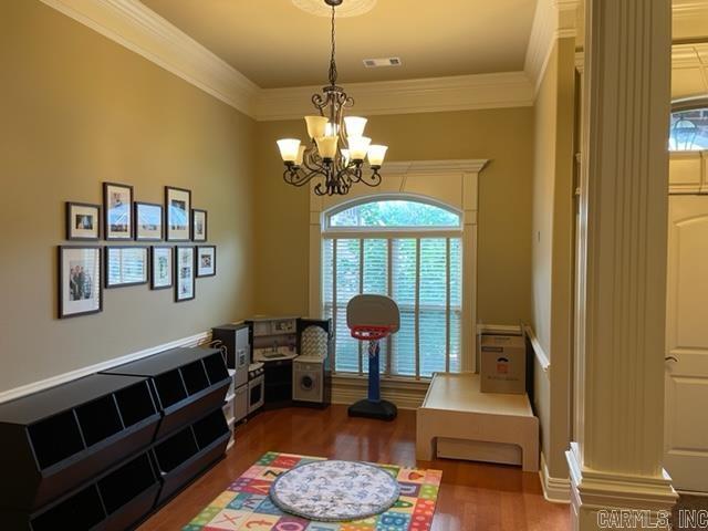
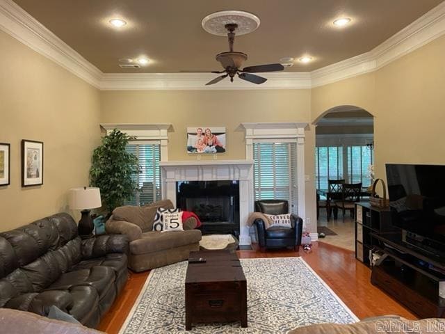
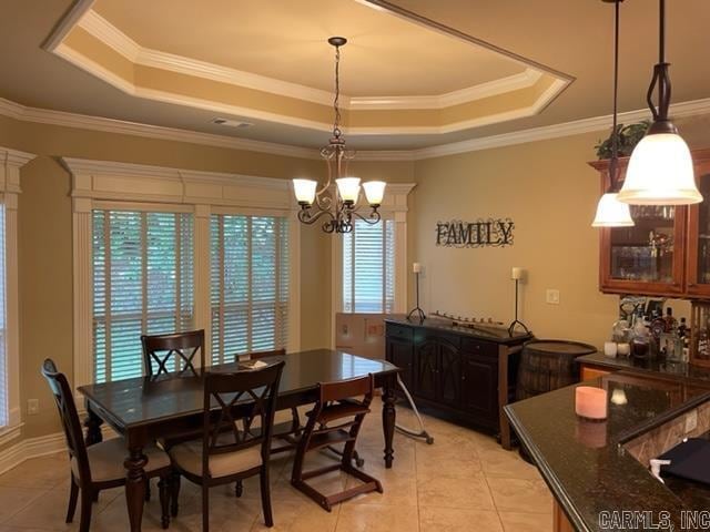
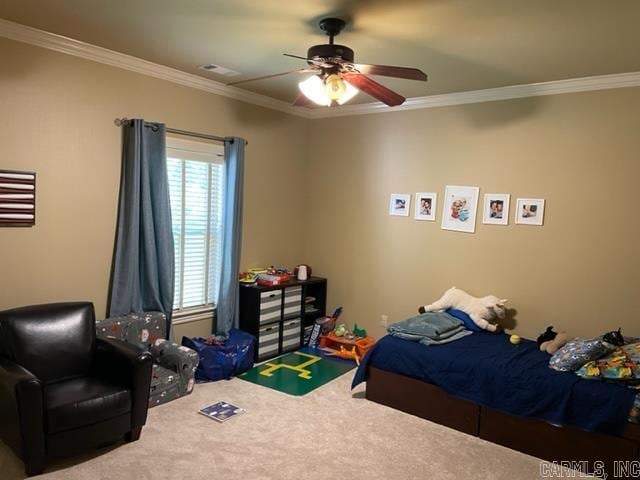
Beautiful All Brick Traditional 1-Level in Woodlands Edge! It features Grt/Rm with gas log FP, Formal Dining, Sep Office, Sep. Brfk. Area, Kit. w/Granite Counter Tops & S.S. Appls, Sep. Laundry Rm., 4 Brms (master sep.), 3 Full Bas, 2 car Gar., Covered patio Overlooking Private Greenbelt!
13600 Foxfield Ln is a house located in Pulaski County and the 72211 ZIP Code. This area is served by the Pulaski County Special attendance zone.
* Price shown is base rent. Excludes user-selected optional fees and variable or usage-based fees and required charges due at or prior to move-in or at move-out. Price, availability, fees, and any applicable rent special are subject to change without notice.
* Square footage definitions vary. Displayed square footage is approximate.
Home Details
Home Type
House
Year Built
Built in 2008
Bedrooms and Bathrooms
3 Full Bathrooms
4 Bedrooms
Interior Spaces
2,676 Sq Ft Home
Kitchen
Gas Oven or Range
Cooktop
Microwave
Dishwasher
Disposal
Laundry
Washer and Dryer Hookup
Listing and Financial Details
Security Deposit $2,700
Lot Details
Property is in excellent condition
Parking
2 Car Garage
Garage Door Opener
Utilities
Central Heating and Cooling System
Heating System Uses Gas
Community Details
Contact
- Listed by Dennis Adkins | Adkins & Associates Real Estate
- Phone Number
- Contact
-
Source
 Cooperative Arkansas Realtors® Multiple Listings Services, Inc.
Copyright ©2025 Cooperative Arkansas Realtors® Multiple Listings Services, Inc.
Location
Get Directions
West Little Rock is comprised of a vast swath of land stretching from Interstate 430 out towards Williams Junction and over Lake Maumelle. There’s an incredible variety of neighborhoods, communities, and landscapes in what’s considered West Little Rock, including waterfront communities on the lake, pastoral reprieves of the Arkansas countryside, and the more suburban communities nearing the city center. There’s a little something for everyone in West Little Rock, but most renters will be enticed by the apartment communities and affordable renters just west of the Interstate that mix the serenity of living outside the city while still being close enough to enjoy its amenities.
Learn more about living in West Little Rock
Education
| Colleges & Universities | Distance | ||
|---|---|---|---|
| Colleges & Universities | Distance | ||
| Drive: | 14 min | 7.5 mi | |
| Drive: | 15 min | 7.7 mi | |
| Drive: | 16 min | 9.6 mi | |
| Drive: | 26 min | 16.3 mi |
13600 Foxfield Ln is within 14 minutes or 7.5 miles from UA Little Rock. It is also near Univ. of Ark. Medical Scis. and Philander Smith College.
Schools


Public Elementary School
Grades PK-5
386 Students
Attendance Zone
Public Elementary School
Grades K-5
352 Students
Nearby
Public Middle School
Grades 6-8
544 Students
Attendance Zone
Public High School
Grades 9-12
783 Students
Attendance Zone
Private Elementary School
Grades PK-6
73 Students
Nearby
Private Elementary, Middle & High School
Grades PK-12
1,323 Students
Nearby
School data provided by
 The GreatSchools Rating helps parents compare schools within a state based on a variety of school quality indicators and provides a helpful picture of how effectively each school serves all of its students. Ratings are on a scale of 1 (below average) to 10 (above average) and can include test scores, college readiness, academic progress, advanced courses, equity, discipline and attendance data. We also advise parents to visit schools, consider other information on school performance and programs, and consider family needs as part of the school selection process.
View GreatSchools Rating Methodology
Data provided by GreatSchools.org © 2025. All rights reserved.
View GreatSchools Rating Methodology
Data provided by GreatSchools.org © 2025. All rights reserved.
Transportation options available in Little Rock include 2Nd St & Center St, located 10.4 miles from 13600 Foxfield Ln. 13600 Foxfield Ln is near Bill and Hillary Clinton Ntl/Adams Field, located 14.3 miles or 23 minutes away.
| Transit / Subway | Distance | ||
|---|---|---|---|
| Transit / Subway | Distance | ||
| Drive: | 17 min | 10.4 mi | |
| Drive: | 17 min | 10.4 mi | |
| Drive: | 17 min | 10.7 mi | |
| Drive: | 18 min | 10.8 mi | |
| Drive: | 18 min | 11.2 mi |
| Commuter Rail | Distance | ||
|---|---|---|---|
| Commuter Rail | Distance | ||
|
|
Drive: | 17 min | 9.6 mi |
|
|
Drive: | 50 min | 40.9 mi |
| Airports | Distance | ||
|---|---|---|---|
| Airports | Distance | ||
|
Bill and Hillary Clinton Ntl/Adams Field
|
Drive: | 23 min | 14.3 mi |
Time and distance from 13600 Foxfield Ln.
| Shopping Centers | Distance | ||
|---|---|---|---|
| Shopping Centers | Distance | ||
| Drive: | 4 min | 1.4 mi | |
| Drive: | 5 min | 1.9 mi | |
| Drive: | 5 min | 2.0 mi |
13600 Foxfield Ln has 3 shopping centers within 2.0 miles, which is about a 5-minute drive. The miles and minutes will be for the farthest away property.
| Parks and Recreation | Distance | ||
|---|---|---|---|
| Parks and Recreation | Distance | ||
|
Little Rock Zoo
|
Drive: | 13 min | 6.8 mi |
|
Central High School National Historic Site
|
Drive: | 15 min | 8.6 mi |
|
Museum of Discovery
|
Drive: | 18 min | 11.0 mi |
|
Pinnacle Mountain State Park
|
Drive: | 25 min | 12.3 mi |
|
Burns Park
|
Drive: | 22 min | 13.4 mi |
13600 Foxfield Ln has 5 parks within 13.4 miles, including Little Rock Zoo, Central High School National Historic Site, and Pinnacle Mountain State Park.
| Hospitals | Distance | ||
|---|---|---|---|
| Hospitals | Distance | ||
| Drive: | 7 min | 2.9 mi | |
| Drive: | 13 min | 7.3 mi | |
| Drive: | 14 min | 7.5 mi |
13600 Foxfield Ln has 3 hospitals within 7.5 miles, the nearest is Arkansas Heart Hospital which is 2.9 miles away and a 7 minute drive.
| Military Bases | Distance | ||
|---|---|---|---|
| Military Bases | Distance | ||
| Drive: | 38 min | 20.6 mi | |
| Drive: | 43 min | 28.2 mi | |
| Drive: | 45 min | 28.5 mi |
13600 Foxfield Ln has 3 military bases within 28.5 miles, the nearest is Camp Joseph T. Robinson Hill which is 20.6 miles away and a 38 minute drive.
You May Also Like
Similar Rentals Nearby


What Are Walk Score®, Transit Score®, and Bike Score® Ratings?
Walk Score® measures the walkability of any address. Transit Score® measures access to public transit. Bike Score® measures the bikeability of any address.
What is a Sound Score Rating?
A Sound Score Rating aggregates noise caused by vehicle traffic, airplane traffic and local sources

13600 Foxfield Ln
Little Rock, AR 72211