


$750
/ Month
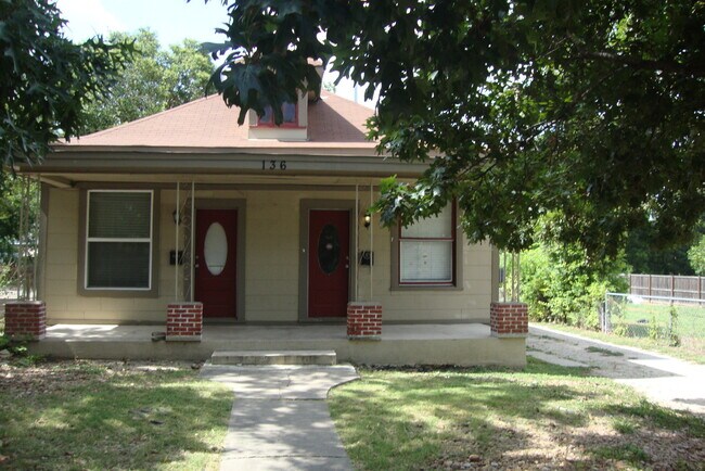
136 E Dullnig Ct Unit 136 E. Dullnig Ct # East
San Antonio, TX 78223
2 Weeks Ago
|
Edit
Favorites
136 E Dullnig Ct Unit 136 E. Dullnig Ct # East

Favorites
Check Back Soon for Upcoming Availability
| Beds | Baths | Average SF |
|---|---|---|
| 1 Bedroom 1 Bedroom 1 Br | 1 Bath 1 Bath 1 Ba | 735 SF |
136 E Dullnig Ct,
San Antonio,
TX
78223
Located about six miles south of Downtown San Antonio, Hot Wells is a tranquil community brimming with apartments and townhomes available for rent. Hot Wells’ abundant lush green space contributes to its peaceful and secluded atmosphere. Although Hot Wells feels secluded, the community is convenient to an array of vibrant shopping centers filled with restaurants, shops, and entertainment in neighboring Brooks City Base as well as the McCreless Corner Shopping Center.
Hot Wells is proximate to numerous parks that line the nearby San Antonio River, including Padre Park, Mission County Park, Espada Park, and Acequia Park. The community is also close to Concepcion Park and San Antonio Missions National Historical Park. Getting around from Hot Wells is simple with access to I-37, I-410, and I-10.
Learn more about living in Hot WellsBelow are rent ranges for similar nearby apartments
Education
| Colleges & Universities | Distance | ||
|---|---|---|---|
| Colleges & Universities | Distance | ||
| Drive: | 8 min | 4.1 mi | |
| Drive: | 14 min | 7.7 mi | |
| Drive: | 15 min | 8.0 mi | |
| Drive: | 18 min | 9.8 mi |
136 E Dullnig Ct Unit 136 E. Dullnig Ct # East is within 8 minutes or 4.1 miles from St. Philip's College, MLK. It is also near St. Philip's College, SWC and Palo Alto College.
Walkability Near 136 E Dullnig Ct San Antonio, TX 78223
Getting Around
 What do Walkability, Transit, Drivability, and Bikeability mean?
Walkability measures the walking distance to day-to-day needs.
Transit measures access to public transportation.
Drivability measures congestion, parking availability, and access to major roads.
Bikeability measures the suitability for cycling.
How It Works
What do Walkability, Transit, Drivability, and Bikeability mean?
Walkability measures the walking distance to day-to-day needs.
Transit measures access to public transportation.
Drivability measures congestion, parking availability, and access to major roads.
Bikeability measures the suitability for cycling.
How It Works
Fairly Walkable
Walkability
40
/ 100
Limited Public Transit
Transit
30
/ 100
Exceptionally Drivable
Drivability
90
/ 100
Exceptionally Bikeable
Bikeability
90
/ 100
Scores provided by
-
Soundscore™
-
/ 100
Traffic
-Airport
-Businesses
-Scores provided by
HowLoud What is a Sound Score Rating? A Sound Score Rating aggregates noise caused by vehicle traffic, airplane traffic and local sources. How It WorksYou May Also Like
Similar Rentals Nearby
-
-
-
-
1 Bed$860+2 Beds$1,099+Total Monthly PriceTotal Monthly Price NewPrices include all required monthly fees.
Pets Allowed Pool Kitchen Tub / Shower Granite Countertops Laundry Facilities Fireplace
-
-
-
-
-
-


What Are Walk Score®, Transit Score®, and Bike Score® Ratings?
Walk Score® measures the walkability of any address. Transit Score® measures access to public transit. Bike Score® measures the bikeability of any address.
What is a Sound Score Rating?
A Sound Score Rating aggregates noise caused by vehicle traffic, airplane traffic and local sources.

136 E Dullnig Ct
San Antonio, TX 78223