$1,895
/ Month
135 N La Peer Dr
Beverly Hills, CA 90211
2 Weeks Ago
|
Edit
Favorites
135 N La Peer Dr

Favorites
Check Back Soon for Upcoming Availability
| Beds | Baths | Average SF |
|---|---|---|
| Studio Studio 0 Br | 1 Bath 1 Bath 1 Ba | — |
About This Property
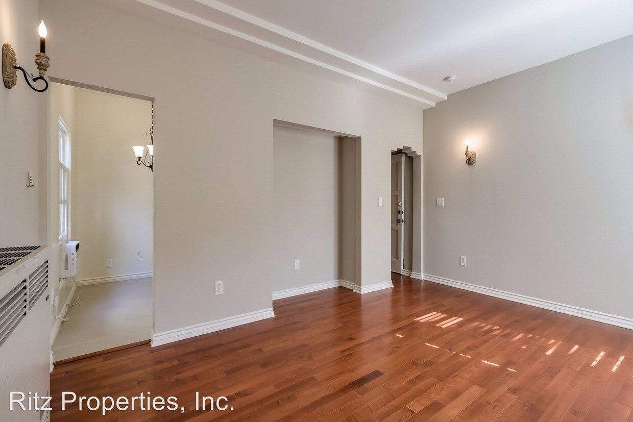
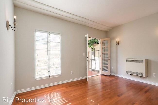
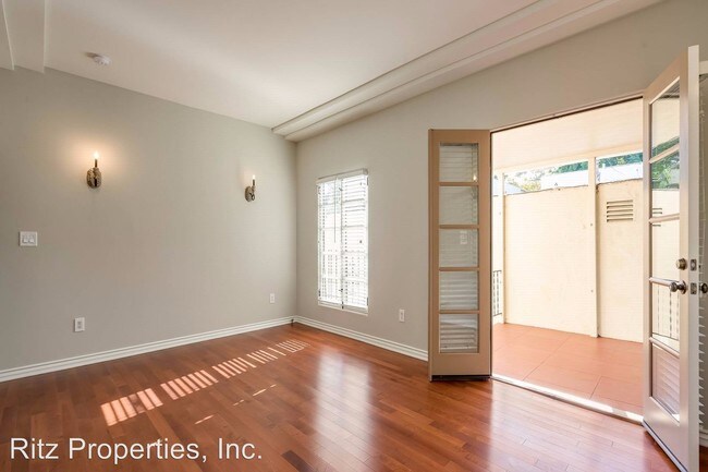
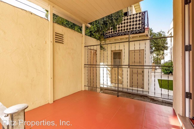
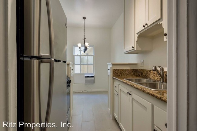
(213) 487-8711 - Art Deco in Bev Hills! Utilities included! - True pride of ownership building in the heart of Beverly Hills! This beautiful Studio Apt has gleaming hardwood floors. Utilities included!!!! Call Robert for showings at 310-270-0057 (RLNE4922646)
135 N La Peer Dr is an apartment community located in Los Angeles County and the 90211 ZIP Code.
Location
Get Directions
Beverly Hills, spanning just 5.71 square miles, combines elegant residential areas with world-class shopping and dining. Tree-lined streets and well-maintained green spaces like Beverly Gardens Park along Santa Monica Boulevard create an inviting atmosphere. The Golden Triangle shopping district, home to the renowned Rodeo Drive, offers high-end retail experiences. Housing options range from estates in Trousdale Estates to apartments south of Wilshire Boulevard, where one-bedroom apartments currently average $2,728 with a 1.1% increase year-over-year.
The city celebrates arts and culture through venues like the Wallis Annenberg Center for the Performing Arts and the historic Greystone Mansion. Landmarks such as the Beverly Hills Hotel and Beverly Wilshire Hotel contribute to the area's distinctive character. Notable areas include the residential streets north of Santa Monica Boulevard and the South Beverly Drive district, with its local shops and eateries.
Learn more about living in Beverly Hills
Education
| Colleges & Universities | Distance | ||
|---|---|---|---|
| Colleges & Universities | Distance | ||
| Drive: | 10 min | 4.3 mi | |
| Drive: | 14 min | 5.4 mi | |
| Drive: | 11 min | 5.4 mi | |
| Drive: | 12 min | 5.8 mi |
135 N La Peer Dr is within 10 minutes or 4.3 miles from UCLA. It is also near Musicians Institute and West Los Angeles College.
Transportation options available in Beverly Hills include Culver City, located 3.2 miles from 135 N La Peer Dr. 135 N La Peer Dr is near Los Angeles International, located 11.0 miles or 21 minutes away, and Bob Hope, located 13.8 miles or 26 minutes away.
| Transit / Subway | Distance | ||
|---|---|---|---|
| Transit / Subway | Distance | ||
|
|
Drive: | 8 min | 3.2 mi |
|
|
Drive: | 8 min | 3.7 mi |
|
|
Drive: | 8 min | 3.9 mi |
|
|
Drive: | 10 min | 4.0 mi |
|
|
Drive: | 9 min | 4.7 mi |
| Commuter Rail | Distance | ||
|---|---|---|---|
| Commuter Rail | Distance | ||
|
|
Drive: | 19 min | 10.6 mi |
|
|
Drive: | 21 min | 10.9 mi |
|
|
Drive: | 21 min | 11.6 mi |
|
|
Drive: | 23 min | 11.7 mi |
|
|
Drive: | 25 min | 12.6 mi |
| Airports | Distance | ||
|---|---|---|---|
| Airports | Distance | ||
|
Los Angeles International
|
Drive: | 21 min | 11.0 mi |
|
Bob Hope
|
Drive: | 26 min | 13.8 mi |
Time and distance from 135 N La Peer Dr.
| Shopping Centers | Distance | ||
|---|---|---|---|
| Shopping Centers | Distance | ||
| Walk: | 13 min | 0.7 mi | |
| Walk: | 13 min | 0.7 mi | |
| Walk: | 15 min | 0.8 mi |
135 N La Peer Dr has 3 shopping centers within 0.8 mile, which is about a 15-minute walk. The miles and minutes will be for the farthest away property.
| Parks and Recreation | Distance | ||
|---|---|---|---|
| Parks and Recreation | Distance | ||
|
Zimmer Children's Museum
|
Drive: | 3 min | 1.3 mi |
|
La Brea Tar Pits
|
Drive: | 4 min | 2.0 mi |
|
Virginia Robinson Gardens
|
Drive: | 7 min | 2.6 mi |
|
Mathias Botanical Garden
|
Drive: | 9 min | 3.8 mi |
|
Runyon Canyon
|
Drive: | 11 min | 4.9 mi |
135 N La Peer Dr has 5 parks within 4.9 miles, including Zimmer Children's Museum, La Brea Tar Pits, and Virginia Robinson Gardens.
| Hospitals | Distance | ||
|---|---|---|---|
| Hospitals | Distance | ||
| Walk: | 17 min | 0.9 mi | |
| Drive: | 3 min | 1.7 mi | |
| Drive: | 4 min | 1.9 mi |
135 N La Peer Dr has 3 hospitals within 1.9 miles, the nearest is Cedars-Sinai Medical Center which is 0.9 mile away and a 17 minute walk.
| Military Bases | Distance | ||
|---|---|---|---|
| Military Bases | Distance | ||
| Drive: | 21 min | 12.6 mi |
135 N La Peer Dr is 12.6 miles and a 21 minute drive from Los Angeles Air Force Base.
You May Also Like
Similar Rentals Nearby


What Are Walk Score®, Transit Score®, and Bike Score® Ratings?
Walk Score® measures the walkability of any address. Transit Score® measures access to public transit. Bike Score® measures the bikeability of any address.
What is a Sound Score Rating?
A Sound Score Rating aggregates noise caused by vehicle traffic, airplane traffic and local sources

135 N La Peer Dr
Beverly Hills, CA 90211