
TENTEN Campus Glendale
414 N Orange St,
Glendale, CA 91203
$3,128 - $5,277 Total Monthly Price
Studio - 2 Beds

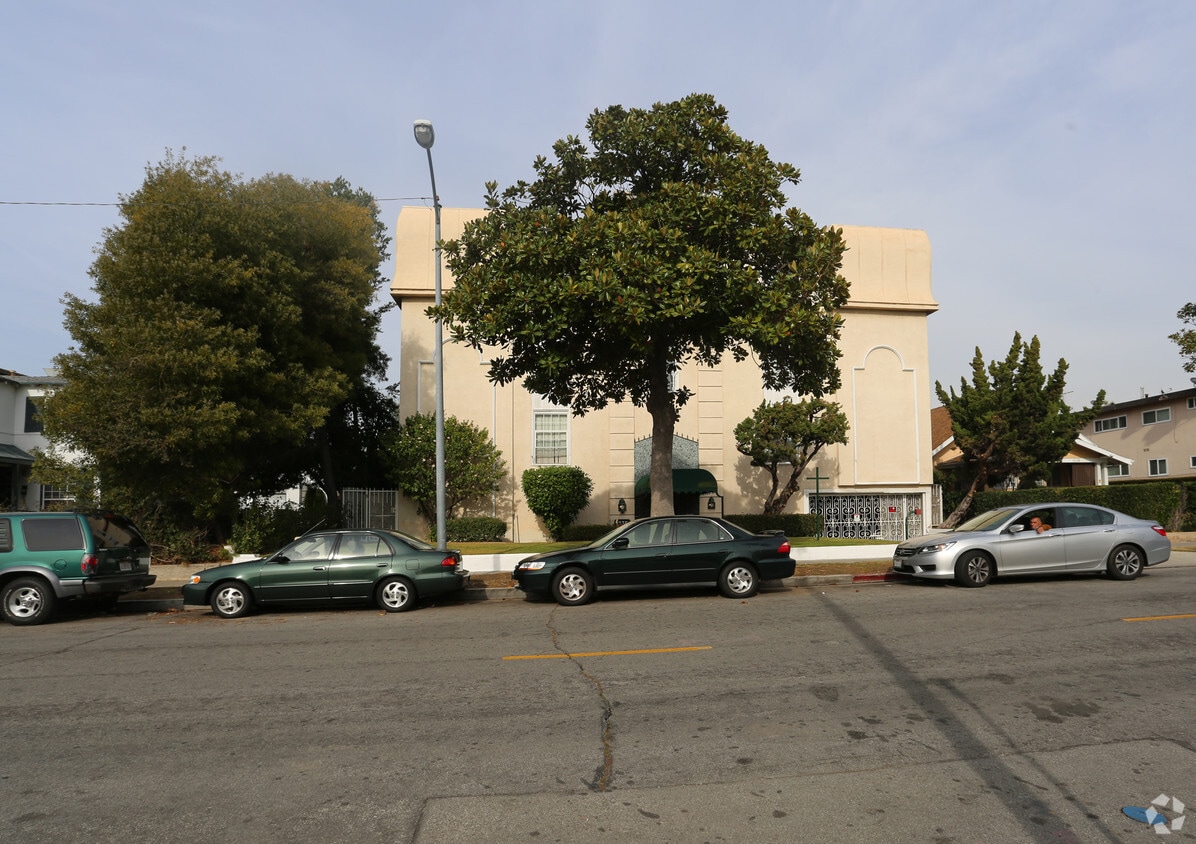
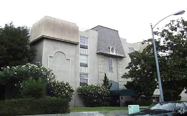
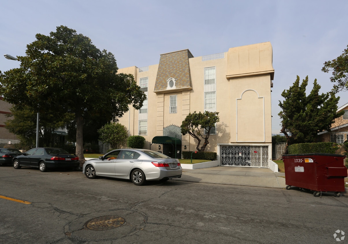
Discover your new apartment at 1335 E Harvard St. Situated in the 91205 Zip code of Glendale on E. Harvard St., you have an easy connection to a number of enjoyable highlights and attractions. From availability to location, the professional leasing staff is ready to match you with the perfect fit. Enjoy a great selection of amenities and features at this community. These include: convenient on-site parking options, balconies, and fireplaces. At 1335 E Harvard St you're home. Stop by the community today.
1335 E Harvard St is an apartment community located in Los Angeles County and the 91205 ZIP Code. This area is served by the Glendale Unified School District attendance zone.
Air Conditioning
High Speed Internet Access
Hardwood Floors
Fireplace
Located in the San Fernando Valley, Citrus Grove allows residents to enjoy some of the best Glendale and Los Angeles County has to offer. This palm-tree-lined, family-friendly neighborhood has excellent schools, several parks, and access to plenty of amenities. Along with its own restaurants and stores, Citrus Grove is only a mile east of Downtown Glendale, so residents live within minutes of a plethora of dining and shopping options, including Glendale Galleria and the Americana at Brand. Highways 2 and 32 connect the Citrus Grove neighborhood with Interstate 5, allowing trips up and down California in all directions, whether the aim is Los Angeles or the coast. The neighborhood is convenient to multiple local favorites including Dodger Stadium and the iconic Griffith Park. Complemented by views of the Verdugo Mountains, Citrus Grove has Mediterranean-style apartments, condos, townhouses, and houses available for rent.
Learn more about living in Citrus GroveCompare neighborhood and city base rent averages by bedroom.
| Citrus Grove | Glendale, CA | |
|---|---|---|
| Studio | $1,459 | $2,014 |
| 1 Bedroom | $1,706 | $2,097 |
| 2 Bedrooms | $2,170 | $2,659 |
| 3 Bedrooms | $2,861 | $3,448 |
| Colleges & Universities | Distance | ||
|---|---|---|---|
| Colleges & Universities | Distance | ||
| Drive: | 4 min | 1.9 mi | |
| Drive: | 6 min | 2.6 mi | |
| Drive: | 12 min | 6.4 mi | |
| Drive: | 13 min | 6.9 mi |


Transportation options available in Glendale include Southwest Museum Station, located 4.5 miles from 1335 E Harvard St. 1335 E Harvard St is near Bob Hope, located 12.0 miles or 18 minutes away, and Los Angeles International, located 22.5 miles or 36 minutes away.
| Transit / Subway | Distance | ||
|---|---|---|---|
| Transit / Subway | Distance | ||
|
|
Drive: | 9 min | 4.5 mi |
|
|
Drive: | 10 min | 4.8 mi |
|
|
Drive: | 9 min | 5.1 mi |
|
|
Drive: | 11 min | 5.6 mi |
|
|
Drive: | 11 min | 6.0 mi |
| Commuter Rail | Distance | ||
|---|---|---|---|
| Commuter Rail | Distance | ||
|
|
Drive: | 6 min | 2.5 mi |
|
|
Drive: | 10 min | 6.6 mi |
|
|
Drive: | 15 min | 8.1 mi |
|
|
Drive: | 13 min | 8.5 mi |
| Drive: | 17 min | 12.5 mi |
| Airports | Distance | ||
|---|---|---|---|
| Airports | Distance | ||
|
Bob Hope
|
Drive: | 18 min | 12.0 mi |
|
Los Angeles International
|
Drive: | 36 min | 22.5 mi |
Scores provided by
Traffic
-Airport
-Businesses
-Scores provided by
HowLoud What is a Sound Score Rating? A Sound Score Rating aggregates noise caused by vehicle traffic, airplane traffic and local sources. How It WorksTime and distance from 1335 E Harvard St.
| Shopping Centers | Distance | ||
|---|---|---|---|
| Shopping Centers | Distance | ||
| Walk: | 7 min | 0.4 mi | |
| Walk: | 8 min | 0.4 mi | |
| Walk: | 10 min | 0.5 mi |
| Parks and Recreation | Distance | ||
|---|---|---|---|
| Parks and Recreation | Distance | ||
|
Elyria Canyon Park
|
Drive: | 8 min | 3.7 mi |
|
Marsh Park
|
Drive: | 8 min | 4.5 mi |
|
Audubon Center at Debs Park
|
Drive: | 11 min | 5.0 mi |
|
Bird Sanctuary
|
Drive: | 11 min | 5.1 mi |
|
Los Angeles Zoo
|
Drive: | 15 min | 5.3 mi |
| Hospitals | Distance | ||
|---|---|---|---|
| Hospitals | Distance | ||
| Drive: | 4 min | 1.1 mi | |
| Drive: | 5 min | 2.3 mi | |
| Drive: | 7 min | 5.0 mi |
| Military Bases | Distance | ||
|---|---|---|---|
| Military Bases | Distance | ||
| Drive: | 33 min | 24.1 mi |
Pets Allowed Fitness Center Pool In Unit Washer & Dryer Clubhouse Balcony
What Are Walk Score®, Transit Score®, and Bike Score® Ratings?
Walk Score® measures the walkability of any address. Transit Score® measures access to public transit. Bike Score® measures the bikeability of any address.
What is a Sound Score Rating?
A Sound Score Rating aggregates noise caused by vehicle traffic, airplane traffic and local sources.
1335 E Harvard St
Glendale, CA 91205


 - Violet on Virgil")


