
Citrus Commons
14150 Riverside Dr,
Sherman Oaks, CA 91423
Studio - 2 Beds $2,945 - $6,995
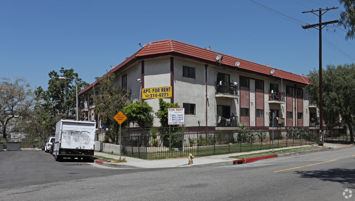
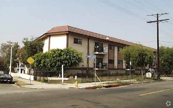
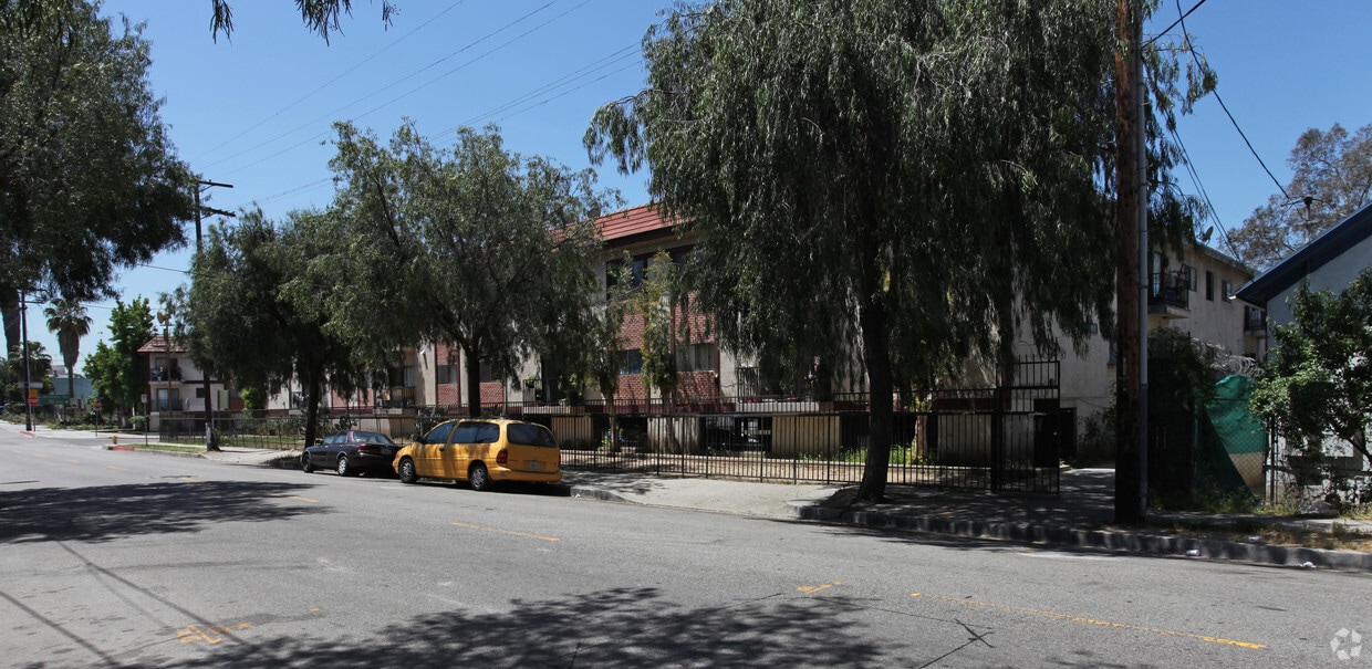

At 1330 Pleasant Ave, experience great living. These apartments are located in Los Angeles at 1330 Pleasant Ave in the 90033 area. The professional community team is waiting to show you all that this community has in store. Make sure you to see the available floorplan options. Stop by to schedule a tour.
1330 Pleasant Ave is an apartment community located in Los Angeles County and the 90033 ZIP Code. This area is served by the Los Angeles Unified attendance zone.
Air Conditioning
High Speed Internet Access
Refrigerator
Smoke Free
Southeast Los Angeles is directly south of the Fashion District and east of the University of Southern California (USC). This large neighborhood is minutes from downtown Los Angeles, Hollywood, and Beverly Hills, with easy access to the 110 Freeway. This great location places you near sunny beaches, nature trails, and a bevy of leading employers. Students can access both USC and California State University Long Beach from their Southeast LA apartment.
This densely populated, diverse neighborhood features everything from food trucks and corner markets to wide sidewalks and residential areas filled with bungalows, ranch, and Spanish Colonial architecture. Southeast LA features palm trees and mountain views, tampered with gritty undertones to give it a cool, funky vibe.
As for outdoor fun, take your pick between Catalina Island, Venus Beach, or the Santa Monica Pier. Nearby, you’ll find more sunny beaches like White Point, Cabrillo, and Long Beach.
Learn more about living in Southeast Los Angeles| Colleges & Universities | Distance | ||
|---|---|---|---|
| Colleges & Universities | Distance | ||
| Drive: | 4 min | 1.6 mi | |
| Drive: | 5 min | 3.2 mi | |
| Drive: | 5 min | 3.2 mi | |
| Drive: | 9 min | 4.6 mi |


Transportation options available in Los Angeles include Mariachi Plaza, located 0.4 mile from 1330 Pleasant Ave. 1330 Pleasant Ave is near Bob Hope, located 17.3 miles or 24 minutes away, and Los Angeles International, located 17.3 miles or 28 minutes away.
| Transit / Subway | Distance | ||
|---|---|---|---|
| Transit / Subway | Distance | ||
|
|
Walk: | 7 min | 0.4 mi |
|
|
Walk: | 13 min | 0.7 mi |
|
|
Walk: | 18 min | 1.0 mi |
|
|
Drive: | 4 min | 1.2 mi |
|
|
Drive: | 2 min | 1.4 mi |
| Commuter Rail | Distance | ||
|---|---|---|---|
| Commuter Rail | Distance | ||
|
|
Drive: | 4 min | 1.2 mi |
|
|
Drive: | 3 min | 1.3 mi |
| Drive: | 6 min | 5.2 mi | |
|
|
Drive: | 11 min | 7.3 mi |
|
|
Drive: | 12 min | 8.2 mi |
| Airports | Distance | ||
|---|---|---|---|
| Airports | Distance | ||
|
Bob Hope
|
Drive: | 24 min | 17.3 mi |
|
Los Angeles International
|
Drive: | 28 min | 17.3 mi |
Time and distance from 1330 Pleasant Ave.
| Shopping Centers | Distance | ||
|---|---|---|---|
| Shopping Centers | Distance | ||
| Walk: | 9 min | 0.5 mi | |
| Drive: | 2 min | 1.3 mi | |
| Drive: | 3 min | 1.6 mi |
| Parks and Recreation | Distance | ||
|---|---|---|---|
| Parks and Recreation | Distance | ||
|
Hollenbeck Lake
|
Walk: | 20 min | 1.0 mi |
|
Vista Hermosa Natural Park
|
Drive: | 5 min | 2.8 mi |
|
Echo Park Lake
|
Drive: | 4 min | 2.9 mi |
|
Chavez Ravine Arboretum
|
Drive: | 7 min | 3.6 mi |
|
Elysian Park
|
Drive: | 10 min | 3.9 mi |
| Hospitals | Distance | ||
|---|---|---|---|
| Hospitals | Distance | ||
| Drive: | 3 min | 1.3 mi | |
| Drive: | 4 min | 2.0 mi | |
| Drive: | 5 min | 3.2 mi |
| Military Bases | Distance | ||
|---|---|---|---|
| Military Bases | Distance | ||
| Drive: | 25 min | 18.9 mi |
What Are Walk Score®, Transit Score®, and Bike Score® Ratings?
Walk Score® measures the walkability of any address. Transit Score® measures access to public transit. Bike Score® measures the bikeability of any address.
What is a Sound Score Rating?
A Sound Score Rating aggregates noise caused by vehicle traffic, airplane traffic and local sources

1330 Pleasant Ave
Los Angeles, CA 90033


 - Violet on Virgil")


 - AVA Burbank")

