13129 Oxnard St Unit 15
Los Angeles, CA 91401
-
Bedrooms
2
-
Bathrooms
2
-
Square Feet
1,000 sq ft
-
Available
Available Now

13129 Oxnard St is an apartment community located in Los Angeles County and the 91401 ZIP Code.
Features
- Dishwasher
Contact
- Phone Number
- Contact
-
Source

- Dishwasher
Residents of Valley Glen, a neighborhood in the southeastern San Fernando Valley, enjoy a lower cost of living than many of the surrounding communities while still having access to all the amenities and easy transportation the Valley offers. Valley Glen features streets filled with mid-century homes with well-kept lawns and large apartment complexes surrounded by tall trees. The Tujunga Wash Greenway gives locals a welcoming place to walk their dogs and to marvel at the renowned half-mile mural depicting the history of California.
Valley Glen is home to Los Angeles Valley College, a junior college, as well as to Grant High School, which features a specialized film program and a highly-ranked academic decathlon team. Small shopping centers in the neighborhood meet basic needs, with higher-end shopping available in neighboring Sherman Oaks and quirky theatrical offerings just next door in the NoHo Arts District.
Learn more about living in Valley Glen| Colleges & Universities | Distance | ||
|---|---|---|---|
| Colleges & Universities | Distance | ||
| Walk: | 7 min | 0.4 mi | |
| Drive: | 10 min | 6.2 mi | |
| Drive: | 14 min | 6.8 mi | |
| Drive: | 14 min | 8.3 mi |
Transportation options available in Los Angeles include North Hollywood Station, located 3.2 miles from 13129 Oxnard St Unit 15. 13129 Oxnard St Unit 15 is near Bob Hope, located 5.1 miles or 10 minutes away, and Los Angeles International, located 21.8 miles or 31 minutes away.
| Transit / Subway | Distance | ||
|---|---|---|---|
| Transit / Subway | Distance | ||
|
|
Drive: | 6 min | 3.2 mi |
|
|
Drive: | 9 min | 5.3 mi |
|
|
Drive: | 14 min | 8.2 mi |
|
|
Drive: | 13 min | 8.4 mi |
|
|
Drive: | 14 min | 9.2 mi |
| Commuter Rail | Distance | ||
|---|---|---|---|
| Commuter Rail | Distance | ||
|
|
Drive: | 9 min | 4.3 mi |
|
|
Drive: | 10 min | 5.0 mi |
|
|
Drive: | 10 min | 6.0 mi |
| Drive: | 12 min | 6.9 mi | |
|
|
Drive: | 14 min | 7.7 mi |
| Airports | Distance | ||
|---|---|---|---|
| Airports | Distance | ||
|
Bob Hope
|
Drive: | 10 min | 5.1 mi |
|
Los Angeles International
|
Drive: | 31 min | 21.8 mi |
Time and distance from 13129 Oxnard St Unit 15.
| Shopping Centers | Distance | ||
|---|---|---|---|
| Shopping Centers | Distance | ||
| Walk: | 15 min | 0.8 mi | |
| Walk: | 21 min | 1.1 mi | |
| Drive: | 3 min | 1.2 mi |
| Parks and Recreation | Distance | ||
|---|---|---|---|
| Parks and Recreation | Distance | ||
|
The Japanese Garden
|
Drive: | 7 min | 4.4 mi |
|
Sepulveda Basin Wildlife Reserve
|
Drive: | 11 min | 4.9 mi |
|
Franklin Canyon Park
|
Drive: | 16 min | 5.7 mi |
|
Lake Balboa
|
Drive: | 11 min | 5.8 mi |
|
Sooky Goldman Nature Center
|
Drive: | 16 min | 5.8 mi |
| Hospitals | Distance | ||
|---|---|---|---|
| Hospitals | Distance | ||
| Drive: | 5 min | 3.1 mi | |
| Drive: | 7 min | 3.6 mi | |
| Drive: | 6 min | 3.6 mi |
| Military Bases | Distance | ||
|---|---|---|---|
| Military Bases | Distance | ||
| Drive: | 32 min | 24.4 mi |
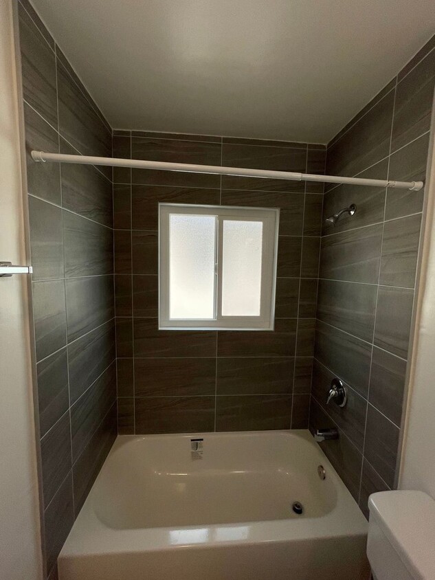
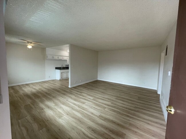
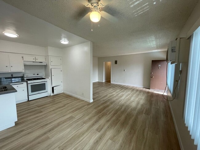
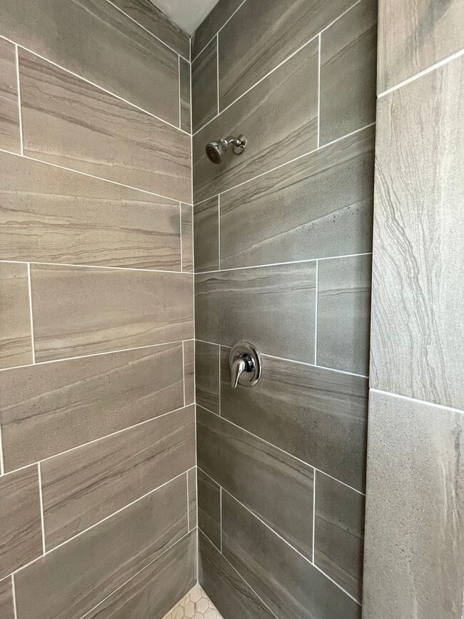
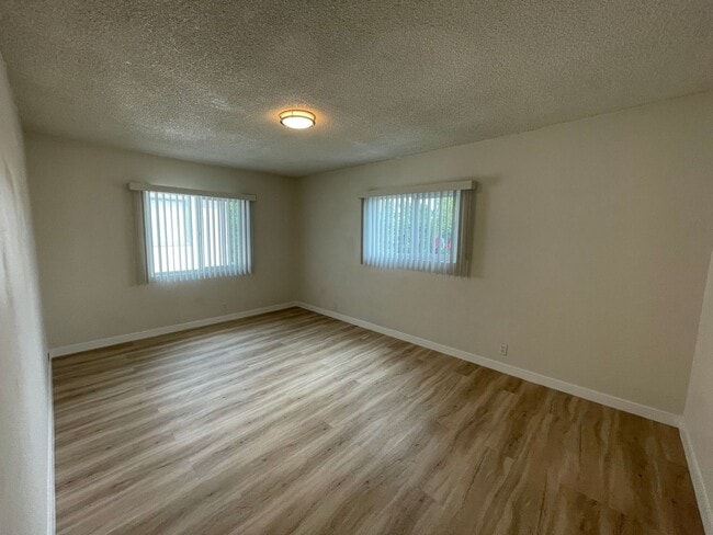
13129 Oxnard St Unit 15 Photos
Nearby Apartments
Within 50 Miles of 13129 Oxnard St Los Angeles, CA 91401
-
Citrus Commons
14150 Riverside Dr
Sherman Oaks, CA 91423
2 Br $5,595-$6,995 2.0 mi
-
Crescent at West Hollywood
1274 N Crescent Heights Blvd
West Hollywood, CA 90046
2 Br $3,300-$3,800 6.7 mi
-
1223 Federal Ave
1223 Federal Ave
Los Angeles, CA 90025
2 Br $2,898-$3,498 9.3 mi
-
Hue39
3909 San Fernando Rd
Glendale, CA 91204
2 Br $3,595-$3,750 9.9 mi
-
sageLA - Brand New
200 N Vermont Ave
Los Angeles, CA 90004
2 Br $3,740-$5,117 10.3 mi
-
Living at Santa Monica
1519 6th St
Santa Monica, CA 90401
2 Br $3,812-$4,938 12.0 mi
What Are Walk Score®, Transit Score®, and Bike Score® Ratings?
Walk Score® measures the walkability of any address. Transit Score® measures access to public transit. Bike Score® measures the bikeability of any address.
What is a Sound Score Rating?
A Sound Score Rating aggregates noise caused by vehicle traffic, airplane traffic and local sources

13129 Oxnard St
Los Angeles, CA 91401