
$3,100
/ Month
129 N High St Unit #2
Mount Vernon, NY 10550
2 Weeks Ago
|
Edit
Favorites
129 N High St Unit #2

Favorites
Check Back Soon for Upcoming Availability
| Beds | Baths | Average SF |
|---|---|---|
| 3 Bedrooms 3 Bedrooms 3 Br | 1 Bath 1 Bath 1 Ba | 600 SF |
Fees and Policies
The fees below are based on community-supplied data and may exclude additional fees and utilities.
- Parking
-
Street--
Details
Utilities Included
-
Water
-
Heat
Property Information
-
3 units
About This Property
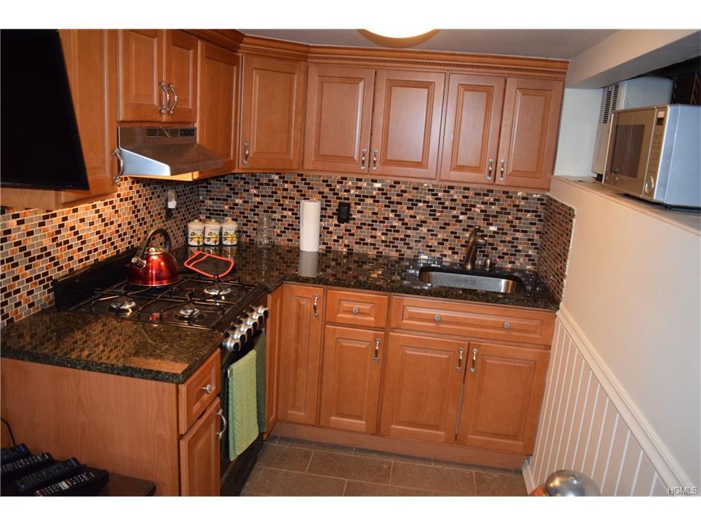
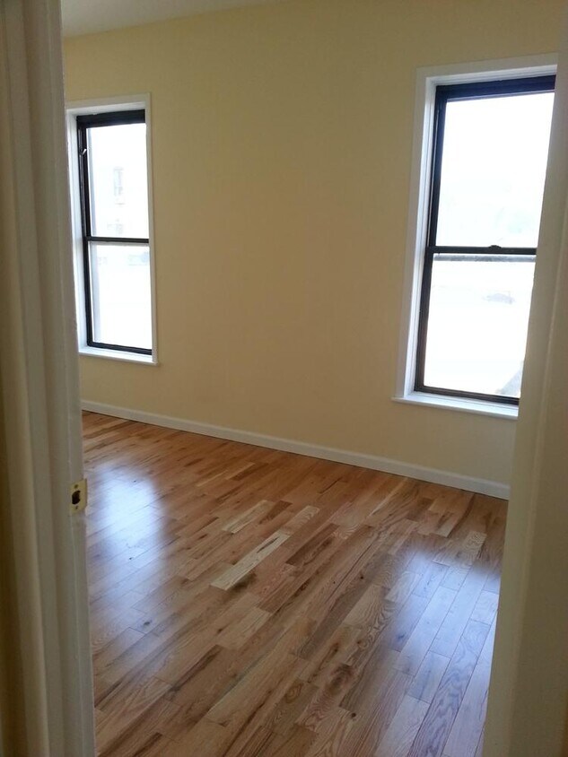
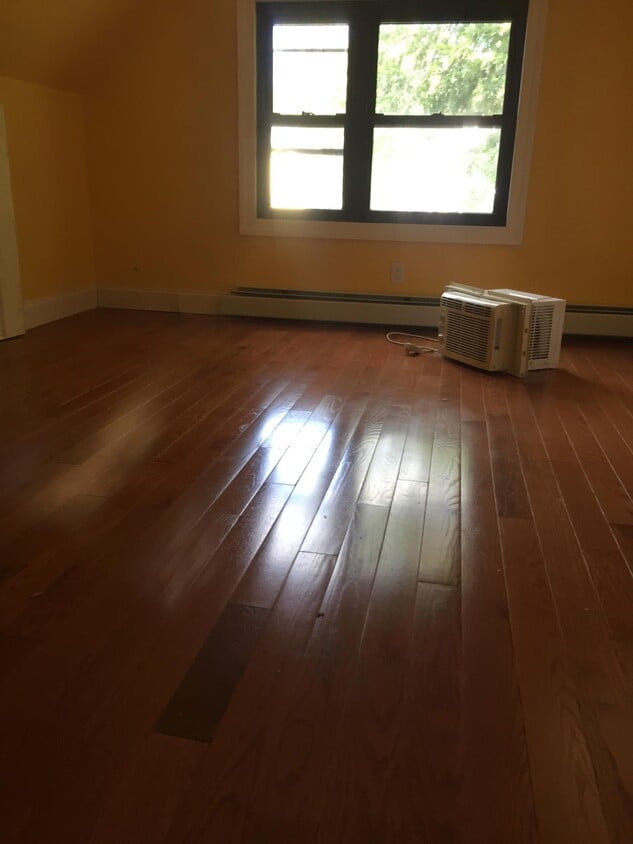
Spacious nicely renovated 2nd floor 3 bedroom 1 bath apartment North High Street. Nice layout in Private house. Disciplined Tenant with Good Credit . No Pets All Programs Invited
129 N High St is an apartment community located in Westchester County and the 10550 ZIP Code. This area is served by the Mt Vernon attendance zone.
Apartment Features
- Smoke Free
Location
Get Directions
The North Side area - which includes Mount Vernon - lies just north of the Bronx and several miles east of Yonkers and the Hudson River. This locale is home to a diverse and close-knit community, making for an incredible variety in shopping and restaurant options. Mount Vernon's proximity to the greater New York metropolitan area makes it a desirable location to live for commuters and those who like to take frequent jaunts into the city. Upscale high-rise apartments and more affordable mid-rise rentals make for a diverse rental scene as well.
Learn more about living in North SideBelow are rent ranges for similar nearby apartments
| Beds | Average Size | Lowest | Typical | Premium |
|---|---|---|---|---|
| Studio Studio Studio | 518 Sq Ft | $1,465 | $1,795 | $2,200 |
| 1 Bed 1 Bed 1 Bed | 721-731 Sq Ft | $1,640 | $2,624 | $3,891 |
| 2 Beds 2 Beds 2 Beds | 1022-1029 Sq Ft | $2,400 | $3,459 | $5,500 |
| 3 Beds 3 Beds 3 Beds | 1371 Sq Ft | $2,850 | $4,237 | $8,681 |
| 4 Beds 4 Beds 4 Beds | 1472 Sq Ft | $3,450 | $3,825 | $4,200 |
Amenities
- Smoke Free
Expenses
Utilities Included
Water, Heat
Included
Education
| Colleges & Universities | Distance | ||
|---|---|---|---|
| Colleges & Universities | Distance | ||
| Drive: | 6 min | 2.1 mi | |
| Drive: | 8 min | 4.2 mi | |
| Drive: | 10 min | 4.8 mi | |
| Drive: | 9 min | 5.3 mi |
129 N High St Unit #2 is within 6 minutes or 2.1 miles from Sarah Lawrence College. It is also near Iona College and The College of New Rochelle.
Schools


Public Elementary School
Grades PK-6
521 Students
Nearby
Public Elementary & Middle School
Grades 5-8
196 Students
Attendance Zone
Public Elementary & Middle School
Grades K-8
354 Students
Attendance Zone
Public Middle & High School
Grades 6-12
383 Students
Attendance Zone
Public High School
Grades 9-12
1,094 Students
Attendance Zone
Private Elementary & Middle School
Grades PK-8
329 Students
Nearby
Private Elementary, Middle & High School
Grades K-12
Nearby
School data provided by
 The GreatSchools Rating helps parents compare schools within a state based on a variety of school quality indicators and provides a helpful picture of how effectively each school serves all of its students. Ratings are on a scale of 1 (below average) to 10 (above average) and can include test scores, college readiness, academic progress, advanced courses, equity, discipline and attendance data. We also advise parents to visit schools, consider other information on school performance and programs, and consider family needs as part of the school selection process.
View GreatSchools Rating Methodology
Data provided by GreatSchools.org © 2025. All rights reserved.
View GreatSchools Rating Methodology
Data provided by GreatSchools.org © 2025. All rights reserved.
Transportation options available in Mount Vernon include Wakefield-241 Street, located 0.9 mile from 129 N High St Unit #2. 129 N High St Unit #2 is near LaGuardia, located 14.5 miles or 26 minutes away, and Westchester County, located 17.4 miles or 27 minutes away.
| Transit / Subway | Distance | ||
|---|---|---|---|
| Transit / Subway | Distance | ||
|
|
Walk: | 18 min | 0.9 mi |
|
|
Drive: | 2 min | 1.4 mi |
|
|
Drive: | 3 min | 1.8 mi |
|
|
Drive: | 4 min | 2.2 mi |
|
|
Drive: | 6 min | 3.1 mi |
| Commuter Rail | Distance | ||
|---|---|---|---|
| Commuter Rail | Distance | ||
|
|
Drive: | 2 min | 1.1 mi |
|
|
Drive: | 3 min | 1.5 mi |
|
|
Drive: | 4 min | 2.3 mi |
|
|
Drive: | 6 min | 3.2 mi |
|
|
Drive: | 7 min | 3.7 mi |
| Airports | Distance | ||
|---|---|---|---|
| Airports | Distance | ||
|
LaGuardia
|
Drive: | 26 min | 14.5 mi |
|
Westchester County
|
Drive: | 27 min | 17.4 mi |
Time and distance from 129 N High St Unit #2.
| Shopping Centers | Distance | ||
|---|---|---|---|
| Shopping Centers | Distance | ||
| Walk: | 14 min | 0.8 mi | |
| Drive: | 3 min | 1.4 mi | |
| Drive: | 4 min | 1.4 mi |
129 N High St Unit #2 has 3 shopping centers within 1.4 miles, which is about a 4-minute walk. The miles and minutes will be for the farthest away property.
| Parks and Recreation | Distance | ||
|---|---|---|---|
| Parks and Recreation | Distance | ||
|
Seton Falls Park
|
Drive: | 4 min | 2.3 mi |
|
Williamsbridge Oval
|
Drive: | 8 min | 3.9 mi |
|
Beczak Environmental Education Center
|
Drive: | 9 min | 4.4 mi |
|
Van Cortlandt Park
|
Drive: | 9 min | 5.2 mi |
|
Bartow-Pell Woods
|
Drive: | 11 min | 5.7 mi |
129 N High St Unit #2 has 5 parks within 5.7 miles, including Seton Falls Park, Van Cortlandt Park, and Williamsbridge Oval.
| Hospitals | Distance | ||
|---|---|---|---|
| Hospitals | Distance | ||
| Walk: | 8 min | 0.5 mi | |
| Drive: | 7 min | 3.8 mi | |
| Drive: | 7 min | 3.9 mi |
129 N High St Unit #2 has 3 hospitals within 3.9 miles, the nearest is Montefiore Mount Vernon Hospital which is 0.5 mile away and a 8 minute walk.
| Military Bases | Distance | ||
|---|---|---|---|
| Military Bases | Distance | ||
| Drive: | 22 min | 12.5 mi |
129 N High St Unit #2 is 12.5 miles and a 22 minute drive from Fort Totten US Govt Reservation.
You May Also Like
Similar Rentals Nearby


What Are Walk Score®, Transit Score®, and Bike Score® Ratings?
Walk Score® measures the walkability of any address. Transit Score® measures access to public transit. Bike Score® measures the bikeability of any address.
What is a Sound Score Rating?
A Sound Score Rating aggregates noise caused by vehicle traffic, airplane traffic and local sources
129 N High St
Mount Vernon, NY 10550