129 Cedar St Unit 3
Boston, MA 02119
-
Bedrooms
5
-
Bathrooms
2
-
Square Feet
--
-
Available
Available Sep 1

About This Home
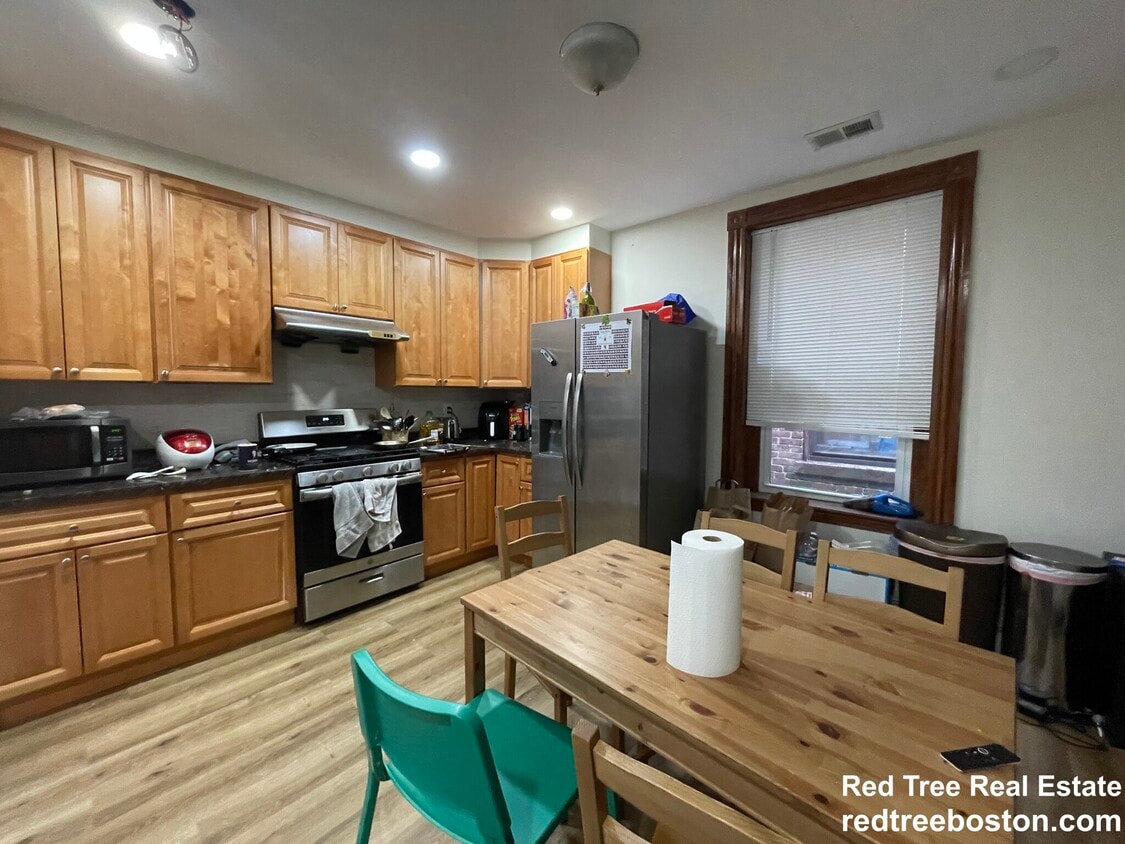
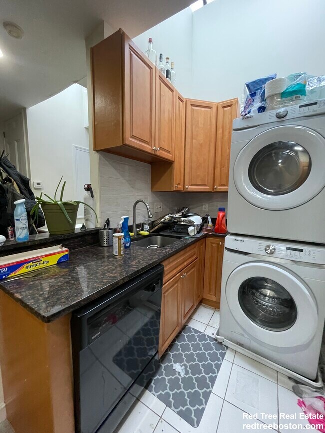
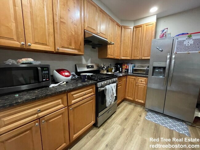
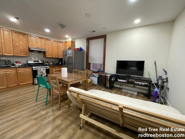
Four bedroom apt w/ hardwood floors, modern kitchen, two full baths, and laundry in the basement. Conveniently located in fort hill area - just 7 minutes walk to the orange line (roxbury crossing station).
129 Cedar St is a condo located in Suffolk County and the 02119 ZIP Code.
Condo Features
- Laundry Facilities
- Porch
Contact
- Phone Number
- Website View Property Website
- Contact
-
Source

Twenty minutes southwest of downtown Boston sits Highland Park, a primarily- residential neighborhood full of beautiful historic homes and apartments along tree-lined streets. The community features over a dozen parks and public green spaces, giving all residents easy access to trails, playgrounds, and historic sites wherever they may live.
The local dining scene is quite unique, with several African and Middle Eastern restaurants and cafes around the neighborhood. MBTA rail service on the west side of the neighborhood makes it easy for folks to get around the city for or leisure.
Learn more about living in Highland Park- Laundry Facilities
- Porch
| Colleges & Universities | Distance | ||
|---|---|---|---|
| Colleges & Universities | Distance | ||
| Walk: | 17 min | 0.9 mi | |
| Drive: | 2 min | 1.4 mi | |
| Drive: | 3 min | 1.5 mi | |
| Drive: | 4 min | 1.8 mi |
Transportation options available in Boston include Roxbury Crossing Station, located 0.3 mile from 129 Cedar St Unit 3. 129 Cedar St Unit 3 is near General Edward Lawrence Logan International, located 6.8 miles or 13 minutes away.
| Transit / Subway | Distance | ||
|---|---|---|---|
| Transit / Subway | Distance | ||
|
|
Walk: | 6 min | 0.3 mi |
|
|
Walk: | 10 min | 0.5 mi |
|
|
Drive: | 2 min | 1.2 mi |
|
|
Drive: | 2 min | 1.2 mi |
|
|
Drive: | 3 min | 1.6 mi |
| Commuter Rail | Distance | ||
|---|---|---|---|
| Commuter Rail | Distance | ||
|
|
Drive: | 3 min | 1.5 mi |
| Drive: | 4 min | 1.9 mi | |
|
|
Drive: | 4 min | 2.0 mi |
|
|
Drive: | 8 min | 2.4 mi |
|
|
Drive: | 10 min | 5.3 mi |
| Airports | Distance | ||
|---|---|---|---|
| Airports | Distance | ||
|
General Edward Lawrence Logan International
|
Drive: | 13 min | 6.8 mi |
Scores provided by
Traffic
-Airport
-Businesses
-Scores provided by
HowLoud What is a Sound Score Rating? A Sound Score Rating aggregates noise caused by vehicle traffic, airplane traffic and local sources. How It WorksTime and distance from 129 Cedar St Unit 3.
| Shopping Centers | Distance | ||
|---|---|---|---|
| Shopping Centers | Distance | ||
| Walk: | 14 min | 0.7 mi | |
| Walk: | 19 min | 1.0 mi | |
| Drive: | 2 min | 1.5 mi |
| Parks and Recreation | Distance | ||
|---|---|---|---|
| Parks and Recreation | Distance | ||
|
Roxbury Heritage State Park
|
Walk: | 8 min | 0.4 mi |
|
Lower Neponset River Trail
|
Drive: | 4 min | 2.1 mi |
|
Franklin Park Zoo
|
Drive: | 4 min | 2.3 mi |
|
Charles River Reservation
|
Drive: | 5 min | 2.6 mi |
|
Coit Observatory
|
Drive: | 6 min | 3.0 mi |
| Hospitals | Distance | ||
|---|---|---|---|
| Hospitals | Distance | ||
| Walk: | 17 min | 0.9 mi | |
| Drive: | 3 min | 1.2 mi | |
| Drive: | 3 min | 1.7 mi |
| Military Bases | Distance | ||
|---|---|---|---|
| Military Bases | Distance | ||
| Drive: | 29 min | 15.6 mi | |
| Drive: | 31 min | 16.2 mi | |
| Drive: | 38 min | 23.1 mi |
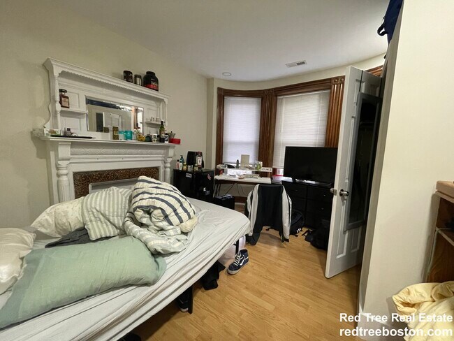
129 Cedar St Unit 3 Photos
Nearby Apartments
Within 50 Miles of 129 Cedar St Boston, MA 02119
-
101 Sumner Rd
Brookline, MA 02445
$9,000 Plus Fees
4 Br 12 Month Lease 1.9 mi
-
Room in Shared 4 bed/1.5 bath home in Somerville
100 Flint St
Somerville, MA 02145
$1,410 Plus Fees
4 Br 4.0 mi
-
169 Maverick St
Boston, MA 02128
$4,200 Plus Fees
4 Br 12 Month Lease 4.1 mi
-
38 Cherry St
Somerville, MA 02144
$5,900 Plus Fees
5 Br 12 Month Lease 4.5 mi
-
33 Raymond Ave
Somerville, MA 02144
$5,500 Plus Fees
4 Br 12 Month Lease 5.7 mi
-
33 Raymond Ave
Somerville, MA 02144
$5,500 Plus Fees
4 Br 12 Month Lease 5.7 mi

129 Cedar St
Boston, MA 02119